

The Dingle Peninsula Drive is very often confused with the Slea Head Drive.
The Slea Head Drive is a section of the main Dingle Peninsula Loop – a much longer road trip route around the main attractions in Dingle.
Below, you’ll find a map of the Dingle Peninsula Drive along with the main stops along the way.
Some quick need-to-knows about the Dingle Peninsula Drive

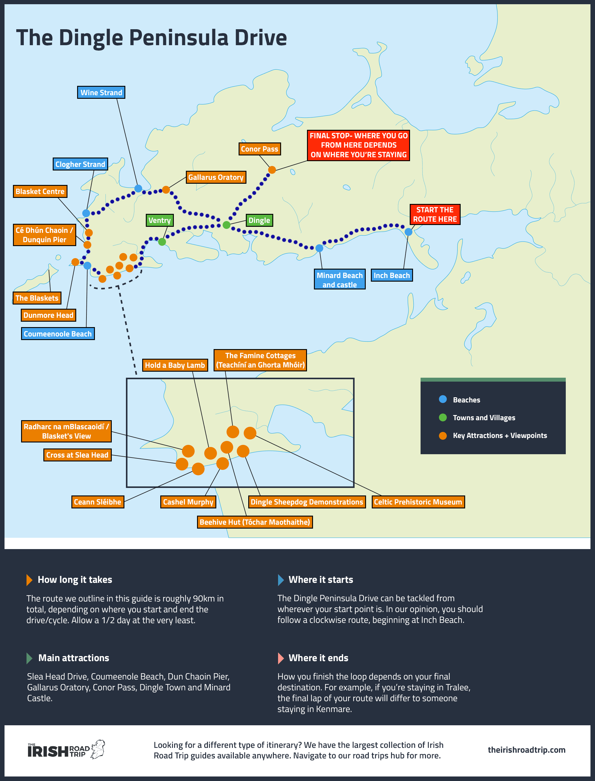
The Dingle Peninsula Drive can cause a bit of confusion if you’re not familiar with the lay of the land. Take a moment to look at the map above, first, before reading the points below:
1. Location
The Dingle Peninsula Drive takes you around, no surprise, the Dingle Peninsula in County Kerry. It’s a 1-hour and 10-minute drive from Killarney and a 1-hour and 45-minute drive from Kenmare.
2. Where it starts and ends
The Dingle Peninsula Loop can be started from either ‘entrance point’ to the peninsula, i.e. the Tralee side or the Killarney side. Personally, I always kick it off from Inch Beach and then follow the coast clockwise.
3. How long it takes
If you follow the route we outline in this guide, you’ll cover a good 90km. You could do it in 1/2 a day, but only if you’re happy to whizz by places.
4. A note for those doing it in one day
The Dingle Peninsula Drive route outlined below doesn’t contain all of the various things to do in Dingle, as you’d need at least two days to properly scratch the surface. It provides those who only have a 1/2 day with a manageable itinerary to follow.
An interactive Dingle Peninsula Drive map
The Dingle Peninsula Drive map above has a rough outline of the route you’ll be following below.
It starts from the brilliant Inch Beach and then continue towards Dingle Town before moving to Slea Head.
If you’re not familiar with this type of map, just double click (if you’re on a computer) or pinch and zoom (if you’re on a phone/tablet).
The main stops on the Dingle Peninsula Loop (in order)

Photos via Shutterstock
Right – enough of me yammering on! Below, you’ll find a mini-itinerary for the Dingle Peninsula Drive.
If you follow this, you’ll stumble upon some of the most magnificent places to visit in Kerry, with a mix of tourist favourites and ‘hidden’ gems.
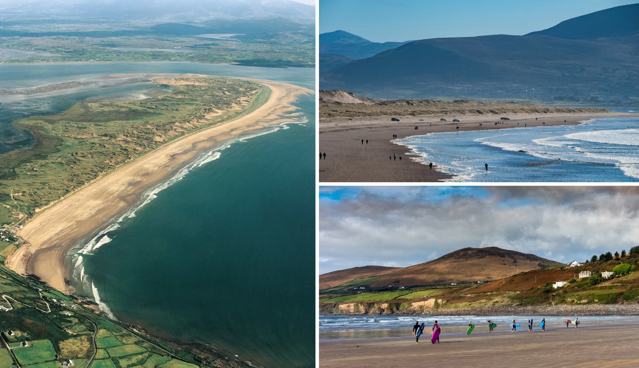
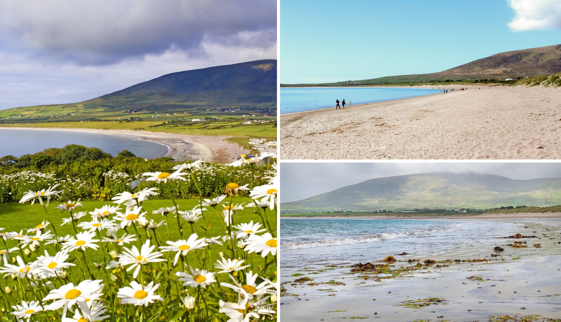
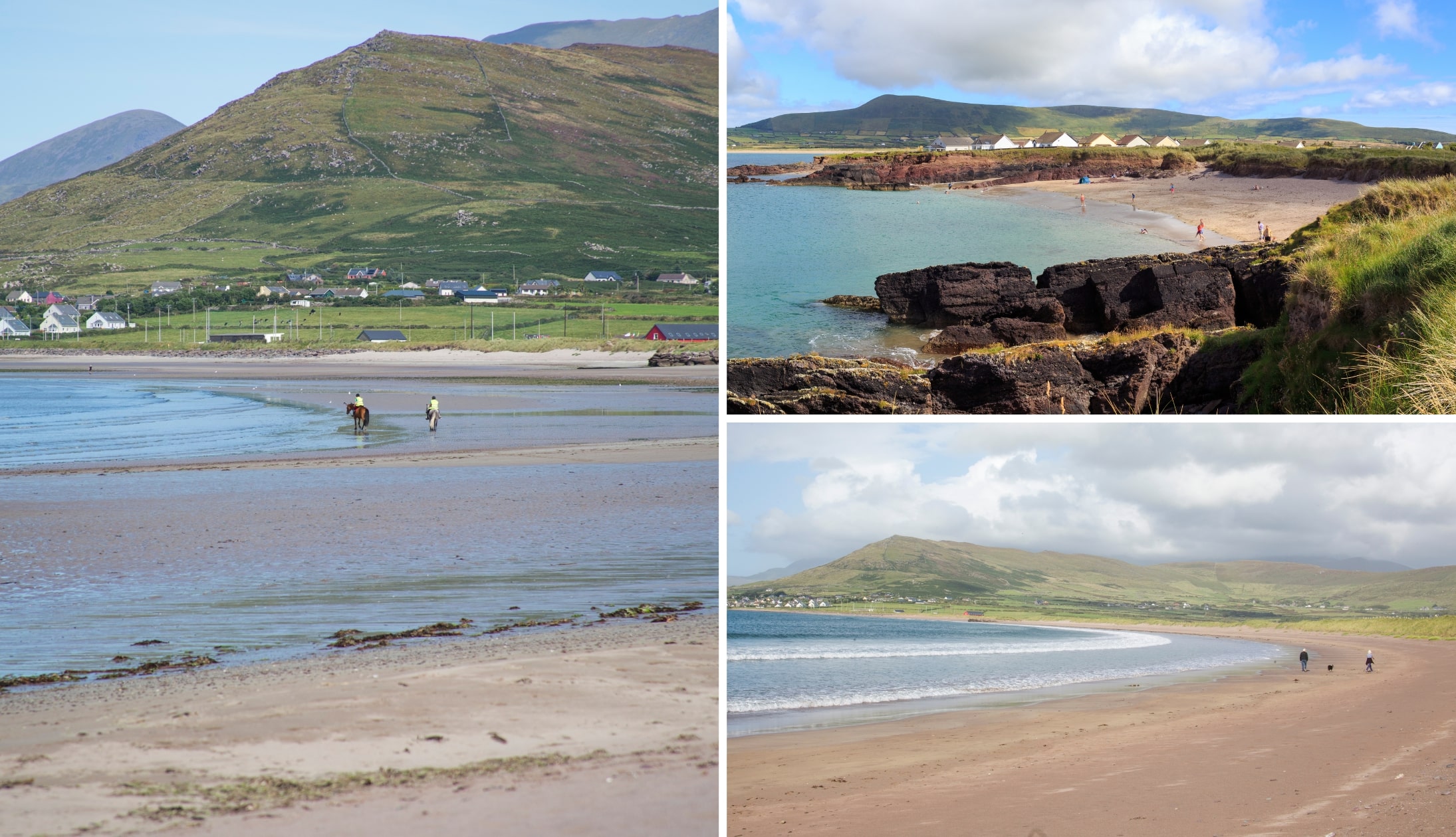
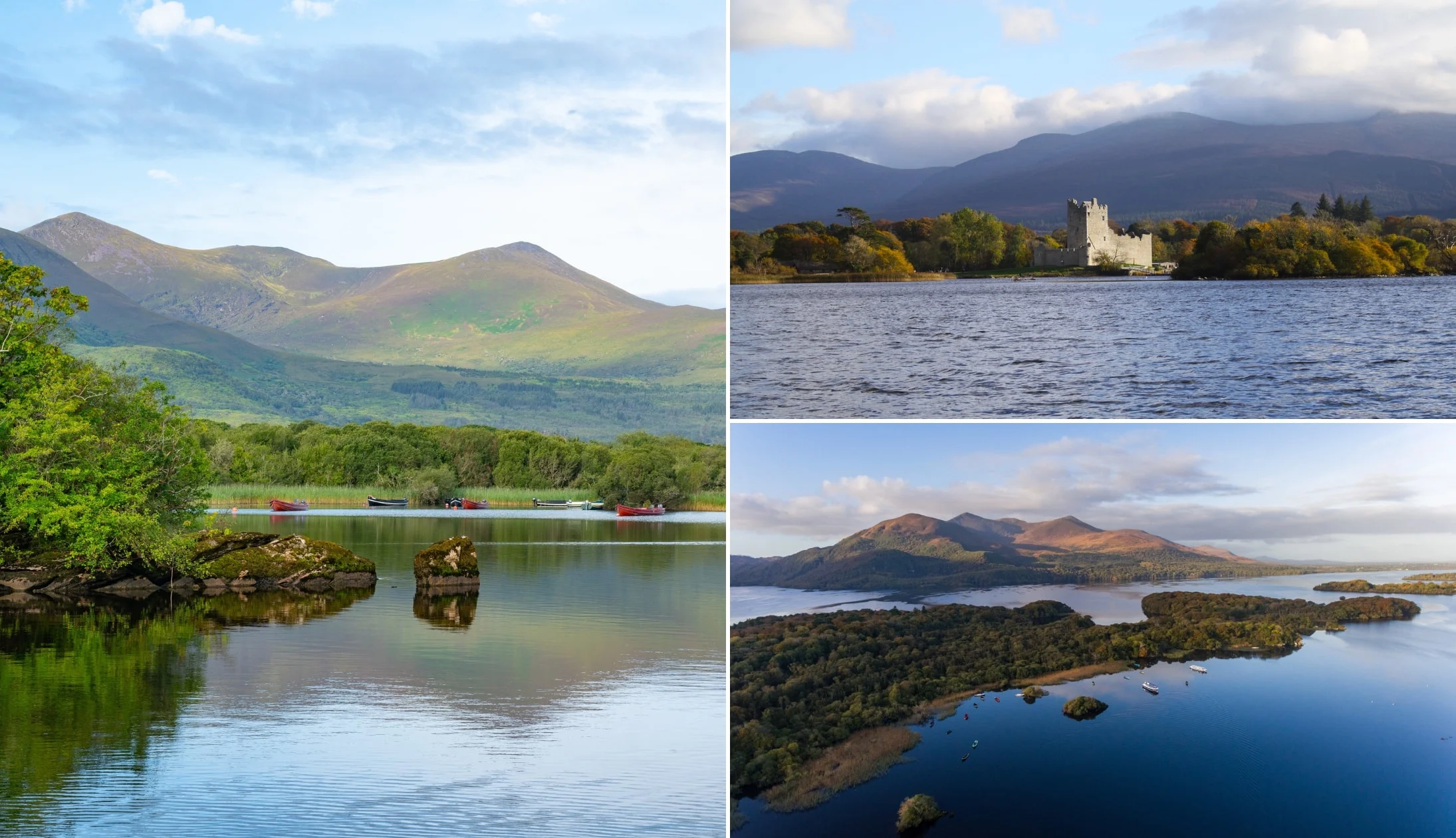
Stop 1: Inch Beach

Photos via Shutterstock
Inch Beach is our first stop. You’ll find parking right next to it and there’s a great coffee spot on the sand (Sammy’s).
Inch is a little peninsula, as you’ll see from the snap on the left above. Well, I say ‘little’, but it juts out for a lofty 5.5km.
As you saunter along the sand at Inch you’ll see local and visiting surfers conquering (or at least attempting to!) the waves.
On a clear day, you’ll be treated to glorious mountain views. A fine start to your Dingle Peninsula Drive road trip.
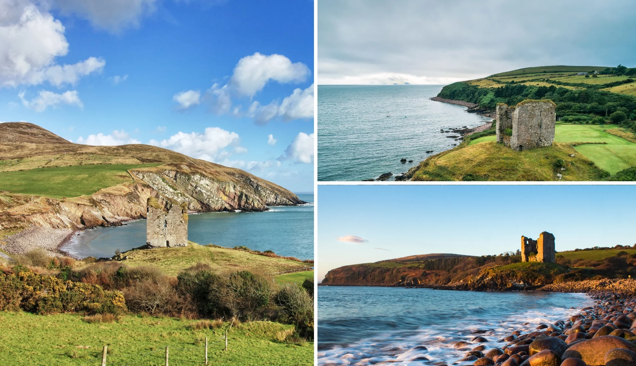
Stop 2: Minard Castle

Photos via Shutterstock
One of the more overlooked stops on the Dingle Peninsula Loop is a short 15-minute spin from Inch – Minard Castle and Beach.
Take the drive up here very handy as you’ll be following narrow country roads that are used by farming vehicles.
You might recognise the castle here from the movie ‘Ryan’s Daughter’, which was released in the 1970’s (they referred to it as ‘The Tower’).
The castle here is finely plonked on a little grassy hill that overlooks the water, commanding breath-taking views on a clear day.
Stop 3: Dingle Town

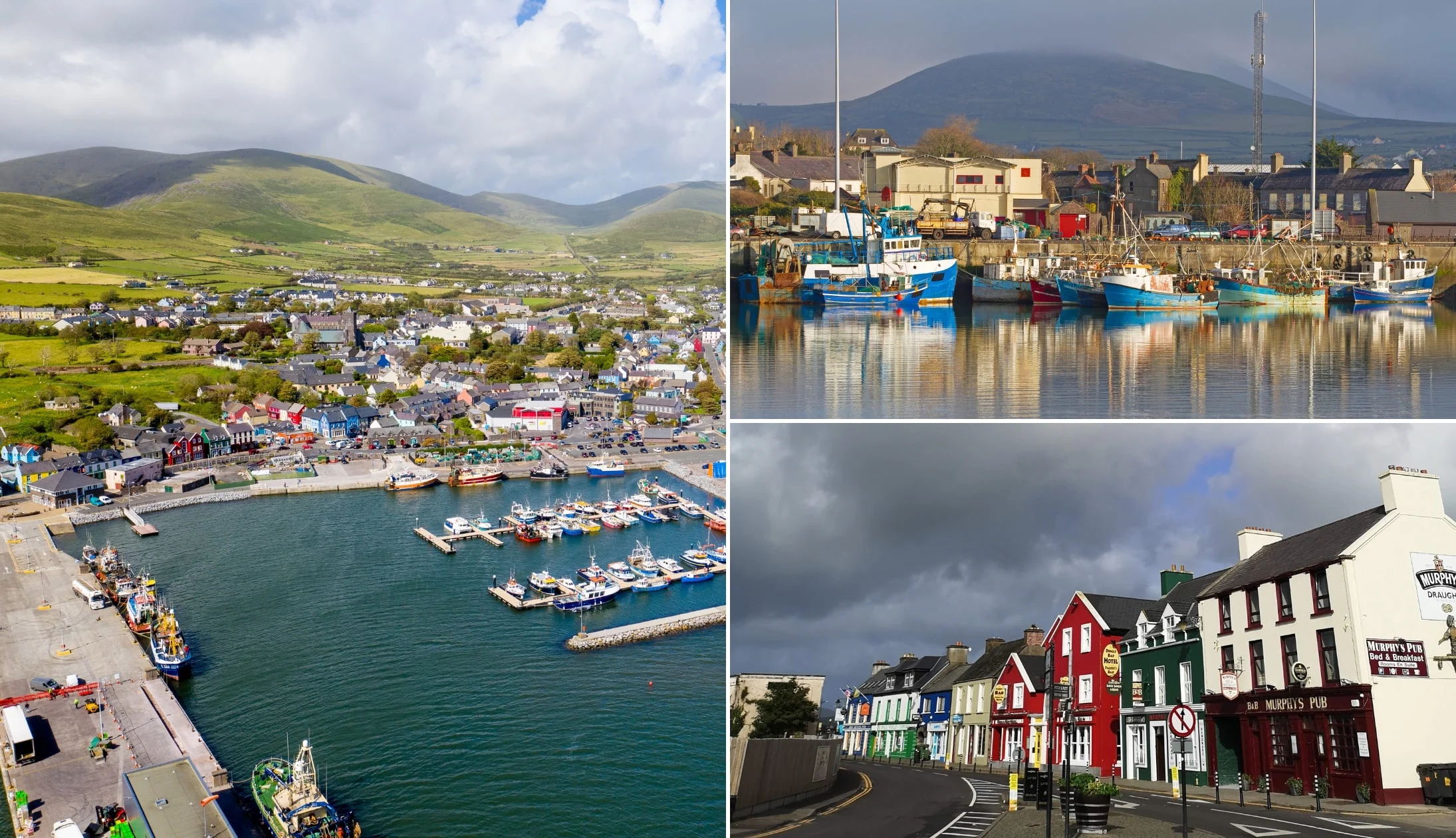
Photos via Shutterstock
Take the 15-minute drive to bustling Dingle Town, next, and head off for a ramble (there’s parking at the harbour).
Although the town is small it attracts thousands of domestic and international tourists each and every day throughout the summer season.
Dingle Town is walkable and it boasts a fine bit of charm and character. In the town, you have attractions like the Dingle Distillery and the Dingle Aquarium.
There’s also plenty of great restaurants in Dingle (Fish Box is our go-to!) and there are endless old-school pubs in Dingle, too!
From the town, you can join one of the various Dingle Tours, like the Sea Safari or the boat trip to the Blasket Islands.
Stop 4: Ventry Beach
Photos via Shutterstock
Ventry Beach (an easy 13-minute drive from Dingle) is a Blue Flag Beach and on a warm day, there’s few places like it.
One of the more popular beaches in Kerry, Ventry Beach stretches for 4.5km and, for many, it’s white sand marks the beginning of the Slea Head Drive.
Hop out, flick off your shoes and head for a stroll or a paddle. It’s from this point that the Dingle Peninsula Drive goes from good to great!
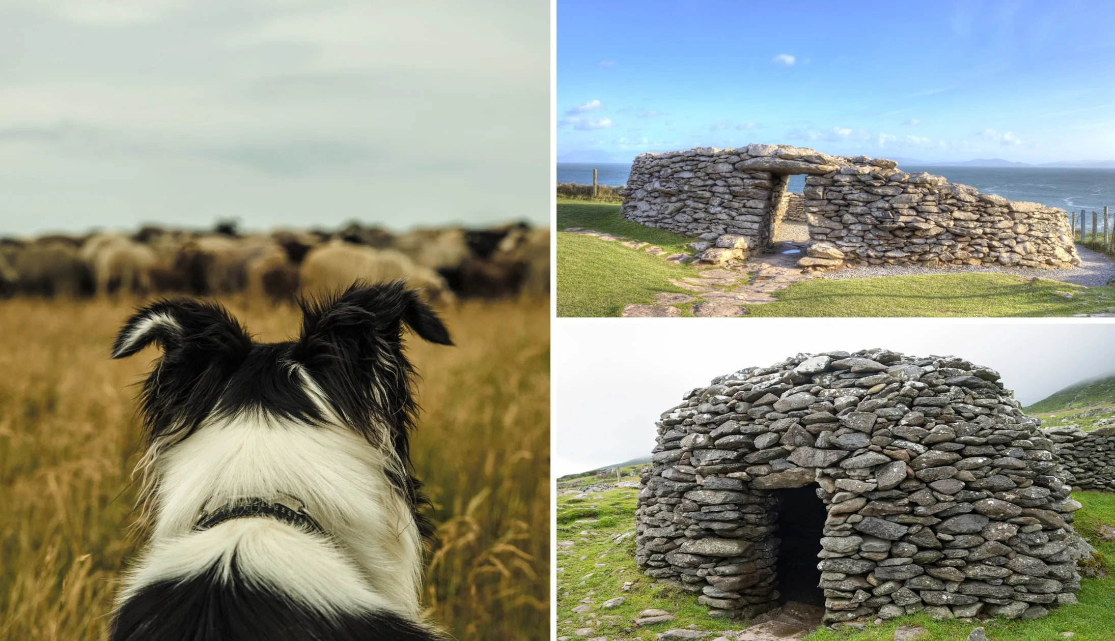
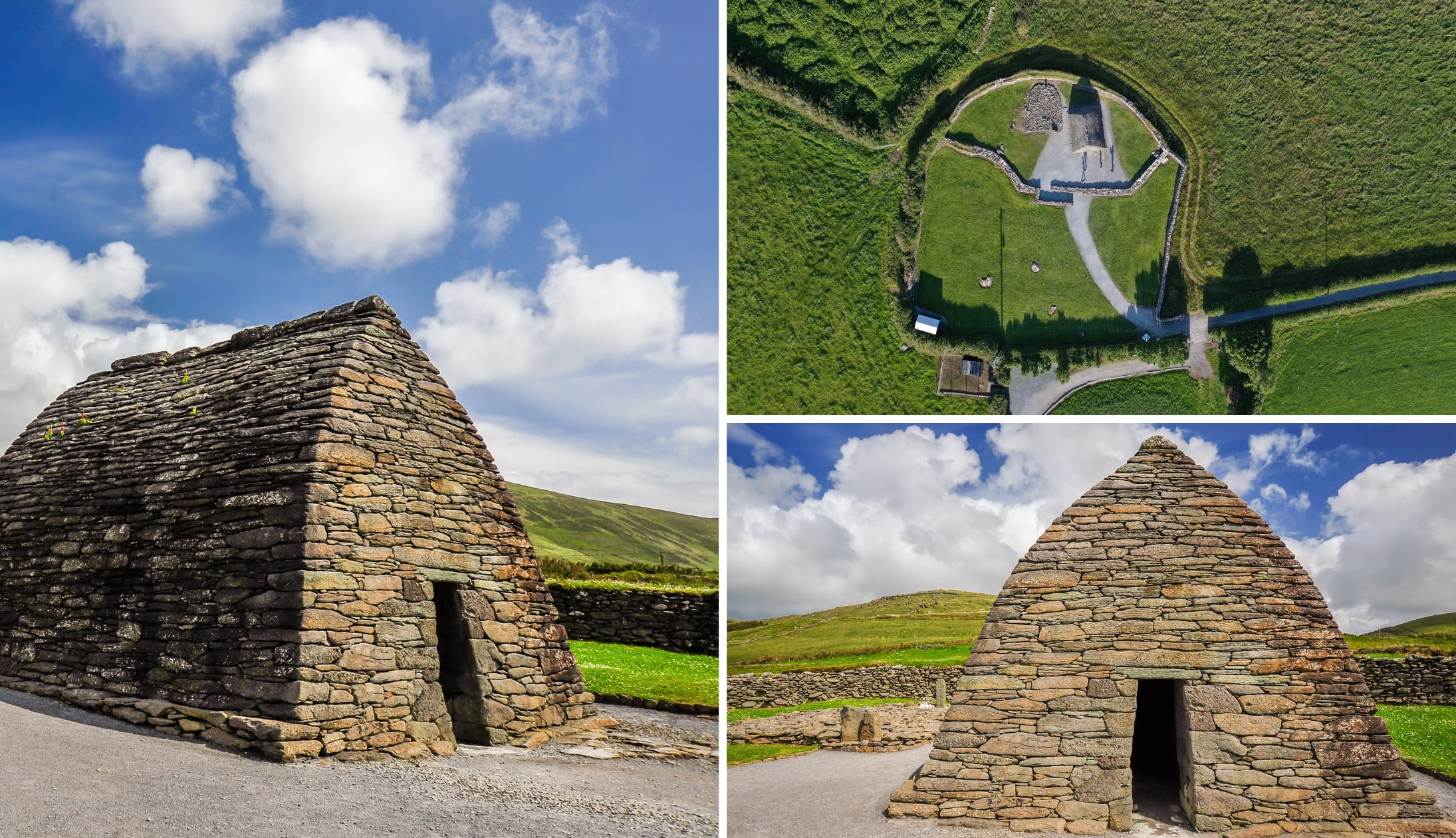
Stop 5: Beehive huts, forts and sheepdog demonstrations

Photos via Shutterstock
Personally, I’ve never stopped at any of these places when doing the Dingle Peninsula Drive.
However, if you’re interested, it’s worth checking out the reviews for each on Google and then deciding if you’d like to add any to your itinerary.
After leaving the village of Ventry, you’ll follow the road to the coast (it’s very straightforward) and it’s here that you’ll find several paid and free attractions, like:
- The Celtic Prehistoric Museum
- The FairyFort Ringfort
- The Dingle Sheepdog Demonstrations
- The Famine Cottages
- Dunbeg Fort
- The Beehive Huts.
You’ll then drive around a bend and reach Cashel Murphy followed by a place where you can hold a baby lamb As I said above, these are optional stops.
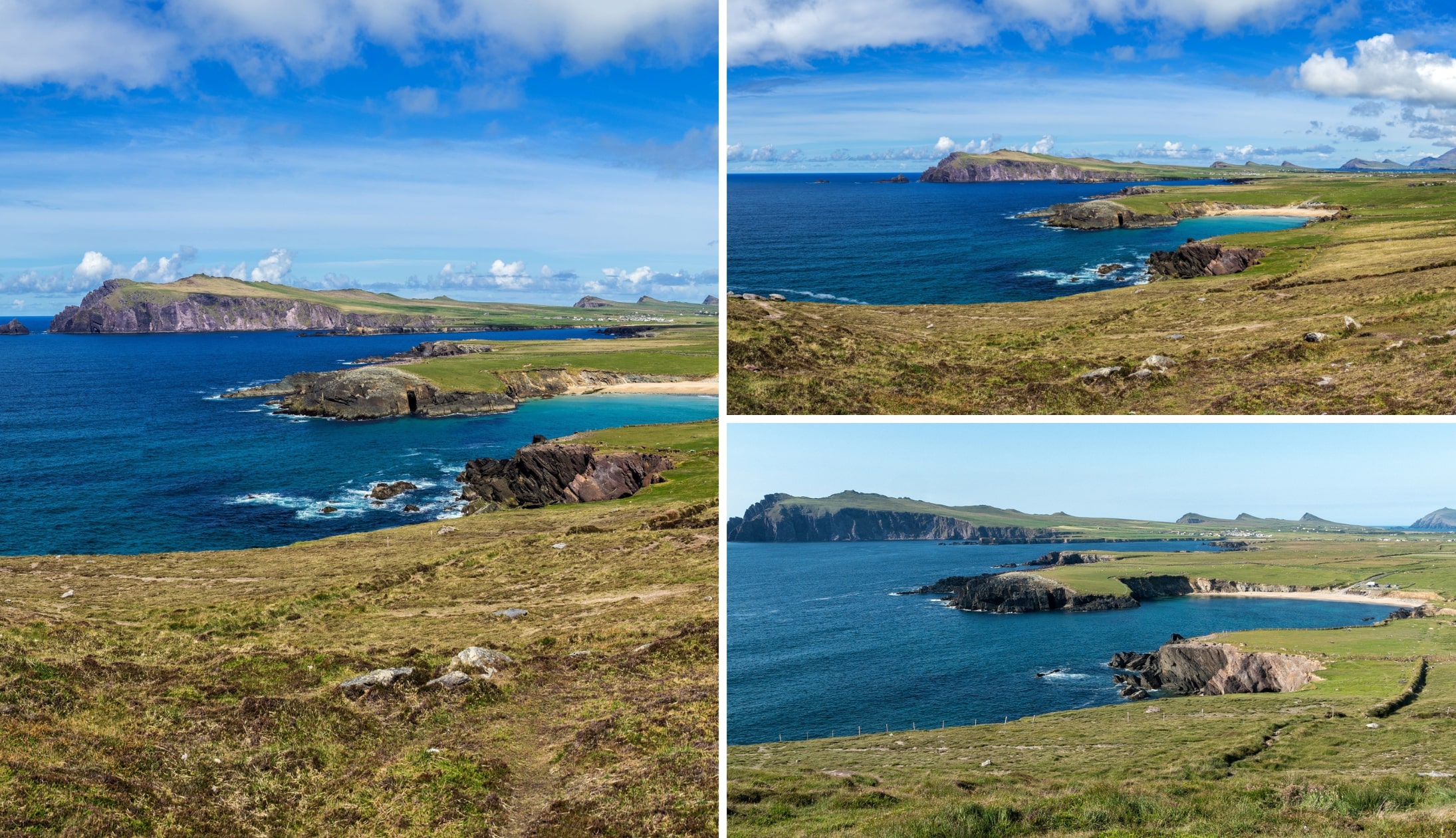
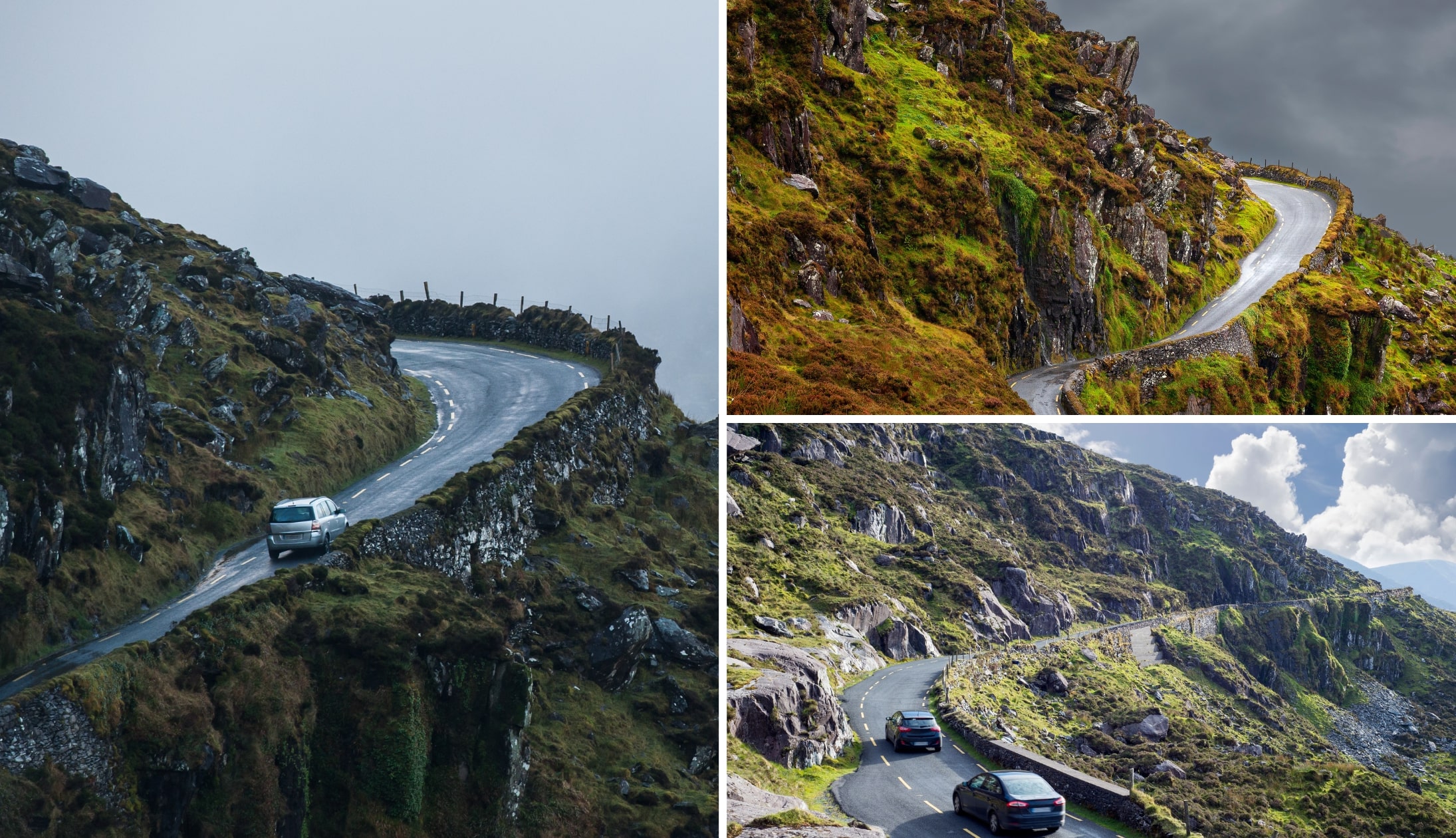
Stop 6: The viewpoints
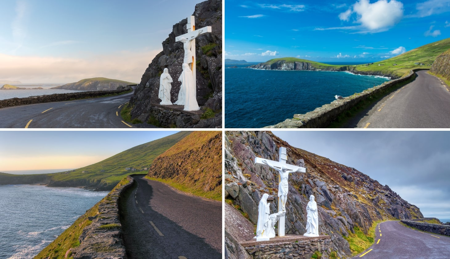

Photos via Shutterstock
The next stretch of the route is my favourite along the Slea Head Drive part of the loop.
However, a quick heads up is needed – the Dingle Peninsula Drive is dotted with magnificent view points, but there’s a problem.
Many of them are tucked away behind bends, so they’re very easy to miss. Add to this the fact that it’s near impossible to find a place to do a U-Turn safely and it can get frustrating.
Translation – time spend looking over our Dingle Peninsula Loop map above will pay dividends!
The first pair of viewpoints you’ll reach are Ceann Sleibhe and the famous White Cross. There’s a little bit of pull in space here where you can hop out and admire the view.
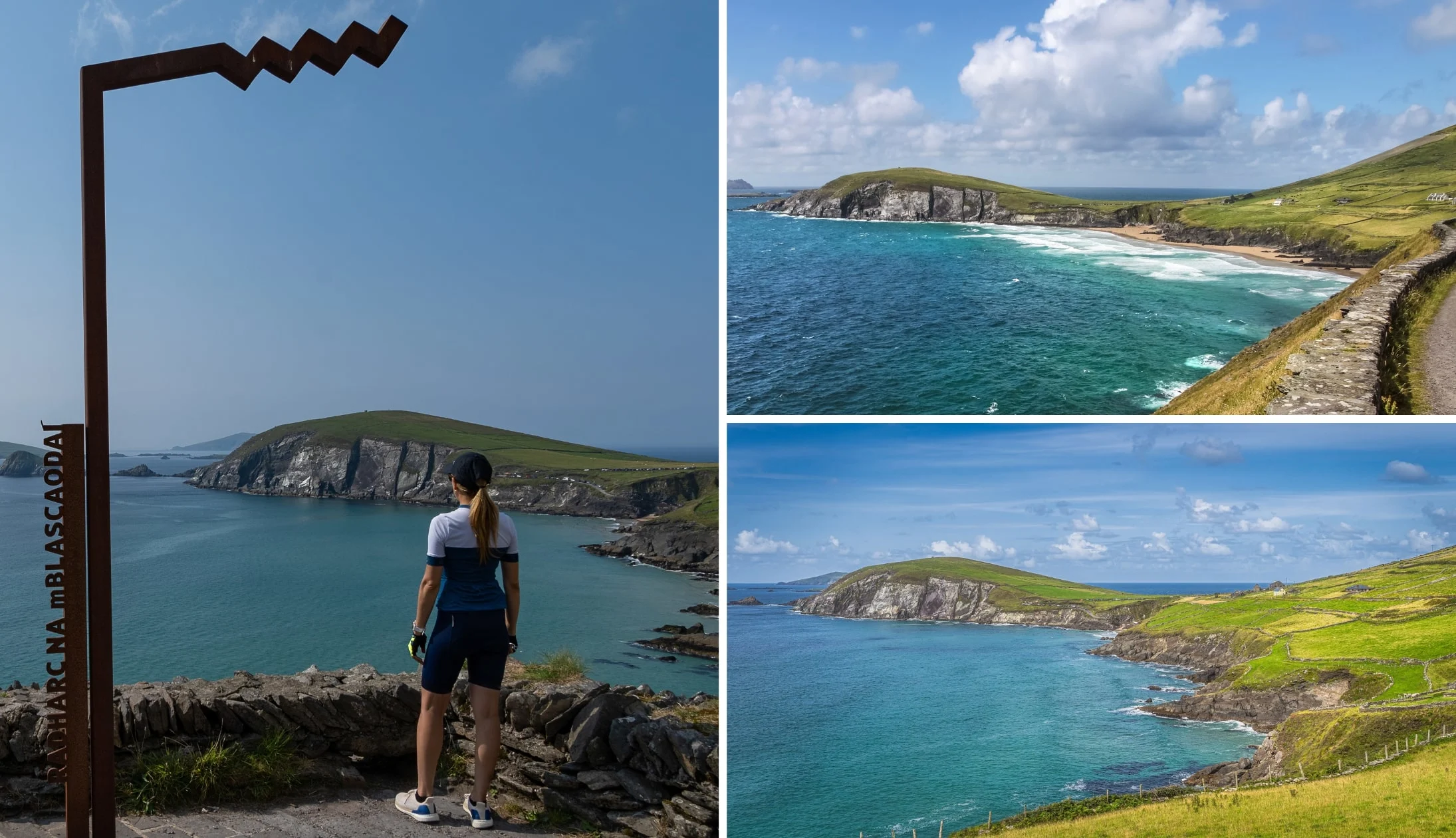
Stop 7: Radharc na mBlascaoidí viewpoint
Photos via Shutterstock
The next viewpoint is Radharc na mBlascaoidí (or ‘Blasket’s View’ as it’s listed on Google Maps), is one of the stand out stops on the Dingle Peninsula Drive, in my opinion.
There’s plenty of room to park up here and you’ll be treated to a mighty view of Dunmore Head.
If you arrive here when the weather’s wild, you can watch (and listen – you’ll have no choice!) to the waves exploding against the rugged cliffs below.
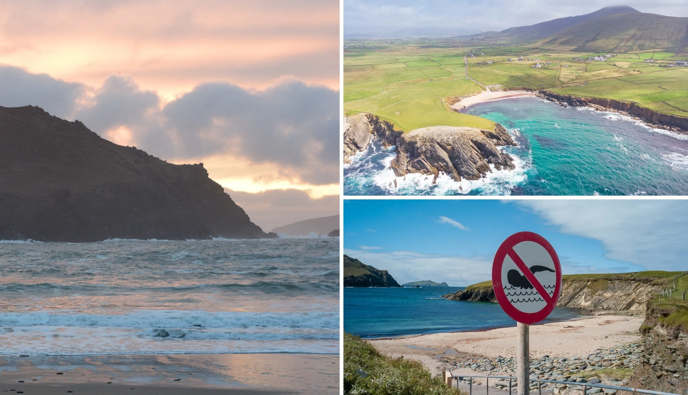
Stop 8: Coumeenoole Beach

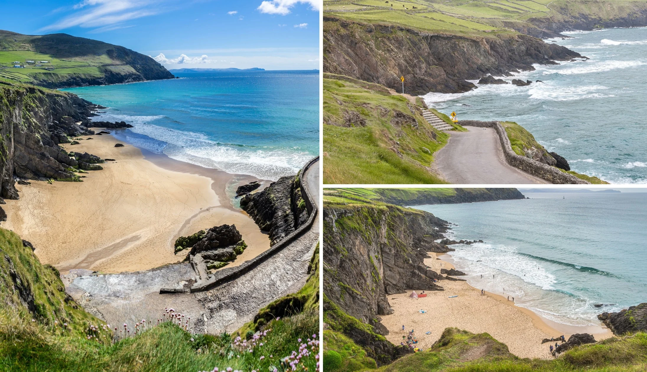
Photos via Shutterstock
Next up is Coumeenoole Beach – another filming location for the famous ‘Ryan’s Daughter’.
This beautiful beach comes with a WARNING – no matter how tempting that often-tropical water looks, keep your feet on dry land.
Coumeenoole may be one of the finest beaches near Dingle, but there’s unpredictable currents at play and swimming is highly unadvisable.
There’s a small parking spot right next to the beach, and you’ve got a couple of choices – enjoy the view from the top or stroll down the twisty path all the way to the sand.
Stop 9: Dun Chaoin Pier

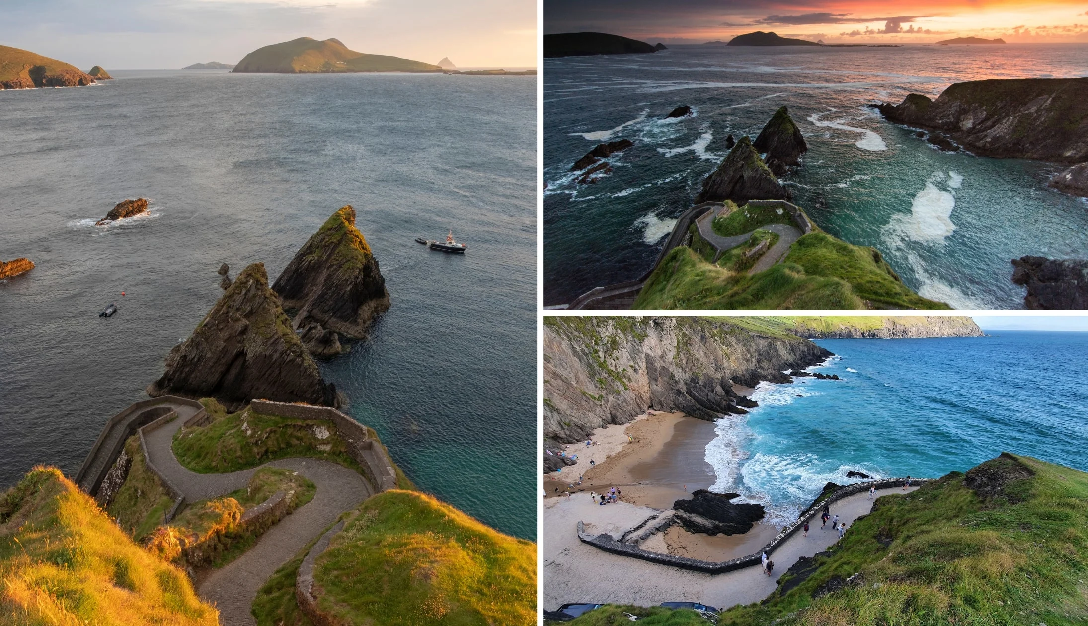
Photos via Shutterstock
Dun Chaoin Pier is arguably the most notable of the many stops on the Dingle Peninsula drive.
Boasting a quirky appearance that’s been snapped by a million-and-one photographers, it’s the departure point for the Blasket Island Ferry.
There’s two warnings for this place:
- Warning 1: The cliff edge is unguarded – avoid getting too close as the wind is very strong as times here
- Warning 2: Never drive down the bendy road. Park at the top near the ticket booth
Stop 10: The Blasket Centre

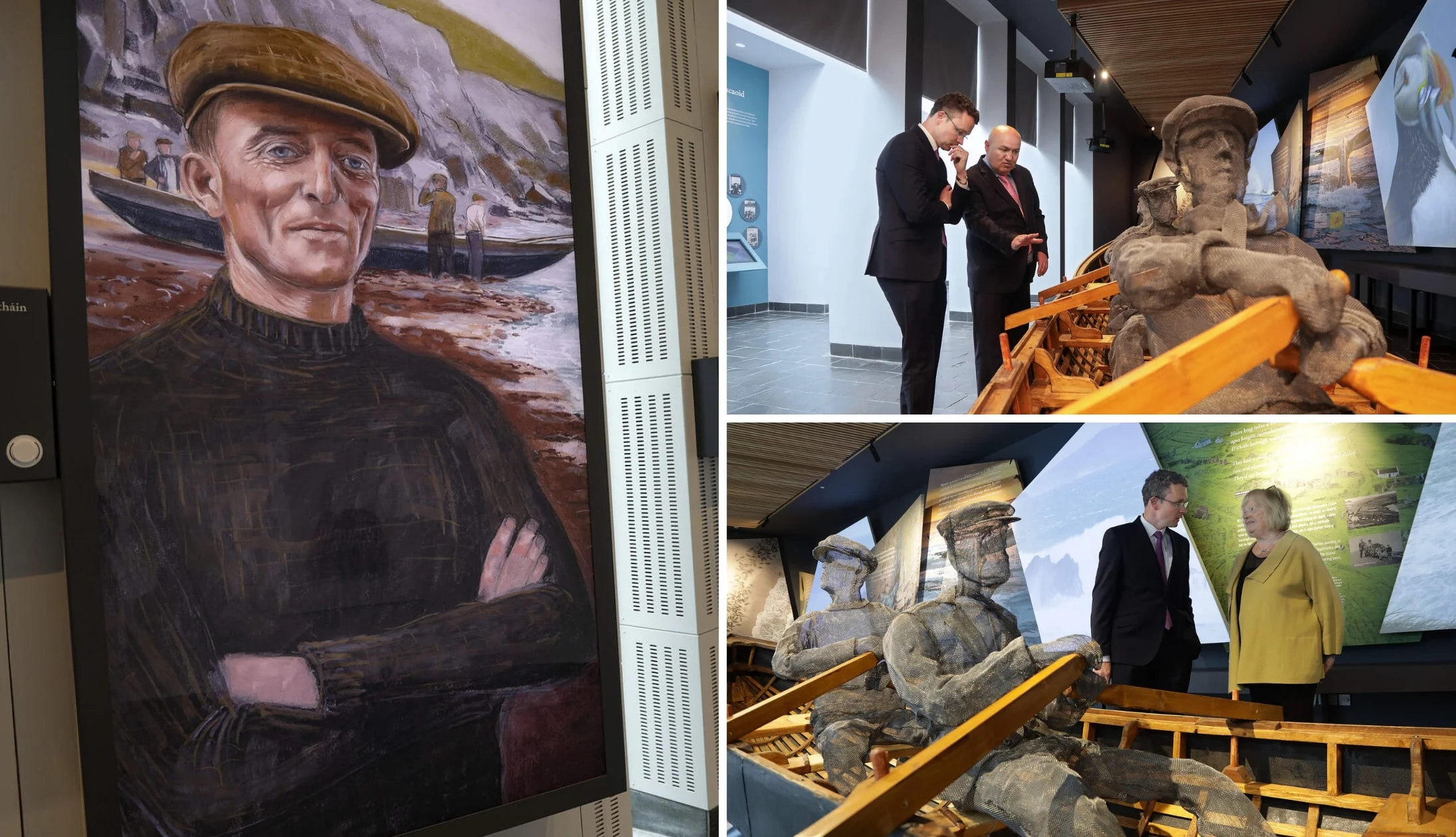
Photos courtesy Valerie O’Sullivan via Ireland’s Content Pool
Next up is The Blasket Centre – this is a great stop if you’d like to get an insight into the unique community that lived on the remote Blasket Islands prior to they were evacuated in 1953.
It’s also a handy spot to stop if it’s raining (or if you fancy a bite-to-eat… or if you need the bathroom!).
As you walk around it, you’ll get an insight into island life, how the island’s inhabitants made ends meet and plenty more.
Stop 11: Ceann Sraithe (Star Wars filming location)

Photos via Shutterstock
Another of our favourite stops along the Dingle Peninsula Drive is this little viewpoint. Now, please not that there’s no dedicated car park here.
There is, however, a nice little place to park around here if you want to take a look on Google Street View.
As you may be aware, parts of Star Wars: The Force Awakens were filmed in Ireland, most notably on Kerry’s Skellig Michael.
However, a section of the Dingle Peninsula was also used to recreate the Skellig Michael set for later movies.
Stop 12: Clogher Strand

Photos via Shutterstock
We’re headed to Clogher Strand next – it’s one several easily-missed beaches you’ll stumble upon along the Dingle Peninsula Drive.
Although it’s a no-go for swimming, Clogher Strand is a stunning little beach, nestled amidst craggy cliff faces on every side.
As you drive to the car park, it also looks like you’re about the head right into the sea (don’t worry, the car park is just to the left).
Stop 13: Wine Strand

Photos via Shutterstock
One of the more impressive beaches on the Dingle Peninsula is the mighty Wine Strand, a short spin from the previous stop.
There’s a little car park here and, as it’s tucked a little out of sight, tends to get missed by those driving Slea Head.
The views from here are outstanding and you’ll often have the place all to yourself in the off-season,
Stop 14: Gallarus Oratory

Photos via Shutterstock
Gallarus Oratory is one of the final stops on the Dingle Peninsula Drive, and it’s a place that gets plenty of mixed reviews.
There’s a visitor centre (which you need to pay into) or, if you can find parking nearby, you can access it for free via a public path.
It’s believed that Gallarus Oratory was built around the 11th or 12th century. It’s a pokey little structure, standing at just 4.8m by 3m in size.
Stop 15: Conor Pass
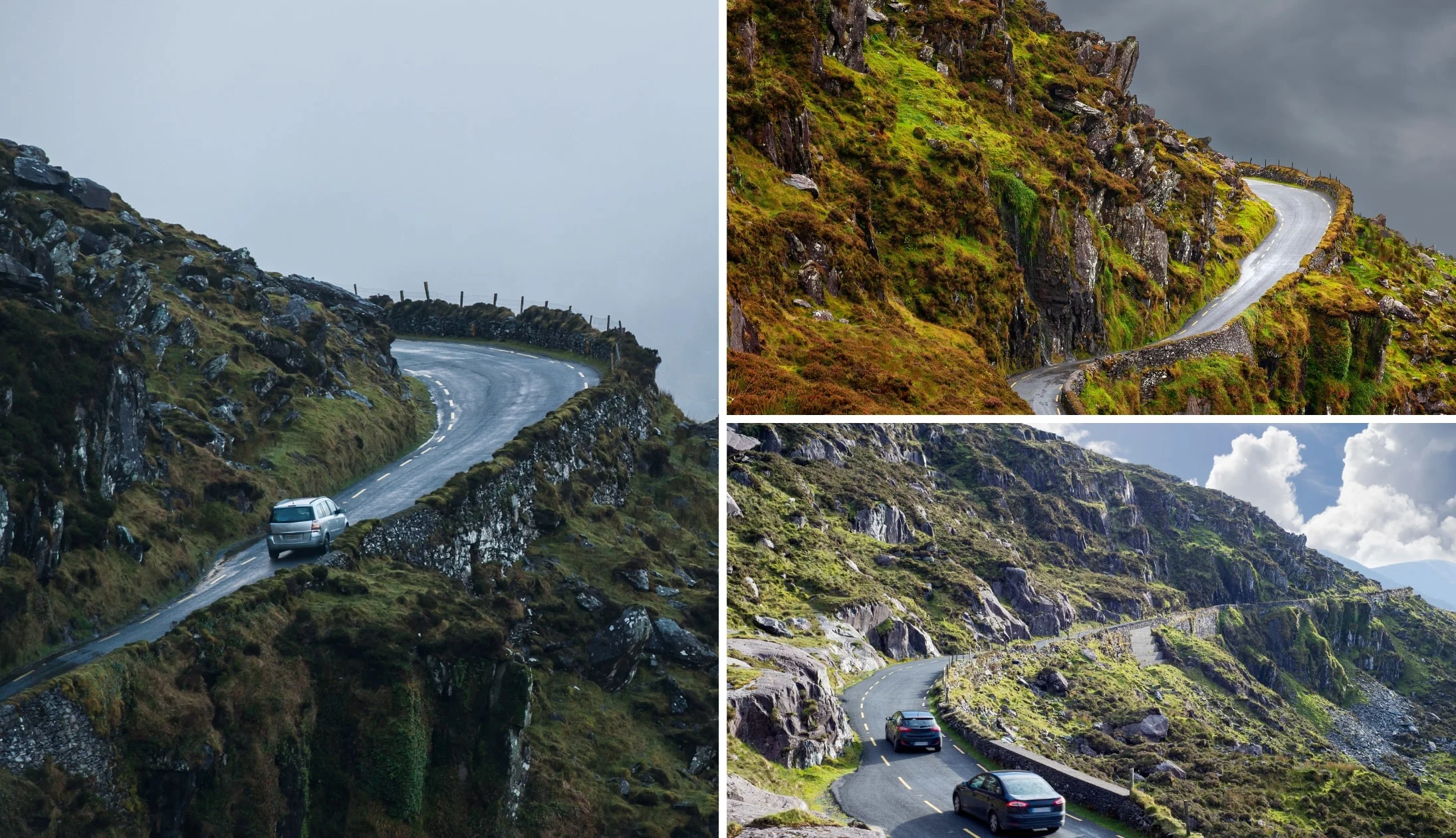
Photos via Shutterstock
The final stop in this Dingle Peninsula Drive itinerary is Conor Pass. From Gallarus, you’ll make your way back into Dingle Town and then up to Conor Pass (takes around 20 minutes).
Conor Pass is one of Ireland’s highest mountain passes, and it can be the stuff of nightmares for nervous drivers.
However, you don’t have to drive it. If you head up to it from the Dingle side, you’ll reach a car park before you hit the narrow road.
From here, you can soak up views of the surrounding valley and watch the cars navigate its narrow bends from afar.
Stop 16: Depends on where you’re heading next

Photos via Shutterstock
When you reach the other side of Conor Pass you’ll be able to continue and reach the northern side of the Dingle coastline.
If you’re heading to Tralee, it’s very straightforward from here. If you’re heading to Killarney or to one of the towns on the Ring of Kerry, you’ll have a slightly longer spin ahead of you.
Wrapping up our Dingle Peninsula itinerary
Photos via Shutterstock
The Dingle Peninsula Loop takes in many of the more popular things to do in Kerry.
If you don’t know the lay of the land, the route can be slightly confusing, but it’s easy to wrap your head around it.
Just take your time, drive carefully and enjoy the many splendours that the Dingle Peninsula throws at you.
FAQs about the Dingle Peninsula Loop
We’ve had a lot of questions over the years asking about everything from ‘Where does it start?’ to ‘How long is it?’.
In the section below, we’ve popped in the most FAQs that we’ve received. If you have a question that we haven’t tackled, ask away in the comments section below.
How long is the drive around the Dingle Peninsula?
It’ll depend on the route. However, if you follow the itinerary above, the Dingle Peninsula Loop is 90km/56 miles in length.
What is the famous drive Dingle Peninsula?
The Slea Head Drive is the world-famous section of the Dingle Loop that’s packed with historical sites and areas of outstanding natural beauty.
How long does it take to drive around Dingle?
You’ll want to allow around 1/2 a day to drive the peninsula if you follow the itinerary that we’ve outlined above. Just keep in mind that you won’t have time for any of the walks.
Keith O’Hara has lived in Ireland for 35 years and has spent most of the last 10 creating what is now The Irish Road Trip guide. Over the years, the website has published thousands of meticulously researched Ireland travel guides, welcoming 30 million+ visitors along the way. In 2022, the Irish Road Trip team published the world’s largest collection of Irish Road Trip itineraries. Keith lives in Dublin with his dog Toby and finds writing in the 3rd person minus craic altogether.