

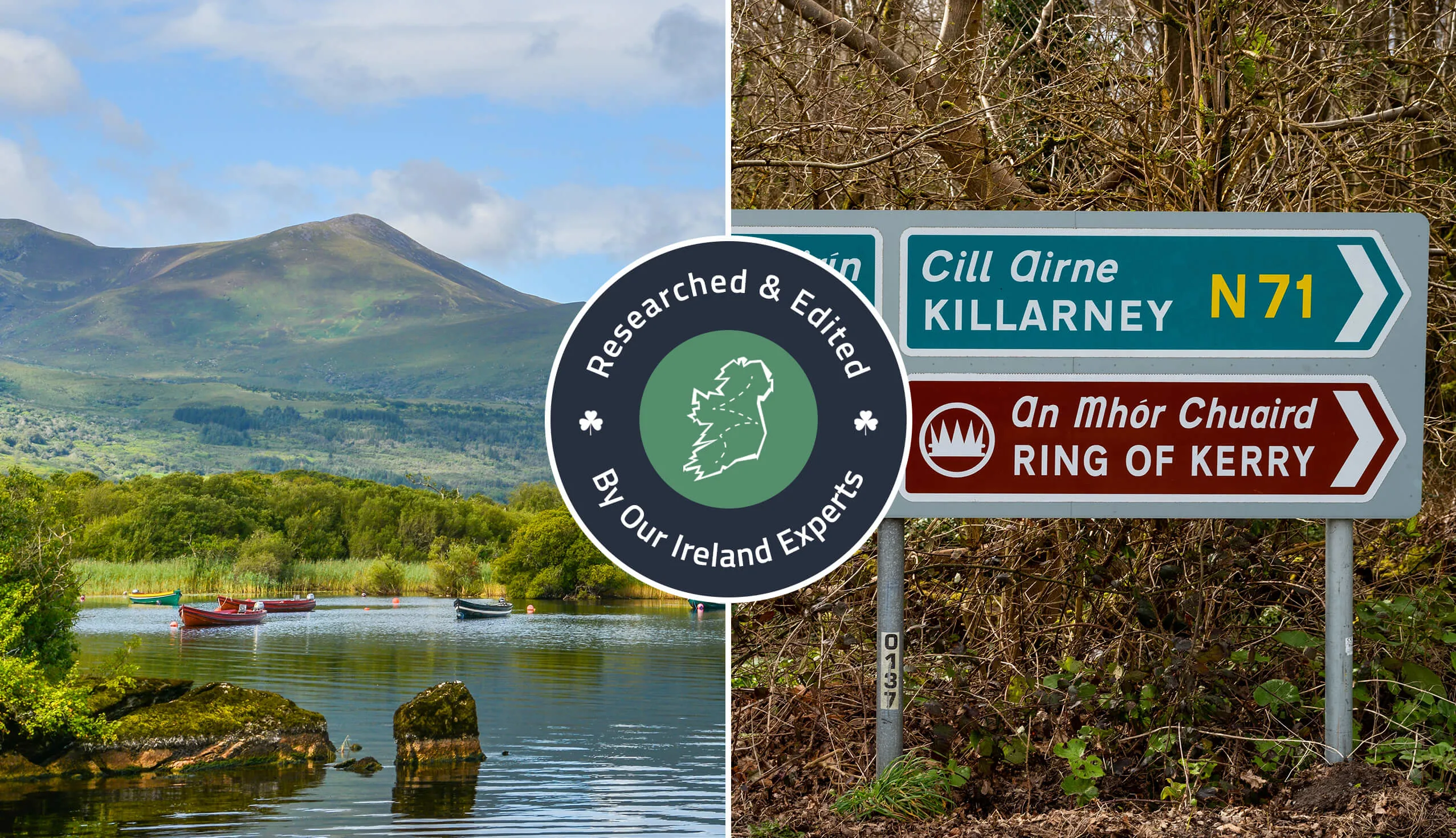
I have driven the Ring of Kerry route 14 times. In this guide, you’ll find a map with stops, an itinerary and useful info.
Home to many of the best things to do in Kerry, ‘the Ring’ is a 179km long (111 miles) scenic driving route around Kerry’s Iveragh Peninsula.
Boasting breath-taking views, historical sites and gorgeous towns, the Ring of Kerry drive (or cycle) is hard to bate, once you follow a logical itinerary.
Below, you’ll find a Ring of Kerry map with stops plotted along with a handy itinerary that you can follow. Cheers!
Some quick need-to-knows about the Ring of Kerry drive


Photos via Shutterstock
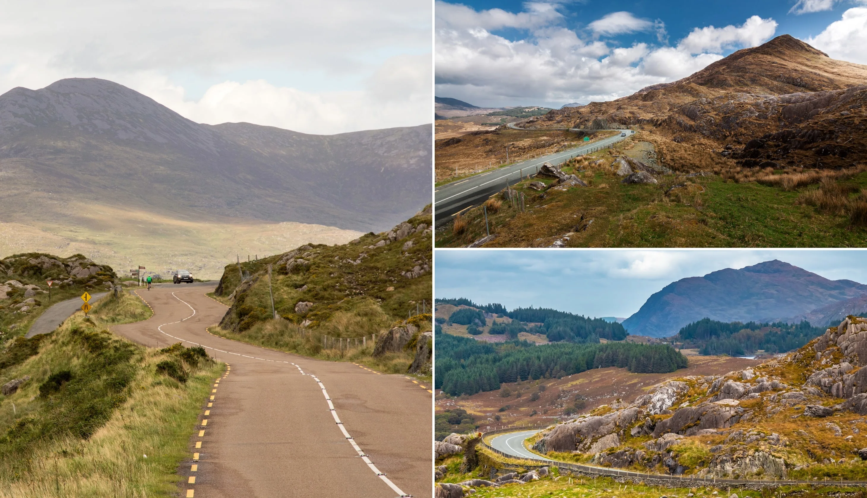
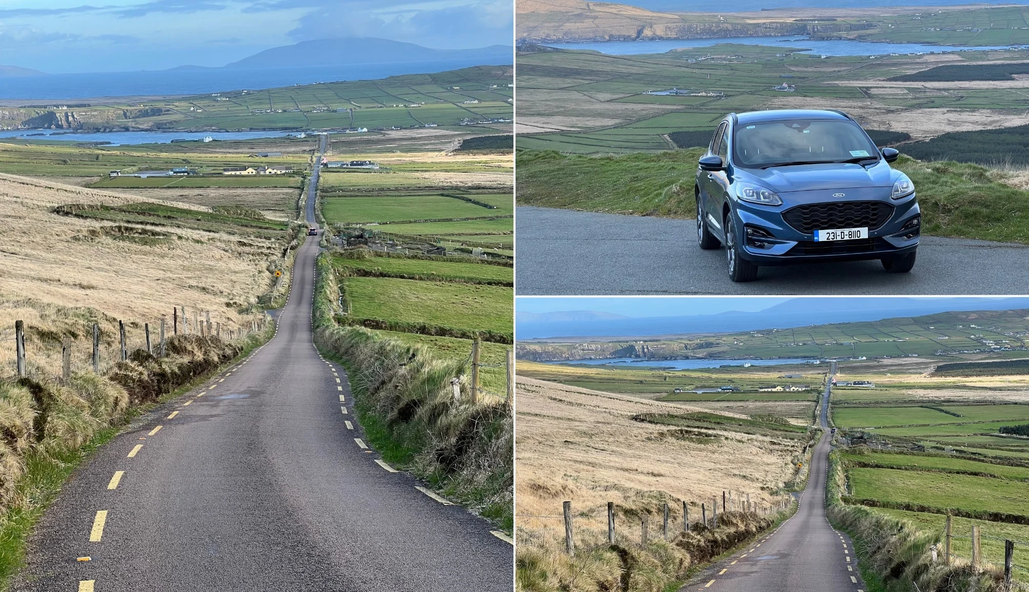
The Ring of Kerry drive leaves Killarney and follows the N71 to Kenmare before taking the N70 out and around the coast to Killorglin.
Driving the Ring of Kerry without a clear route planned will result in you missing key stops along the way. Here’s a quick overview.
1. Where it starts and ends
The Ring of Kerry route starts and finishes in the lively town of Killarney. Now, although Killarney is the traditional start and end point, you can always join the route wherever you see fit.
2. How long is the Ring of Kerry drive
The Ring of Kerry route is 179km long (111 miles) and takes in the towns and villages of Killarney, Kenmare, Sneem, Caherdaniel, Waterville, Cahirciveen, Kells, Glenbeigh, Killorglin and Beaufort.
3. How long the drive takes
If you were driving the Ring of Kerry from start to finish without stopping, it’d take you around 2.5 hours. In order to give you sufficient time to get out of your car and explore, allow at least 7 hours.
4. What direction to drive
You should do the Ring of Kerry drive in a clockwise direction as tour buses go anti-clockwise by rule. You can of course drive either way, but driving clockwise ensures that you don’t get stuck behind 2+ tour buses. It also ensures you have better roads for the last section (Glenbeigh-Killorglin-Killarney) when you’ll likely be more fatigued.
5. The 2 routes
There are 2 ways to tackle the Ring of Kerry drive. The official route (the blue line on the map below) follows the original Ring of Kerry route. The unofficial route includes the Skellig Ring (the red line on the map below). This addition is well worth adding to your Ring of Kerry itinerary, as you’ll discover below.
Our Ring of Kerry map with stops
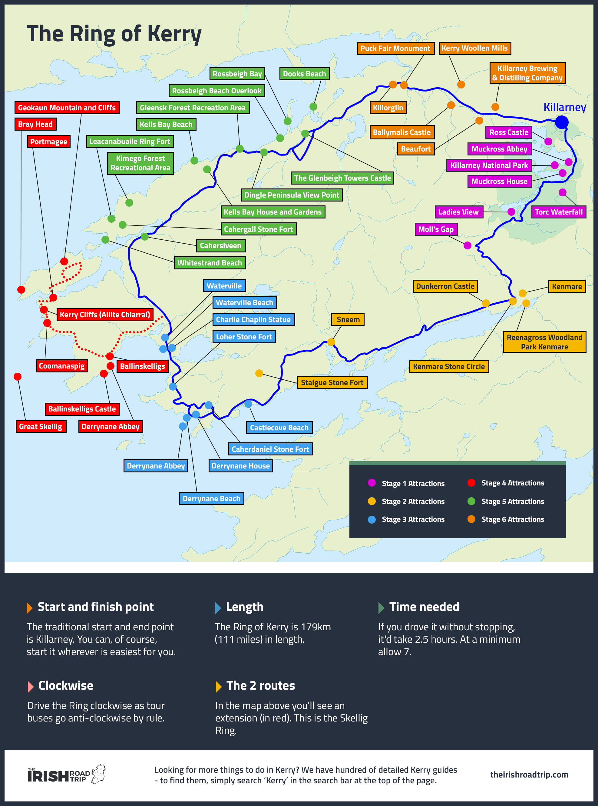

Our first Ring of Kerry map with stops is the static map above that gives you an eagle-eyed overview of the route, the different Ring of Kerry towns and the main attractions.
Take 30 seconds to look at the route above as it’ll get you familiar with the lay-of-the-land quickly.
A Google Map with the stops plotted
Our second Ring of Kerry map with stops is the Google Map above that has been used over 1,000,000 times as of 2024.
Now, you don’t have to stop at all of these places. You can pick and choose based on what you’re into.
The different coloured pointers on this Ring of Kerry map indicate the attractions located at different stages of the route.
If you’re thinking, ‘Eh where’s the Gap of Dunloe, the Black Valley and Carrauntoohil?’, they’re not actually on the Ring of Kerry route, but you can of course add them.
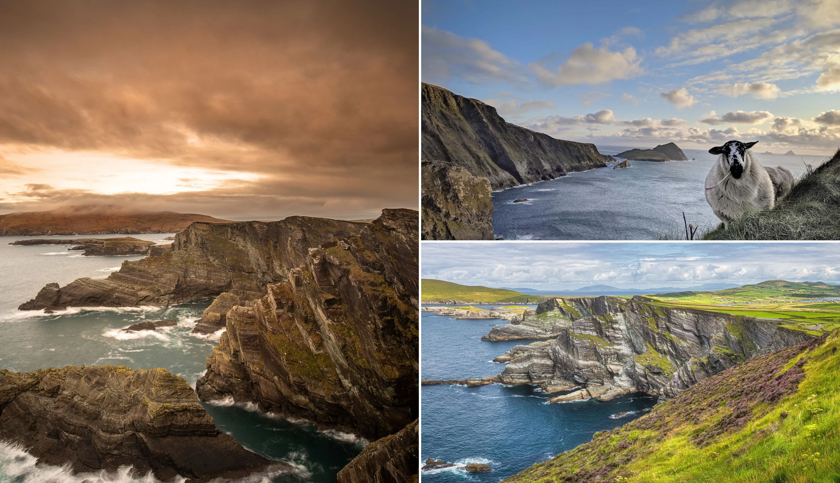
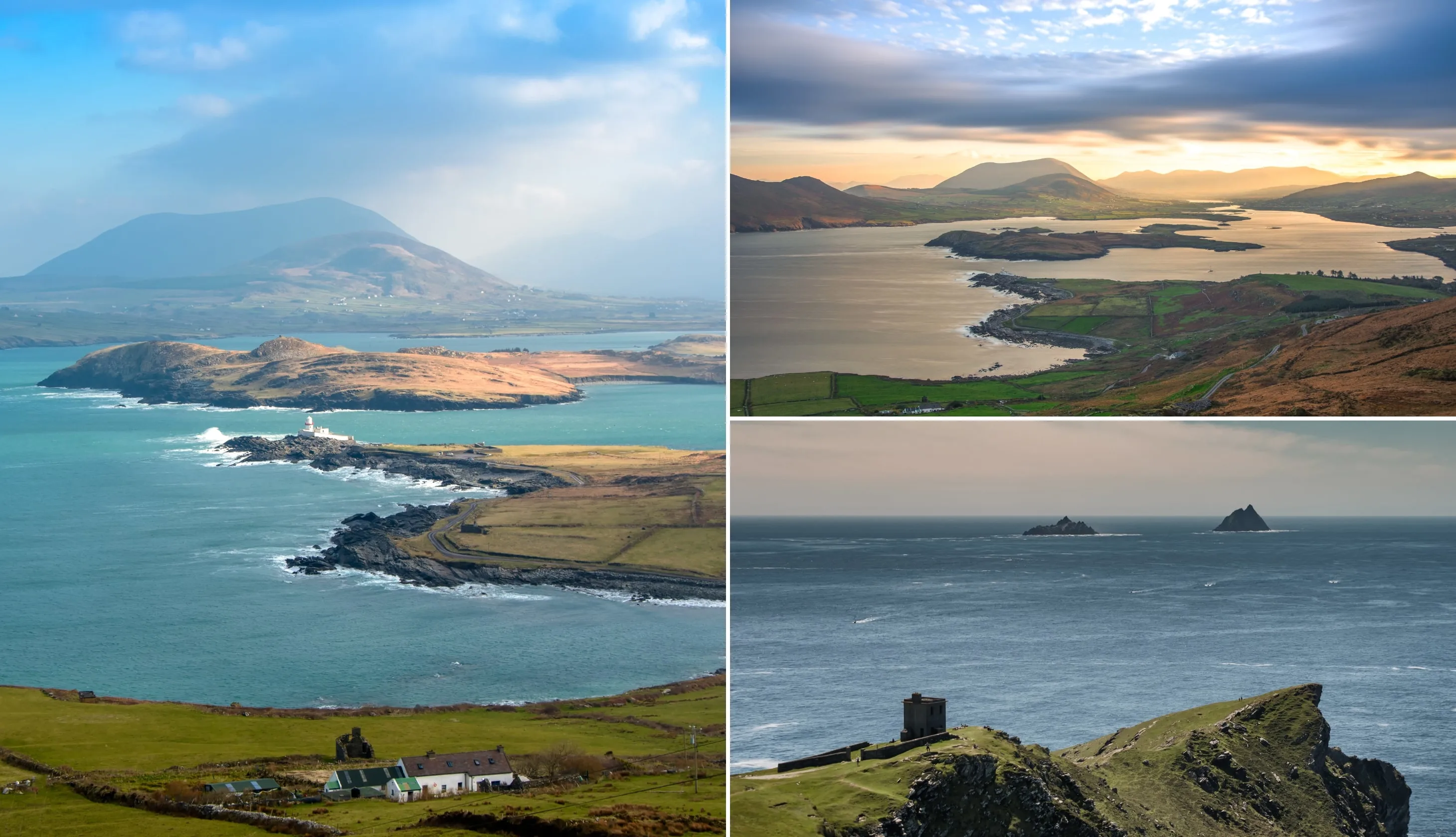
The Ring of Kerry highlights

Photos via Shutterstock
The Ring of Kerry highlights are the attractions that have graced the cover of a million + postcards over the years.
There are several Ring of Kerry highlights (we’ve included them in the itinerary below):
A 1 day Ring of Kerry itinerary

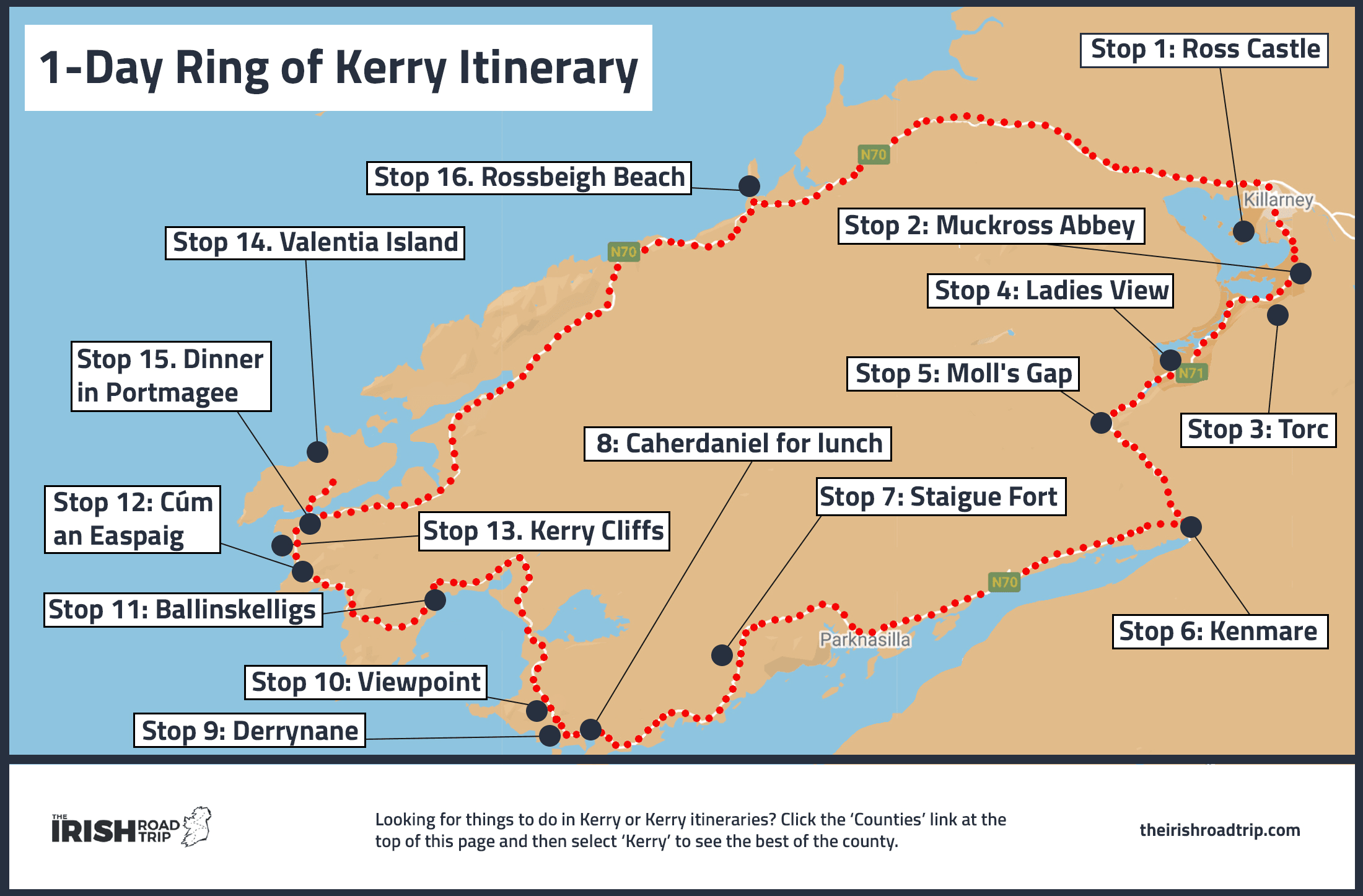
Although it’d be better to tackle the Ring of Kerry drive over 2 days, it’s doable in 1 day if you’re visiting County Kerry between April and September when the days are long.
Below, you’ll find an easy-to-follow Ring of Kerry itinerary with timings to help you conquer the route in one go. Here’s some organised tours if you’re not driving (affiliate link).
Take 10 seconds to look at the Ring of Kerry map above. This a route I’ve done many times and it includes places to stop for lunch and dinner along the way.
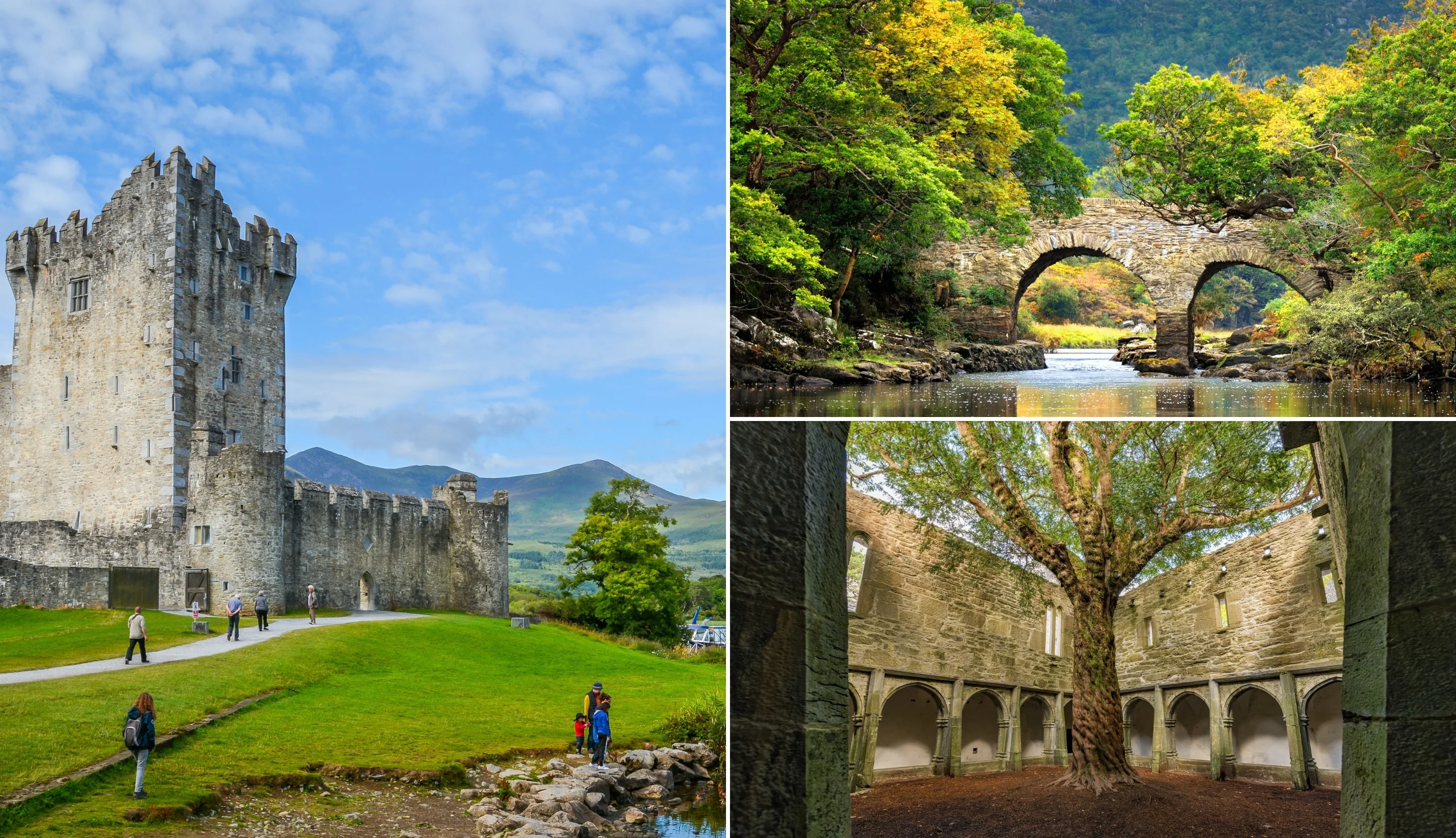
Stop 1: Ross Castle

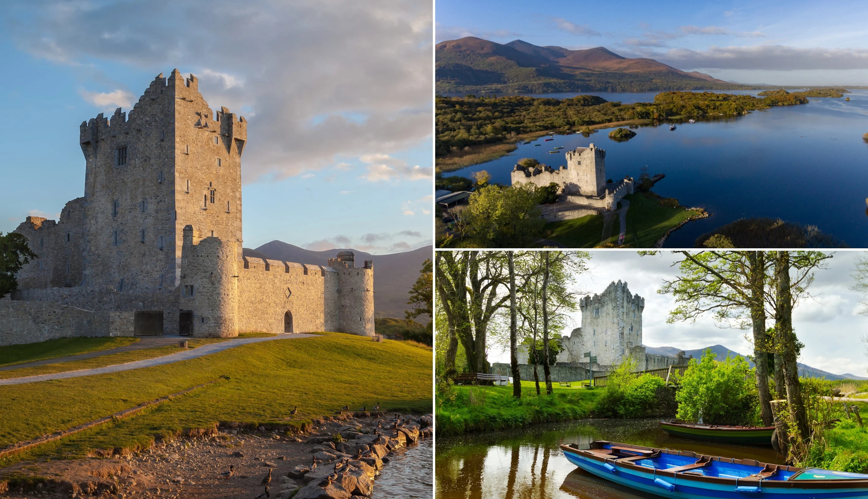
Photos via Shutterstock
Although the best way to explore Killarney National Park is by bike, you won’t have time if you’re tackling the Ring of Kerry route in a day.
So, park near Ross Castle and then head for a stroll around its impressive exterior. The castle has sat at the edge of Lough Leane for over 500 years.
You’ll get some mighty mountain and lake views as you saunter alongside it.
Key info:
- Drive time from Killarney Town: 5 minutes
- Arrive: 07:10
- Leave: 07:40
- Parking: Here on maps
Stop 2: Muckross Abbey
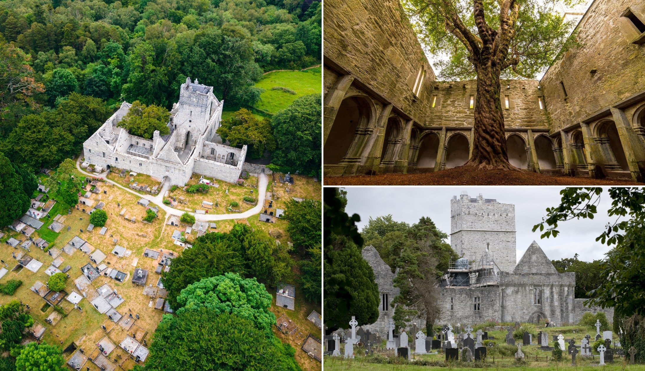
Photos via Shutterstock
The next of our Ring of Kerry stops is Muckross Abbey (not to be confused with Muckross House). If you can, try and park in this car park. You can walk through the little arch and get to the abbey in less than 10 minutes.
Although it’s mostly in ruin, many parts of Muckross Abbey, which was founded in 1448, are well preserved.
There’s an upstairs and a downstairs with the most impressive feature being the ancient yew tree that grows at its centre.
Key info:
- Drive time from last stop: 10 minutes
- Arrive: 07:50
- Leave: 08:40
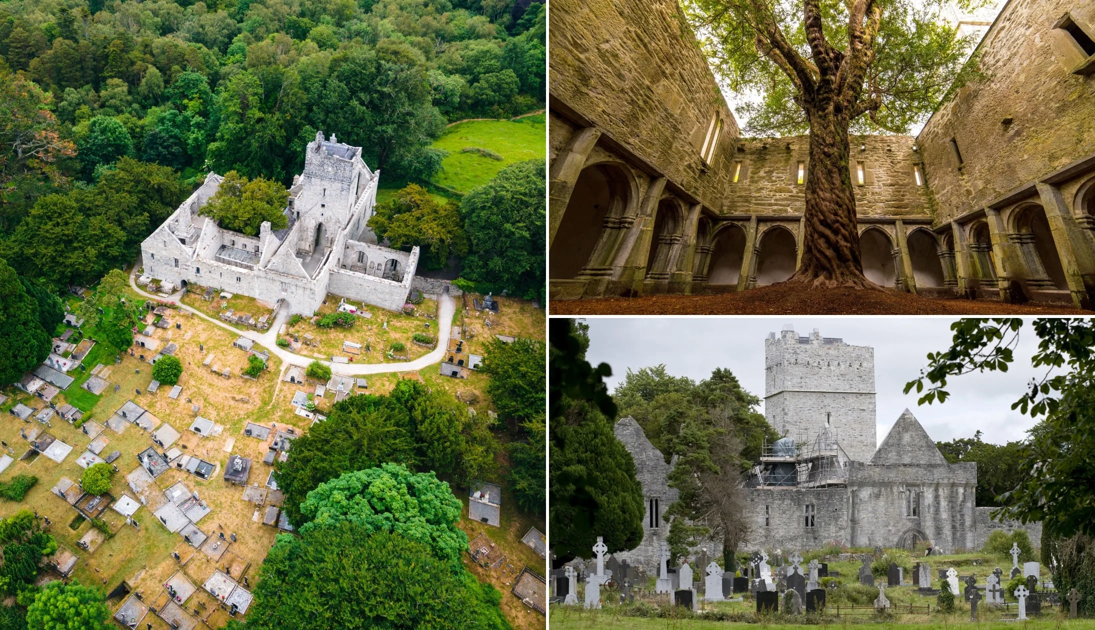
Stop 3: Torc Waterfall

Photos via Shutterstock
Torc Waterfall is a highlight on many a Ring of Kerry road trip. You can park beside it and then it’s a 5 minute walk to the waterfall.
As a visit here is one of the most popular things to do in Killarney, it gets very busy, so arrive early. Although Torc isn’t the biggest waterfall (66 ft high and 360 ft long), it’s very impressive.
It’s a handy stroll from the car park to the viewing area where you can enjoy the sight and sound of the water ‘plopping’ and crashing into the river below.
Key info:
- Drive time from last stop: 5 minutes
- Arrive: 08:45
- Leave: 09:10
- Parking: Here on maps
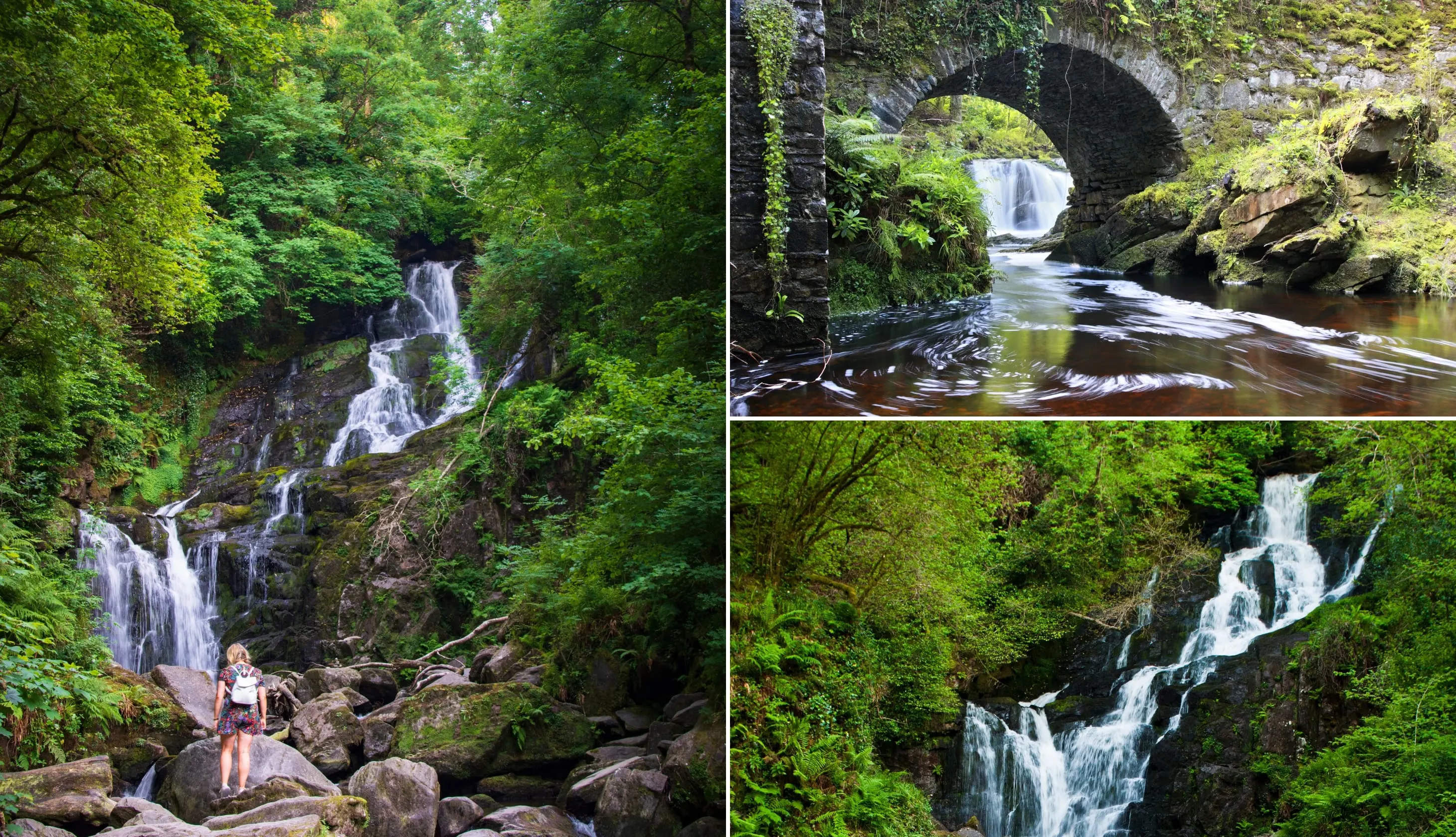
Stop 4: Ladies View

Photos via Shutterstock
The next stop in our Ring of Kerry guide takes us to the wonderful Ladies View. It got its name after Queen Victoria and Prince Albert visited in 1861.
It’s said that the Queen’s ‘ladies-in-waiting’ (i.e. personal assistants) were so taken by the view that it was named after them!
Park next to the viewing area, step out and soak up a view of the National Park and the Lakes of Killarney.
Key info:
- Drive time from last stop: 20 minutes
- Arrive: 09:30
- Leave: 09:50
- Safety warning: Be extremely careful when pulling out of the car park
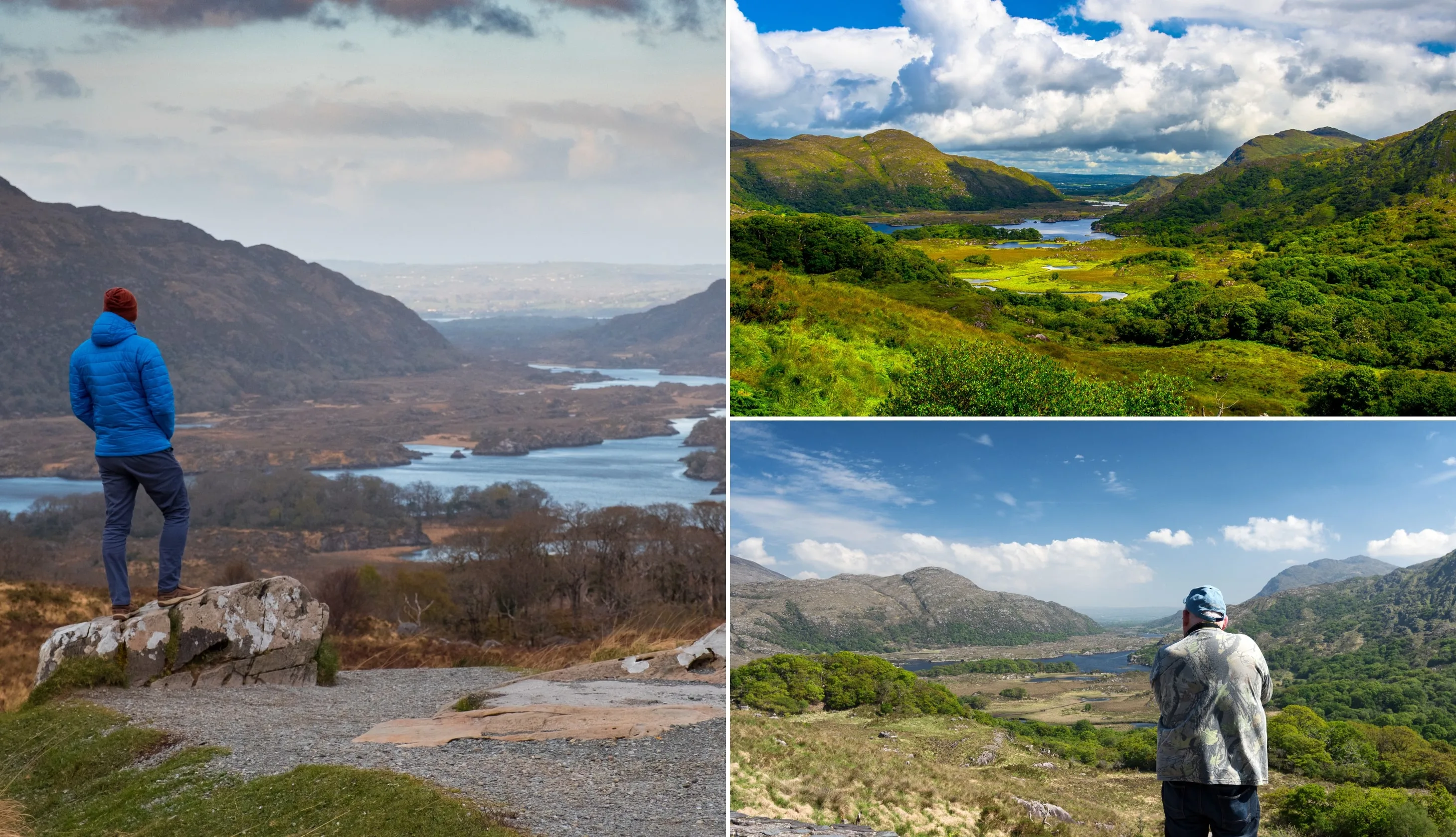
Stop 5: Moll’s Gap

Photos via Shutterstock
The next stop on the Ring of Kerry drive is the mighty Moll’s Gap – a bendy pass that offers spectacular views of the Macgillycuddy’s Reeks.
You can park right next to it in the Avoca car park. It got its name from Moll Kissane who ran a Sibin (unlicensed pub) during the construction of the Killarney to Kenmare road in the 1820s.
She was well-liked in the area. Possibly due to the fact that she sold homemade Poitin to the men working on the road.
Key info:
- Drive time from last stop: 10 minutes
- Arrive: 10:00
- Leave: 10:10
- Parking: Here on maps
Stop 6: Kenmare

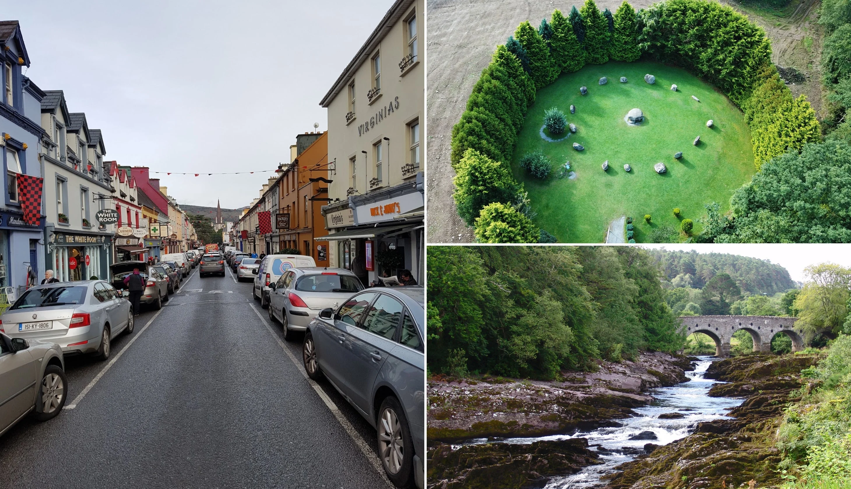
Photo left: The Irish Road Trip. Others: Shutterstock
Next up is Kenmare – a lovely little town that’s a lot quieter than Killarney (it’s also home to a handful of Ring of Kerry hotels!).
Although, there are plenty of things to do in Kenmare (like the stone circle), as this is a 1 day Ring of Kerry itinerary, I’m going to recommend you grab a coffee and head for a wander.
Aim for Henry Street (left in the photo above) to see the colourful shops and pubs that have graced many-a-postcard.
Key info:
- Drive time from last stop: 15 minutes
- Arrive: 10:25
- Leave: 11:00
- Parking: Here on maps
Stop 7: Staigue Stone Fort

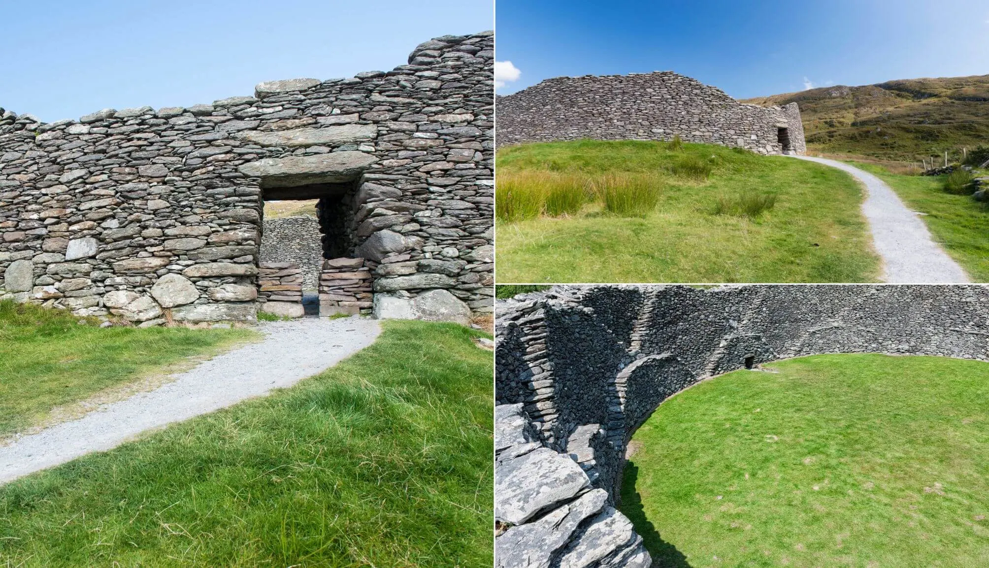
Photo bottom right: powerofforever. Others: pepmiba (Canva)
Many driving the Ring of Kerry tend to miss Staigue Stone Fort but, as the reviews online will attest, it’s well worth a visit.
It’s thought that it was constructed during the late Iron Age (sometime between 300 and 400 AD) to act as a defensive structure, likely for a local king.
It was partly restored and you can walk inside it. There are some glorious views of the surrounding countryside from Staigue, too!
Key info:
- Drive time from last stop: 50 minutes
- Arrive: 11:50
- Leave: 12:20
- Parking: Here on maps
- Coin needed: €1 entrance fee
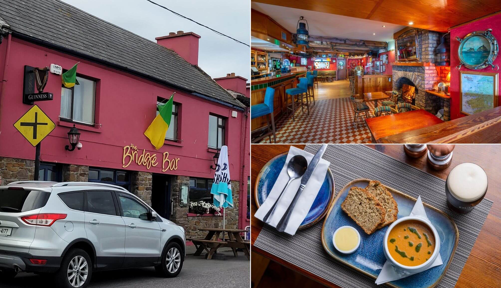
Stop 8: Lunch


Photos via the Blind Piper
This is one of our optional Ring of Kerry stops. You’ll likely need a feed at this point and, luckily enough, you’ll have to pass through Caherdaniel.
Head for the Blind Piper (a traditional pub), relax for a bit and fuel up with some hearty fare. There’s plenty more exploring to be done!
Key info:
- Drive time from last stop: 15 minutes
- Arrive: 12:35
- Leave: 13:20
- Location: Here on maps
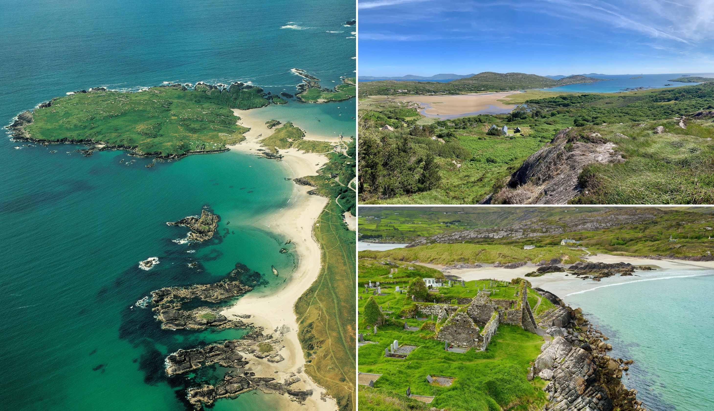
Stop 9: Derrynane Beach

Photos via Shutterstock
You’ll find Derrynane Beach, one of the best beaches in Kerry, a short spin from our lunch spot and the perfect place to walk off your lunch!
Derrynane is reasonably sheltered and boasts a natural harbour. Keep an eye out for the ruins of Derrynane Abbey (believed to date to the 6th century) as you saunter along the sand.
This is one of the most frequently missed Ring of Kerry stops, but it’s well worth the short detour.
Key info:
- Drive time from last stop: 10 minutes
- Arrive: 13:30
- Leave: 14:00
- Parking: Here on maps
Stop 10: Coomakista viewpoint


Photos by The Irish Road Trip
One of the best things about driving the Ring of Kerry is the endless Wild Atlantic Way discovery points that you stumble upon.
One of the most popular is the Coomakista viewpoint. There’s plenty of parking here and, on a clear day, you’ll have unbeatable views of Deenish and Scariff islands.
Key info:
- Drive time from last stop: 10 minutes
- Arrive: 14:10
- Leave: 14:25
- Parking: Here on maps
Stop 12: Coomanaspig via Ballinskelligs

Photos by The Irish Road Trip
If you look at our Ring of Kerry map with stops you’ll see that we’re now entering the Skellig Ring.
When you leave Derrynane, you’ll pass through the coastal town of Waterville before making your way to Ballinskelligs.
Hop out for an eyeful of Ballinskelligs Beach (lookout for the castle) and then head up to Coomanaspig Pass – it’s one of the highest places in Ireland reachable by car.
There’s a fine big viewing area with parking. When you’re ready, make your descent towards our next stop.
Key info:
- Drive time from last stop: 45 minutes
- Arrive: 15:10
- Leave: 15:30
- Parking: Here on maps
13. The Kerry Cliffs

Photos via Shutterstock
Next up is another spot that’s missed by many driving the Ring of Kerry – the 1,000 ft high Kerry Cliffs.
The cliffs, which are believed to be over 400 million years old, are reached via private land (I think it was €5/6 when I was here last). It’s a steep 10-minute walk up to the view point but it’s well worth the effort.
Although Clare’s Cliffs of Moher and Donegal’s Slieve League get much of the attention from tourists, the Kerry Cliffs are strong contenders for Ireland’s most impressive cliffs.
Key info:
- Drive time from last stop: 2 minutes
- Arrive: 15:35
- Leave: 16:35
14. Geokaun Mountain

Photos via Shutterstock
The next stop on our Ring of Kerry road trip is Valentia Island (connected to Portmagee village by the Maurice O’Neill Memorial Bridge).
When you arrive on the island, head up to the car park near Bray Head. You’ll get an eyeful of the Skellig Islands from here. When you’re done here, make your way up to the Geokaun Mountain and Cliffs.
There’s a €5/6 entry fee and then you take the very steep ‘road’ to the viewing area. It’s from here that you’ll get one of the finest views on the Ring of Kerry drive.
You’ll see everything from Knightstown below to the Dingle Peninsula off in the distance.
Key info:
- Drive time from last stop: 20 minutes
- Arrive: 16:55
- Leave: 17:40
- Parking: Here on maps
15. Dinner in Portmagee

Photos via the Moorings
Next is another of the optional Ring of Kerry stops, but it’ll likely be dinner time when you reach this point so head to Portmagee.
One of the best options food-wise in this little village is the Moorings. Head in and fuel up for the final section of the Ring of Kerry route.
Key info:
- Drive time from last stop: 10 minutes
- Arrive: 17:50
- Leave: 18:40
- Parking: Here on maps
16. Rossbeigh Beach

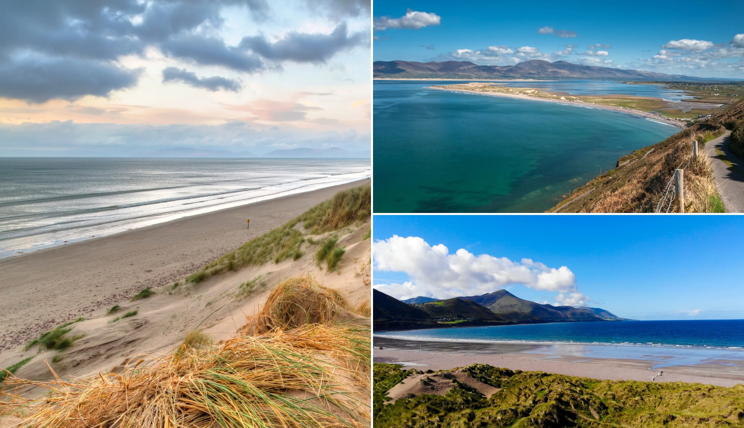
Photos via Shutterstock
The last stop on our Ring of Kerry route is the beautiful Rossbeigh Beach. Now, if you want you can stop in Cahersiveen en route to Rossbeigh (refer to our Ring of Kerry map for ideas on what to do).
However, as it’s getting late in the day, we’re going to power on. Rossbeigh Strand is one of the more popular beaches near Killarney and there’s plenty of parking.
This is a lovely stretch of sand for a ramble, especially after the long drive from Portmagee.
Key info:
- Drive time from last stop: 45 minutes
- Arrive: 19:25
- Leave: 19:45
- Parking: Here on maps
Stop 17: Pints in Killarney

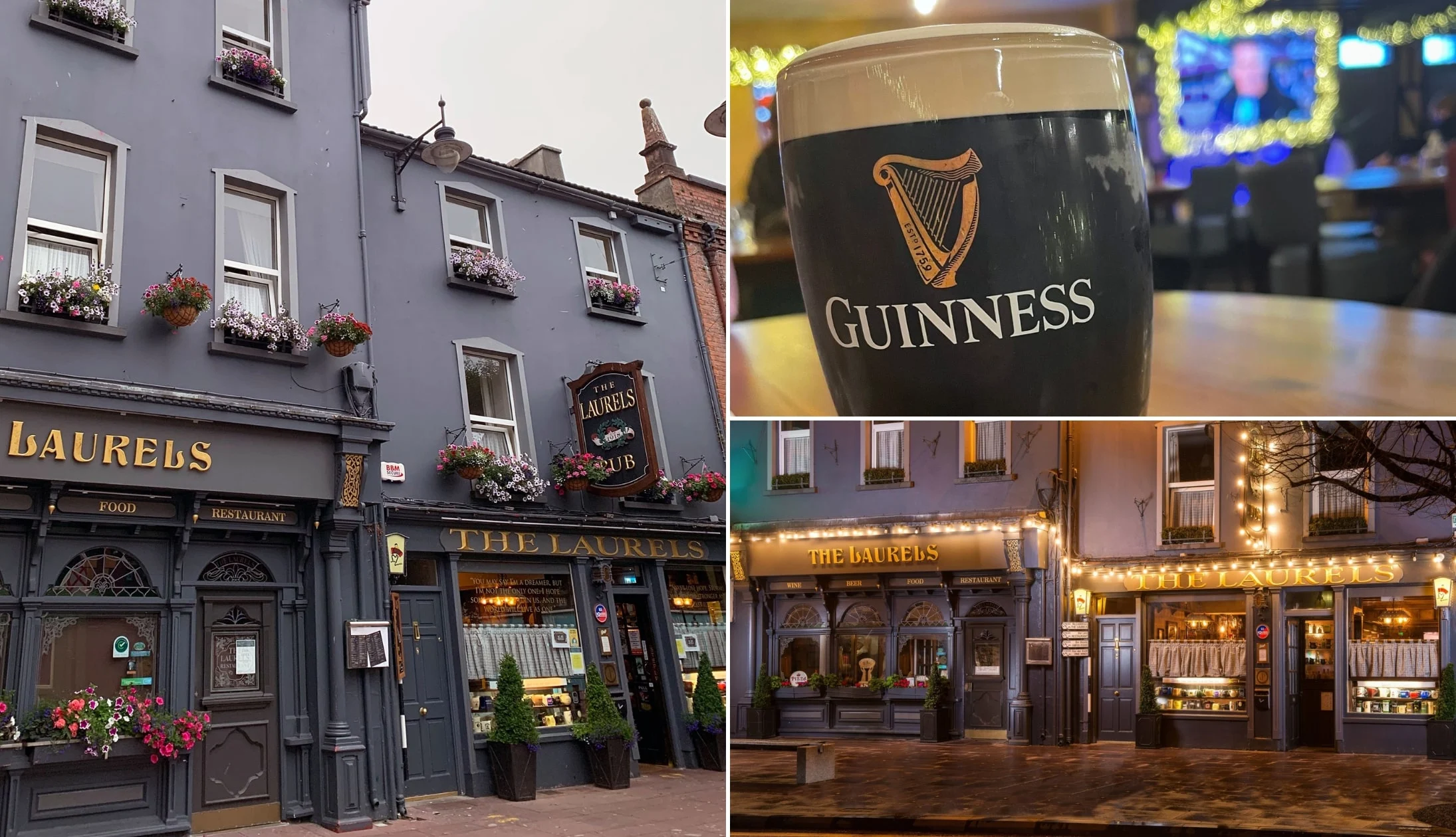
Photos via The Laurels on FB
When you finish up at Rossbeigh, it’s time to head on to Killarney, and it’s here that our Ring of Kerry itinerary comes to an end.
There are plenty of great pubs in Killarney to nip into and there are endless restaurants in Killarney for a feed.
If you’re looking for accommodation in Killarney, these guides should come in handy:
- Our favourite hotels in Killarney
- 11 B&Bs in Killarney that make a good base
- 5 fanciest 5 Star Hotels In Killarney
The Ring of Kerry drive: Wrapping it all up

And that’s a wrap. The Ring of Kerry route itinerary that I’ve outlined above is a busy one, but it’ll suit those that only have 1 day.
If you had 2 days, you could add in some of the walks in Killarney, like the Torc Mountain walk and Cardiac Hill
You could then do the rest of the Ring of Kerry route outlined on the map at the start of this guide, at a much slower pace.
Regardless of which way you tackle it, enjoy it, and don’t feel the need to tick off all of the various Ring of Kerry stops, as you’ll just end up spending all of your time driving.
FAQs about driving the Ring of Kerry
Since first publishing a Ring of Kerry route planner many years ago, we’ve had hundreds (literally) of emails and messages asking various questions.
I’ve tried to tackle the most FAQs below, however, if you have a question that we haven’t answered, ask away in the comments section.
Is the Ring of Kerry drive worth doing?
Yes. The Ring of Kerry route takes in many of the county’s most famous attractions, like the National Park. It’s also a straightforward route with plenty of towns along the way.
How long does it take to drive the Ring of Kerry route?
The route, which follows the N71 and the N70 roads, measures 179 km/111 miles. Driving the Ring of Kerry from start to finish without stopping takes 2.5 – 3 hours. Allow 7 – 10 hours with stops.
Where does Ring of Kerry start and end?
The Ring of Kerry route starts and finishes in Killarney. It takes in key attractions like Killarney National Park, Torc Waterfall, Ladies View and Derrynane Beach. However, the magic of the Ring of Kerry drive is the scenery you encounter along the route.
Is the Ring of Kerry difficult to drive?
Although some road along the Ring of Kerry route are narrow in places, the circuit is not difficult to drive. Make sure to plan your route and drive with care and caution.
Keith O’Hara has lived in Ireland for 35 years and has spent most of the last 10 creating what is now The Irish Road Trip guide. Over the years, the website has published thousands of meticulously researched Ireland travel guides, welcoming 30 million+ visitors along the way. In 2022, the Irish Road Trip team published the world’s largest collection of Irish Road Trip itineraries. Keith lives in Dublin with his dog Toby and finds writing in the 3rd person minus craic altogether.
Steve Michener
Thursday 23rd of February 2023
Keith- thanks for putting in the effort to do this. We are doing the drive next week and we'll use your guide to lead us. I did notice that the link at the end to affordable hotels is the same one as the luxury hotels so that could use a fix.
Laura Joyce
Friday 2nd of December 2022
We are very much in the planning stage of our trip in May 2023. Thankyou so much for your detailed information it’s been so help full Laura from Australia
Anders Bergåker
Wednesday 10th of August 2022
Awesome guide! Did an amazing one day tour today and your map and tips was a great help! I'd say 7h is a bit optimistic, plan for at least 10h! Cheers, Anders
Akshay
Wednesday 23rd of March 2022
The best road trip guide I’ve ever gotten and everything, every place was perfect. We had 1 day in Kerry and wanted to drive the ring of Kerry and this article was absolutely spot on.
Keith O'Hara
Wednesday 23rd of March 2022
Cheers Akshay! Glad you found it useful and that you enjoyed the spin!
Kim McPartland
Sunday 8th of March 2020
Love the info and suggestions. We are think8ng of doing the alternative route late August early September, in out camper van. Do you have any information on campsites along the route. Also what's the position regarding wild camping? Any advice would be welcome.