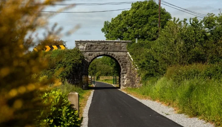
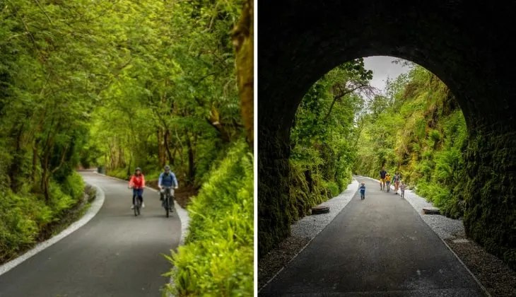
The Limerick Greenway is a 40km route that can be tackled in one swoop or over the course of multiple days.
Set along the historic long Limerick – Tralee railway, this mighty greenway offers cyclists and walkers stunning countryside scenery to explore.
In the guide below, you’ll find everything from a Limerick Greenway map and where to park along the route to what to expect from the cycle.
What to know before cycling the Limerick Greenway

Photos courtesy of True Media (Sean Curtin) via Tourism Ireland’s Content Pool
We’ve broken up some important need-to-knows into chunks of info that you can scan. Take 30 seconds to read this – it’ll save you time and hassle later!
1. The Route
The Greenway seamlessly joins the agricultural landscape of West County Limerick, with its rolling fields and busy villages. It stretches from Rathkeale to Abbeyfeale near the Kerry border.
2. Length/distance
The Limerick Greenway stretches out over 40km in total but has been broken into several smaller sections. These shorter sections may suit those with mobility issues or those who like to explore at a slower pace.
3. How it takes to cycle and walk
It’ll take you around 3 hours and 20 minutes to cycle the Limerick Greenway (1 way) and roughly 9 hours and 40 minutes to walk (1 way). Allow more time for stops.
4. Difficulty
The Limerick Greenway follows a smooth and sealed pathway and boasts a predominantly level surface for the most part. This is a relatively easy walk/cycle if you’re used to trails of this length.
5. Parking, start points + toilets
5 main car parks serve the route (see our Limerick Greenway map below) and there are multiple access points along each stage. You’ll find portaloos in the car parks at Rathkeale, Newcastle West and Abbeyfeale. There’s also public toilets at the Market Square in Newcastle West and at The Square in Rathkeale.
6. Bike hire
Don’t worry if you don’t have a bike of your own, or if you discover yours isn’t working. There are five cycle-hire locations along the route, and these are discussed further in the article.
Limerick Greenway map (read note below)
A disclaimer first – the intention of the Limerick Greenway map above is to give you a very rough outline of where the route takes you.
The blue line above is not entirely accurate and is intended to only give you a sense of the overall route.
You won’t really need to follow any Limerick Greenway map, as the route is very straightforward to follow. Here’s what each arrow represents:
- The purple arrows: Show the various access points
- The green arrows: Show Limerick Greenway bike hire providers
- The red arrows: Show some of the main points of interest
- The yellow arrows: Show the different car parks
An overview of the Limerick Greenway route

Photo via Shutterstock
Now that you have an idea of the Limerick Greenway route and what to see along the way, it’s time to break down each section.
Below, you’ll get a sense of the 6 stages of the Limerick Greenway (remember, you don’t have to do it from start to finish, you can join it at any of the stages).
Stage 1: Rathkeale to Ardagh (10km)

Photo courtesy of True Media (Sean Curtin) via Tourism Ireland’s Content Pool
- Distance: 10km
- Cycling: 45 mins
- Walking: 2.5 hours
With heritage and hospitality in abundance, Rathkeale is either the start or the finish of your Limerick Greenway experience.
The town is one of the larger on the Greenway and is the perfect spot to grab a hearty breakfast, and a packed lunch before setting out on your journey.
As you leave Rathkeale towards Ardagh, you’ll pass through five overhead bridges, all of which are built from local stone.
If you’re staying in or near Rathkeale, you can also take advantage of the town’s attractions on the River Deel; the historic 12th century Augustinian Abbey, stop by the Irish Palatine Heritage Centre in the old Rathkeale Station for some local history, and you can always go fishing on the river too!
Stage 2: Ardagh to Newcastle West (4km)

Photo courtesy of True Media (Sean Curtin) via Tourism Ireland’s Content Pool
- Distance: 4km
- Cycling: 15 minutes
- Walking: 1 hour
Take your time along this section, as its reputation for some of Limerick’s most beautiful scenery is understated. With rolling fields of lush green pastures and ancient historic sites for you to discover, you won’t want to rush it.
Stop just outside Ardagh for the ringfort, the site of the Ardagh Fort and Ardagh Hoard – a superb example of 8th-century Irish metalwork, the chalice was discovered in the late 19th century as part of the hoard.
Closer to Newcastle West, and you can explore Desmond Castle and more local history, or stop into Castle Demesne Park to use the facilities there. If you decide to linger, you can always make yourself cosy in one of the town’s pubs, or excellent restaurants.
Stage 3: Newcastle West to Barnagh (10km)

Photo courtesy of True Media (Sean Curtin) via Tourism Ireland’s Content Pool
- Distance: 10km
- Cycling: 45 minutes
- Walking: 2.5 hours
A gentle incline leads you out of Newcastle West and on towards the next town, Barnagh. Along this stretch, you’ll reach the peak of the Limerick to Tralee line, and it’s worth pausing to take in the spectacular views across Country Limerick and into the distance.
On the route, you’ll also pass two Victorian Era constructions that helped shape the train line. First, you’ll go past the cast iron Fergusons Viaduct, and then through the 115-meters long Barnagh Tunnel.
By the time you reach Barnagh, you’ll have slowly climbed to 164-meters above sea level, and there’s a brilliant viewpoint with views to Clare, Cork, and Kerry; be sure to linger here and capture the moment in both memory and on a camera.
Stage 4: Barnagh to Templeglantine (4km)

Photo courtesy Marie Keating/©Limerick City and County Council via Ireland’s Content Pool
- Distance: 4km
- Cycling: 15 minutes
- Walking: 1 hour
After the slow ascent to Barnagh, this next stage flows like music off the page, with the weaving Greenway path meandering through woodland cuttings, around earthen embankments, and even dipping briefly under two stone bridges.
The Barnagh to Templeglantine, or Glantine as the locals call it, certainly feels like it’s a part of the area’s rich musical tradition. With its roots in the Sliabh Luachra area, the distinctive musical style is as entrancing as the Greenway itself and the trickling waterway it follows.
You’re invited to explore the town of Templeglantine, and make use of its facilities, but don’t be surprised if you decide to stay a while and explore this enchanting corner of the world and its superb scenery.
Stage 5: Templeglantine to Abbeyfeale (9km)

Photos courtesy of True Media (Sean Curtin) via Tourism Ireland’s Content Pool
- Distance: 9km
- Cycling: 1 hour
- Walking: 2 hours
As you leave Templeglantine and head towards Abbeyfeale, you’ll pass through the Tullig Wood. This beautiful forest and woodland are captivating, with its mixed broadleaf canopy it has a distinctly magical feel.
As the Greenway continues, you’ll pass through a more natural forest where you’ll be able to identify a multitude of native species of trees, plants, and fauna. Oaks, elms, owls, badgers, birds and butterflies are all known to inhabit the area, as the area is considered one of the most tranquil along the Limerick Greenway.
As you move on further, you’ll also pass the restored Devon Road station (now a private home), and into the region known as the Sliabh Luachra with its rugged landscape and breathtaking scenery.
Stage 6: Abbeyfeale to Kerry border (3km)

Photo via Shutterstock
- Distance: 3km
- Cycling: 20 minutes
- Walking: 40 minutes
The final stage of the Limerick Greenway will carry you from the busy hub of Abbeyfeale on the border of Kerry. The Greenway follows along near the River Allaghan, and takes in some stunning wooded glens and open fields.
Once in Abbeyfeale, you’ll be able to explore this historic market town, and its main feature, the Abbeyfeale Square and statue of Father William Casey, Fr. and hidden remains of the town’s previous abbey.
The town also has a rich musical tradition, and even a music festival, so it’s well worth checking out the local venues for live music.
Although Abbeyfeale is the final point of the Limerick Greenway in County Limerick and the border of Kerry, it is possible to continue along the border and on to Listowel.
Limerick Greenway bike hire

Photo by FS Stock (Shutterstock)
There’s heaps of Limerick Greenway bike hire companies operating at each stage of the route (see our Limerick Greenway map for their locations).
We’ve included pricing below, but these may change, so check with whichever company you’re going with in advance.
1. Pedal Pursuits Bike Hire
Pedal Pursuits is situated just off the N21 in Newcastle West and offers customers a range of bicycles to suit every age and level of cycling competence.
They also offer a collection or drop-off service, but this must be arranged in advance, and helmets are supplied. A shuttle service is also available to book.
2. Limerick Bike Hire
Offering a fully tailored package, Limerick Bike Hire will arrange to drop off and collect your bikes, giving you the optimum time on the Greenway.
They can also arrange cycle/hotel packages in Limerick, with a chauffeur service to collect you after your ride.
3. Locomotion Bike Rental
Your one-stop shop in Newcastle West; with a full range of adult and kids bikes, electric bikes, and disability bikes, Locomotion Bike rental will have you rolling along the Greenway in no time.
There are even refreshments and amenities at their Platform 22 restaurant to make your journey even more enjoyable.
4. LiKe Bikes – Greenway Cycle Hire
With locations in Abbeyfeale, Listowel, and Ballybunion, you’ll be all set to hit the Greenway in comfort and style.
Bookings are recommended and can be made online, and you’ll also receive safety gear with each rental. LiKe has a wide range of hybrid and electric bikes for adults, along with large and small children’s bikes
