Waterford’s Copper Coast runs for 25km between the towns of Tramore and Dungarvan. It’s named after the old copper mines carved into its cliffs and it is now a UNESCO Global Geopark.
Arguably the best of the many things to do in Waterford, this breath-taking coastline boasts some of Ireland’s finest beaches along with seembingly never-ending viewpoints.
Below, you’ll find a map of the Copper Coast Drive along with a breakdown of the different stops along the route. Cheers!
About the Copper Coast Geopark
Pictured is Annestown Beach (via Shutterstock)
As is the case with the brilliant Waterford Greenway, the Copper Coast Geopark is reasonably easy to navigate, once you know what to see and where to stop.
1. Length and start point
The Copper Coast Geopark stretches 25km from between Tramore and Dungarvan. You can start the drive from either town.
2. A UNESCO Global Geopark
Unesco Global Geoparks are sites where landscapes of international geological importance are managed holistically, protecting and sustaining while at the same time educating visitors. The purpose of the parks is to foster a connection between locals and their geographical heritage, providing a sense of identity with, and responsibility for, their natural landscape.
3. Geological significance
The Copper Coast tells the story of the land beneath our feet, shaped by undersea volcanoes, shifting deserts and ice ages. Its geological history runs alongside a deep human connection, with people living and working on this landscape for thousands of years.
Copper Coast Drive map and stops outlined
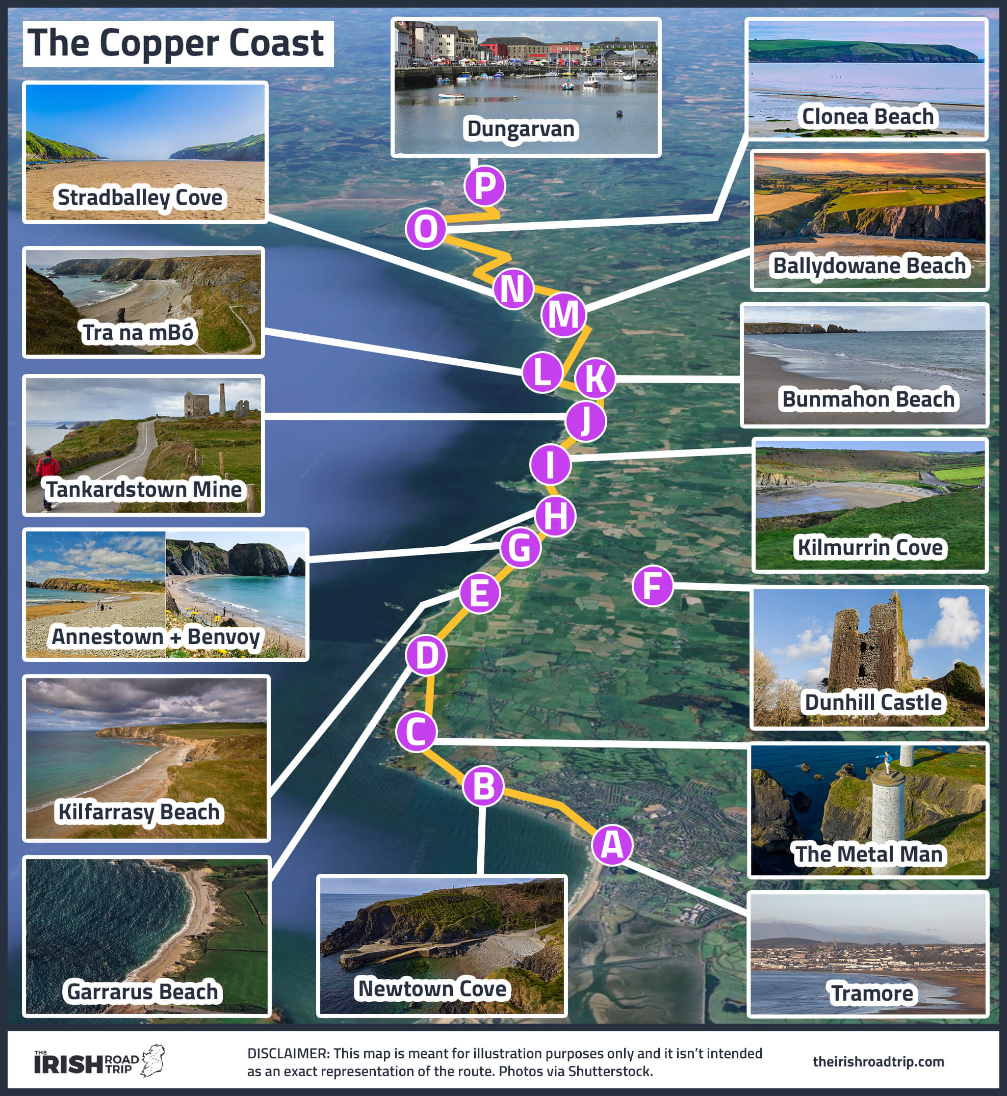
This is the first of two Copper Coast Drive maps in this guide – the second is at the end of this page and it’s a Google Map with the stops plotted.
You can easily save the map above to your phone and use it to guide you along the route. Here’s an overview of the stops!
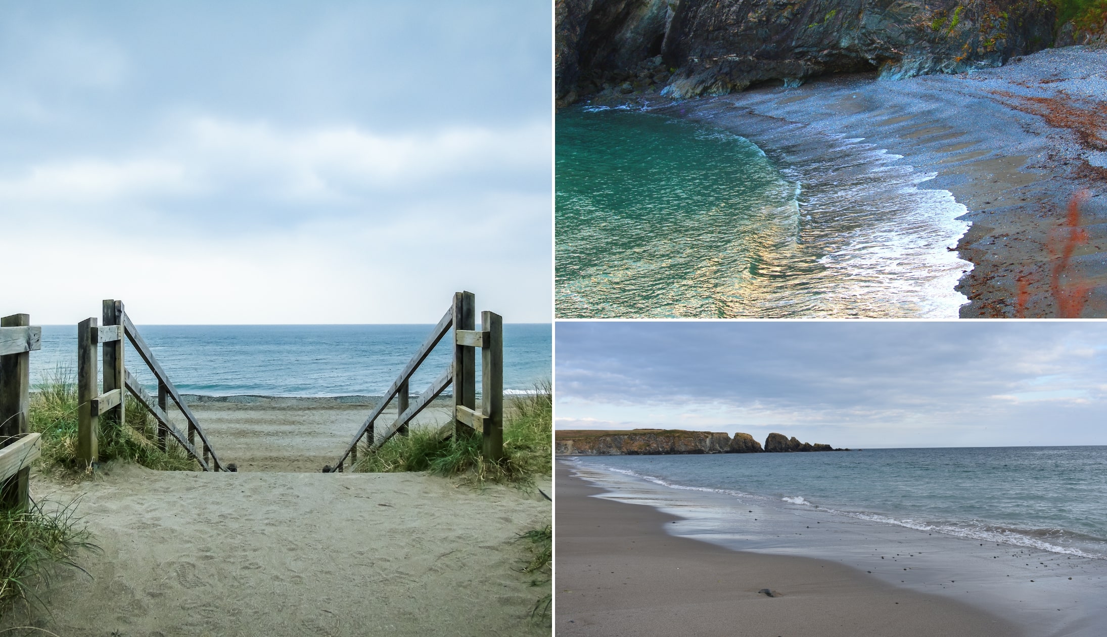
Stop 1: Tramore Beach
Photos via Shutterstock
The meaning of the word ‘Tramore’ is Big Strand, and that’s precisely what you have here. Tramore Beach is 3 miles long (5km) and can be the first stop on your Copper Coast journey.
It’s a lovely beach for swimming, and with it being on the Atlantic Coast, surfers flock to the area. If you’re a fisherman or woman, around the mouth of the lagoon is good for bass and flounder.
The town is exactly what you’d expect, lots of amusements to keep the kids entertained and there’s plenty of restaurants in Tramore if you’re in need of a feed.
Stretch your legs: Walk 15 minutes from the town to this gate here. Then take the short ramble to this viewpoint. Total walking time is around 30 minutes and the views are spectacular
Stop 2: Newtown Cove
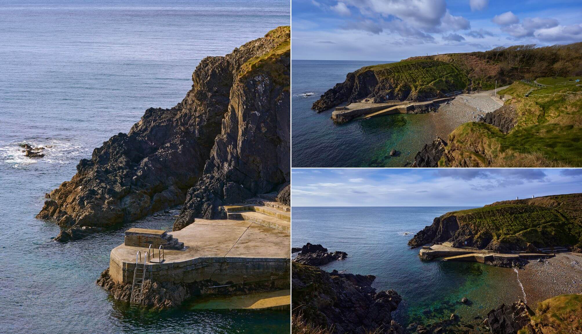
Photos licensed via Shutterstock
Newtown Cove is a handy 5-minute spin from Tramore. Famous for their clear waters, the swimming coves of Newtown and Guillamene are often regarded as two of the best beaches in Waterford.
Newtown cove is small and sheltered with a stony beach, and swimmers have easy access via a ladder or slipway. Guillamene is accessed by several sets of steps. If you see a sign that says men-only, it’s because Guillamene was only for male swimmers until the 1980s.
Women and children had to swim in Newtown whether they wanted to or not. Thankfully, the sign is the only thing that remains of that time, and everyone can enjoy both coves these days.
WARNING: Please always use caution whenever thinking about entering the water in Ireland. If in doubt, keep your feet on dry land
Stop 3: The Metal Man (note warning)
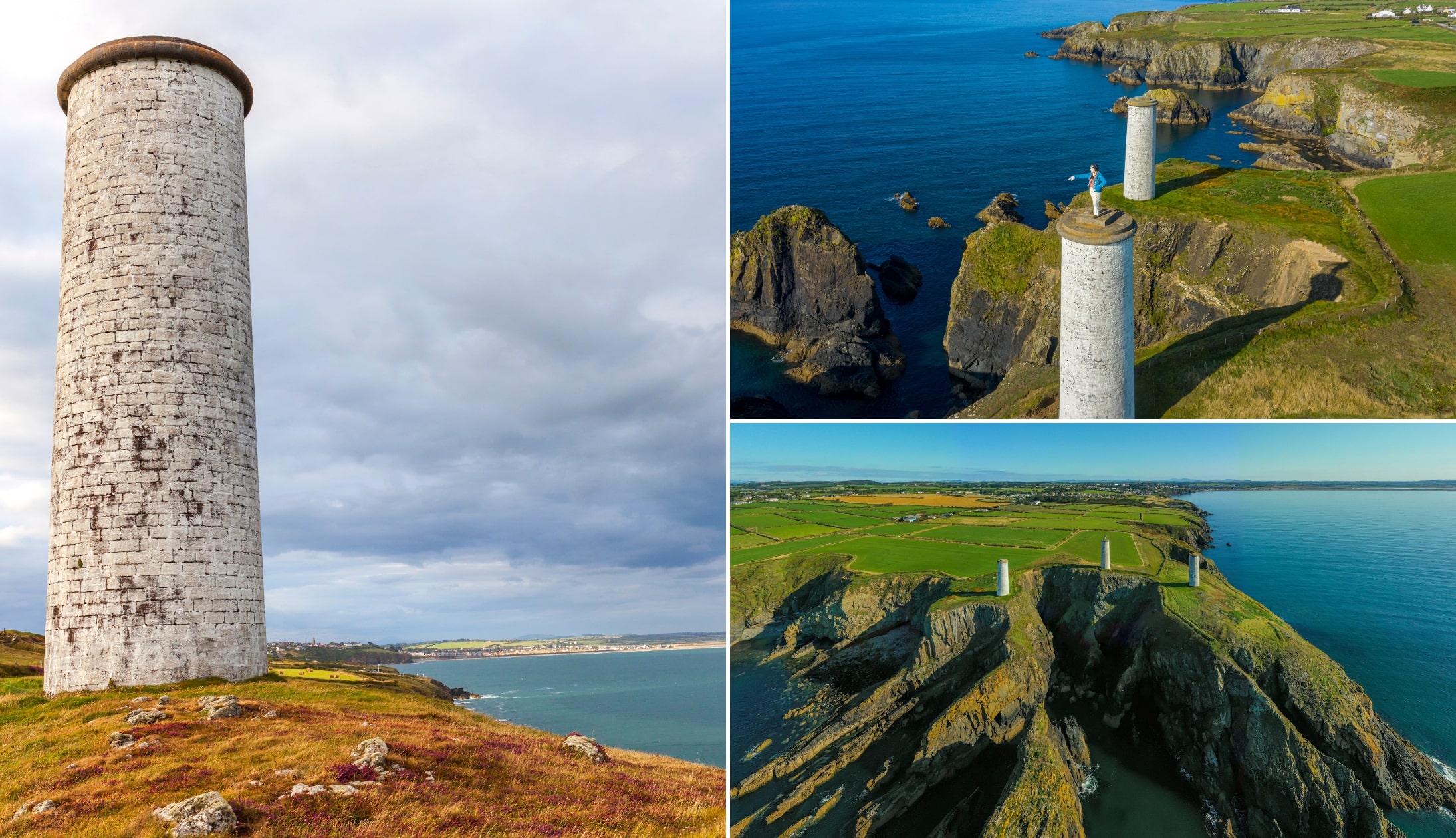
Photos via Shutterstock
Near Newtown Cove, three stone pillars stand above the cliffs. These maritime beacons were built after the 1816 Sea Horse tragedy, when over 360 lives were lost in Tramore Bay.
On one of them stands the Metal Man, a cast iron sailor in full British naval dress, pointing out to sea. He has watched over these waters for more than 180 years, warning ships away from danger.
Locals still share stories about him, including the claim that if you hop barefoot around the pillar three times, you will be married within a year.
WARNING: The only legal way to walk to the Metal Man is via the cliff trail from Newtown Cove, but it isn’t safe. After doing it once, I’d never do it again. You can, however, see the metal man from afar as you drive along the coast from the last stop
Stop 4: Garrarus Beach
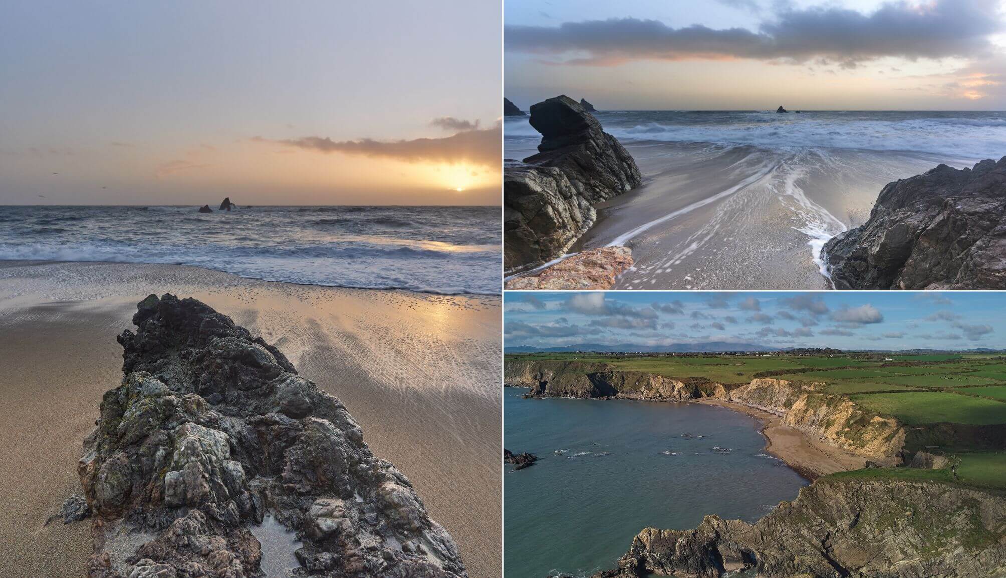
Photos via Shutterstock
Tucked along the Copper Coast Drive a 10-minute drive from Newtown Cove, Garrarus Beach is a quiet, unspoiled stretch where sea, rock and sky collide.
You’ll find no cafés, no crowds, just a narrow road leading to a small car park and a wild, ever-changing shoreline.
On fine days, it’s a peaceful spot for a stroll. On stormy days, it’s all power and motion – spray in the air, gulls riding the wind and waves hammering the shore. This is the Copper Coast at its finest.
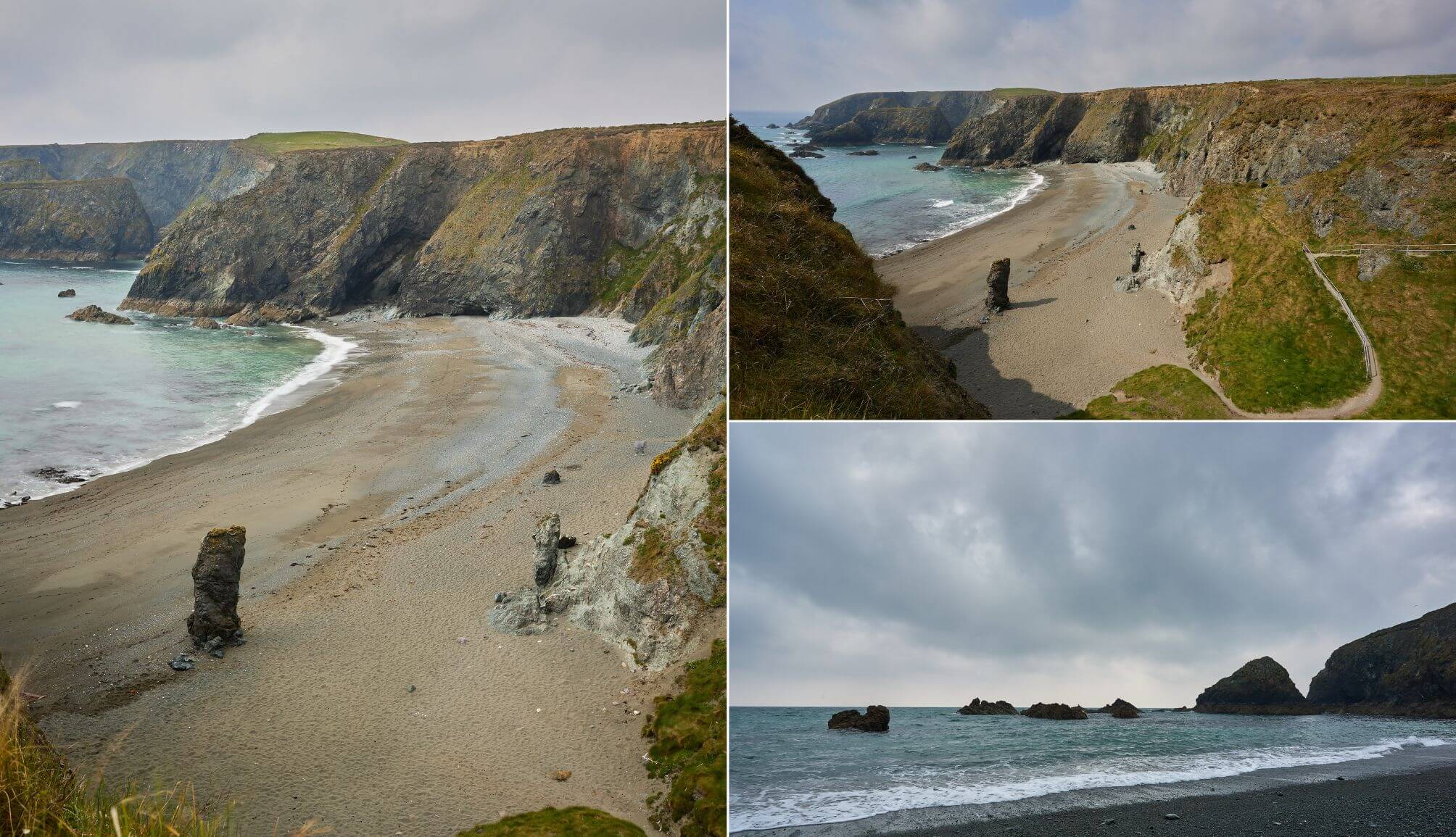
Stop 5: Kilfarrasy Beach
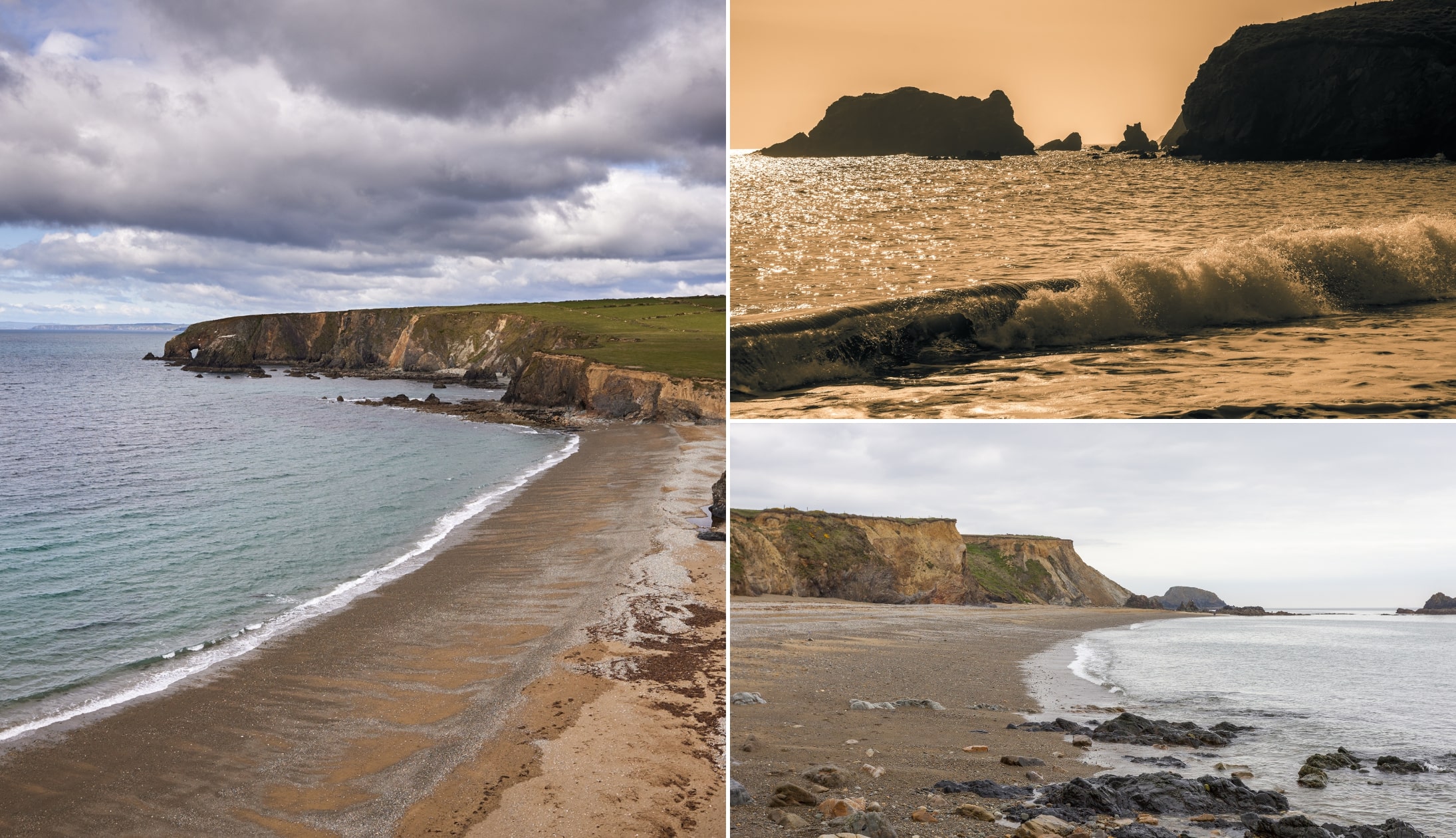
Photos via Shutterstock
Just 15 minutes up the coast is one of the best beaches in Waterford – Kilfarrasy. The craggy cliffs which shelter this beach are approximately 460 million years old, but it’s the rock formations and islands on both sides of the beach that draw the most attention.
The beach is a popular spot for swimming, snorkeling and kayaking, so long as you remain on the main beach.
If you go further, you can quickly become isolated by the tide, even at low levels, so please take care.
Stop 6: Dunhill Castle
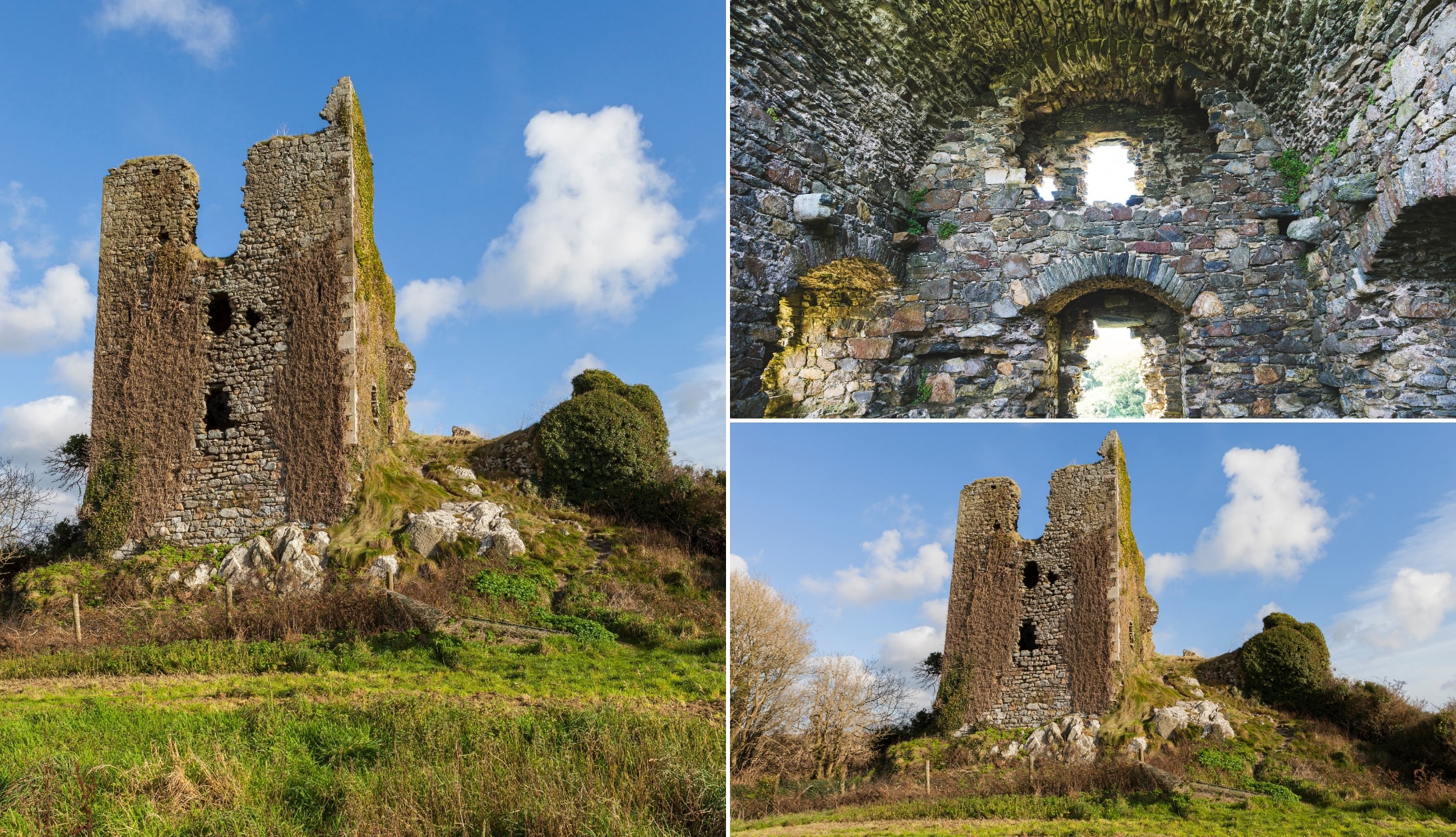
Photos via Shutterstock
Dunhill Castle (20-minute drive from Kilfarrasy) was built by the la Poer family in the 1200s on the site of an earlier Celtic fort, and its ruined remains tower above the River Anne, near Dunhill village.
The castle might have been ravaged by time, but it’s still fierce interesting. The La Poer (Power) family were ferocious in the 14th Century, but in 1345 they tried to take Waterford City, and many of their elders were captured and hanged.
The remaining family members fought for another 100 years until they, too, were defeated. A period of peace lasted for a couple of centuries until Cromwell arrived in 1649.
How to see it: You can park beside it and take the short steep walk up to it
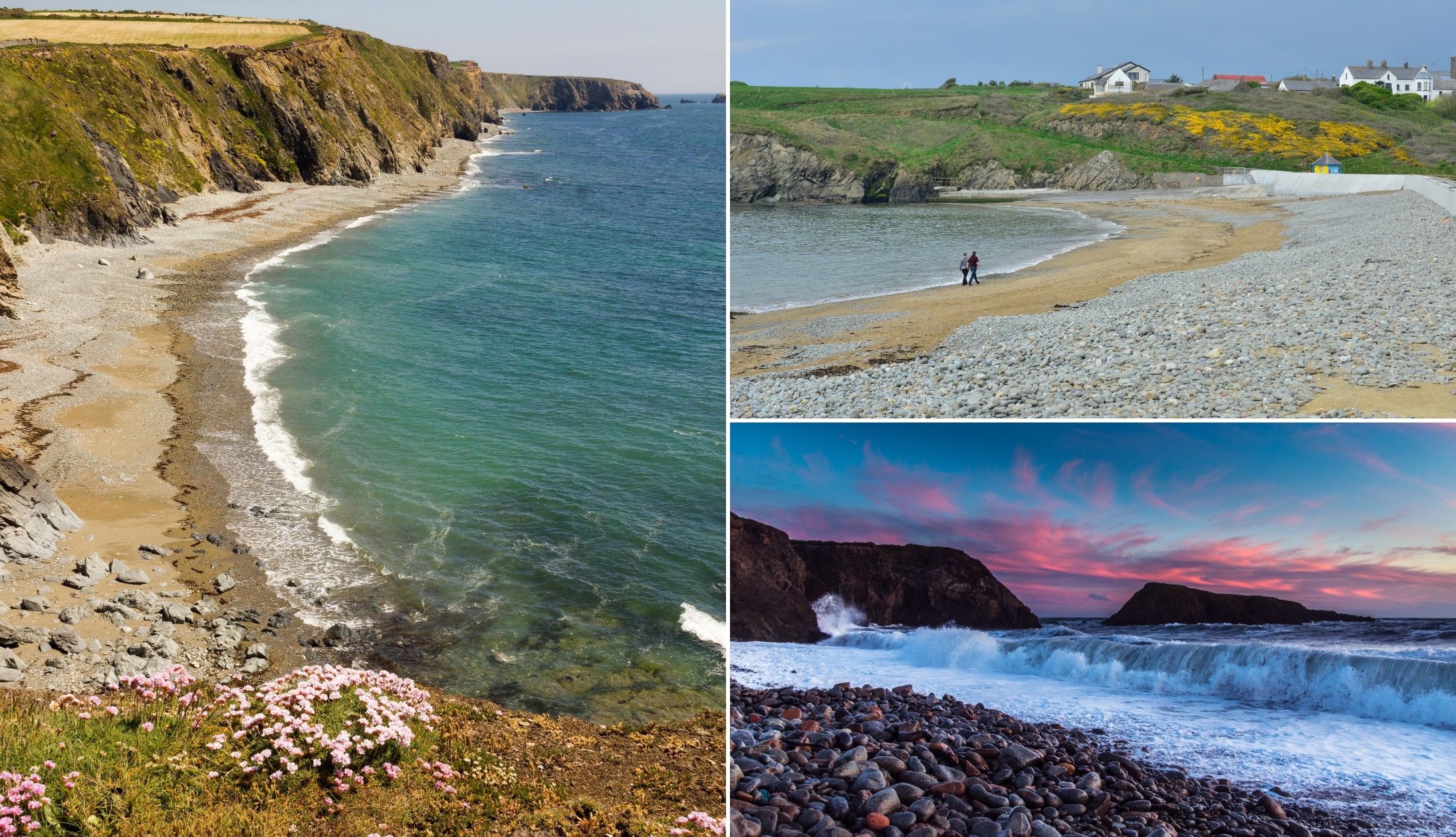
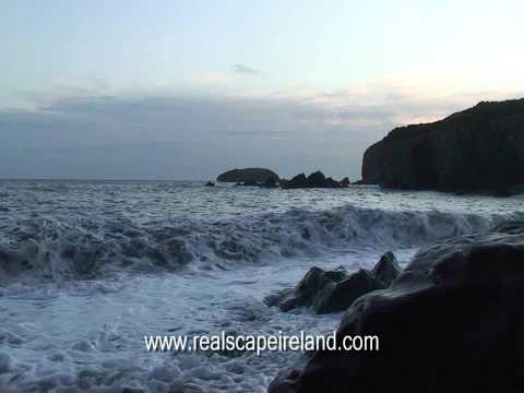
Stop 7: Annestown and Benvoy Beach
Pictured is Annestown Beach (via Shutterstock)
You’re taking the 5-minute drive from Dunhill to Annestown, next! This is a quiet, stony cove along the Copper Coast Drive route that’s framed by cliffs and scattered rock formations.
It’s small, scenic and rarely crowded outside of the summer months, with strong surf, a sea arch, and views that shift with the weather.
A short cliff path links Annestown to nearby Benvoy, and the Anne Valley Walk begins here, running 10km inland to Dunhill.
Stop 8: Dunabrattin Head / Boatstrand Harbour
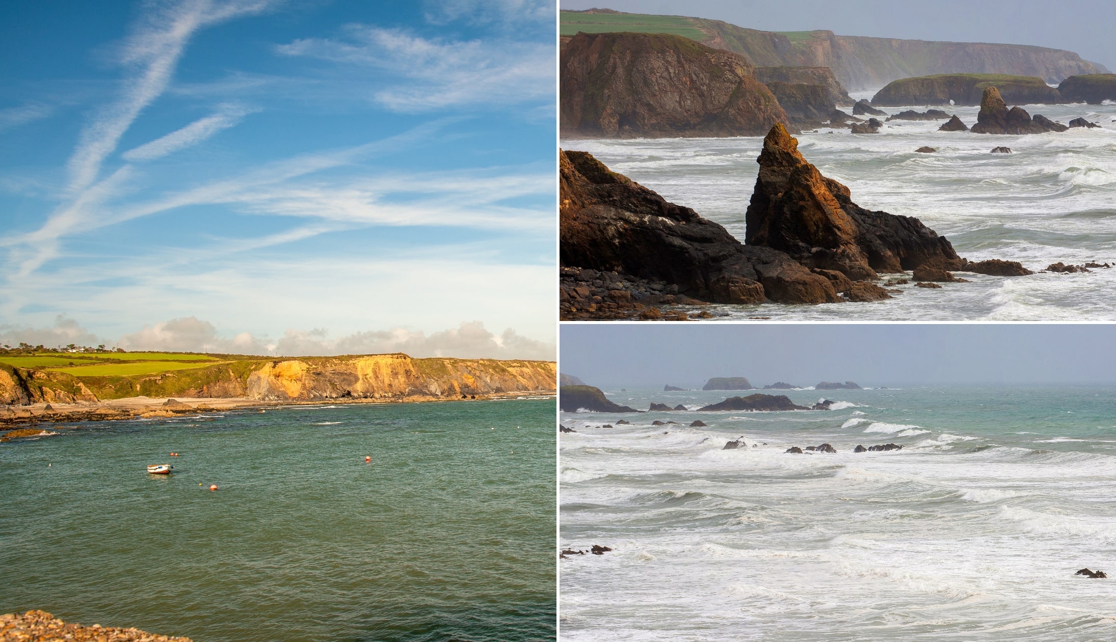
Photo left: Luke Myers. Others: Shutterstock
The tiny village of Boastrand (5 minutes from Annestown) has a fishing cove from which their fishing fleet and leisure craft launch.
The 19th-century dock is particularly popular during the summer, with many sea swimmers finishing their swim from Kilmurrin Cove there.
You’ll also find one of the best fishing spots in the county here – Dunbrattin Head. The rocks at the end of the Head attract the likes of mackerel because of the warmer temperatures here.
Don’t miss the viewpoint nearby: Park up here and enjoy some of the finest views on the Copper Coast Drive
Stop 9: Kilmurrin Beach
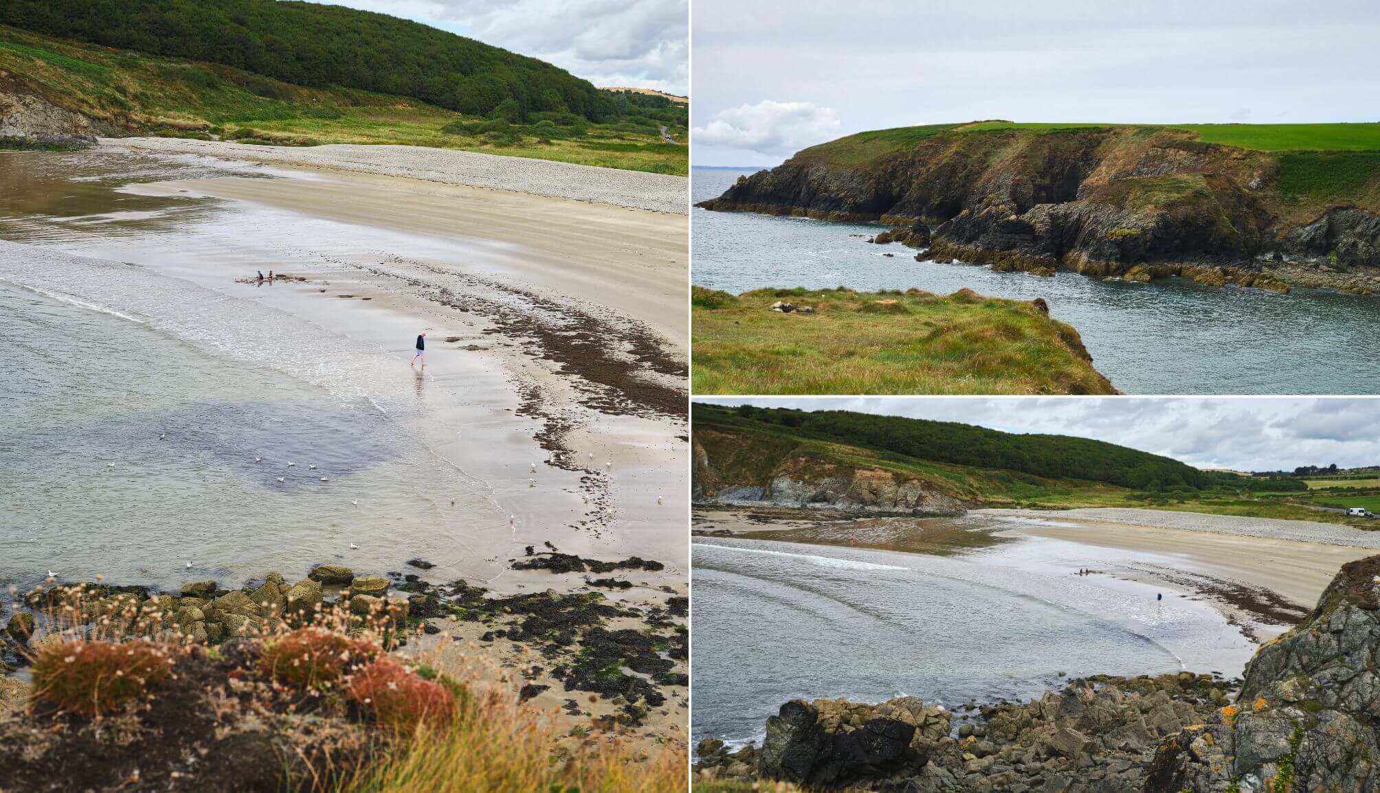
Photos courtesy Failte Ireland
Kilmurrin Beach (1-minute drive from last stop) is a small, sheltered cove along the Copper Coast that’s tucked between two rocky headlands.
It’s popular with families thanks to its soft sand, calm waters at high tide, and easy parking close to the shore.
A blowhole at one end of the cove puts on a show when the tide hits right. While conditions are generally safe close to shore, currents can pick up further out, and the beach is often windy.
Views from the surrounding cliffs are a highlight, and the drive in is one of the most scenic stretches on the Copper Coast.
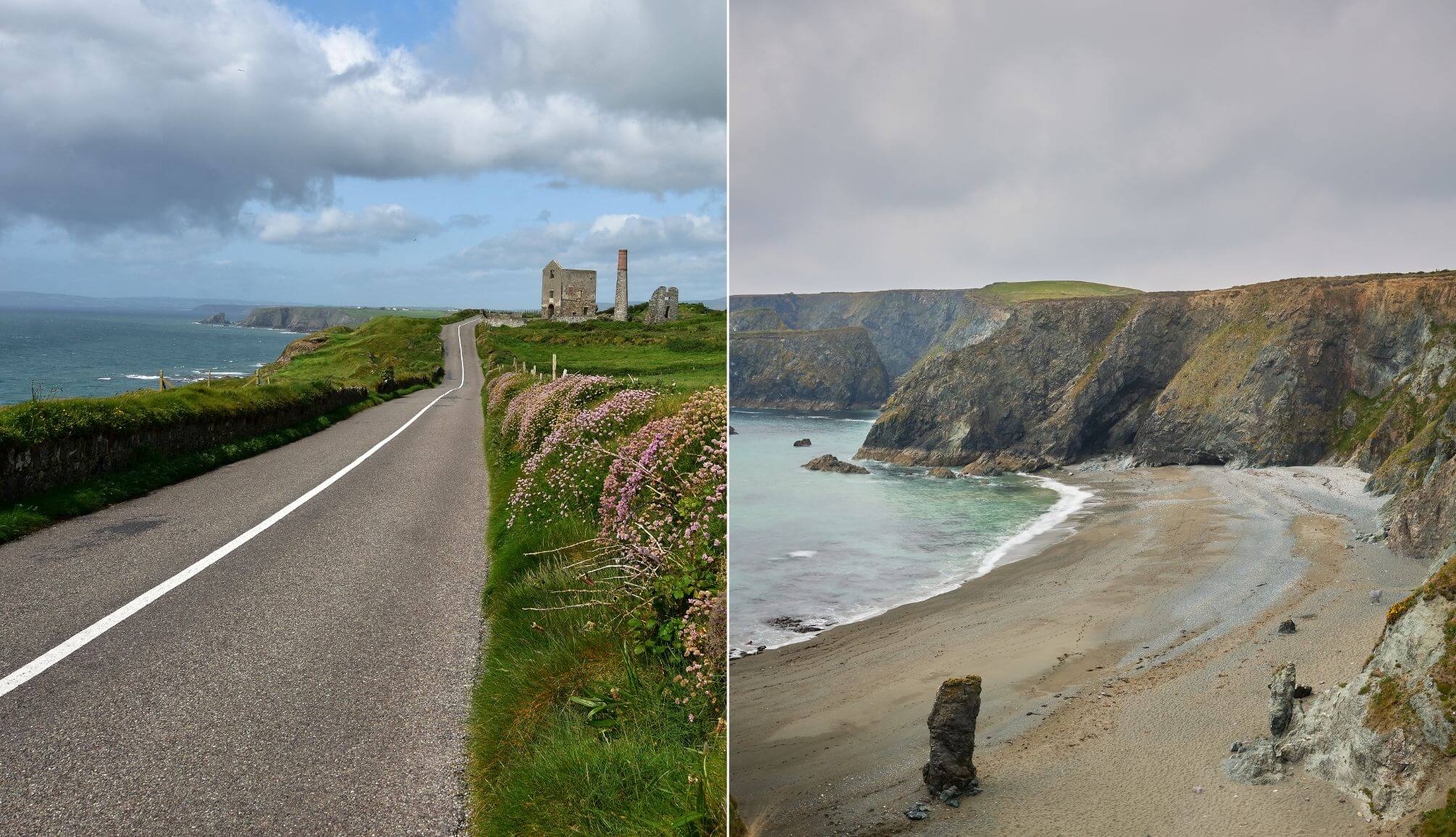
Stop 10: Tankardstown Engine House
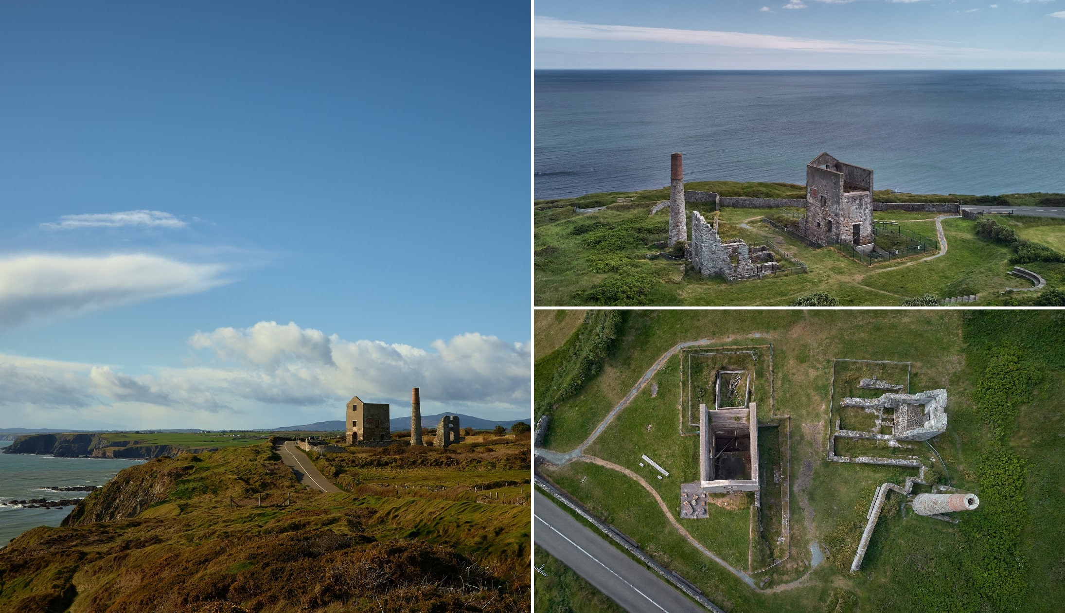
Photos via Shutterstock
The Tankardstown Engine House (3-minute drive) is one of the most notable attractions along The Copper Coast.
Located just 2km from Bunmahaon village, which was a hub of activity during the copper-mining years, the Engine House ruins are a stark reminder of the industry that flared here briefly in the 1800s.
1,200 men worked the mines at one time, but the owners’ greed and the resulting strikes and lockouts signaled the end of the mines after barely 50 years.
The mining area is accessible, and you can even see mineral veins winding across the ground (there’s plenty of parking here).
Stop 11: Bunmahon Beach
Photos via Shutterstock
The unspoiled Bunmahon Beach (3-minute drive) is a wide, south-facing stretch of sand backed by dunes and steep cliffs.
It’s framed by headlands and exposed to strong Atlantic swell, giving the beach its reputation for powerful surf and shifting tides.
The beach itself is long, clean and visually striking, with views that stretch out across Bunmahon Bay. It’s a popular spot for walks and for watching surfers take on the waves.
Swimmers beware: There’s a strong riptide here along with a big swell at times. Only enter the water if you are an experienced swimmer
Stop 12: Trá na mBó
Photos via Shutterstock
Trá na mBó is one of Ireland’s most beautiful beaches. You can walk to it from Bunmahon Beach (the trail starts from this point).
This is a small, cliff-framed beach around a 10-minute walk from Bunmahon, known for its dramatic rock formations, sea caves, and exposed layers of ancient volcanic stone.
You can view the two beaches from the grassy headland above but please note that the ground is VERY UNEVEN, so you need to stay WELL CLEAR of the edge at all times as there is a MASSIVE DROP.
Toilets and warnings: There’s a public toilet across from Bunmahon Beach. Please take heed of the warning above.
Stop 13: Ballyvooney Cove
It may be small, but Ballyvooney Cove (10-minute drive) punches well above its weight in terms of beauty, and it’s well worth stopping off at.
Backed by sheer cliffs and stitched with caves, it’s wild, weathered, and rarely busy. The beach is steep and stony (not built for barefoot strolls) but if you’ve got decent shoes and an eye for geology, there’s plenty to look forward to.
At low tide, rusted ribs of a shipwreck (the SS Cirilo Amoros, a 1,252-ton Spanish steamship, ran aground here on February 15, 1926) appear through the shingle like the bones of a story half-told.
Stop 14: Ballydowane Beach
Photos © Tourism Ireland by Chriss Hill
Tucked between Bunmahon and Stradbally, Ballydowane (5-minute drive) is one of the Copper Coast’s best-kept secrets.
Backed by towering cliffs and fronted by sculpted sea stacks, it’s a small, sheltered cove with coarse sand, scattered boulders, and surreal coastal scenery.
The cliffs here are layered with history, both geological and maritime, and the sea stacks just offshore shift mood with the weather. When the tide’s out, it feels like another world. No signs, no shops, no fanfare – just the magic of the Copper Coast.
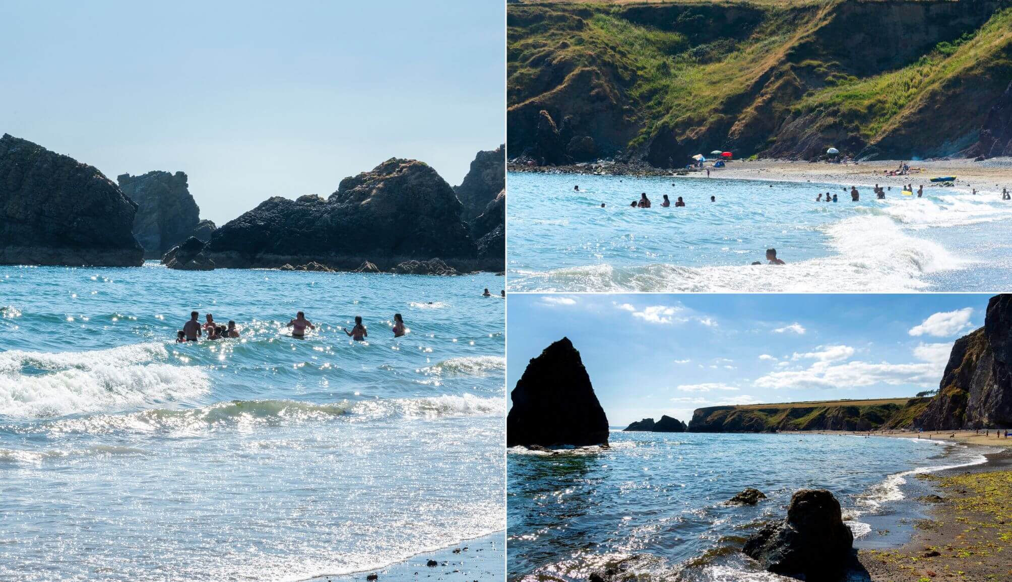
Stop 15: Stradbally Cove
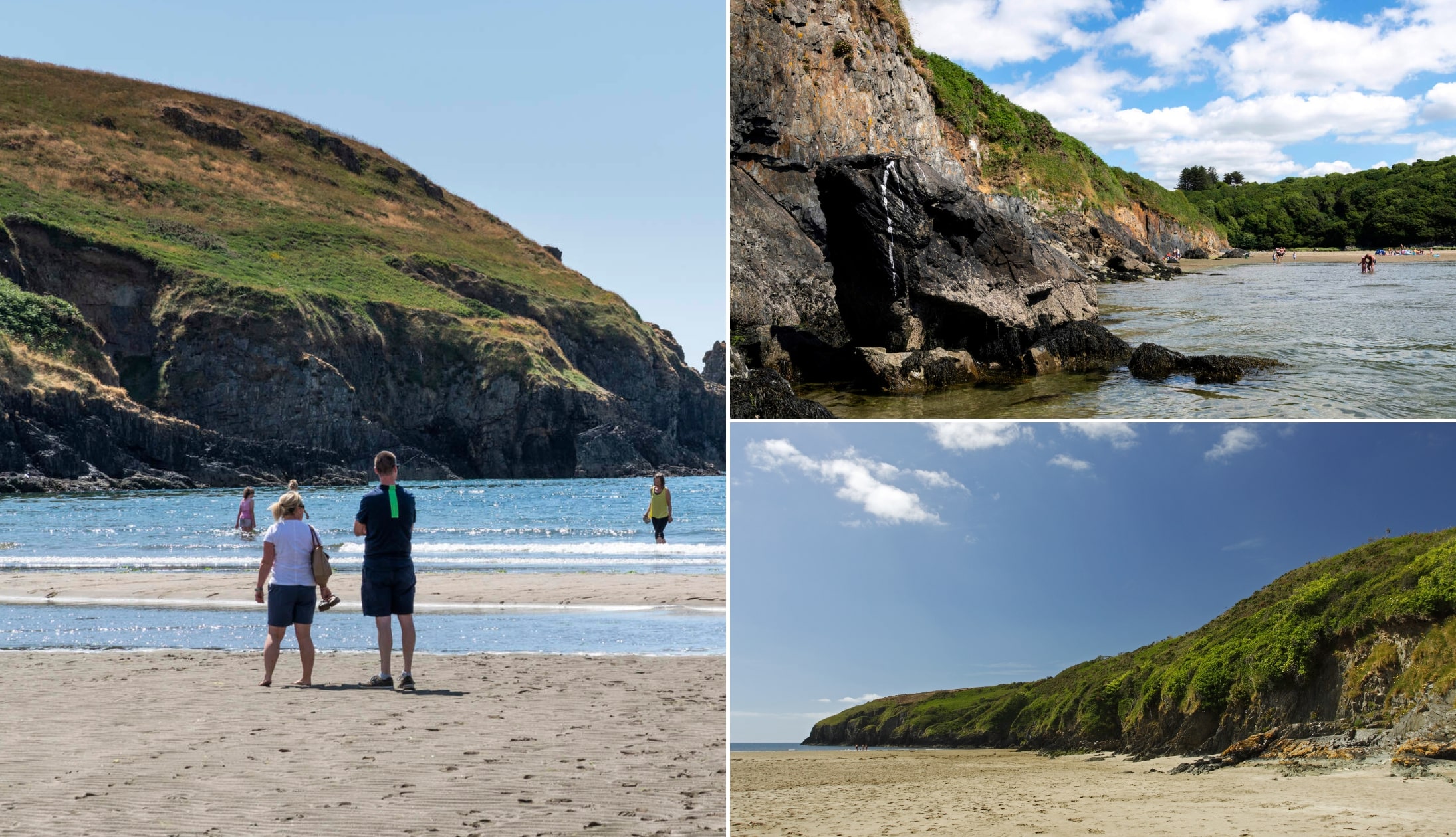
Photo left and top right: Chris Hill. Others via Shutterstock
Stradbally Cove (8-minute drive) is a sheltered beach at the mouth of a narrow river valley on the Copper Coast, flanked by grassy cliffs and shaped by 460 million years of geological drama.
You follow a narrow road, half-convinced you’ve taken a wrong turn, and then suddenly you’re looking out over a river-fed cove hugged by copper cliffs and oak woodland.
At low tide, the beach stretches wide and flat, revealing rockpools, sea caves, and sand firm enough for football or a wander.
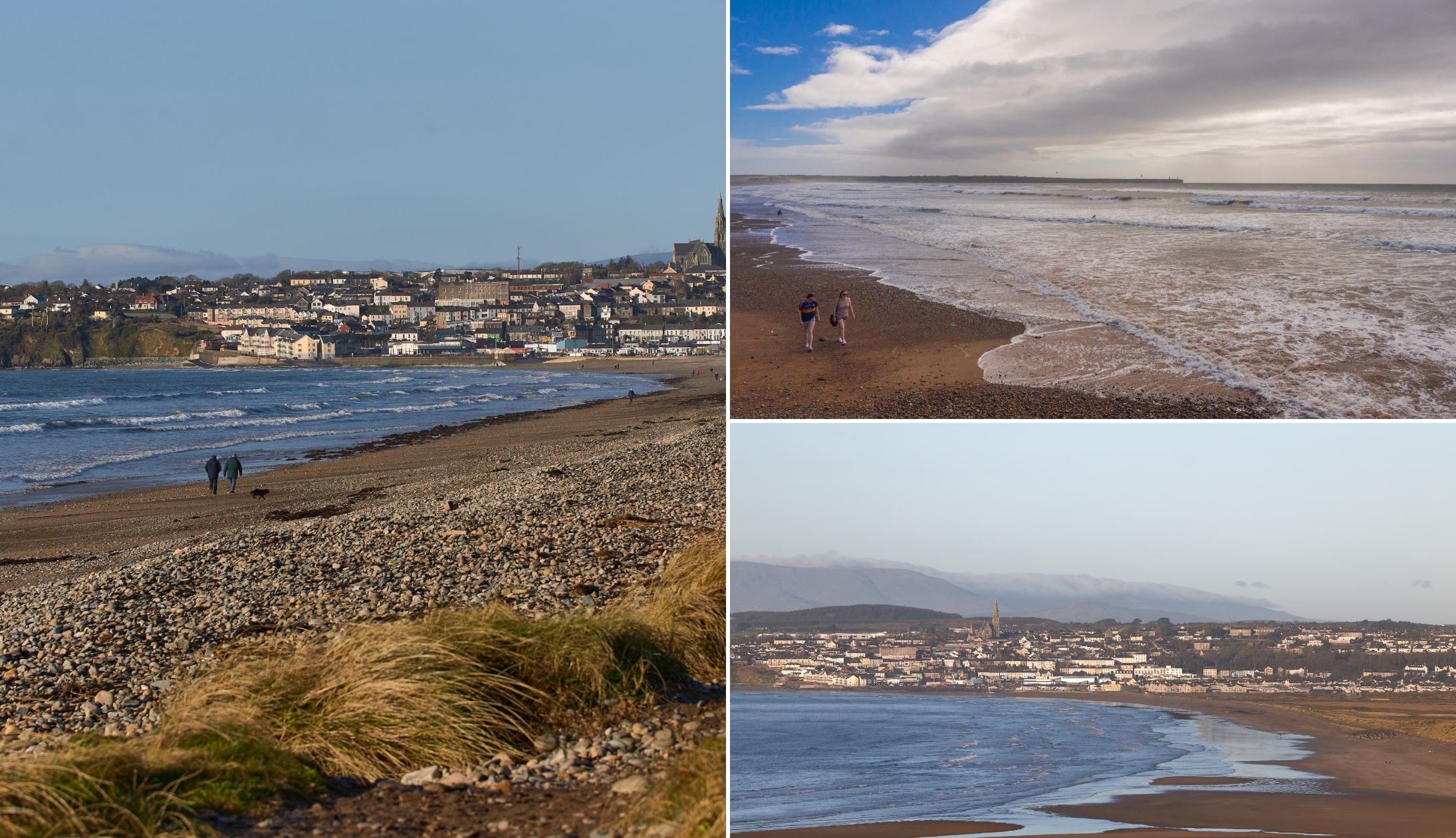
Stop 16: Clonea Strand

Photos via Shutterstock
The Copper Coast Drive comes to an end after our next stop, Clonea Strand, a 15-minute drive away. It stretches out in a sweeping curve just 5km from Dungarvan, a broad ribbon of clean, fine sand backed by dunes and the Waterford Greenway.
It’s one of the region’s most accessible beaches, with lifeguards in summer, public toilets, and parking close to the shore. Calm waters and a gradual shelf make it popular with swimmers, while long walkers favour the firm sands at low tide.
The beach holds Blue Flag status and, despite its popularity, rarely feels overcrowded. On calmer days, it’s ideal for sea swims; on wilder ones, it rewards with stirring Atlantic views.
Stop 17: Dungarvan

Photos via 2 Sisters on FB
I’m going to finish off our road trip along the Copper Coast Geopark in Dungarvan – a town divided into two parts by the Colligan River. These two parts are the parishes of Dungarvan and Abbeyside and are connected by causeways and bridges.
Walk along the waterfront, taking in the history and the sea air before exploring the town’s quaint streets. You’re only a few minutes from Clonee Strand, one of the South East’s most popular beaches, or you can rent a bike and cycle along the Waterford Greenway.
There’s plenty of things to do in Dungarvan while you’re there or, if you’re feeling peckish, you’ll find several excellent restaurants in Dungarvan to drop into.
Copper Coast Drive map
This map shows the full route with every stop along the way clearly pinned, making it easy to follow your journey.
Click on each marker to see more details about the stop or to get directions straight from your current location.
Keith O’Hara has lived in Ireland for 35 years and has spent much of the last 13 creating what is now The Irish Road Trip guide. Over the years, the website has published thousands of meticulously researched Ireland travel guides, welcoming 40 million+ visitors along the way. In 2022, the Irish Road Trip team published the world’s largest collection of Irish Road Trip itineraries. Keith lives in Dublin with his dog Toby and finds writing in the 3rd person minus craic altogether.
Elena
Friday 2nd of February 2024
What a brilliant idea for the bank holiday ahead! Thank you so much! Very interesting and helpful for exploring.
sumit
Friday 12th of May 2023
very informative .. Thanks for sharing
Carel van der Merwe
Wednesday 21st of December 2022
Thank you, thank you, thank you. Brilliant article and very helpful!