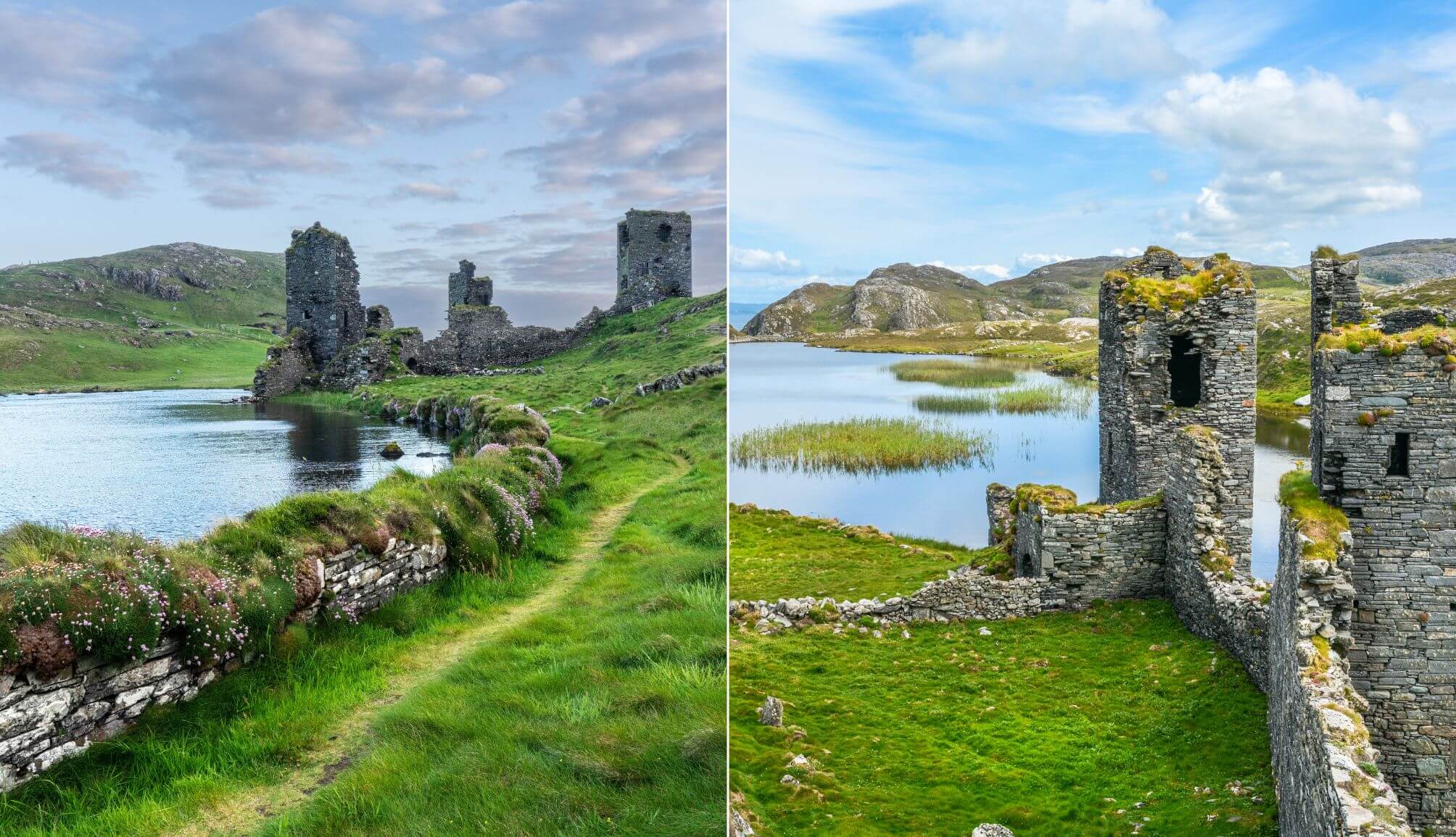
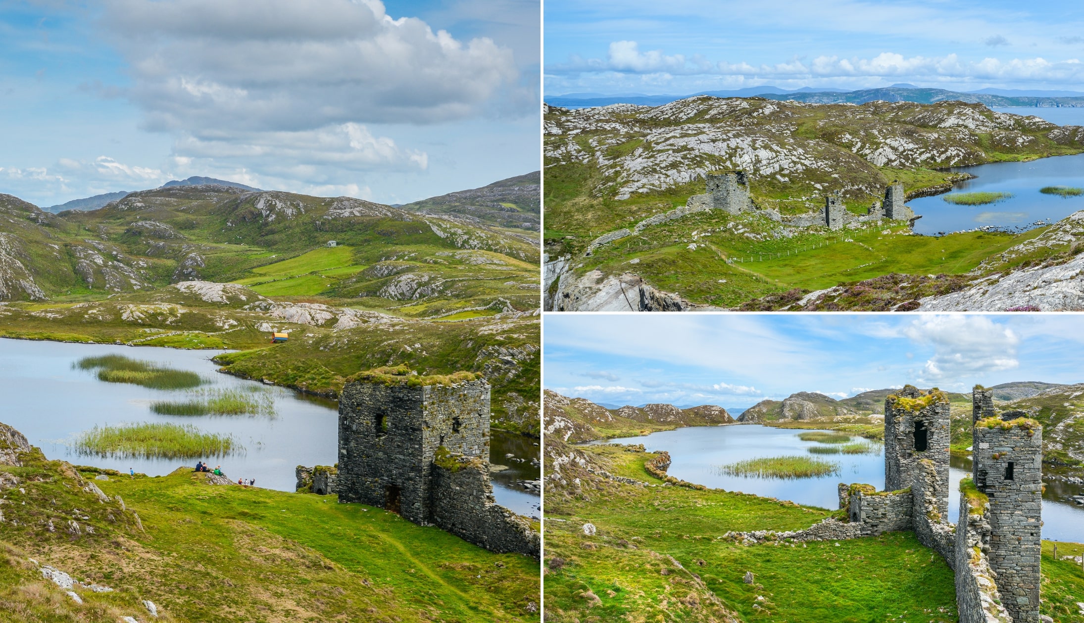
Perched between sheer cliffs and a silent lake, Dunlough Castle at Three Castle Head is one of the most haunting places in Ireland.
Built in 1207 at the very tip of the Mizen Peninsula, this trio of stone towers has stood untouched by war, untouched by restoration, and largely untouched by tourism.
If you’re looking for somewhere that feels truly remote and unfiltered, this is where West Cork ends in the most unforgettable way.
Important visitor information for Dunlough Castle

There are some important points to take note of before you set off for Three Castle Head, the most important of which is in relation to the weather:
1. Access is across private farmland
There’s a marked walking trail that begins near an honesty box in the car park (here on Maps). Bring €3 per person, adhere to the signage (e.g. no drones allowed) respect the land, and stay on the track.
2. Good fitness and footwear is a must
There’s a good, steep climb that you need to conquer here, so decent fitness is required. The route can get muddy, too, especially after rain. The terrain is uneven and boggy in parts.
3. Allow time and take care
The walk to Dunlough Castle from the car park and back again is roughly 2.3km/1.4 miles and takes around 55 minutes in total to complete at a steady pace. If going at a relaxed pace, allow for 35 – 40 minutes each way.
4. Avoid during poor weather
When mist and fog descend, this place becomes extremely dangerous. The cliff edge is unguarded and visibility can be reduced to nothing, so please do take care.
The History of Dunlough Castle
Photos via Shutterstock
Few castles in Ireland can rival the sheer uniqueness of Dunlough Castle’s setting. Wedged between towering sea cliffs and a dark inland lake at the edge of the Mizen Peninsula, it’s as wild and remote as they come.
Only Dunluce Castle in Antrim comes close. Here’s the story behind this remote stronghold and the wild land that surrounds it.
The O’Mahony Clan and the Norman Advance
By the late 1100s, the Normans were tightening their grip on Ireland. Powerful native families like the O’Mahonys were pushed westward as Anglo-Norman forces claimed more land.
In 1207, Donagh “the Migrator” O’Mahony led his people to the furthest corner of West Cork. There, where the land ends and the ocean takes over, he built a new stronghold: Dunlough Castle.
A Strategic but Isolated Location
The site was chosen with care. A man-made lake guards one side, sheer sea cliffs drop from the other, and a narrow neck of land connects it all to the mainland.
It was ideal for defence and retreat, and it was perfect for a family no longer looking to expand, but to hold on to what little was left.
Life at the Edge of the Atlantic
For the next four centuries, the O’Mahonys lived here, fishing, farming, and defending their isolated territory. The castle itself consisted of three small towers connected by a stone wall, stretching from cliff to lake.
Each tower served a distinct purpose: residence, defence, and storage, all connected by walls that once rose to fifteen feet.
Unlike later castles, Dunlough was constructed without mortar, using dry stone techniques more often seen in prehistoric Irish sites.
What to see nearby
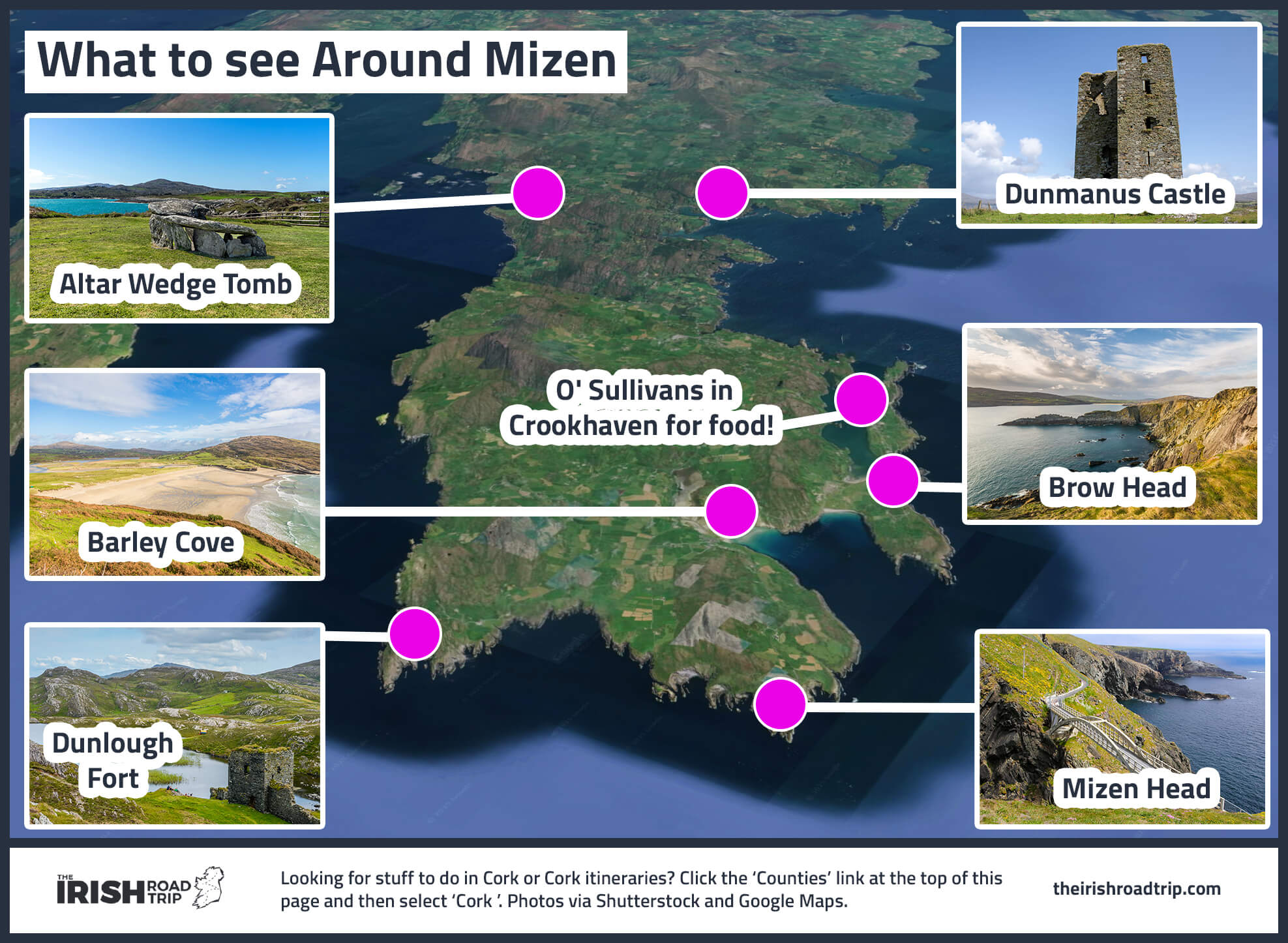
There are endless things to see-and-do around Three Castle head, including several of the best places to visit in Cork, like:
- Barleycove Beach: A sweeping sandy bay backed by dunes, formed by a tsunami in 1755
- Mizen Head: Ireland’s southwesterly tip with a dramatic bridge, signal station, and mighty Atlantic views
- Brow Head: The true southernmost point of mainland Ireland, with clifftop ruins and raw, rugged scenery
Keith O’Hara has lived in Ireland for 35 years and has spent much of the last 13 creating what is now The Irish Road Trip guide. Over the years, the website has published thousands of meticulously researched Ireland travel guides, welcoming 40 million+ visitors along the way. In 2022, the Irish Road Trip team published the world’s largest collection of Irish Road Trip itineraries. Keith lives in Dublin with his dog Toby and finds writing in the 3rd person minus craic altogether.