The various Ballyhoura walks are like Sudocrem for the soul.
This stunning corner of Ireland is home to arguably some of the best rambles the island has to offer, yet many overlook them.
However, as you’ll discover below, many of the Ballyhoura walking trails are up there with the best things to do in Limerick and Tipperary!
Our Favourite Ballyhoura walks and hikes
Photos via Shutterstock
The first section of our guide is packed with our favourite Ballyhoura walking trails – these are walks that one or more of our team have done over the years.
Below, you’ll find everything from the Clare Glens Loop and the Canon Sheehan Loop to some of the more overlooked Ballyhoura walks.
1. The Canon Sheehan Loop
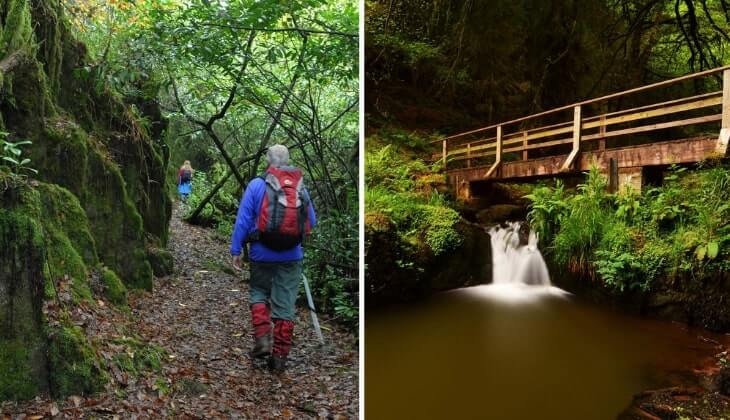
Photo © Ballyhoura Fáilte via Ireland’s Content Pool
- Distance: 7km
- Difficulty: Easy
- Time: 2 – 2.5 hrs
- Map: Find one here
The 7km Canon Sheehan Loop takes around 2 hours and is named after Canon Patrick Augustine Sheehan (1852-1913) who wrote his famous works here while he was Parish Priest.
The trail follows the Ogeen River (left bank) through native woodland to a natural well. You’ll cross two footbridges and two county boundaries (Cork to Limerick and back again) before joining a forestry road.
Look out for Mass Rock which is still used for religious services on occasion. Then pause and admire the panoramic views laid out before you of Blackwater Valley and the Nagle and Knockmealdown Mountains.
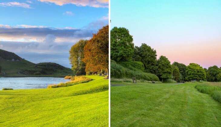
2. The Clare Glens Loop
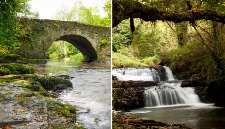
Photos via Shutterstock
- Distance: 2km or 4km
- Difficulty: Easy
- Time: 30 minutes to 1 hour (2km) or 1 – 1.5 hours (4km)
- Map: Find one here
The Clare Glens Loop is one of the most popular Ballyhoura walks for good reason. There’s a 2km and a 4km stroll through this beautiful forest on offer here.
Walk beside the Clare River as it flows through the sandstone gorge with multiple waterfalls adding to the delight. At the wooden footbridge, turn right on the 2km Nature Loop or proceed straight ahead for the 4km Glen Loop.
These Ballyhoura walking trails are nice and easy with gentle slopes and take 30-60 minutes for the short loop and around 90 minutes for the longer one.
3. The Kilfinane Loop Walk

Map with thanks to Sport Ireland
- Distance: 10km
- Difficulty: Moderate
- Time: 3.5 hours
- Map: Find one here
The Kilfinane Loop is a 10km loop walk that starts and ends in, unsurprisingly enough, Kilfinane Town. It’s considered a moderately easy hike with a steady ascent of 191m.
It peaks midway through the forested walk before descending again. The maximum trail height above sea level reaches 1100 feet (335m) and provides superb views of the surrounding area.
Allow 3.5 hours to complete the loop at a steady pace.
4. The Lough Gur Trails
Photos via Shutterstock
- Distance: Varies by trail
- Difficulty: Easy
- Time: Varies by trail
- Map: Find one here
Explore the ancient banks of Lough Gur on trails that take you past ancient monuments and thought-provoking archaeological sites.
To make the most of this 2.5km ramble, pick up an audio guide from the Heritage Centre (€5) to accompany you.
The trail is divided into 15 segments, each with its own piece of interesting history. The commentary includes Irish music and folklore.
Learn about the ancient dwellings and inhabitants along the walk and enjoy spectacular lake views. The high point of this trail is reaching the ancient Stone Circle, the oldest and largest in Ireland.
Ballyhoura walking trails under 2.5 hours in length

Photo via Shutterstock
Now that we have our favourite Ballyhoura walks out of the way, it’s time to see what else the area has to offer.
Below, you’ll find everything from Darby’s Bed Walk and the Castlegale Loop to some pretty tough Ballyhoura trails.
1. The Attychraan Loop

Photos via Shutterstock
- Distance: 5km
- Difficulty: Easy
- Time: 1.5 to 2 hours
- Map: Find one here
The Attychraan Loop is another of the more popular Ballyhoura walks. It takes you up into the Galtee Mountains on a 5km amble that takes 1.5 to 2 hours to complete.
The trail-head starts at the Kings Yard car park (you’ll find toilets and a shop here) before passing through the Galtee Castle Woods.
When the castle was demolished in the 1940s, the stone was used to build the Catholic Church in nearby Glanworth.
Pass the surviving stables, tennis court and water mill before returning on a forestry road beside the Attychraan River.
2. The Castlegale Loop

Map with thanks to Sport Ireland
- Distance: 7km
- Difficulty: Moderate
- Time: 1.5 to 2 hours
A little more challenging, the 7km Castlegale Loop starts from Darragh Bridge and ascends to a cairn known as Castle Gale. It has an interesting story connected to it.
Tenants would hoist a flag above the cairn to warn others when the landlord was collecting the rent! Pass the Holy Well on Class 3 and 4 trails with some rough conditions.
End back at the Bridge of Darragh which marks the site of the Battle of Darragh in 1798. You can see the plaque as you cross the bridge commemorating when North Cork Militia clashed with the United Irish Men.
3. The Glounreagh Loop
Photo via Shutterstock
- Distance: 6.5km
- Difficulty: Moderate
- Time: 2 – 2.5 hrs
- Map: Find one here
The Glounreagh Loop also begins in Kings Yard but this trail follows black markers and ascends into the Galtees for about 160m before levelling out.
Look down on the Glounreagh River as the path skirts the valley before disappearing along forest tracks (more black arrows) and back to Kings Yard.
The loop is 6.5km long and the walk offers 2-2.5 hours of scenic hiking.
4. Darby’s Bed Walk Loop

Map with thanks to Sport Ireland
- Distance: 7km
- Moderate
- Time: 2.5 hours
- Map: Find one here
Another of the more moderate Ballyhoura walks, the Darby’s Bed trail is a 7km route takes 2.5 hours and starts in Galbally village in Limerick.
Highlights along the route include a megalithic passage grave called the Fort of the Three Pillar Stones, which is 6,000 years old.
It is known as Darby’s Bed and hence the name of the walk. It is believed to be the resting place of Olill Olum, an early king of Munster.
You need to follow white signs for a short detour to visit the site before returning to the loop.
Walks in Ballyhoura over 2 hours in length

Photos via Shutterstock
The next section of our Ballyhoura walks guide takes a look at trails that stretch for 2 hours and over – many of these need a bit of planning.
Below, you’ll find everything from the Ballyhoura Way and the Blackrock Loop to some long and tough Ballyhoura walking trails.
1. Ballinaboola Woods

- Distance: 10km
- Difficulty: Moderate
- Time: 2.5 – 3 hours
- Map: Find one here
This 10km route shares the route in places with mountain bikers as it cross-crosses the mountain. The loop walk is moderately difficult and follows forestry roads and tracks.
Over the course of this hike, expect stunning views, particularly from the steep trail on the outskirts of Ardpatrick village.
Ard Phadraig means Height of Patrick and was where St Patrick founded a monastery in the 5th century.
It’s worth the climb to see the panorama below and to soak up 1500 years of history at the monastic site with its church ruins and graveyard.
2. The Benard Loop

Map with thanks to Sport Ireland
- Distance: 18km
- Difficulty: Strenuous
- Time: 4 – 5 hours
Next up is one of the toughest, in our opinion, Ballyhoura walking trails. Starting from the trail-head at Anglesboro Community Centre, the Benard Loop starts at the highest village in the Galtee Mountains.
The community centre has a plaque commemorating past rebel traditions and a monument of Liam Lynch, a General in the IRA during the War of Independence.
The strenuous route ascends Paradise Hill on a road that once carried turf-laden sleds down from Temple Hill.
After following the Paradise Hill Loop, it heads right on a forestry road with superb views of Knockaceol (Hill of Music). This 18km hike takes 4-5 hours.
3. The Blackrock Loop
Photos via Shutterstock
- Distance: 11km
- Difficulty: Strenuous
- Time: 2.5 – 3 hours
- Map: Find one here
Starting in Greenwood Forest, Ardpatrick, follow in the footsteps of the men and women of the O’Sullivan-Bere Clan as they fled from Crown forces in 1602.
The strenuous 11km Blackrock Loop witnesses more history as you pass the “Black Ditch” tribal boundary before approaching the summit (528m) of Seefin Mountain.
You’ll pass the castle-shaped rock (Castle Philip) often used as a hideout by outlaws. The summit rewards hikers with views across the six counties of Munster on a clear day.
Seefin (Sui Finn) is said to be where the giant Finn McCool would sit and wash his feet in the River Shannon – some 50km away!
4. Darragh Hills Loop

Map with thanks to Sport Ireland
- Distance: 10km
- Difficulty: Moderate
- Time: 2.5 – 3 hours
The Darragh Hills Loop is another of the trickier Ballyhoura trails, but it’s well worth doing. It’s a 10km-long trail that starts at Darragh Bridge.
It’s an extension of the Castlegale Loop (see above), ascending to a cairn where a flag was hoisted to warn tenants when the landlord was collecting the rent!
Pass the Holy Well, where legend has it that after a women used it for her laundry, the well magically moved to the opposite side of the path!
You’ll cross the Bridge of Darragh which marks the site of the Battle of Darragh in 1798.
5. Paradise Hill Loop

- Distance: 13km
- Difficulty: Moderate
- Time: 3 – 4hours
- Map: Find one here
The well-named Paradise Hill offers a 13 km hike starting from the community centre in Anglesboro along with the Benard Loop (see above).
Before ascending the hill, look for the plaque marking past rebellions and the statue/monument of Liam Lynch who led the IRA during the War of Independence.
Born nearby in Barnagurraha, he died in a gun battle in the Knockmealdown Mountains in 1923. The old turf road is a reminder of the sleds once used to bring dried turf down from Temple Hill.
6. The Ballyhoura Way

Photos via Shutterstock
- Distance: 89 km
- Difficulty: Moderate
- Time: 4 days (approx)
- Map: Find one here
If you’re looking for very long Ballyhoura walks, look no further than the mighty Ballyhoura Way – a 89 km trail with 7 different trail heads.
It starts at John’s Bridge, North Cork and runs to Limerick Junction. It requires moderate fitness levels and those wanting to complete the route should allow 4 days.
The route includes four upland sections: one over Seefin and the Ballyhoura Mountains, shorter ascents over Benyvoughella Hill and Slievereagh and a final traverse over Slievenamuck Ridge with stunning views of the Glens of Aherlow.
7. The Slieve Felim Way

Photo via Shutterstock
- Distance: 43 km
- Difficulty: Moderate
- Time: 2 days (approx)
- Map: Find one here
The Slieve Felim Way has plenty of appeal with spectacular waterways, forest trails and a mountain section that is not overly demanding.
It has some uphill stretches but no peaks to climb. It runs for 36km from Murroe, Co. Limerick to Silvermines village, Co. Tipperary and every step is rural and beautiful.
As you head steadily north through the Mauher Slieve Mountains, look for Keeper Hill (694m), the highest peak in the Shannon region.
8. The Ballyorgan Loop

Map with thanks to Sport Ireland
- Distance: 20 km
- Difficulty: 5 hours
- Time: Moderate
Starting in Ballyorgan, after which the trail is named, this 20km loop hike takes around 5 hours with moderate difficulty on mainly Class 3 trails.
From Ballyorgan village follow the red arrows across the field to 13th century Kilflynn Church with its large chancel window featuring the Oliver-Gascoigne coat of arms.
After that auspicious start, follow the route beside the Keale River to historic Darragh Bridge. The red arrows will take you to Castlegale (see above loop) for superb views before a forest path leads to the summit of Carrigeenamronely.
Return along forest roads back to the river and starting point.
Family-friendly Ballyhoura trails
The final section of our Ballyhoura walks guide looks at some of the more family-friendly rambles in the area.
Below, you’ll find everything from the Knockduv Loop and the Griston Bog walk to some very easy-going Ballyhoura trails.
1. Ballyhoura Nature Trail

Map via Visit Ballyhoura
- Distance: 2 km
- Difficulty: 40 minutes
- Time: Easy
For a leisurely amble with family, the Ballyhoura Nature Trail is a 2km route allowing kids of all ages to discover 20 hidden creatures along the way.
Start at the Ballyhoura car park and follow the guide, ticking off the animals as you spot them. It should take around 40 minutes to complete.
The trail head has excellent amenities. Accessed via a pay barrier (€5 per vehicle) it includes a CCTV monitored car park, shops and hot drinks.
2. Griston Bog

- Distance: Varies by trail
- Difficulty: Easy
- Time: Varies by trail
- Map: Find one here
Nature enthusiasts will revel in this Griston Bog walk through Ballylanders wildlife bog. It is home to many flora, fauna, insects and water life that are in danger of extinction elsewhere in the world.
The route has a raised 0.5 km boardwalk providing easy viewing over the peatland bog with informative boards providing information and identification of birds, frogs, newts and insects along the way.
There are deck areas, a bird hide, insect hotel and dipping ponds adding to the interest of these wetland habitats. This is one of the more popular family-friendly Ballyhoura walks for good reason!
3. Keale River and Molanna Loop Walk

Map with thanks to Sport Ireland
- Distance: River Walk (7km) and Loop (13km)
- Difficulty: Moderate
- Time: 2.5 – 3.5 hours
This level fenced trail is very family-friendly and extends for 7km between the villages of Glenroe and Ballyorgan. The route includes a waterfall and many bridges crossing over the river.
It’s a good opportunity to play pooh sticks or spot resident otters, dippers, herons and kingfishers. You may spot jumping salmon, bluebells and fungi in this last remaining oak tree woodland in Ireland.
For a longer route, the Molanna Loop Walk continues a further 6km. Allow 2.5 to 3.5 hours.
4. Knockduv Loop

- Distance: 5 km
- Difficulty: Moderate
- Time: 1.5 hours
- Map: Find one here
Finally Knockduv Loop hiking trail overlaps with a mountain biking route and the views across Limerick are breathtaking. Starting in Ballinboola Woods car park, this easy 5km loop walk takes 75-90 minutes.
Follow the way-marked route along forest roads and tracks.
The detour to the monastery site at Ardpatrick is well worth doing for the panoramic views and ruins of this 5th century monastery, founded by St Patrick himself.
Keith O’Hara has lived in Ireland for 35 years and has spent much of the last 13 creating what is now The Irish Road Trip guide. Over the years, the website has published thousands of meticulously researched Ireland travel guides, welcoming 40 million+ visitors along the way. In 2022, the Irish Road Trip team published the world’s largest collection of Irish Road Trip itineraries. Keith lives in Dublin with his dog Toby and finds writing in the 3rd person minus craic altogether.