
The Dun Chaochain cliffs and their highest summit, Benwee Head, is one of Mayo’s hidden gems.
Located along the glorious North Mayo coast around an hours drive from Ballina, the area is home to many trails known as the ‘Carrowteige Loop Walks’.
In this guide, you’ll discover everything you need-to-know about the Benwee Head Walk, from a map of the trail to where to park.
Some quick need-to-knows about Benwee Head in Mayo
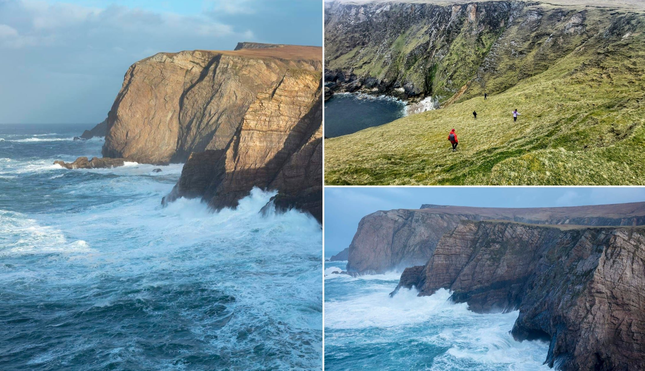
Photo left + bottom right: Gareth McCormack. Top right: Anne-Marie Flynn (via Failte Ireland)
A visit to Benwee Head isn’t as straightforward as some of the more popular places to visit in Mayo, and a bit of planning is required if you want to do the walk.
Here are some quick need-to-knows about the Benwee Walk. You’ll find a map and an overview of the walk later in the guide.
1. Location
Located on the North coast of County Mayo, the walk to Benwee Head begins from Carrowteigue Village which is a 30-minute drive from Belmullet, 35-minute drive from Ballycastle and a 1-hour drive from Ballina.
2. Walk start point
The starting point for the trail is Carrowteigue Village. You’ll find some parking here on Maps. You could also start it from the car park at Portacloy Beach, if you like.
3. Length/difficulty
The Benwee Head Cliff Walk is a strenuous, 12km trail that takes around 3 – 4 hours to complete, depending on pace. The ground is boggy in places so appropriate footwear is a must.
4. Safety
The cliffs here are unguarded, so great caution is required. Please keep your distance from the edge and mind yourself at all times.
About Benwee Head
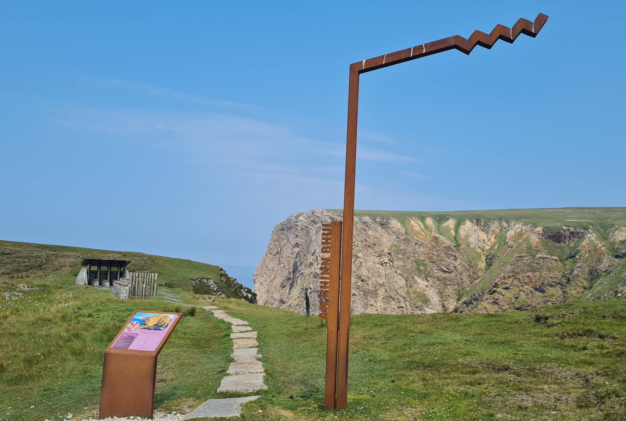
Photo courtesy Edel Healy via Fáilte Ireland’s Content Pool
At its highest point, Benwee Head hits 250m above the chilly Altantic below. For perspective, the Cliffs of Moher reach 214m above sea level.
The cliffs here overlook Broadhaven Bay and the famous 4 Stags of Broadhaven – 4 islands that rise 100m above sea level.
The majesty of nature is all around, with the towering cliffs, steep tracks, and thunderous waves attacking the coast, resulting in huge sea stacks and rock formations.
Benwee Head is the tallest in the Dun Chaochain range, and it’s remarkably different to other Irish mountains with a unique yellow colour, although it complements the green surroundings wonderfully.
The sheer north face of the cliff seems to fall vertically into the Atlantic Ocean.
Seeing Benwee Head on one of the Carrowteige Loop Walks

So, there are several different walks in and around this area; the Benwee Loop, the the Carrowteige Loop, and the Portacloy Loop.
In this guide, I’ll tackle the Benwee Head Walk:
Starting the trail
To start the walk, leave the village and head for Portacloy Beach – one of the more impressive beaches in Mayo.
This section of the trail takes around 50 minutes and it follows an old country road with fields on either side.
Keep going until you see the horse-shoe-shaped Portacloy Beach in the distance.
The cliffs around this initial section of the trail are impressive and you’ll see one of the old Eire signs in the distance.
The beginning of the cliff walk
As you leave Portacloy behind you, look out to your right – in the distance you’ll see the 4 Stags of Broadhaven off in the distance.
After around 2.5km you’ll start to get a good eyeful of Benwee Head. Please avoid going anywhere near the cliff edge.
The wind here can be fierce, so care is needed.
The return journey
Keep following the trail and you’ll eventually reach the car park for the Carrowteige Loop.
Off in the distance you’ll see the Mullet Peninsula and the distinctive form of Erris Head.
The final lap of the Benwee Head Cliff Walk is around 3km and will take around 45 minutes.
Things to do after the Benwee Head walk

One of the beauties of the Benwee Head Walk is that, when you finish it, you’re a short spin away from some of the best places to visit in Mayo.
Below, you’ll find a handful of things to see and do a stone’s throw from Benwee Head!
- Ceide Fields (30-minute drive): They date back almost 6,000 years and are the oldest known field systems in the world
- Downpatrick Head (45-minute drive): Home to Dun Briste, a sea stack, and the ruins of a church founded by Saint Patrick
- Achill Island (1-hour drive): Accessed via a bridge, it’s home to Keem Bay and plenty more
FAQs about the Benwee Head Cliff Walk
Since mentioning the Benwee Head walk in a guide to Mayo a few years ago, we’ve received a clatter of questions asking about the trail.
In the section below, we’ve popped in the most FAQs that we’ve received. If you have a question that we haven’t tackled, ask away in the comments section below.
Is the Benwee Head walk hard?
Yes. This is a walk for the more seasoned walkers, as the trail is tricky in places and requires experience with navigation in the event that conditions change.
How long does the Benwee Head loop take?
This is a 12km trail that takes around 3 – 4 hours. Please do note that this depends on pace/how long you spend admiring the views.
Is Benwee Head worth visiting?
Yes! The North Mayo coast is home to some of the most unspoiled scenery in Ireland. The Benwee Head walk treats you to glorious views throughout.
Keith O’Hara has lived in Ireland for 35 years and has spent much of the last 13 creating what is now The Irish Road Trip guide. Over the years, the website has published thousands of meticulously researched Ireland travel guides, welcoming 40 million+ visitors along the way. In 2022, the Irish Road Trip team published the world’s largest collection of Irish Road Trip itineraries. Keith lives in Dublin with his dog Toby and finds writing in the 3rd person minus craic altogether.
Jill
Tuesday 18th of April 2023
Please be aware that when you arrive at the car park by the post office where the walk begins there are two large no dogs allowed signs definitely connected to the walk. This information hasn’t appeared anywhere we have looked for info about the walk including a well recognised book about walks to enjoy whilst completing the wild Atlantic way. We have a dog. We totally respect the landowners decision that this is a dog free walk but PLEASE CAN DOG OWNERS BE MADE AWARE OF THIS BEFORE THEY EMBARK ON A LONG TRIP OUT HERE AND DISAPPOINTMENT.
Peter Morley
Wednesday 7th of September 2022
We have just done the cliff section of the Benwee Head walk and the scenery is fantastic. We parked at Portacloy beach (there is a small parking area) and then followed the very well signposted path all along the cliffs and then back again, which took us 3 hours. The path bypasses the first headland which has the "Eire" sign in the ground but it is well worth going to the tip to see the views. The first half of the walk is the best and the ground isn't boggy. After that it was boggy in places, although we could have managed in walking shoes rather than our boots.
Carol
Sunday 23rd of January 2022
Really enjoyed your description of the Benwee walk, just finished it today and it’s everything you said it is!
Keith O'Hara
Monday 24th of January 2022
Glad you found it useful, Carol! Definitely one of those walks for banishing the cobwebs!