
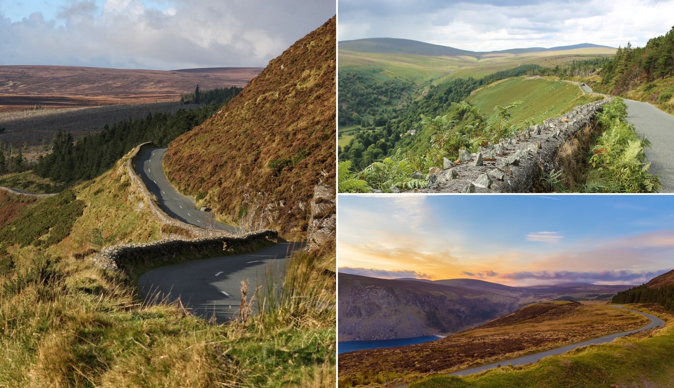
A visit to Glenmacnass Waterfall along the Sally Gap is one of the more popular things to do in Wicklow.
Glenmacnass Waterfall is an impressive 80-metre high tumble of water, tucked away in the magnificent Wicklow Mountains.
It’s a popular stop on the scenic drive to Sally Gap but a visit here comes with some safety warnings.
In the guide below, you’ll find everything from where to get parking at Glenmacnass Waterfall to where to soak up (not literally…) a fine view from afar.
Some quick need-to-knows before you visit Glenmacnass Waterfall in Wicklow

Although a visit to Glenmacnass Waterfall near Laragh is fairly straightforward, there are a few need-to-knows that’ll make your visit that bit more enjoyable.
Please, please, please pay particular notice to the two safety warnings – in particular point 2 about staying on the road side.
1. Location
Glenmacnass Waterfall sits at the head of the Glenmacnass Valley in the Wicklow Mountains National Park. It can be seen from the Old Military Road which runs from Sally Gap to Laragh village.
2. Parking
There is a handy parking area just past the waterfall, at the top of the hill on the left (here on Google Maps). There’s plenty of space there for quite a few cars, so you shouldn’t have any issue grabbing a space.
3. Safety point 1
To get the best view of the waterfall you need to walk back down the road (towards Laragh) against traffic, towards a bad bend in the road. Caution is needed here – stay tight to the side and listen out for approaching vehicles.
4. Safety point 2
When visiting Glenmacnass Waterfall, please don’t climb over the fence/wall and try and get near the top of the waterfall. Stay on the road side.
About Glenmacnass Waterfall
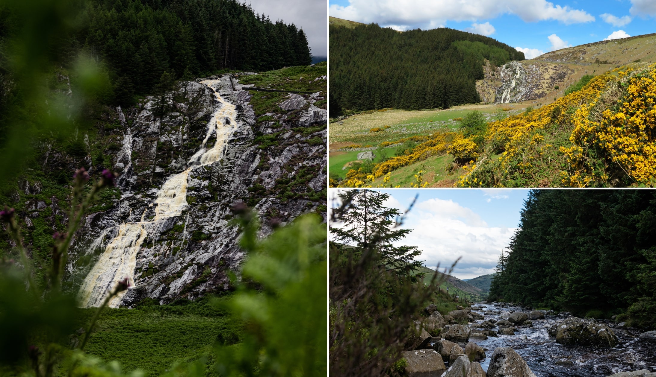
Photos via Shutterstock
Glenmacnass Waterfall falls 80-metres over the edge at the head of the Glenmacnass Valley.
The name of both the valley and waterfall means “the glen of the hollow of the waterfall” in Irish.
Geography of the waterfall
Glenmacnass Waterfall is fed by the Glenmacnass River which begins high on the southeast slopes of Mullaghcleevaun, the 15th highest peak in Ireland.
The river reaches the top of the waterfall at 350 metres above sea level where it falls in three staggered drops to the bottom of Glenmacnass Valley.
The river then continues through the valley until it eventually joins up with the Avonmore River at Laragh village.
This river continues to become the Avoca River which eventually flows into the Irish Sea at Arklow town.
Geology of the valley
The Glenmacnass Valley is a glaciated U-shaped valley with steep cliff sides and a flat floor.
It dates back to the last glacial period called the Ice Age and even contains moraines or glacial till which mark the position of the ice front as it retreated higher up in the Wicklow Mountains.
The waterfall flows over smooth porphyritic granite bedrock. Further down in the valley, you’ll see dark jagged schist rock which juts out on either side of the waterfall.
Glenmacnass Waterfall forms the boundary between these two major rock types in the valley.
The two ways to see the waterfall (and one way NOT to!)

Photo left: Severas. Bottom right: Kacper Cybuch. Top right: Tony Brierton (Canva)
So, there are a couple of different ways to admire Glenmacnass Waterfall from afar.
One is handy enough and the other can be tricky, depending on when you visit.
1. As you climb the hill towards it
If you approach the falls from Laragh village, you’ll see Glenmacnass Waterfall from afar as you climb uphill on the Old Military Road.
There are limited places to pull off the side for a photo, but there are some, mostly on the right side of the road.
You’ll get great views of the fields below and falls from afar as you drive, so this is a very picturesque option if you want to see the falls from your car.
2. From above
Another option is to stop at the main car park at Glenmacnass Waterfall (the one at the top of the hill).
There’s plenty of space here to park and then you can walk from there to the top of the falls to see them tumbling down into the valley.
As mentioned above, be cautious with this as you have to walk back along the road for a bit and it can be dangerous with cars driving past.
3. What not to do
Some people try to park their car and then walk along the stones in the river next to the parking area down to the falls.
This is not a good idea and should be avoided, as the stones are slippery, and the flowing river can be dangerous.
Things to do nearby
One of the beauties of Glenmacnass is that it’s a short spin away from a clatter of other attractions, both man-made and natural.
Below, you’ll find a handful of things to see and do a stone’s throw from the falls.
1. The Sally Gap Drive
Photos via Shutterstock
The Sally Gap Drive is one of the most scenic drives in Ireland. The Glenmacnass Waterfall and Old Military Road are usually combined to make one fantastic circular route through the mountains.
The best route for the drive is to head off from Roundwood village up to Sally Gap and then take a sharp left down the Old Military Road.
This way you can drive down past the waterfall and stop to take your photos before continuing on to Laragh village.
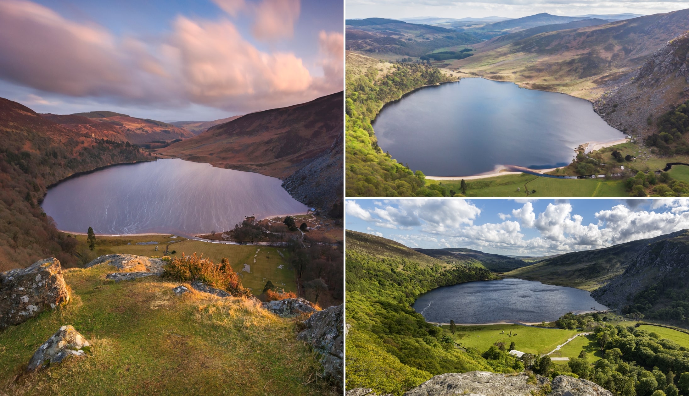
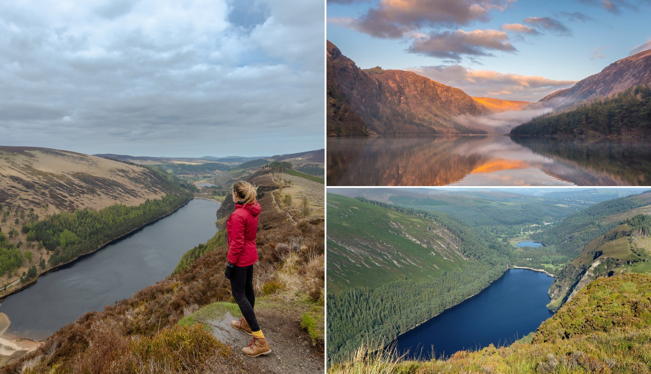
2. Lough Tay
Photos via Shutterstock
Lough Tay is a small but stunning lake in the Wicklow Mountains. It’s another popular photo stop on the Sally Gap Drive and sits in a bowl of mountains just off the road between Roundwood and Sally Gap.
It’s an incredible place to soak up the views from one of the viewpoints with a parking area just off the road.
3. Lough Ouler

Photos via Shutterstock
For another beautiful lake in the Wicklow Mountains, Lough Ouler is otherwise known as Ireland’s heart-shaped lake for its unique form that looks exactly like a reflective love heart in the side of Tonelagee Mountain.
If you want to get a nice view of this lake, you’ll have to head off on the Tonelagee hike which is best started from Turluogh Hill car park. This is arguably one of the best walks in Wicklow!
4. Glendalough
Photos via Shutterstock
Just to the south of the Glenmacnass Waterfall, a visit to Glendalough is a must for any trip to the Wicklow Mountains National Park.
This glacial valley is home to important historical sites, including the monastic ruins of the Christian settlement founded by St Kevin in the 6th century. See our guide to the best Glendalough walks for more.
Keith O’Hara has lived in Ireland for 35 years and has spent much of the last 13 creating what is now The Irish Road Trip guide. Over the years, the website has published thousands of meticulously researched Ireland travel guides, welcoming 40 million+ visitors along the way. In 2022, the Irish Road Trip team published the world’s largest collection of Irish Road Trip itineraries. Keith lives in Dublin with his dog Toby and finds writing in the 3rd person minus craic altogether.