
Yes, there are Northern Ireland counties (6 of them) that sit within the United Kingdom.
Now, if you’re reading that and thinking, ‘Eh, excuse me?!’, it’s worth reading our speedy guide to the differences between Northern Ireland vs Ireland.
There are 6 counties of Northern Ireland: Antrim, Armagh, Tyrone, Down, Derry and Fermanagh and each is home to breath-taking beauty.
Some quick need-to-knows about the 6 Northern Ireland counties

Photos via Shutterstock
Before diving into the guide, take 60 seconds to read these quick need-to-knows about the 6 counties of Northern Ireland.
In the second half of the guide you’ll find more handy info on each of the counties of Ulster (excluding Donega, which is part of Ireland).
1. There are 6 counties
There are 6 counties in Northern Ireland. These are Antrim, Armagh, Down, Fermanagh, Derry/Londonderry and Tyrone. The most populous of these is Antrim (thanks mostly to Belfast), while Fermanagh is the least populous. By area, Tyrone is the largest and Armagh is the smallest.
2. These counties are part of the UK
Following the partition of Ireland in the early 1920s, these 6 counties have been a part of the United Kingdom. That means they belong to the UK political system and take part in UK elections, although they do have a devolved government based in Belfast (Stormont) who can take certain local decisions without Westminster intervening.
3. Different currency and customs
While there are plenty of cultural similarities to the rest of Ireland, the Northern Ireland counties have some key differences. The pound sterling is used rather than the Euro and all the road signs take the same form as the UK. And the police forces are different too.
A map of the 6 counties of Northern Ireland

Photo via Shutterstock
The map of the 6 counties of Northern Ireland above gives you a quick overview of the lay-of-the-land in the north.
Armagh, Tyrone, Fermanagh and part of Derry are known as ‘Border counties’ – i.e. they’re on the border of Northern Ireland and the Republic of Ireland.
At 3,266 square kilometres in size, Tyrone is the larges of the Northern Ireland counties while Armagh, at 1,327 square kilometres, is the smallest.
An overview of the Northern Irish counties
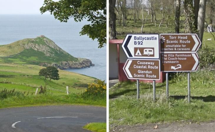
Photo left: Shutterstock. right: Google Maps
Now that you’re up-to-speed on the various Northern Ireland counties, it’s time to give you a quick overview of each of them.
Below, you’ll find the need-to-knows about each of the 6 counties of Northern Ireland along with their key landmarks.
1. Antrim
Photos via Shutterstock
- Size – 3,086 square kilometres
- Population – 618,108
With the majority of Belfast straddling its southern border with County Down, County Antrim is the most populous of the Northern Ireland counties, but it’s also packed full of stunning landscapes that are wildly different from Belfast’s urban pleasures.
Although speaking of Belfast, it would be foolish not to spend some time in Ireland’s second-largest city. Home to fascinating history, colourful street art, cracking pubs and the unique Titanic Belfast attraction, it’s well worth spending a couple of days in this vibrant spot.
The north coast of Antrim is a deadly place to visit too, and not just because of the Giant’s Causeway UNESCO World Heritage Site (but definitely go there!). Make time to check out the lively seaside town of Portrush before taking on the gorgeous coastal walk east to Dunluce Castle. Finish off with a visit to the world-famous Old Bushmills Distillery nearby.
2. Down
Photos via Shutterstock
- Size – 2,490 square kilometres
- Population – 531,665
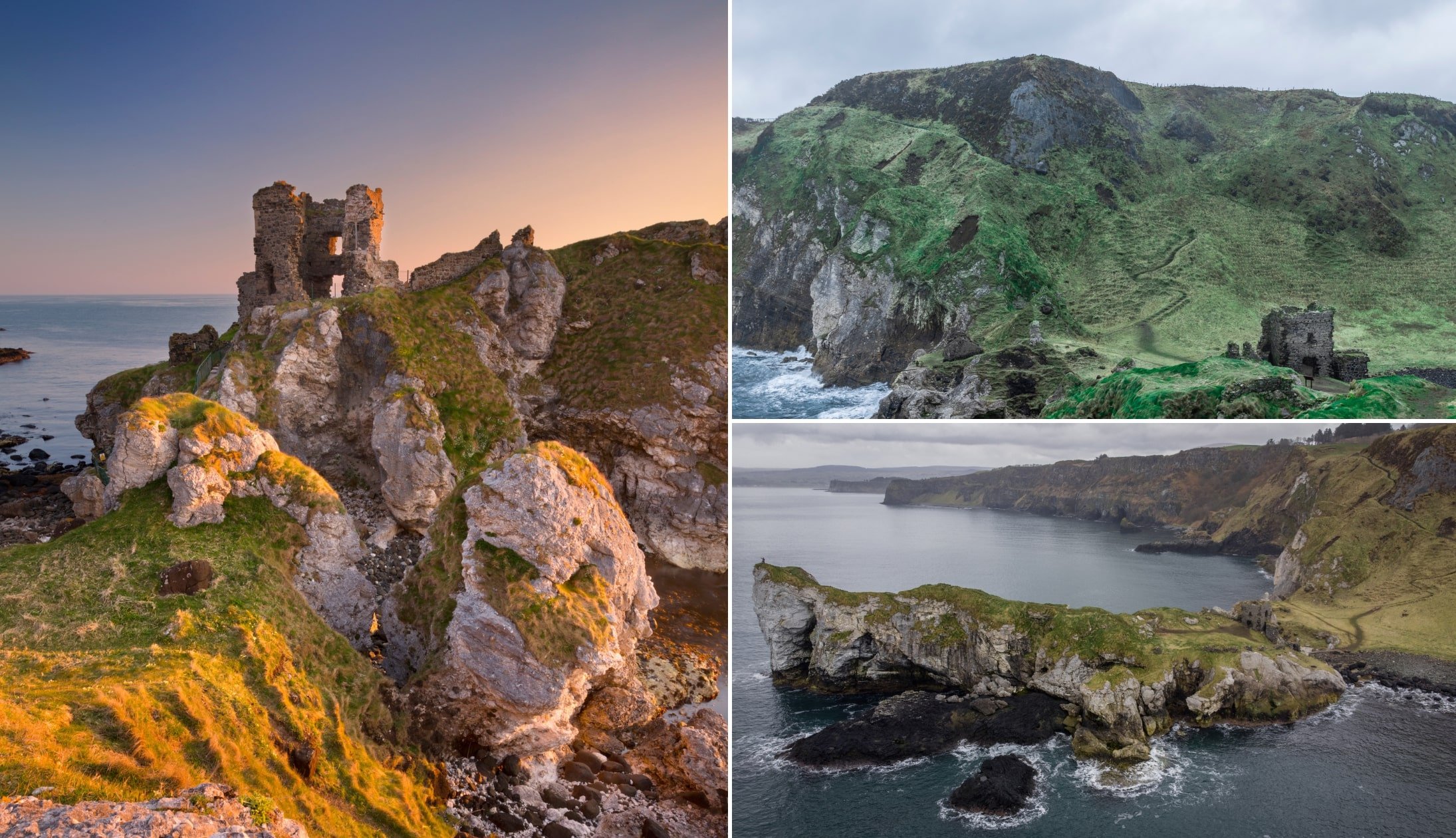
The second-most populous of the Northern Ireland counties, County Down is located directly south of County Antrim and directly north of County Louth in the Republic of Ireland. It’s also pretty recognisible on a map – look for the Ards Peninsula veering off to the right on its east coast.
With Slieve Donard soaring to almost 3,000ft (Northern Ireland’s tallest mountain), Down is home to the majestic Mourne Mountains on its southern coast and there are tons of trails and things to do around the area (nip over the border and check out the fascinating Cooley Peninsula too, if you’ve got time).
There are also cracking castles here such as Dundrum Castle and Castle Ward (one that Game of Thrones fans will recognise instantly!), as well as the beautiful Tollymore Forest Park and the sweeping sands of Murlough Beach.
3. Derry (aka Londonderry)
Photos via Shutterstock
- Size – 2,118 square kilometres
- Population – 247,132
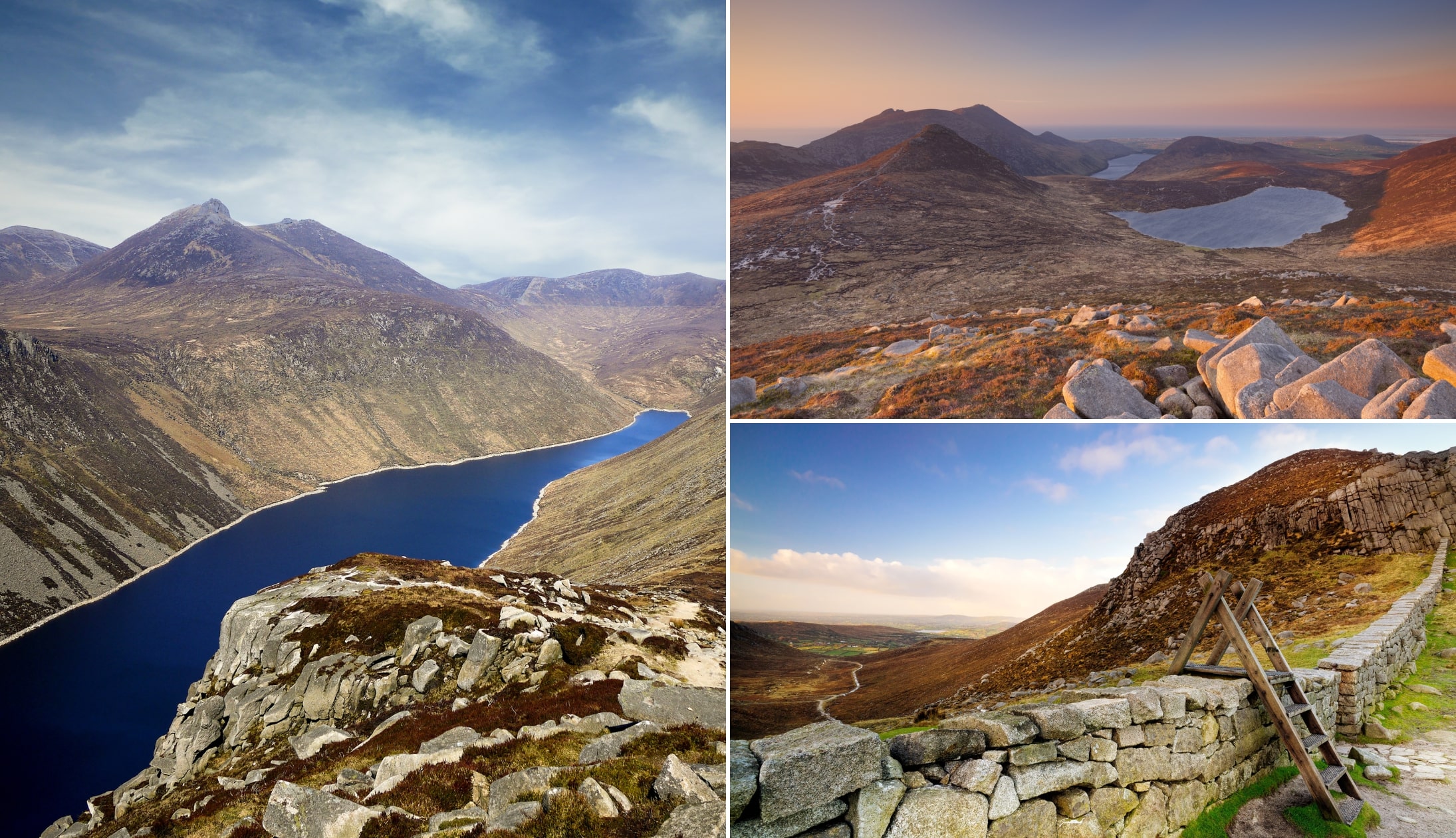
Located to the west of County Antrim and the north of County Tyrone, County Derry (or County Londonderry, as some Unionists prefer to call it) has some fine spots to explore. From the charms of Derry City to some beautiful beaches, there’s tons to see and do here!
The difficult times of The Troubles seem a long time ago now, as modern Derry is a vibrant and welcoming place with a real buzz about it. The only completely walled city in Ireland, its old ramparts are wonderfully intact and are a unique slice of history. Also don’t miss walking tours of the city’s murals (including Derry Girls!) and the famous Free Derry corner.
Outside of the city, the picturesque Mussenden Temple on Downhill Demesne forms part of a gorgeous scene on the north coast and don’t forget to take a ramble along the beautiful Portstewart Strand.
4. Armagh

Photos via Shutterstock
- Size – 1,327 square kilometres
- Population – 174,792
Bordering County Down to the east and County Tyrone to the west, County Armagh is arguably the most overlooked of the 6 Northern Ireland counties. However, there’s plenty to get stuck into here!
For a start, did you know Armagh is famous for its cider? With tons of apple orchards, it’s arguably Ireland’s finest cider country so enjoy a few drops and take a few orchard tours. Even better, time your trip to coincide with the Armagh Food and Cider Festival in September.
There’s also a load of history and scenery to enjoy Armagh too. The ancient Navan Fort is a hugely significant archeological site, while the Armagh Robinson Library is like stepping into a time machine to the 18th-century (and it includes Jonathan Swift’s own copy of Gulliver’s Travels dating from 1726!).
5. Fermanagh
Photos via Shutterstock
- Size – 1,691 square kilometres
- Population – 61,170
County Fermanagh is – by some distance – Northern Ireland’s smallest county by population but don’t let that put you off visiting! In fact, see it as a positive and explore the lovely scenery this underrated county has to offer.
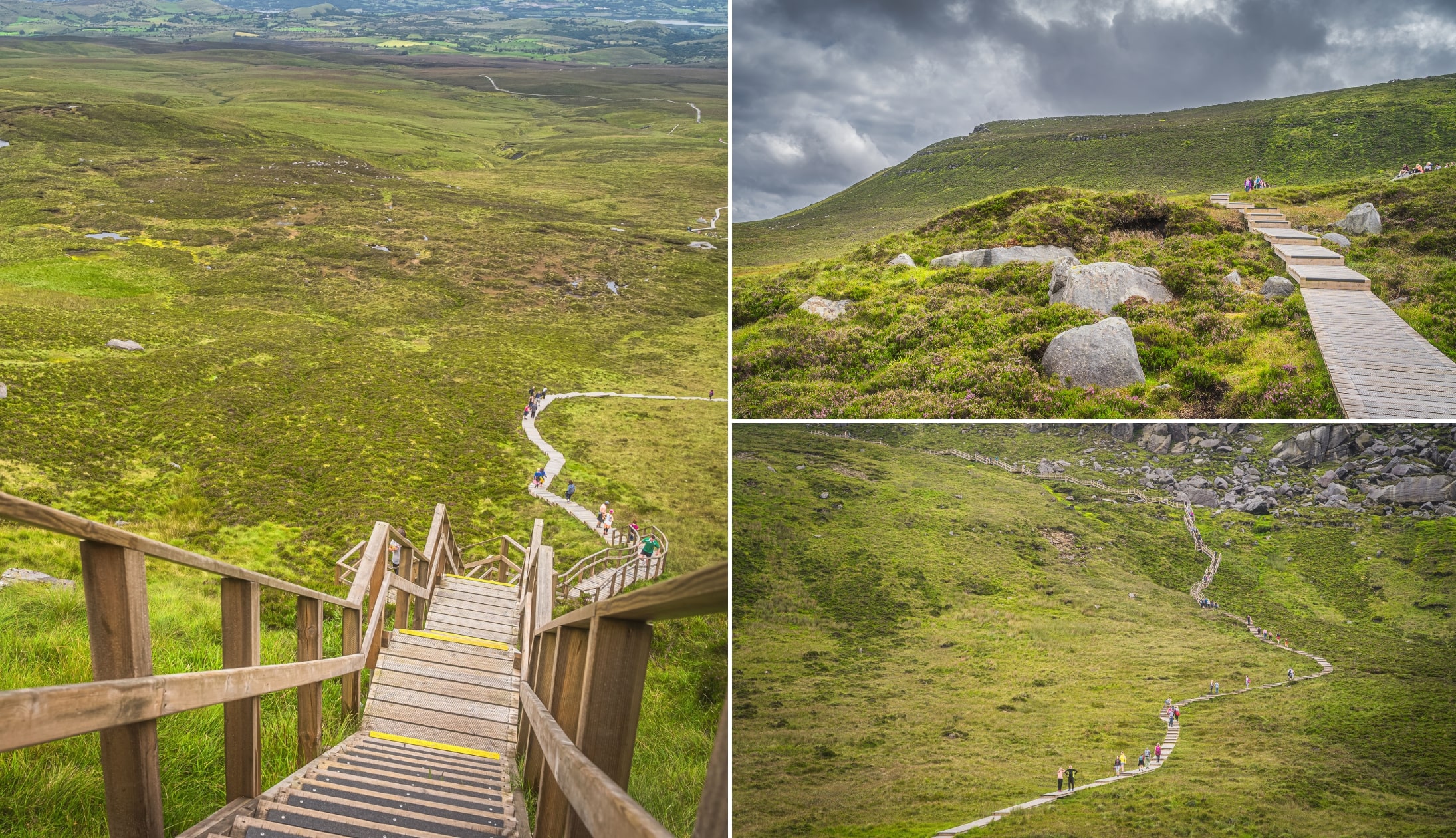
Known by many as the Stairway to Heaven Walk, the Cuilcagh Boardwalk Trail snakes through one of the largest expanses of blanket bog in Northern Ireland before reaching the viewing platform on Cuilcagh Mountain and its epic panoramic views.
Head deep down in the opposite direction by descending into Marble Arch’s natural limestone caves (the longest cave system in Northern Ireland).
Enniskillen is the charming county town and the 16th-century Enniskillen Castle is a fascinating slice of history to explore before settling into one of the town’s fine pubs (a creamy pint at the famous Blakes of the Hollow pub is top of the list!).
6. Tyrone

Photos by Emma Mc Ardle via Ireland’s Content Pool
- Size – 3,266 square kilometres
- Population – 177,986
With an area of 3,266 square kilometres, County Tyrone is the largest of the counties in Northern Ireland and its rolling fields and pastoral landscapes immediately capture the imagination. There’s also loads of history and some great pubs here to sink your teeth into as well!
Ireland saw tons of emigration to America during the 19th century and Ulster American Folk Park tells their story and features thatched cottages, an emigrant ship, food sampling and live characters explaining the challenges they faced.
The gateway to the Sperrin Mountains, Gortin Glen Forest Park is a gorgeous cocktail of scenic drives, cascading waterfalls, shimmering lakes and handy walking trails. After all that, head back to The Village Inn in Omagh for a relaxing pint or two.
Why Northern Ireland has separate counties to the Republic of Ireland

Click to enlarge
For this, we’ll need a quick history lesson! The late 19th-century and early 20th-century saw a ton of campaigning for Ireland to be granted Home Rule from Britain (Ireland was a part of Britain back then) and repeated failures eventually lead to the events of 1916 and the Easter Rising in Dublin.
This and the political pressure for Irish independence post-World War One meant that in 1920, the Government of Ireland Act 1920 was passed to grant Home Rule.
However, it partitioned Ireland into two self-governing bodies – the combined majority Protestant six counties of Northern Ireland and the remaining 26 counties of Southern Ireland (as it was called at the time).
This concept of ‘Southern Ireland’ wasn’t recognised by the vast majority of its citizens and instead they recognised themselves as the self-declared Irish Republic in the ongoing Irish War of Independence.
This conflict eventually lead to the Anglo-Irish Treaty of 1921, in which Ireland would finally break free from the UK (with the option for Northern Ireland to opt out and remain part of the UK) in December 1922 and become the Irish Free State (what we now call the Republic of Ireland).
The Parliament of Northern Ireland exercised its right to remain in the UK and those six counties are still part of the UK over 100 years later.
FAQs about the 6 Northern Ireland counties
We’ve had a lot of questions over the years asking about everything from ‘What counties in Northern Ireland are the most scenic?’ (Down and Antrim) to ‘What counties in Ulster are part of Ireland?’ (Donegal).
In the section below, we’ve popped in the most FAQs that we’ve received. If you have a question that we haven’t tackled, ask away in the comments section below.
What are the 6 counties in Northern Ireland?
The 6 Northern Irish counties are Antrim, Armagh, Down, Derry, Tyrone and Fermanagh.
What are the Northern Ireland provinces?
There are none. Northern Ireland is part of the province of Ulster, which is also called home by Donegal, which is part of Ireland.
Keith O’Hara has lived in Ireland for 35 years and has spent much of the last 13 creating what is now The Irish Road Trip guide. Over the years, the website has published thousands of meticulously researched Ireland travel guides, welcoming 40 million+ visitors along the way. In 2022, the Irish Road Trip team published the world’s largest collection of Irish Road Trip itineraries. Keith lives in Dublin with his dog Toby and finds writing in the 3rd person minus craic altogether.