The Slieve Donard Walk is well worth conquering! The trail takes you up Slieve Donard Mountain – the highest peak in the Mourne Mountains (850m/2789ft).
As is the case with many of the trails in the area, the 4-5 hour Slieve Donard hike requires some planning .
Below, you’ll find info on everything from where to park and what to expect to a map of the trail.
Some quick need-to-knows about the Slieve Donard Walk

Photo via Shutterstock
Our Slieve Donard hike guide begins with several chunks of info (and warnings) that you need to take note of:
1. Location
You’ll find Donard Mountain in County Down, right next to the lively town of Newcastle and just over an hour from Belfast City.
2. Parking
The Slieve Donard car park can be found right here on Google Maps. It’s in Newcastle and you can use this as your Slieve Donard Walk starting point.
3. Difficulty
Climbing Slieve Donard isn’t to be sniffed at. This is a moderate to strenuous walk. However, while long and steep in places, it’ll be doable for those with reasonable fitness levels.
4. Length
The Glen River Slieve Donard mountain walk is a linear route of around 4.6km (9.2km in total). It should take between 4-5 hours to complete, depending on pace and weather.
5. Proper preparation needed
Although the Slieve Donard route we outline below is straightforward, you need to plan adequately. Check the weather, dress appropriately and bring adequate supplies.
About Slieve Donard Mountain
Photos via Shutterstock
Located on the County Down coast, the mighty granite peak of Slieve Donard Mountain is visible for miles amid the 12 other majestic peaks that make up the magnificent Mournes.
The Slieve Donard walk is one of the more popular walks in the area, however, the likes of the Slemish Mountain walk and the Glenariff Forest Park walk are worth a shot, too!
Slieve Donard mountain is named after a saint – known in Irish as Domhanghart. A disciple of Saint Patrick, Saint Donard built a small prayer cell at the summit of the mountain during the fifth century.
Up until the 1830s, people would do the Slieve Donard Mountain walk as part of a pilgrimage in late July of each year.
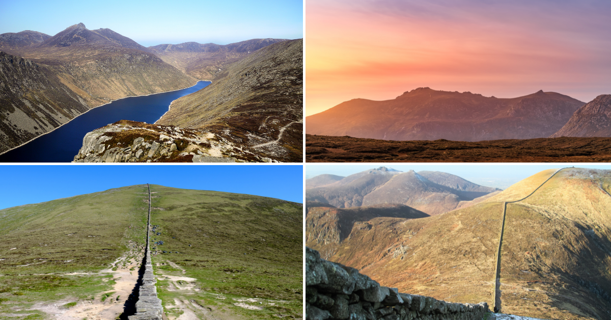
Our Slieve Donard walk map
Our Slieve Donard walk map above shows you a rough outline of the trail from beginning to end.
As you can see, the starting point is the car park in Newcastle and the trail is linear.
It looks relatively straightforward, but it’s worth reading our overview below to give you a much better sense of what to expect.
An overview of the Slieve Donard Hike (The Glen River Route)

Photo by Carl Dupont on shutterstock.com
Right – once you’ve left the Slieve Donard car park, it’s time to head off towards the start of the trail.
Leave the car park and ascend the hill along a well-trodden path into the forest of Donard Wood, where the Slieve Donard hike truly starts.
A walk through woodland
Full of oak, birch and Scots pine, it’s rich woodland you’ll be walking through here.
There are a few bridges along the way as you cross and re-cross the cascading Glen River but these shouldn’t be any bother and the going is fairly steady.
Then the challenge really begins
This is where the Slieve Donard hike really starts. As the route gets steeper, watch out for a section of the river that overhangs.
This part can be a little tricky so take extra care when navigating. Following a gate and stile, you’ll eventually start rising above the Glen River.
Reaching the saddle
Head along this section for a couple of kilometres and on towards the saddle between Slieve Commedagh and Slieve Donard Mountain.
The track here should be easy as it was recently paved with new steps in order to deal with the pressure of thousands of walkers who choose to take on the Slieve Donard hike each year.
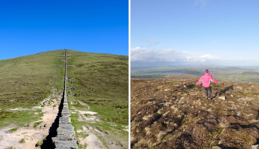
The Mourne Wall
After one more river crossing, you’ll be able to make your way up towards the famous Mourne Wall. Once you’ve made it up to the wall, turn left and follow the wall’s steep path to the summit.
You’ll head over a few false peaks along this part of the Slieve Donard mountain walk, so keep ploughing on up this steep section until you see a shelter in the form of a tower with a trig point on top.
Reaching the summit
You’ll know then that you’ve reached the top of the highest mountain in Northern Ireland! And, of course, the two cairns will also be nearby if you want to inspect them.
The first point of order, though, should be enjoying one of Ireland’s mightiest views! Fingers crossed it’s a clear day when you head up as there’s a smorgasbord of natural beauty emanating all across the British Isles from the lofty peak of Slieve Donard mountain.
The return journey
When you’re ready, it’s time to head back down. You’ll need to retrace your steps back to the Slieve Donard walk starting point.
Return by the same route along the wall until you reach the saddle. Be vigilant – it can get very steep in places, which can be tricky in wet weather.
Things to do after climbing Slieve Donard
One of the beauties of the Slieve Donard climb is that it’s a short spin away from many of the best things to do in Down.
Below, you’ll find a handful of things to see and do a stone’s throw from Slieve Donard Mountain (plus places to eat and where to grab a post-adventure pint!).
1. Post-hike food in Newcastle

Photos via Quinns Bar on FB
Worked up an appetite climbing Slieve Donard? When you head back to the town, you’ve your pick of great places to eat. We tend to head to Quinn’s, but there’s plenty to choose from.
2. Newcastle Beach
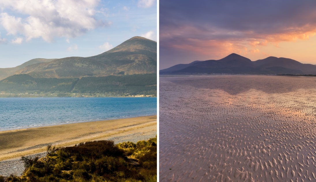
Photos via Shutterstock
If you’ve a bit of energy left over after you climb Slieve Donard, head out to Newcastle, grab a coffee and then head for a saunter along the town’s magnificent beach.
3. Tollymore Forest Park
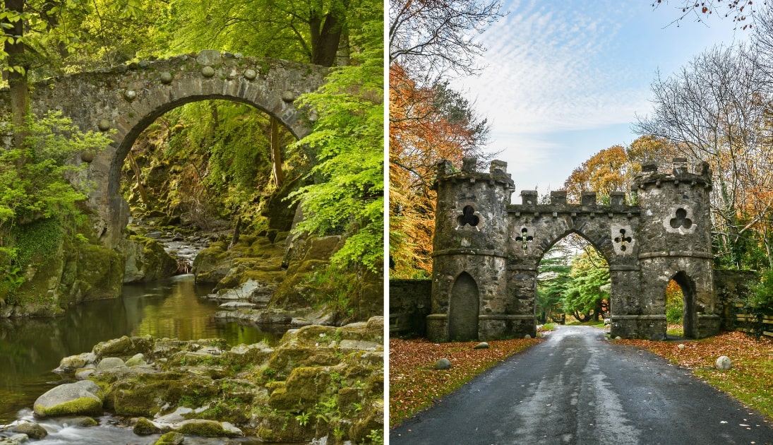
Photos via Shutterstock
Tollymore Forest Park is a 15-minute spin from Newcastle and it’s a glorious spot for a stroll. There’s some long walks here that treat you to some of the finest woodland in the country.
4. More Mourne walks
Photos via Shutterstock
There’s endless Mourne Mountain walks. Here are a few of our favourites to get stuck into:
Slieve Donard Walk FAQs
We’ve had a lot of questions over the years asking about everything from ‘Is climbing Slieve Donard worth it?’ to ‘How long does it take?’.
In the section below, we’ve popped in the most FAQs that we’ve received. If you have a question that we haven’t tackled, ask away in the comments section below.
How long does it take to walk up Slieve Donard?
It takes 4-5 hours to climb Slieve Donard (up and down) if you follow the Glen River Trail, which stretches for around 4.6km/9.2km
Is Slieve Donard a hard walk?
Climbing Slieve Donard is moderately difficult and requires a good level of fitness. Particular care is needed when the trail is wet.
Where does Slieve Donard walk start?
If you look at our Slieve Donard walk map above, you can see the starting point is the car park in Newcastle.
Jacqui Gough
Sunday 26th of September 2021
Was a great walk James even in stormy weather Thanks for your piece Helped me prep n reflect once back down.