
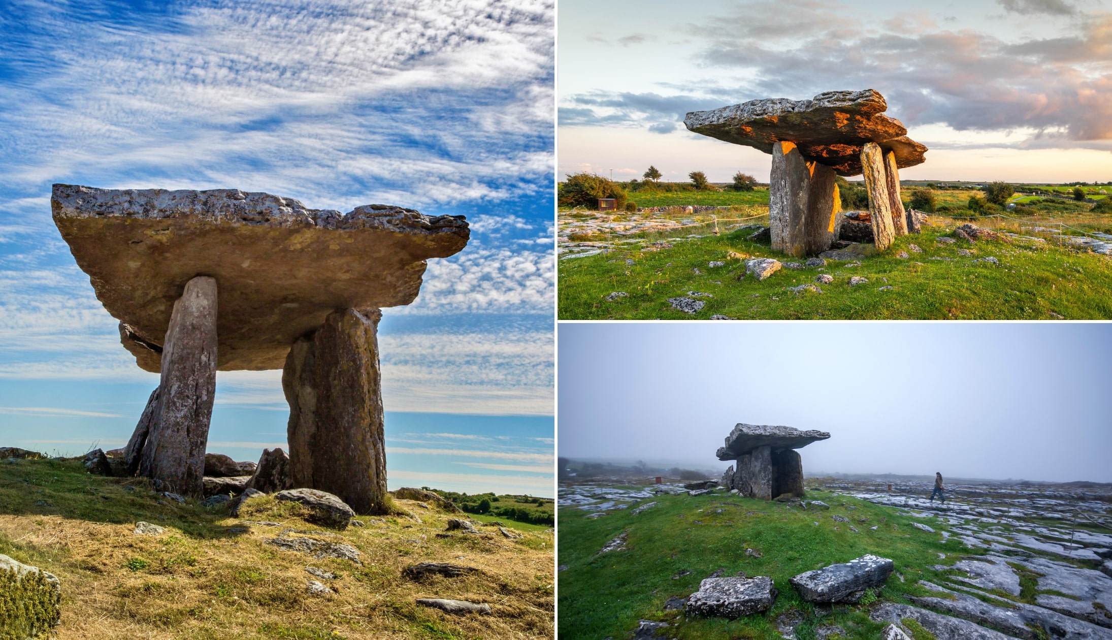
The Burren’s Poulnabrone Dolmen is one of the Wild Atlantic Way’s archaeological treasures, dating between 4,200 – 2,900 BC.
Located within the Burren National Park in County Clare, Poulnabrone is a portal tomb that was used as a burial site (more on the discoveries made during the excavations in 1986 and 1988 below!).
While it’s not the oldest megalithic monument in Ireland, it’s arguably the most famous, as it has been used widely in advertising from Tourism Ireland over the years.
An overview of Poulnabrone Dolmen
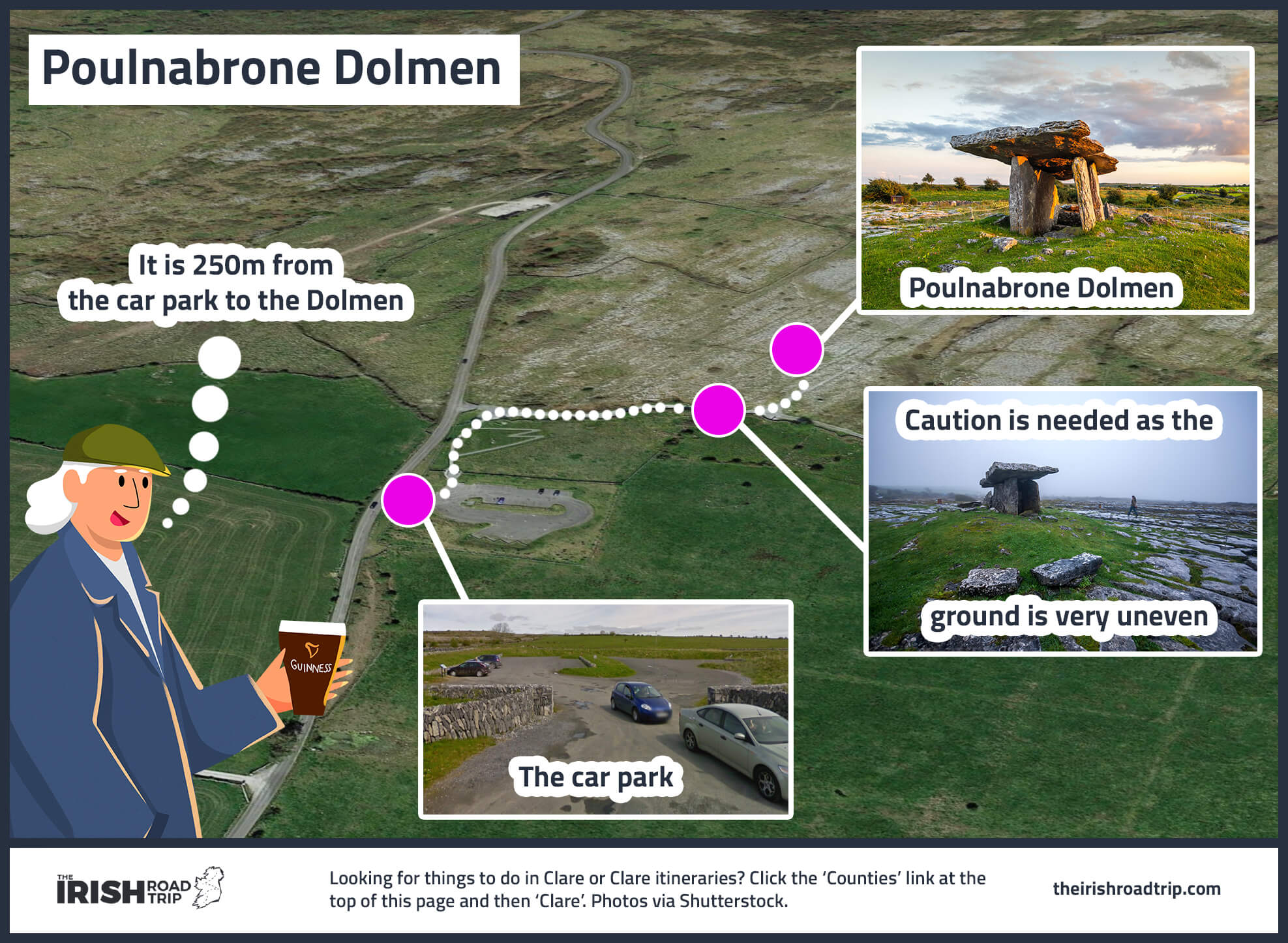
Although a visit to Poulnabrone Dolmen in Clare is fairly straightforward, there are a few need-to-knows that’ll make your visit that bit more enjoyable.
1. Location
Poulnabrone Dolmen can be found in a rocky field in a quiet corner of the Burren. It is close to the R480 road and is 8 kilometres south of Ballyvaughan.
2. Parking
There’s a handy bit of parking right beside Poulnadrone Dolmen (here’s the location on Google Maps). It’s a 250m walk from the car park to the Dolmen, but as the ground is very uneven, it may prove tricky for those with limited mobility.
3. Meaning of the name
As is often the case with names in Ireland, Poulnabrone is the English phonetic transcription of the Irish words ‘Poll na Brón‘. ‘Brón’ comes from the Irish word ‘Bró’, meaning ‘Quern’, so the name means “Hole (or Pool) of the Quernstone”.
The history of Poulnabrone Dolmen
Photos via Shutterstock
Poulnabrone Dolmen is made up of three standing portal stones that support a large horizontal capstone, and it dates to the Neolithic period, about 4200 BCE and 2900 BCE.
Although there are roughly 172 Dolmens in Ireland, Poulnabrone Dolmen is the best known and arguably the most visited.
What it was used for
The topography was formed from limestone that was laid down around 350 million years ago.
It was built by Neolithic farmers who chose the area either as a collective burial site, to mark their territory or for ritual.
At the time, the stones that remain would have been covered with soil and the flagstone topped with a cairn.
The design of the dolmen
Poulnabrone dolmen is a portal tomb – i.e. large capstones that are elevated at an angle and held up by standing stones.
The slab-like tabular capstone is almost four metres in length, two to three metres wide and 30 centimetres thick.
The capstone slopes to the west, which is unusual for this kind of dolmen. The chamber roof is supported by upright standing stones, each about 2 metres high.
The upright stones provide stability for the chamber and the entry faces north.
The discovery of human remains
The site was excavated in 1986 and 1988. Some 33 human remains were discovered (men, women and children along with stone and bone objects that would have been buried with the bodies).
The human remains and the burial objects are thought to be from 3800 BCE to 3200 BCE and the bodies were taken elsewhere to decompose before the bones were transferred to the location.
Only one of the adults was over the age of 40. The burial site also contained the remains of a much later Bronze Age baby (1750 to 1420 BCE).
Things to do nearby

As there are endless things to do in Clare, I’d argue that you shouldn’t head straight for Poulnabrone Dolmen as you’ll miss many attractions along the way.
I’d recommend following the Burren Scenic Drive that’s pictured in the map above.
However, here are the distances from some of the area’s main attractions:
- Cliffs of Moher (35-minute drive)
- Ailwee Caves (15-minute drive)
- Father Ted’s House (25-minute drive)
- Doolin (30-minute drive – ferry to the Aran Islands leaves from the pier)
- Fanore Beach (35-minute drive)
Keith O’Hara has lived in Ireland for 35 years and has spent much of the last 13 creating what is now The Irish Road Trip guide. Over the years, the website has published thousands of meticulously researched Ireland travel guides, welcoming 40 million+ visitors along the way. In 2022, the Irish Road Trip team published the world’s largest collection of Irish Road Trip itineraries. Keith lives in Dublin with his dog Toby and finds writing in the 3rd person minus craic altogether.