
Unlike many of the hikes outlined in our guide to the best walks in Wicklow, the Lugnaquilla hike isn’t one to be taken lightly.
The highest mountain in Ireland outside of County Kerry, Lugnaquilla Mountain is a mighty hike deep in the heart of the Wicklow Mountains!
And while it doesn’t have the classic pointy pyramid look of other famous nearby mountains, like the one you climb on the Great Sugarloaf walk, its vast flat-topped plateau is nonetheless impressive.
Fancy taking on the beast known locally as ‘Lug’? There are a few different Lugnaquilla routes that you can choose from, so let’s get into them!
A warning: If you can’t use a map and compass, or if you aren’t doing this hike with someone who can, you shouldn’t attempt this climb.
Some quick need-to-knows about the Lugnaquilla hike

Climbing Lugnaquilla Mountain isn’t straightforward and it isn’t safe for novice hikers looking for an adventure (see our Wicklow walks guide for easier hikes).
There are some VERY important need-to-knows about the Lugnaquilla hike – pay careful attention to the weather and safety warnings later in the guide.
1. Location
Located in the south-west corner of the Wicklow Mountains, Lugnaquilla Mountain is surrounded by many other summits along with a handful of corrie lakes.
2. Height
Coming in at a not-too-shabby 925 metres (3,035 ft), ‘Lug’ is Ireland’s 11th tallest peak, the highest in the province of Leinster and the highest mountain in Ireland outside of County Kerry.
3. Name
Its name comes from the Irish Log na Coille, meaning “hollow of the wood”, while its plateau is known as Percy’s Table, apparently after a local 18th-century landowner going by the name of Colonel Percy.
4. This is not a substitute for a map
Our guide to climbing Lugnaquilla Mountain is intended to give you an insight into what to expect – it is not a substitute for a map, so please ensure to plan your climb accordingly (and mind yourself!).
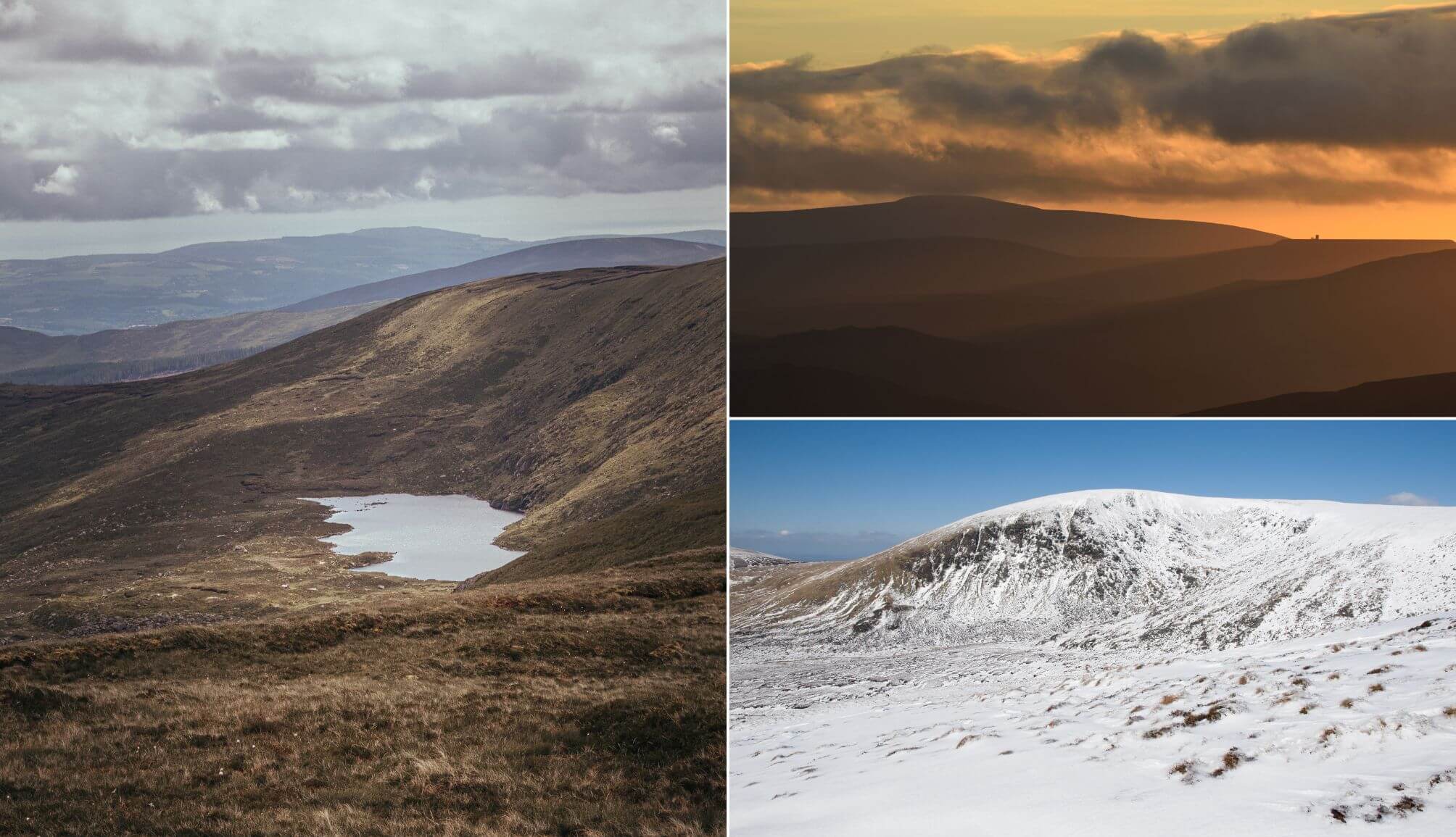
Things to be aware of before you consider climbing Lugnaquilla

Photo left: Sebastian Kaczorowski. Top right: eugene_remizov. Bottom right: andreybl (Canva)
Owing to its length and the notoriously poor visibility in poor weather conditions (particularly on the plateau), the Lugnaquilla hike is one of the more difficult hikes in Ireland.
Thus, it is really only suitable for experienced hikers who are trained in navigation and that are capable of looking after themselves in bad weather conditions (unless you’re taking part in a guided hike, that is!).
1. Lugnaquilla weather conditions
Lugnaquilla Mountain frequently gets wetter, windier and colder weather than its neighbours so it’s essential to prepare properly and check the weather forecast.
In fact, temperatures at the summit of Lugnaquilla can get as low as -15C with windchill! It’s also worth noting that a clear day in the Wicklow Mountains doesn’t mean a clear day on Lug.
You’ll often have clear blue skies around Wicklow and then low, dense cloud hanging over Lug (it’s the highest point in the county, after all).
The likes of Mountain Forecast and Yr.No are two handy sites for checking conditions (you can also just whack ‘Lugnaquilla Weather’).
2. Navigation skills
The different Lugnaquilla routes can be extremely difficult to follow in the recurrent cloud cover so the ability to use a map and a compass is an ESSENTIAL skill.
Climbing Lugnaquilla isn’t the issue – it’s getting back down it in poor conditions that can result in VERY serious situations. If in doubt, do not attempt the Lugnaquilla hike.
3. Daylight, a phone and a companion
If you’re planning on climbing Lugnaquilla Mountain, make sure to arrive at the starting point for the route early, to ensure that you won’t be up the mountain when the sun starts to drop.
You should also do this hike with a companion, when possible. Hopefully, it goes without saying that a fully charged phone, food, water and proper hiking gear are all essential.
Climbing Lugnaquilla Mountain: the different routes
Photos via Shutterstock
If you’re thinking about climbing Lugnaquilla, you have several different routes to choose from, depending on where you fancy starting the hike and how long you want to walk for.
Below, you’ll find two Lugnaquilla routes (there are several others, such as Luqnaquilla via the Great Gully) with info on where to park, where the trail starts, how long each takes and more.
If you’ve read to this point and you’re worried about navigation, try a different Wicklow walk, like the Lough Ouler hike where you’ll get a glimpse at Ireland’s heart-shaped lake.
Route 1: Lugnaquilla from Glenmalure

Climbing Lugnaquilla from Glenmalure is the most scenic hike of the two in this guide. This route is 15km long and will take you around 5-6 hours to complete.
You’ll be heading into the beautiful Glenmalure Valley and passing by some gorgeous scenery on the way to the summit.
This Lugnaquilla hike is tough at times and does go through some boggy marshland but it’s arguably the most rewarding of the three routes.
Where to park
If you’re driving the 80km journey from Dublin, you’ll need to come via the M50 and the R755 and head for Baravore car park. The drive should take around an hour and a half.
Where to start the trail
Start the trail at the path near the historic Glenmalure Youth Hostel (dating back to 1903!). It’s a 9-minute walk from the car park to the hostel.
The forest track to the left will take you into the steep rock-strewn Fraughan Rock Glen, just next to the Benleagh River. The views in the section are stunning and it’s worth stopping for a moment to drink them all in!
The twin flanks of the valley open up and you’ll be rewarded with great views all the way across to the sloping summit of Lugduff.
The route to the summit
Once you’re up and over the glen and heading to the north ridge of Lugnaquilla Mountain, you’ll hit the boggy marshland mentioned earlier.
This section can be a little hard going (and monotonous) but the spectacular landscapes around you should make this part of the trail much easier to abide by.
When you reach the vast open summit, you’ll then be able to take in some incredible views.
If you get lucky and the skies are clear, you’ll be treated to views of Dublin, the Great Sugarloaf, the coast and maybe, just maybe, a glimpse of Snowdon’s jagged peak over in Wales.
Route 2: Lugnaquilla from Glen of Imaal / Fenton’s Pub

The shortest route of the three and, unsurprisingly, also known as ‘the tourist route’, this trek starts from Fenton’s Pub in the Glen of Imaal.
Coming in at a slightly brisker 13km, this version of the Lugnaquilla hike should take you between 4-5 hours to complete.
It’s also an easier walk than the Glenmalure route though the trail does pass through an artillery range (seriously!) so look out for the triangular warning signs on the way.
Where to park
The Luqnaquillan from Glen of Imaal trail kicks off near the now-iconic Fenton’s Pub. It’ll take you 70 minutes to get here from Dublin Airport and just over 40 minutes if you’re leaving from Glendalough.
Where to start the trail
The trail from Fenton’s isn’t marked, but it’s reasonably straightforward to follow on the way up. Head around to the back of Fentons and you’ll see a worn trail that forms the starting point of this Lugnaquilla trail.
The route to the summit
The trail from the back of Fenton’s takes you out onto Military Road. You’ll follow this road for a bit until it reaches a bend. You’ll see a trail just after the bend that goes up the hill (Camara Hill) in front of you.
You’ll need to reach the top of this hill first before you head on to the summit of Lug. The ground here can be difficult enough to walk along, but a sturdy pair of walking boots should do the job.
This Lugnaquilla walk will take you VERY CLOSE TO an artillery range (it’s on your left as you ascend) so look out for the triangular warning signs on the way and make sure to adhere to the notices.
The range is usually pretty quiet at weekends but be sure to check ahead on their operating times if you’re tackling this walk mid-week.
FAQs about the Lugnaquilla hike
We’ve had a lot of questions over the years asking about everything from how long does it take to climb Lugnaquilla Mountain to which route is the most scenic.
In the section below, we’ve popped in the most FAQs that we’ve received. If you have a question that we haven’t tackled, ask away in the comments section below.
How long does it take to climb Lugnaquilla Mountain?
The Lugnaquilla from Glenmalure route takes between 5 and 6 hours to complete while the Lugnaquilla from Glen of Imaal route takes between 4 and 5. Allow extra time for breaks.
Is Lugnaquilla hard to climb?
Yes. This is the highest mountain in Ireland, outside of Kerry, and it tends to be the summit plateau that causes climbers trouble, especially when conditions are poor / when they deteriorate.
Is there a Lugnaquilla hike route for inexperienced climbers?
No. No. No. No…. NO! The only way you should attempt this climb is if 1, you’re an experienced climber or 2, you’re with an experienced climber.
Keith O’Hara has lived in Ireland for 35 years and has spent much of the last 13 creating what is now The Irish Road Trip guide. Over the years, the website has published thousands of meticulously researched Ireland travel guides, welcoming 40 million+ visitors along the way. In 2022, the Irish Road Trip team published the world’s largest collection of Irish Road Trip itineraries. Keith lives in Dublin with his dog Toby and finds writing in the 3rd person minus craic altogether.
Gabrielle Dunne
Sunday 9th of February 2025
Thanks Keith Very helpful, informative, honest information. People can totally underestimate how quick the weather can change & deteriorate in Ireland. I've had 2 bad experiences & that was with experienced mountain guides/navigators. Despite having climbed lots of hills/mountains in Ireland & elsewhere, I've still to climb Lug. On my bucket list.