
The spectacular Connemara Loop meanders through some of Ireland’s wildest and most dramatic scenery, covering a distance of 93km (58 miles) depending on the route you follow.
Taking in the wild heart of northwest Connemara, the loop winds past mist-shrouded lakes, jagged mountains, a glacial fjord, historical landmarks, and some of Galway’s most striking beaches.
Below, you’ll find a map of the Connemara Loop along with information on each of the stops along the way. Enjoy!
About the Connemara Loop
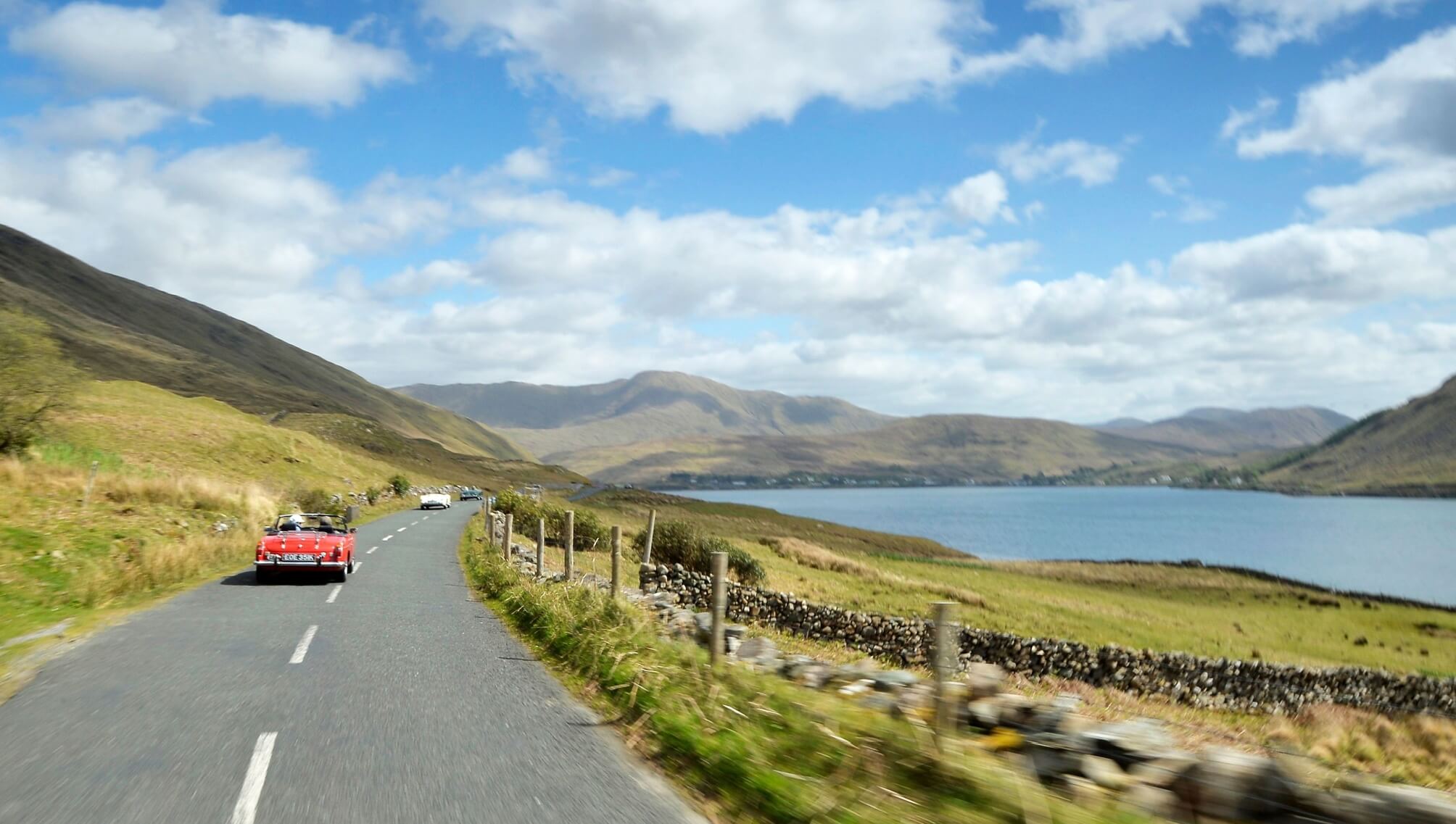
Photo licensed from Anxo Rial
Although you’ll be able to follow the route on my map of Connemara below, there are a few need-to-knows that’ll make your spin that bit more enjoyable.
1. Where it starts and ends
The Connemara Loop traditionally starts and ends at Maam Cross, but you can just as easily begin at Clifden, Leenane, or any point along the route (see this guide on where to stay in Connemara).
2. Length and how long it takes
The loop covers around 93km (58 miles). If you were to drive it without stopping, it would take roughly 1 hour 45 minutes, but plan for 4 to 6 hours to fully enjoy the stops and scenery.
3. The beauty of this drive
The Connemara Loop boasts many points of interest, like the ancient Kylemore Abbey. However, the real magic lies between them – the quiet stretches where mountains, lakes, and oil-painting-like-scenery steals the show.
Connemara Loop map and stops overview
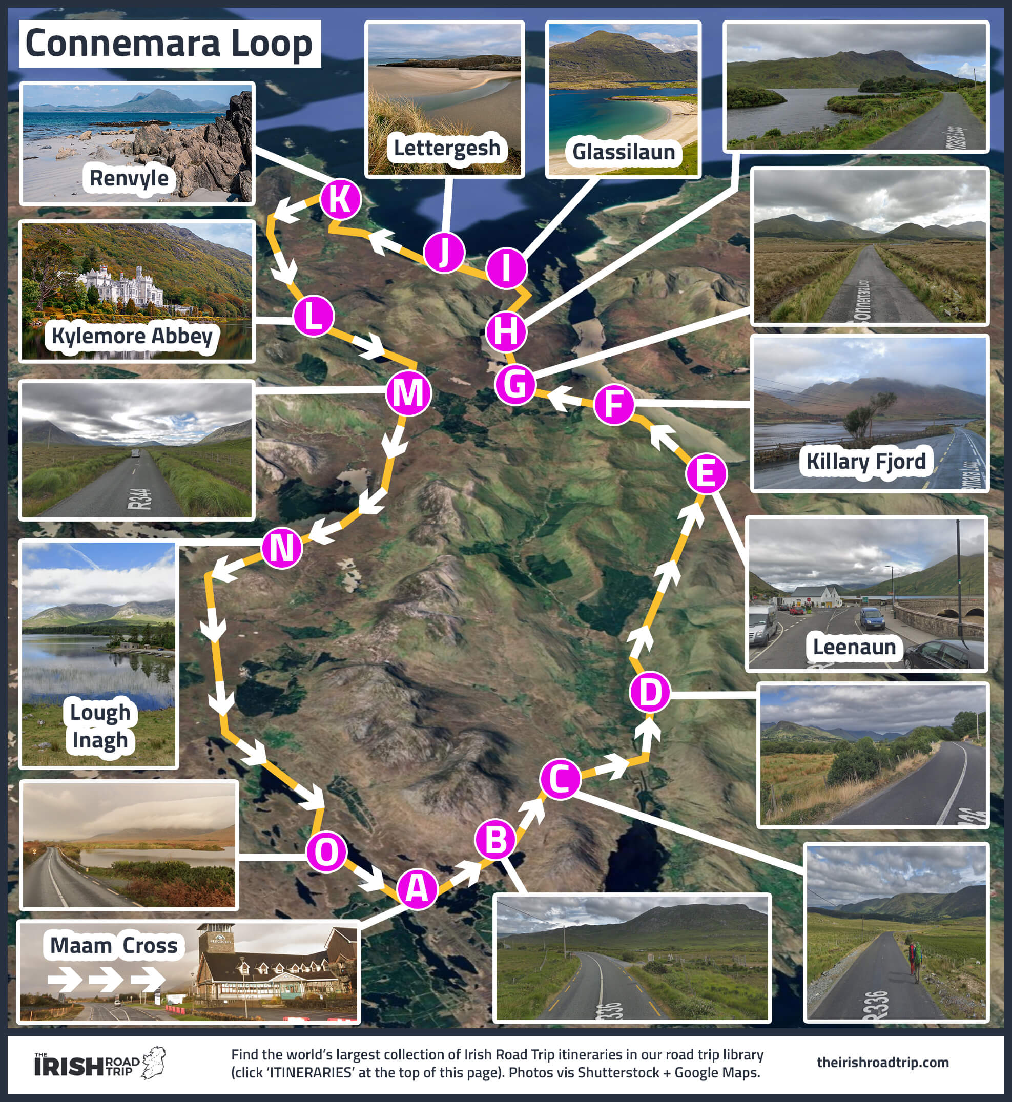
I’ve created a map of the Connemara Loop above so that you can save it to your phone. I’ve also added a Google Map of the route to the end of this guide.
Now, a note – not all of the locations dotted on the map above are stops – many of them (the ones without place names, mostly) are there to give you a sense of the scenery you can expect.
1. Starting from Maam Cross
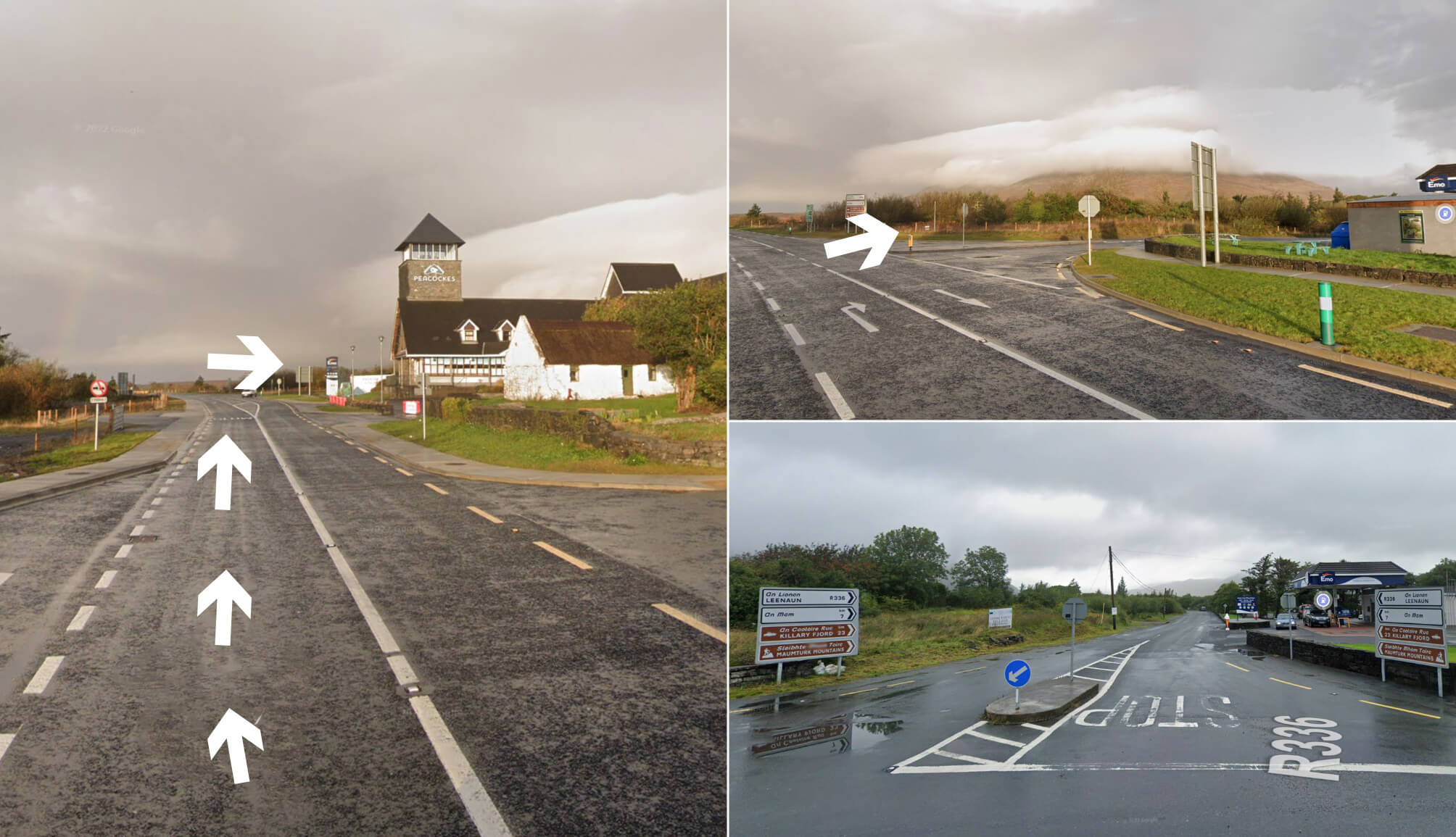
Photos via Google Street View
The Connemara Loop kicks off at Maam Cross, a well-known crossroads about 45 minutes northwest of Galway City.
You’ll know you’re there when Peacockes Hotel comes into view. This is where you leave the N59 and join the R336.
Turn right at the junction (here on Google Maps) and the landscape begins to change, with Connemara’s raw, untamed beauty starting to unfold.
Handy tip: there’s a petrol station just after the turn. If you’re low on fuel, now’s the time to top up.
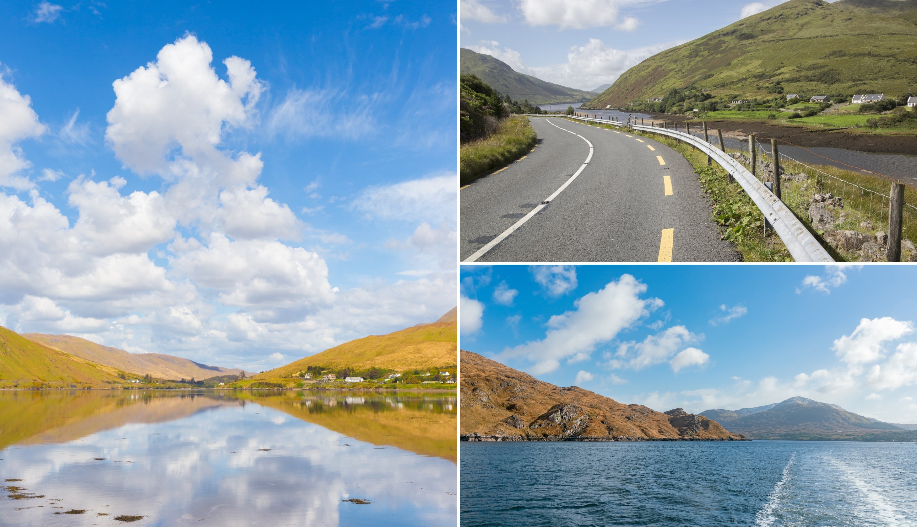
2. The road to Leenaun
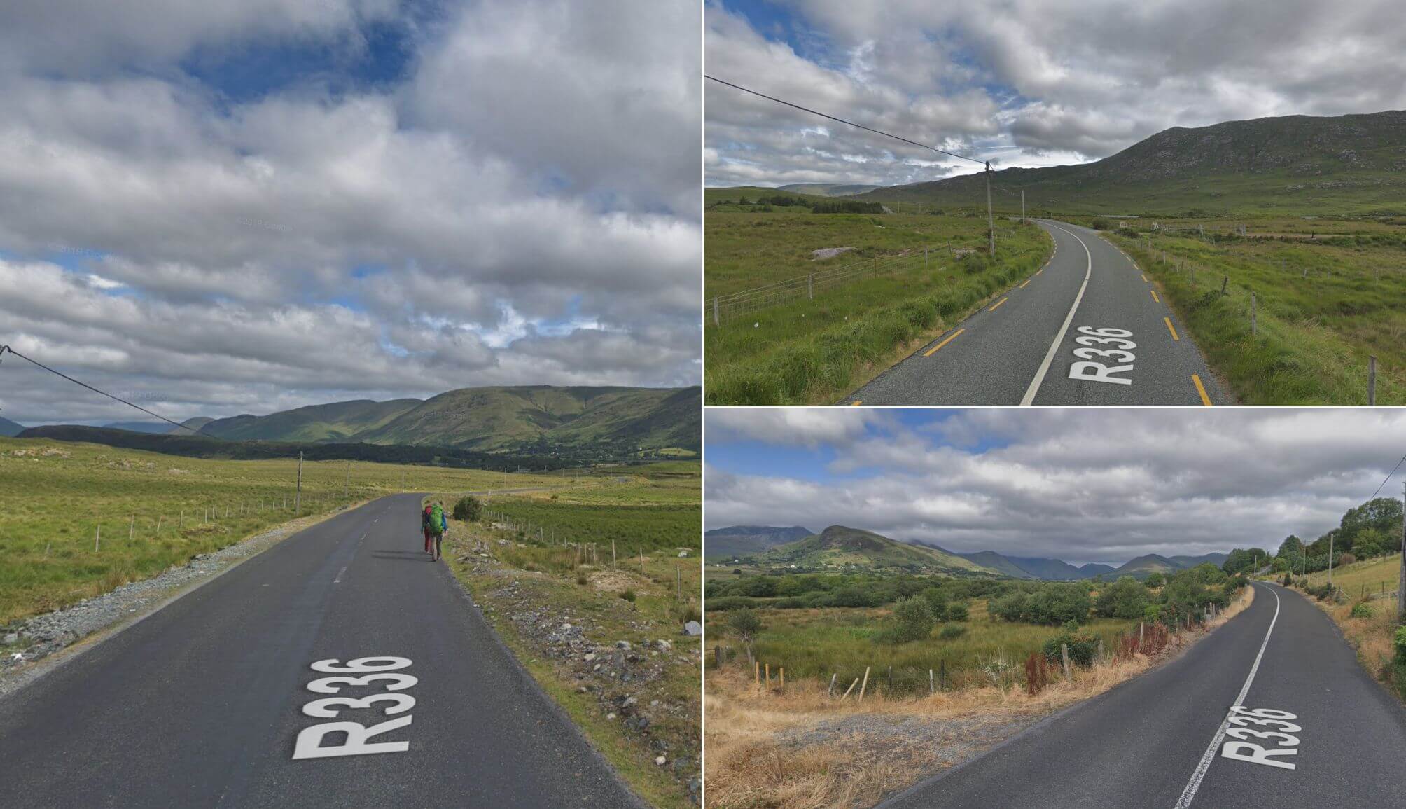
Photos via Google Street View
The road from Maam Cross to Leenane carves through a broad valley framed by towering green peaks. On the right, Lackavrea Mountain looms over Loughanillaun, its dark, rugged slopes mirrored in the still water below.
To the left, Corcogemore rises sharply, its rocky face painting a dramatic line against the sky. The narrow tarmac winds between bogland and mountain, with sheep dotting the open landscape and bursts of heather adding flashes of colour.
It’s a short, 20-minute drive to Leenane, but the sheer scale and shifting light across this wild terrain make it unforgettable.
3. Leenaun Village

Leenaun sits at the head of Killary Harbour, Ireland’s only fjord, where the Maam Valley meets the Atlantic. Surrounded by steep slopes – the Devilsmother to the east, Leenaun Hill to the west – the village feels hemmed in by mountains and water.
Across the fjord, Ben Gorm and Mweelrea rise dramatically, their peaks often lost in cloud. The village itself is small but lively during summer, with two pubs, a hotel, cafés, and even a sheep and wool museum.
It’s also known from the 1990 film ‘The Field’ and Martin McDonagh’s play The Beauty Queen of Leenane (you’ll pass the pub from the film, Gaynor’s, on your left as you enter the village).
Handy tip: You’ll find parking here right in front of the water. If you fancy a coffee and a cake or a bit of lunch, the Killary Cafe is located across the road!
4. Killary Fjord
Photos via Shutterstock
The water stretching out from Leenaun is Killary Harbour – a 16 km-long inlet carved by a glacier. To the north, the slopes of Mweelrea, Connacht’s highest mountain, plunge steeply into the water, while to the south, the Maumturk Mountains and Twelve Bens rise in rugged layers.
At its deepest, the fjord drops to 45 metres, its sheltered waters home to dolphins, seals, and salmon farms. From the village, you can take a boat tour to see the fjord up close, or keep driving and stop at pull-ins along the way (this is a great viewpoint with plenty of space to park).
As you continue the Connemara Loop, the road hugs the water’s edge, with Killary’s calm surface on your right and sheer hills closing in around you.
5. Leaving the N59
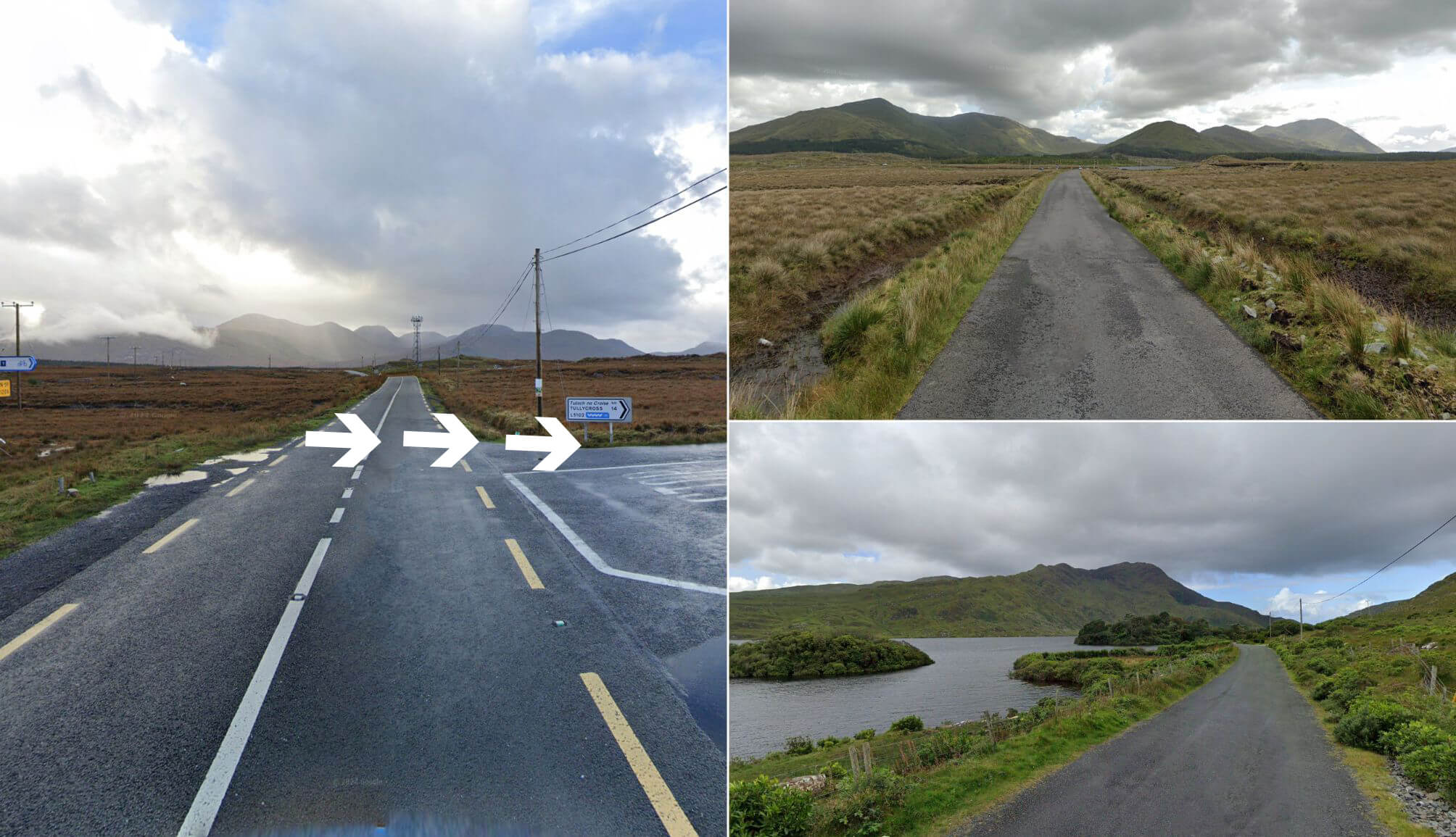
Photos via Google Street View
After leaving Leenaun, you’ll drive for about 10 minutes before taking an easily missed right turn (here on Google Maps). This section of the Connemara Loop is one of the most photographed.
To your left, Lough Fee runs alongside the road, its dark waters set against the rugged slopes beyond. On the right, the ground rises into open hillside, with the narrow road threading through a raw, windswept landscape.
Continue along this stretch past Lough Muck and the route will carry you onto the Renvyle Peninsula.
6. Glassilaun, Lettergesh and Renvyle Beach

Photos via Shutterstock
Three of Connemara’s best beaches sit within 15 minutes of each other, making this stretch of the Loop one of the highlights.
Start with Glassilaun, where powdery white sand and turquoise water meet the dramatic backdrop of Mweelrea. This is one of the most photographed beaches in Galway, with parking just steps from the sand.
A short drive brings you to Lettergesh, a long golden beach with easy access and calm waters perfect for a stroll or a quick paddle. Finish at Renvyle Beach, where soft sand, vivid blue water, and sweeping views of offshore islands create a quiet, postcard-perfect setting.
Handy tip: From Renvyle Beach, take the 3-minute drive to Renvyle House hotel where you can grab a bit of lunch
7. Kylemore Abbey

Photos by the Irish Road Trip
A 15-minute drive from Renvyle brings you to Kylemore Abbey, one of the most popular places to visit in Galway. Built in 1868 as a neo-Gothic castle by Mitchell Henry, it later became a Benedictine monastery in 1920 when Belgian nuns fled World War I.
The abbey sits on the edge of Pollacappul Lake, backed by the slopes of the Twelve Bens, and its reflection in the water is one of Connemara’s most famous images.
Visitors can explore the ground floor of the abbey, the Gothic church, often called a “cathedral in miniature”, and six acres of Victorian Walled Gardens.
Allow 1.5 to 2 hours to take in the history, architecture, and peaceful woodland and lakeside walks that surround this remarkable estate.
8. The Inagh Valley
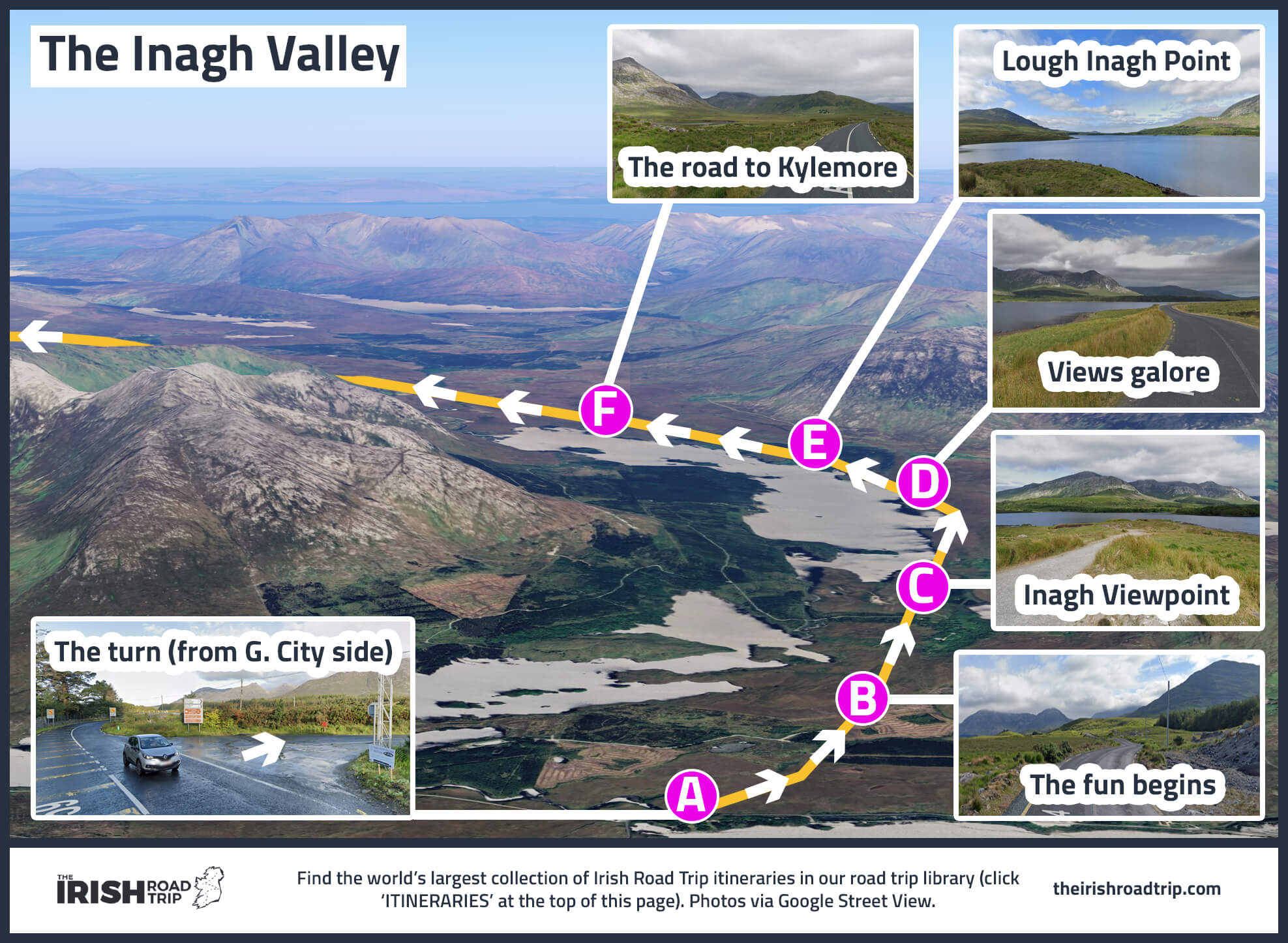
As the Connemara Loop draws to a close, it saves one of its most memorable stretches for last. About 7 minutes from Kylemore Abbey, turn off the N59 onto the R344 (here) and enter the Inagh Valley, a glacial corridor framed by the Twelve Bens on one side and the Maumturks on the other.
Around 20 minutes from the abbey, Lough Inagh comes into view on your left. Its still waters perfectly mirror the surrounding peak. There’s a lovely little pull-in area here where you can soak up the views.
Take a moment here – the raw beauty of the valley is a fitting reminder of why Connemara leaves such a lasting impression.
Note on the map above: If you follow the loop as outlined in this guide, you’ll be starting the drive into the valley from the Kylemore side (i.e. you’ll be driving in the opposite direction to what’s on the above map)
9. The road back to Maam
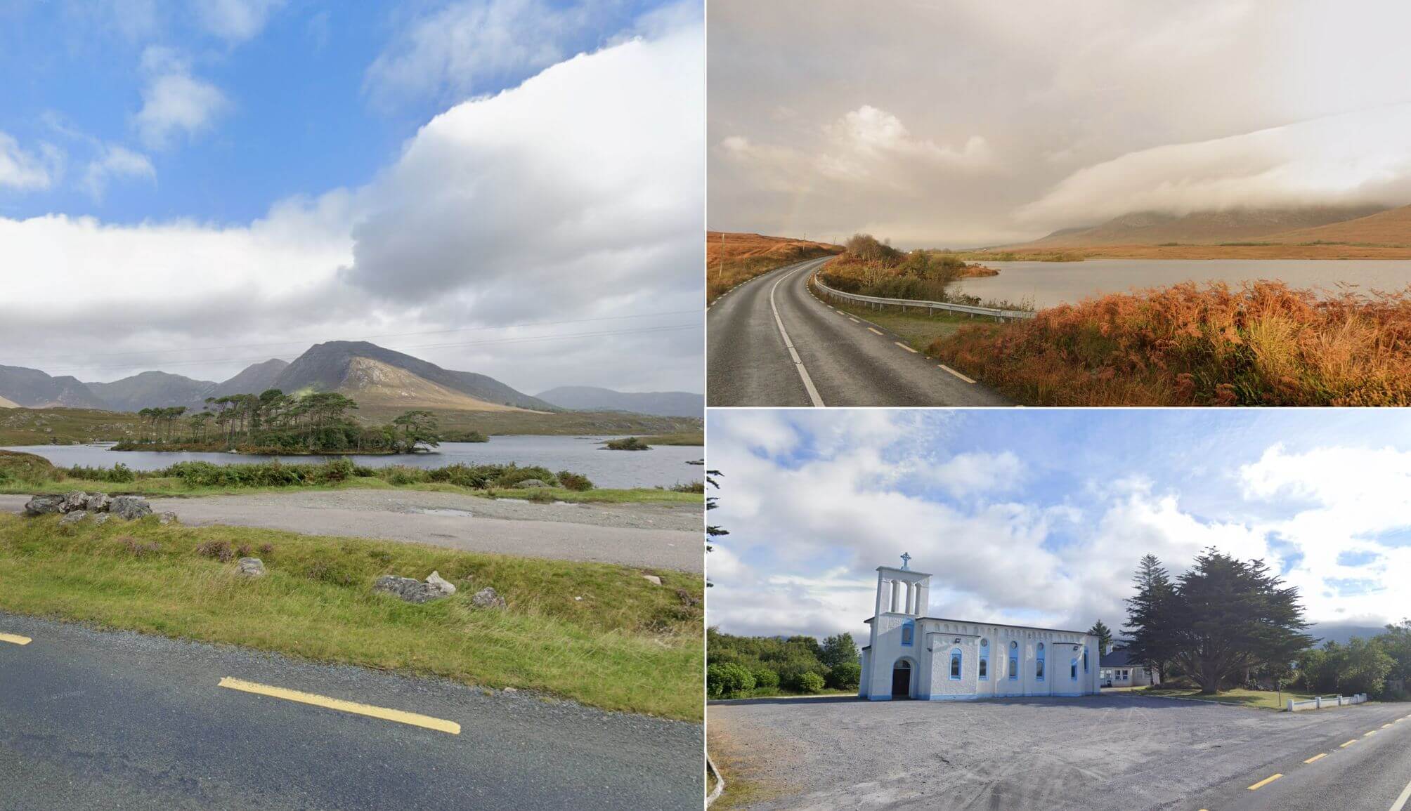
Photos via Google Street View
From the Lough Inagh viewpoint, it’s a 15-minute drive back to Maam Cross, but the loop isn’t done impressing yet. Before rejoining the N59, you’ll pass Derryclare Nature Reserve, a 19-hectare protected area of native woodland at the foot of the Twelve Bens.
When you reach the junction, take the right towards Clifden. We’re taking a 2-minute detour to this pull-in-area. This is the Twelve Pines viewpoint – one of Galway’s most photographed locations.
Here, rows of Scots pines stand against the backdrop of Derryclare Lough and the towering Bens beyond. From there, rejoin the N59 for the final run back to Maam Cross, completing the loop.
A Google Map of the Connemara Loop
Above you’ll find an interactive map of the Connemara Loop that you can use to navigate to the different stops I’ve outlined above.
This route is relatively easy to follow, once you keep an eye on the easy-to-miss turns that I have plotted on the map.
Explore beyond Connemara
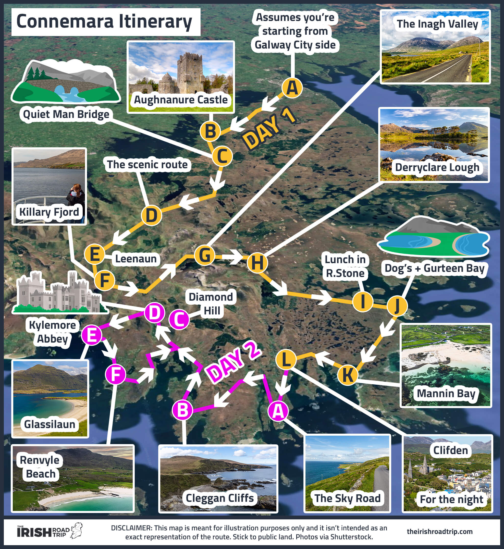
The Loop is just one way to see this glorious corner of the Wild Atlantic Way. You could also follow my 2-day Connemara itinerary that’s pictured on the map above.
Or, you could stay in Galway City and explore the area around it on day trips, visiting the likes of the Aran Islands, the Cliffs of Moher and plenty more!
Keith O’Hara has lived in Ireland for 35 years and has spent much of the last 13 creating what is now The Irish Road Trip guide. Over the years, the website has published thousands of meticulously researched Ireland travel guides, welcoming 40 million+ visitors along the way. In 2022, the Irish Road Trip team published the world’s largest collection of Irish Road Trip itineraries. Keith lives in Dublin with his dog Toby and finds writing in the 3rd person minus craic altogether.