The Dingle Way is arguably one of the best things to do in Kerry, if you have some time and you fancy exploring on foot.
This is a 179km-long walking trail that’s broken up into stages and that’s best conquered over the course several days.
Taking in many of the best places to visit in Dingle, the trail takes in everything from stop-you-in-your tracks scenery to historical sites.
In the guide below, you’ll find a full overview of the Dingle Way hike, with advice on what to see and where to stay, too.
Some quick need-to-knows about the Dingle Way hike
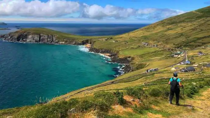
Photo via Hillwalk Tours
If you’re doing the Dingle Way self guided, you’ll need to spend a decent bit of time planning out your route and accommodation around County Kerry. Here are some quick need-to-knows to get the ball rolling:
1. A long-distance walk
Starting and ending in Tralee, The Dingle Way hike is 179km long. The itinerary for the complete experience takes place over 8-10 days, and if you have the wind for it, you can climb Ireland’s second-highest mountain, Mt Brandon.
The scenery is dramatic, with a surprise around every corner, and so long as you plan ahead and prepare, the walk will be an unforgettable experience for all the right reasons.
2. Several different stages
The trail has been broken into 8 stages, with the shortest at 13km and the longest being 28km. Although the trail begins in Tralee, the walking doesn’t start until you reach Camp, by bus or taxi.
The trail consists of forest walks, boardwalks, and minor roads. The roads are mostly quiet and scenic but with a few busy stretches between, where care must be taken. All the routes are well marked and easy to follow.
3. How long the Dingle Way takes
The 8 stages can each be walked in a day. However, you might prefer to take your time and go on one of the looped walks and enjoy some of the touristy stuff along the way. If you are daunted by the idea of all that walking, you can take a shorter route by joining the trail at several different points along the Wild Atlantic Way.
4. Proper preparation, planning and safety
The Dingle Way is a long-distance walk, so you you’ll need to plan your trip carefully, ensuring you understand the terrain in advance. The majority of the 8 stages are doable with moderate fitness, but weather can change and make conditions dangerous at times, so good working knowledge of navigating a map and using a compass is needed.
A day-by-day breakdown for exploring the Dingle Way on a self guided adventure
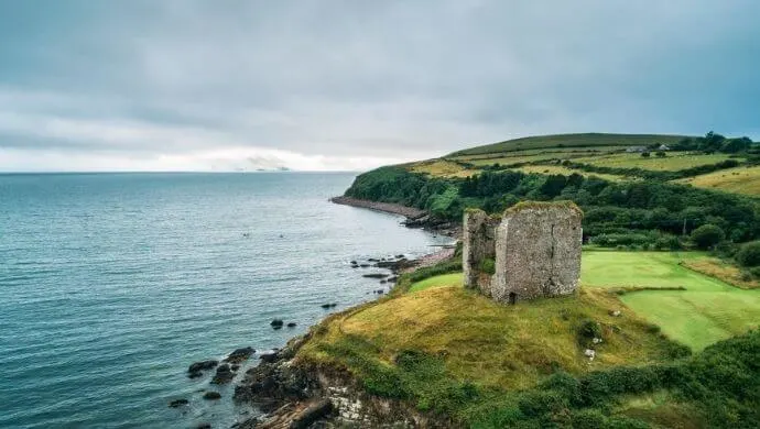
Photo by Nick Fox (Shutterstock)
The next section of our guide offers an insight into each section of the Dingle Way hike, for those of you who fancy doing a self guided walk.
Note: if you book a hotel through one of the links below we may make a tiny commission that helps us keep this site going. You won’t pay extra, but we really do appreciate it.
Day 1: Tralee – Camp
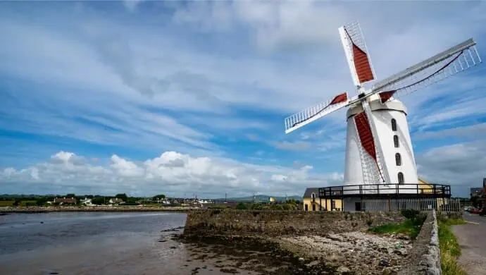
Photo by gabriel12 (Shutterstock)
The first stage along the trail is Tralee to Camp. Here’s a quick overview of what to expect from day one of the walk:
- Distance: 18km
- Ascent: 200m
- Time: 5 – 7 hours
- Grade: Difficult
- Find places to stay in Camp here
Starting the Walk
This long-distance Dingle Way hike begins and ends in Tralee, with the first stage being Tralee to the little village of Camp.
Follow the Blennerville signs, which will bring you to the canal walk and ultimately over the bridge on the River Lee.
The Belly of the Trail
The first item of interest is the Blennerville Windmill, which is one of the more popular places to visit in Tralee. It dates to around 1800 and was restored in the ’80s.
Over the following 5km, you’ll use stepping-stones to cross 3 streams and gradually climb to where you can cross the Currahaeen River.
The terrain rises and falls after that until you reach the Derryquay River Bridge, where it only rises. Climb a few hundred metres, crossing the bridge along the way (be careful, it can be tricky going along here) until you arrive at Killelton, where the ruins of an old settlement can be found, concealed by the trees.
Finishing Day 1
You’re on the homeward stretch now. Climb 7 stiles, cross a few streams, and you’re back on Tarmac again.
When you come to a fork in the road, go right for Camp and then left along the track, bringing you down to the river with a rope handrail and large stepping-stones to help you cross.
At the next signpost, turn right, and your day’s journey is over. Find places to stay in Camp on night 1 here.
Day 2: Camp – Annascaul
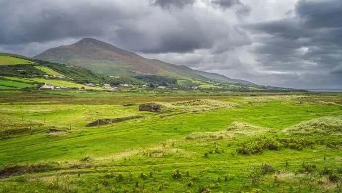
Photo by Dawid K Photography (Shutterstock)
Leaving Camp the next day, you’ll hopefully not have too many aches and pains. Here’s a quick overview of what to expect from day two of the walk:
- Distance: 17km
- Ascent: 235m
- Time: 4-6 hours
- Grade: Moderate
- Find places to stay in Annascaul here
Starting the Walk
You set off up the Slieve Mish Mountains and soon reach the upper Emlagh River valley, where you might see peat being cut. Walk for 4km through the valley until you descend to a tarmac road again. Be careful of traffic here.
The Belly of the Trail
Luckily, you only have to walk about 500m on this road before you take to the tracks again, and it’s not long before Inch strand and spit are spread out in front of you.
A few hundred metres farther on, and you’re back on a tarmac road, but again, it’s only for 200m, and you’re off and climbing again.
Finishing Day 2
After another couple of road crossings, you’ll arrive at a junction where you’ll choose the left option. This road descends straight to the village of Annascaul.
On the way, you’ll be treated to stunning views of Dingle Bay, Tralee Bay and Slieve Mish and the McGillycuddy Reeks. Find places to stay in Annascaul on night 2 here.
Day 3: Annascaul – Dingle

Photo by Nick Fox (Shutterstock)
Happy days! You probably could do with an easier route. Here’s a quick overview of what to expect from day three of the walk:
- Distance 23km
- Ascent 150m
- Time 5-7 hours
- Grade Easy
- Find places to stay in our Dingle hotels guide
Starting the Walk
Annascaul offers lots of walks, so you might be tempted to take a side trip here, but if you’re intent on continuing The Dingle Way hike, you’ll set off along the busy Tralee to Dingle road.
It’s not long before you find a quieter road, and you twist and turn for about 4km before reaching sea level and the ruin of Minard Castle, built by the Fitzgeralds to protect them from Cromwell’s men.
The Belly of the Trail
After a bit of a rest on the beach, the track rises steeply through boreens, minor roads, and farmland for about 6km until you reach the remains of the Lispole Railway Viaduct.
Head north towards Croaghskearda Mountain along a minor road and then cut across farmland and up onto the lower mountain slopes for approximately 5 mucky Kilometres.
Finishing Day 3
And just like that, you cross the Garfinny River and head straight for Dingle. You have to cross the Conor Pass Road, which can be busy with tourist traffic, so be careful.
Continue on to the town. See our Dingle accommodation guide for great places to stay in the town.
Day 4: Dingle to Dunquin
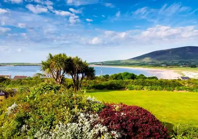
Photo by Chris Hill
So long as you don’t get sidetracked in the Distillery, today is the day you head for Dunquin, the Last Parish before America. Here’s a quick overview of what to expect from day four of the walk:
- Distance 20km
- Ascent 370m
- Time 5-7 hours
- Grade Moderate
- Find places to stay in Dunquin here
Starting the Walk
The beginning of the walk takes you over the bridge on the Milltown River and along the main road before you turn off towards Ventry. After a couple of Kilometres, you start uphill. Watch your footing as it’s quite wet along here.
The Belly of the Trail
This part of the walk is where you can stock up on necessities or visit the pottery in the pretty village of Ceann Trá. From here, the trail makes a long detour across Ventry Harbour, where, so the story goes, the King of Ireland took on the forces of the kings of France, Spain and The World in a battle lasting a year and a day.
Once you’ve left the beach and travelled for about 2km, you reach Slea Head Road, which is not only a popular scenic road but quite treacherous if great care is not taken. For another 7km, you walk amongst spectacular scenery, including Fán, one of Ireland’s most significant archaeological sites.
Finishing Day 4
The trail arrives back at the Slea Head Road again for 3km before it descends to a pier where you can take a side trip to the Blasket Islands from the beautiful Dunquin Pier.
One of the ships belonging to the Spanish Armada, The Santa Maria de la Rosa, sank here, and a plaque commemorates the event at the top of the cliff. Find a place to stay in Dunquin on night 4 here.
Day 5: Dunquin – Feohanagh
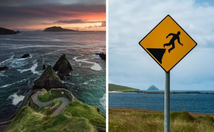
Photos via Shutterstock
You’re into the second half of the trail now, and this is an easy day. Here’s a quick overview of what to expect from day five of the walk:
- Distance 20km
- Ascent 125m
- Time 5-7 hours
- Grade Easy
- Find places to stay here
Starting the Walk
Head north, climbing towards Mionnan Mor, which leads to beautiful views of Mt Brandon, the Three Sisters, Smerick Harbour, and Sybil Point. Depending on the weather, the ground here can be pretty wet so take care. The trail heads downwards again and onto a road where you can drop into Louis Mulcahy’s pottery for a browse.
The Belly of the Trail
You’re onto a narrow road now where hedges may be overgrown and visibility poor, so again, be on the watch out for vehicles. Soon you’ll arrive at Clogher’s secluded beach with views of Inis Tuaisceart (otherwise known as The Dead Man).
The trail takes many twists and turns at this stage, so having your itinerary and map is crucial. Having followed the road to its end, Smerick Harbour will be on your left for the next 6km across the beach.
On the way to where the trail hits the road again, you can visit a dry-stone oratory from the 7-12th century and the 15th-century Gallarus Castle that was recently renovated.
Finishing Day 5
The Dingle Way hike then passes through Baile na nGall, a small fishing port, before heading back to the cliff and inland. This part of the trail can be marshy, and if the rains have been heavy, there may be flooding.
You now head to the main road again and from here make your way to Feothanach, where the trail ends at An Cúinne Pub. Find places to stay on night 5 here.
Day 6: Feohanagh to Cloghane
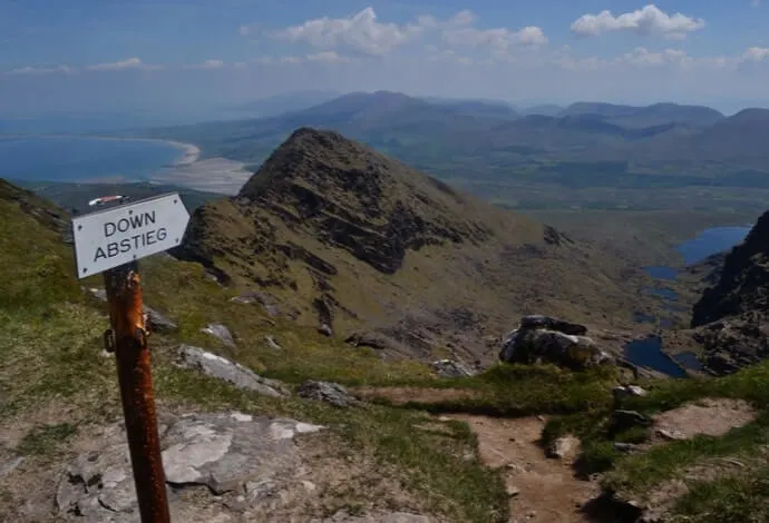
Photo by cozizme (Shutterstock)
This is the hardest part of the trail, there’s a fair bit of climbing, and its grade is difficult. If the weather conditions are bad, you ought to consider an alternative way of reaching Cloghane. Here’s a quick overview of what to expect from day six of the walk:
- Distance 24km
- Ascent 655m
- Time 6-7 hours
- Grade Difficult
- Find places to stay here
Starting the Walk
Within a few kilometres of starting your day’s walk, you’ll come across a medieval castle (stone fort) and then Brandon Creek, from where, according to legend, St Brendan is said to have set sail for America in 535 A.D. with his 14 monks.
The Belly of the Trail
The climb up Mt Brandon starts shortly after, and on a clear day, you can enjoy spectacular views of Tralee Bay, the Blaskets and the mountains of Magharees and Slieve Mish.
The descent begins at an Ogham stone placed where the trail crosses the saddle between Más an Tiompáin and Piaras Mór.
It’s extremely steep, and you’d be wise to carry a walking stick. The way is well marked in case of fog, but it’s perilous in places, and weather plays a huge factor.
Finishing Day 6
Once you’re safely down the mountain, there’s a short walk to where you can take a breather at the Brandon pier before heading off on the last 6km of lanes until you reach Cloghane. Find places to stay on night 6 here.
Day 7: Cloghane – Castlegregory
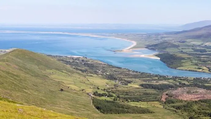
Photo by Colm K (Shutterstock)
I hope you had a good sleep because it’s going to be a long day. Here’s a quick overview of what to expect from day seven of the walk:
- Distance 29km
- Ascent 50m
- Time 7-9 hours
- Grade Moderate
- Find places to stay here
Starting the Walk
A quiet 3.5km starts today’s walk as you wander up and down, seeing first glacial valleys and then the seafront at Fermoyle, where one of the best beaches in the Northern Hemisphere stretches for 11km. Sometimes, if there’s a high tide, you may need to climb onto a dune around the 6km mark and walk there until it’s safe to come back down.
The Belly of the Trail
Once past the beach, you follow a path through dunes and from there to Fahamore, a small hamlet. You can walk along the beach again for 1km or otherwise use the road parallel to the beach on a low tide.
The trail winds around Scraggane Bay, from where you can view the Seven Hoggs island. On a stormy night in 1894, a ship, the Port Yarrock of Glasgow, sank in Brandon Bay, and it can be seen at low tide on Kilcummin beach.
Finishing Day 7
The Peninsula is called The Magharees by the locals, and a rare species of toad, the Natterjack Toad, makes its home here. If you’re on the lookout for it, it’s got a yellow line running along its back.
Near where you leave the beach at Kilshannig, there’s an ancient site with a cross and the Greek letters Chi-Rho carved on it. After a further 3km or so, the trail picks up on the tarmac road and takes you to Castlegregory. Find places to stay on night 7 here.
Day 8: Castlegregory – Tralee
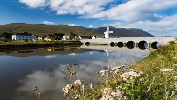
Photo by gabriel12 (Shutterstock)
The last day of your journey on The Dingle Way. Here’s a quick overview of what to expect from day eight of the walk:
- Distance 27km
- Ascent 300m
- Time 6.5 – 8.5 hours
- Grade Easy
- See our Tralee hotels guide for places to stay
Starting the Walk
There are a couple of kilometres of road walking at the start of today’s walk before you reach the beach. If the tide is in, you can avail of the ramp that takes you over the rocks and walk safely around the edge of the field. You will eventually be led back to the beach and Carrigagharoe Point.
The Belly of the Trail
There’s another stretch of road after Kilgobbin Church, and when you reach a signposted crossroads, you turn towards Tralee. Busy is how I’d describe the next stretch of the trail.
There’s the Finglas River to cross, then you go uphill for a bit, and on the descent, there are 9 stiles, 2 streams and a small gate to navigate over only 2km. Another road leads to another boreen and another stile until you eventually return to the main road.
Finishing Day 8
The busyness continues with another couple of climbs and a river crossing followed by 3 streams. You will get a chance to have a look at the Blennerville Windmill on the way.
From here, you follow the signposts for about 5km until you arrive back where you started only 8 days, and an unforgettable experience ago. See our Tralee hotels guide for places to stay
FAQs about doing the Dingle Way self guided
We’ve had a lot of questions over the years asking about everything from how long is the Dingle Way hike to where to stay on the way.
In the section below, we’ve popped in the most FAQs that we’ve received. If you have a question that we haven’t tackled, ask away in the comments section below.
How long is the Dingle Way?
The Dingle Way hike is 179km.
What are the different stages of the Dingle Way hike?
There are 8 stages on the Dingle Way hike: Day 1: Tralee – Camp, Day 2: Camp – Annascaul, Day 3: Annascaul – Dingle, Day 4: Dingle to Dunquin, Day 5: Dunquin – Feohanagh, Day 6: Feohanagh to Cloghane, Day 7: Cloghane – Castlegregory and Day 8: Castlegregory – Tralee.
Can you do the Dingle Way self guided?
Yes, but it’s recommended that you only tackle this long-distance route if you have experience with lengthy hikes, as it can get tricky in places.
