
I’d argue that the Djouce Mountain Walk is one of the best hikes in Wicklow.
If you do it 1, on a clear day and 2, manage to avoid parking mayhem, that is….. More on this below!
The Djouce Mountain hike (not to be confused with the Djouce Woods walk) is relatively straightforward and it takes 2.5-3 hours to complete.
Some quick need-to-knows about the Djouce Mountain walk

The walk from JB Malone car Park is one of the more straightforward walks in the area, especially when compared to the likes of the Lugnaquilla hike and Lough Ouler. Here’s some key info:
1. Height
Rising to a respectable 725 metres and located in the north-eastern area of the Wicklow Mountains National Park, Djouce Mountain is the 74th tallest peak in Ireland and one of the range’s most accessible mountains.
2. Djouce Mountain car parks
There are several places to park for the Djouce walk (see map above and the Google Map below for exact locations). The JB Malone car park is the ideal place to park as it’s right at the beginning of the Djouce hike trailhead, but it fills up very quickly.
3. Length and difficulty
If you tackle the Djouce Mountain walk from the JB Malone car park, the trail will stretch around 6km in total and it should take you between 2 and 3 hours, with stops. Trail wise, you’ll ramble along uneven surfaces and boardwalk sleepers. This is a moderately difficult walk.
4. Arrive early
The Djouce hike is one of the more popular things to do in Wicklow, especially when the weather’s fine. The result is that the car park can fill up quickly, so make sure that you arrive early to avoid disappointment.
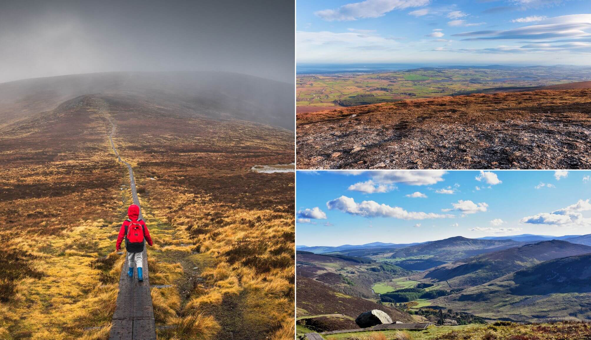
An overview of the Djouce hike
Photos via Shutterstock
OK, so, hopefully this’ll go without saying, but make sure that you 1, bring water, 2, you dress for the weather and 3, leave no valuables visible in the car.
When you’ve all that done, it’s time to set off. I’m going to breakdown the walk below, so you’ve an idea of what to expect (there’s a Google Map of the trail further down).
Starting off the walk
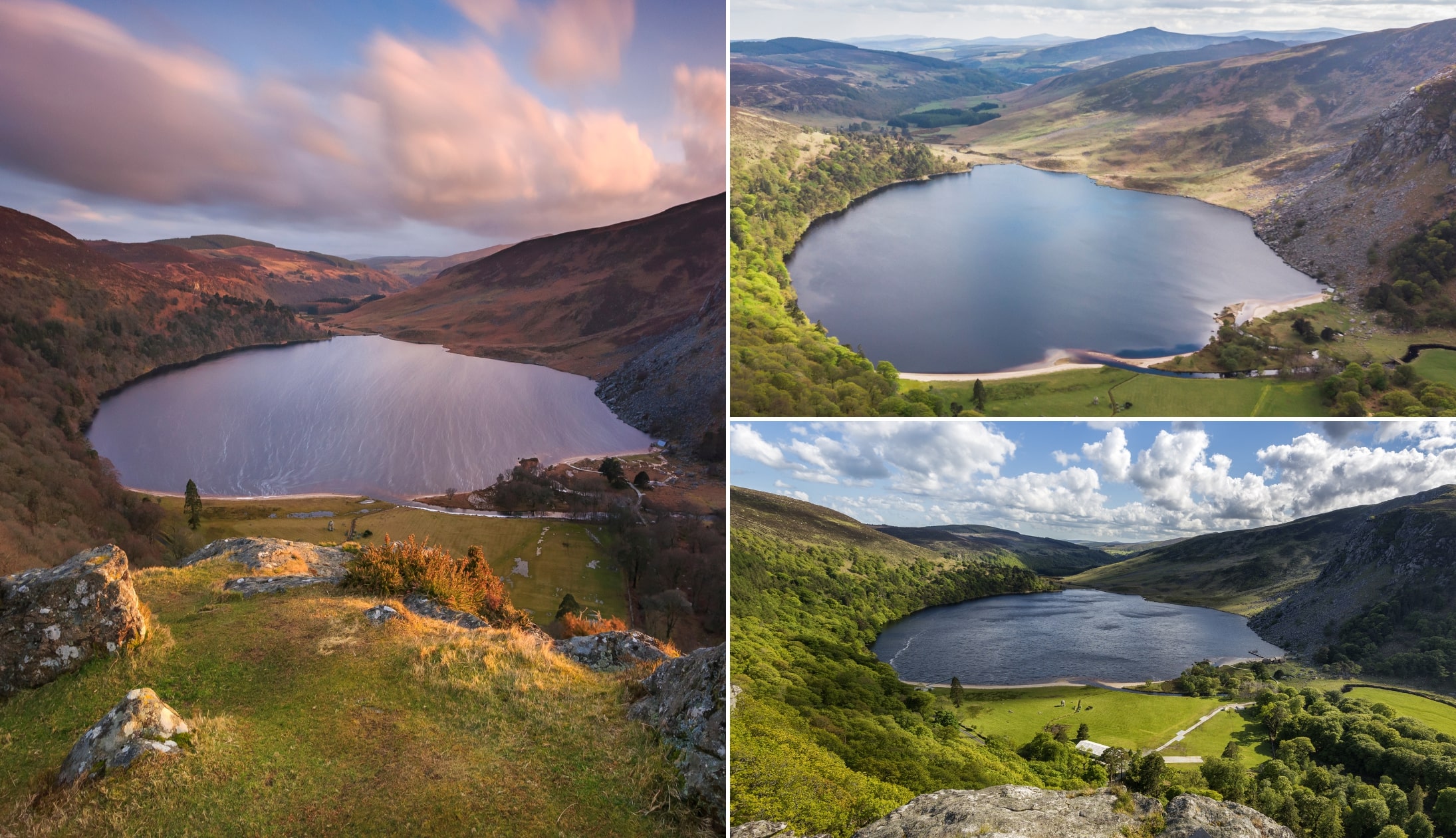
After (hopefully) parking, take a minute to admire the view across the road. From the parking area, you’ll have some mighty views out over Lough Tay (aka ‘Guinness Lake‘).
When you’re ready, you’ll see the trail from the car park that leads into the forest. The ground here is rough, so shoes with good grip are needed, especially after rain.
Reaching the boardwalk
You’ll walk uphill for a little bit before the boardwalk sleepers first come into view. These are wrapped in wire, so they’re nice and handy to stroll along.
After a while, you’ll come to the JB Malone Monument (a big rock with a little stone memorial). This is a great spot to catch your breath and soak up some of the views that surround you.
The summit
The last 2 times that I’ve done the Djouce Mountain walk, it’s taken between 60 and 80 minutes (this includes multiple stops) to reach the summit.
If you reach the summit of Djouce on a clear day, you’ll be able to see everywhere from Dublin City and Bray to Arklow and beyond.
When you’ve had your fill of the views, make your way back down towards the boardwalk and on to the car park.
A map of the Djouce Mountain hike
The map above outlines the main things you need to be aware of on the Djouce hike.
The little redish pointers mark the different places to park. Again, keep in mind that they fill up fast on good days.
The ideal car park for the Djouce hike is the J B Malone Car Park, as it’s right at the start of the trailhead.
The other car parks require a bit of a walk, with the one at Pier Gates needing a tough 18-minute uphill climb to reach the trailhead.
The white line roughly outlines the Djouce Mountain walk route – it’s very straightforward when the weather is clear.
Do the Sally Gap Drive after you’ve conquered Djouce Mountain in Wicklow

One of the beauties of doing the Djouce walk is that, when you’re finished, there’s plenty to see and do nearby.
Now, if you’re feeling peckish, head to Roundwood or Laragh and grab a bite to eat. However, if you fancy delaying dinner a while, it’s well worth following the Sally Gap Drive route.
1. Lough Tay
Photos via Shutterstock
Yes, the obvious one. It’s across the road from the JB Malone car park and the views really are the business. You can’t get down to Lough Tay, but the view from above is mighty.
2. Ballinastoe Woods

Photos via Shutterstock
Ballinastoe Woods is another nice stroll to take after completing the Djouce Mountain hike. If you just want to see the boardwalk, you enter a little down the hill from the JB Malone Car Park.
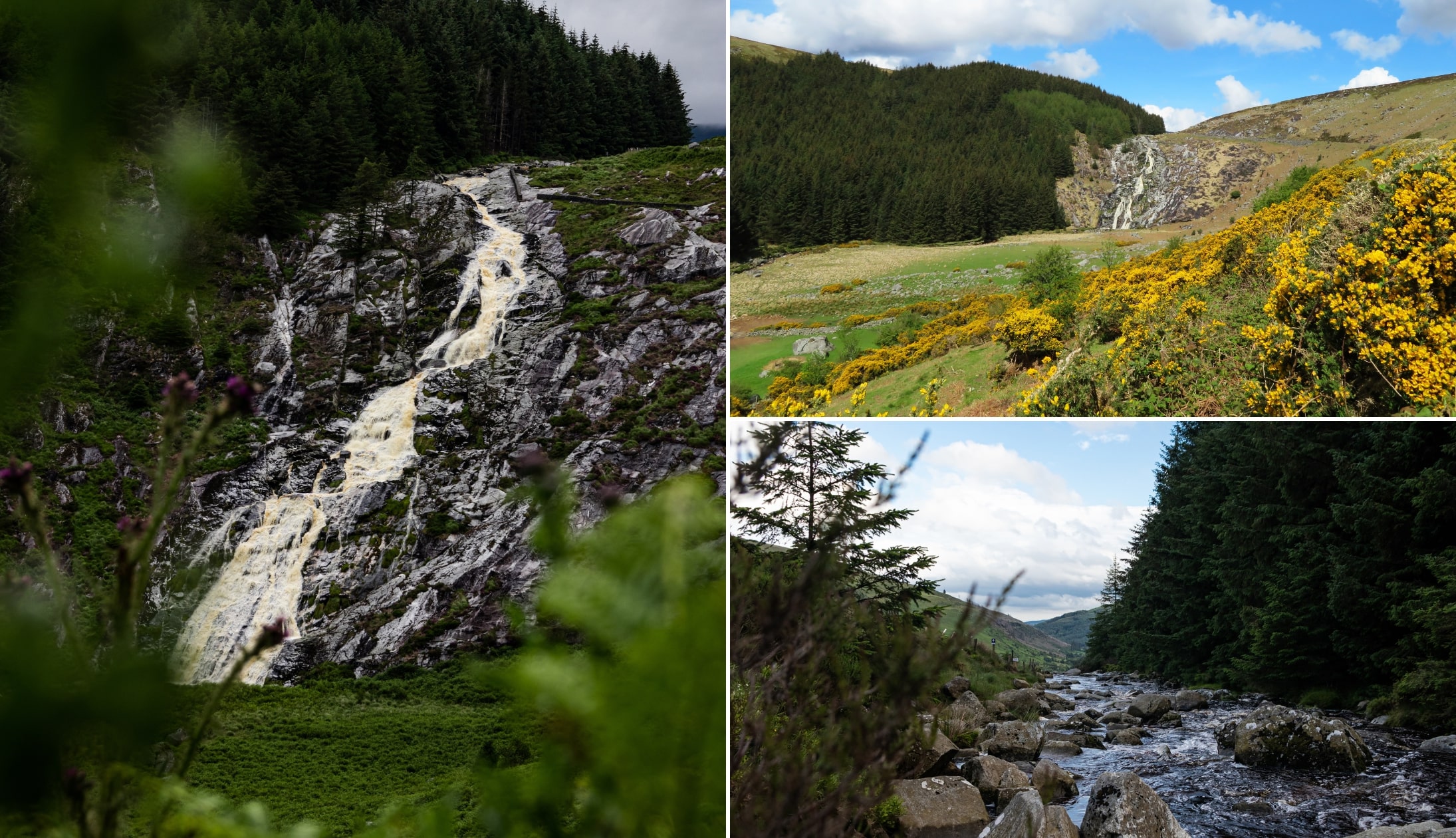
3. Glenmacnass Waterfall
Photos via Shutterstock
You’ll find Glenmacnass Waterfall just after the Sally Gap. There’s a car park right next to it and you can take a short stroll to a viewing area to the left (never climb over the fence or walk along the stones towards the falls).
4. Lots more walks

Photos via Shutterstock
There are plenty more Wicklow walks nearby. From the Lough Ouler hike and the Great Sugarloaf to the many Glendalough walks and the Lugnaquilla hike, there’s something to tickle most fancies.
Keith O’Hara has lived in Ireland for 35 years and has spent much of the last 13 creating what is now The Irish Road Trip guide. Over the years, the website has published thousands of meticulously researched Ireland travel guides, welcoming 40 million+ visitors along the way. In 2022, the Irish Road Trip team published the world’s largest collection of Irish Road Trip itineraries. Keith lives in Dublin with his dog Toby and finds writing in the 3rd person minus craic altogether.
Laura
Sunday 18th of December 2022
Hi, how can I get to Ballisnatoe Woods by bus? Is it possible? Or I really need to do by car Thank you!
Keith O'Hara
Monday 19th of December 2022
Hey Laura. You really do need a car unfortunately. In theory, you could try and get a bus into Roundwood village and then walk, but it's a 2 hour walk along fairly unsafe roads.