
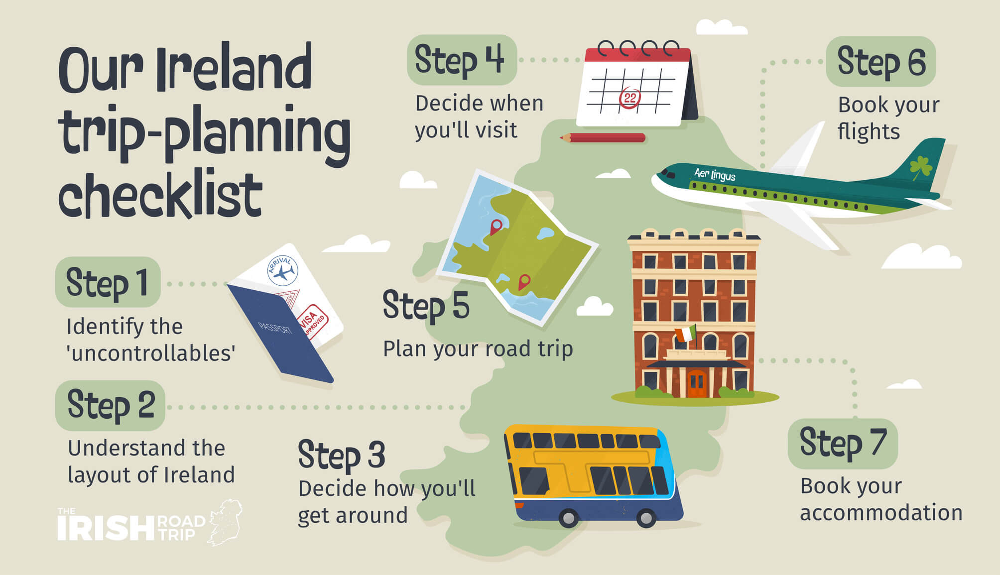
Planning a 7-day Ireland itinerary can be a pain in the backside… So, I’ve done all of the hard work for you!
I’ve spent 25+ years travelling around Ireland and the itinerary below leans on that experience and the many mistakes that I made along the way!
In a nutshell, this 7-day itinerary:
- Has been meticulously planned
- Has an hour-by-hour itinerary for each day to save you time/hassle
- Follows logical routes that take you to hidden gems, tourist favourites and great pubs and restaurants
Who this itinerary will suit
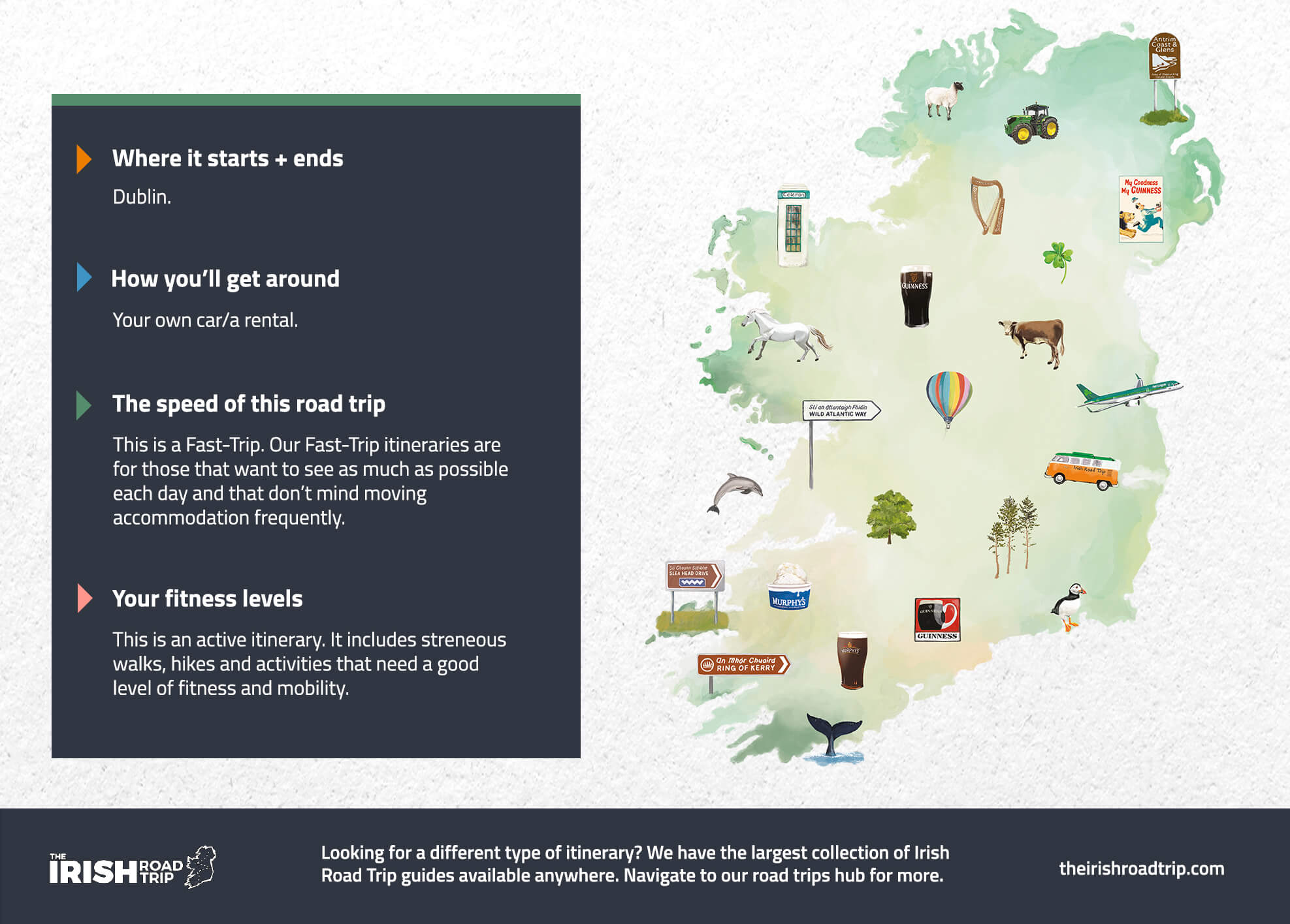
Now, before you scroll down, take 10 seconds to look at the graphic above – each of our road trip itineraries have been tailored to specific needs.
This road trip is specifically for those of you:
- Start point: In/near Dublin
- Mode of transport: You’ll need a car (if you’re renting a car, read this Irish car rental guide – it’ll save you time and hassle)
- Travel speed: This is a fast-paced itinerary
- Fitness levels needed: Good – it includes long walks
- Need a different itinerary? I have many variations of this trip length here
Why trust this guide

I have spent the last 25+ years travelling around Ireland and have dedicated the last 10 to writing what is now The Irish Road Trip Guide.
While the image above will give you a sense of some of the feedback that I receive, this is a drop in the ocean – these hand-crafted itineraries are used by tens of thousands of people every year with nothing but A+ feedback.
Day 1: Arrive in Dublin

Day 1 is going to be very dependent on the time that you arrive into Dublin. If you need to rent a car, I’d recommend collecting one at Dublin Airport via Discover Cars.
While you won’t need it for the first day in the city, it’ll save you having to go and collect one on the morning of day 2.
For this itinerary, I’m going to make an assumption that you’ve landed in the morning and are ready to explore from early-afternoon.
Recommended accommodation in Dublin
- Budget: Abigail’s Hostel (Temple Bar), Jacobs Inn (central hostel) and the Generator Hostel (short walk from the city)
- Mid-range: Dublin Skylon Hotel (just outside the city), Wren Urban Nest (Temple Bar) and the Harding Hotel (very central)
- Luxury: The Merrion (St. Stephen’s Green – very central) and The Westin (just off Grafton Street)
Getting around Dublin + money savers
- Time savers: If you want to avoid walking where possible, it’s worth getting a ticket for the Hop On Hop Off Bus around Dublin. It goes to or near all of the main sites on this itinerary plus plenty more.
- Money saver: If you’re visiting the ‘main’ Dublin attractions, the Dublin Pass can save you €€€ (here’s how)
- The guided walking tour: The local-led Highlights and Hidden Gems Walking Tour immerses you in 1,000 years of history over 2 hours
Stop 1: Lunch
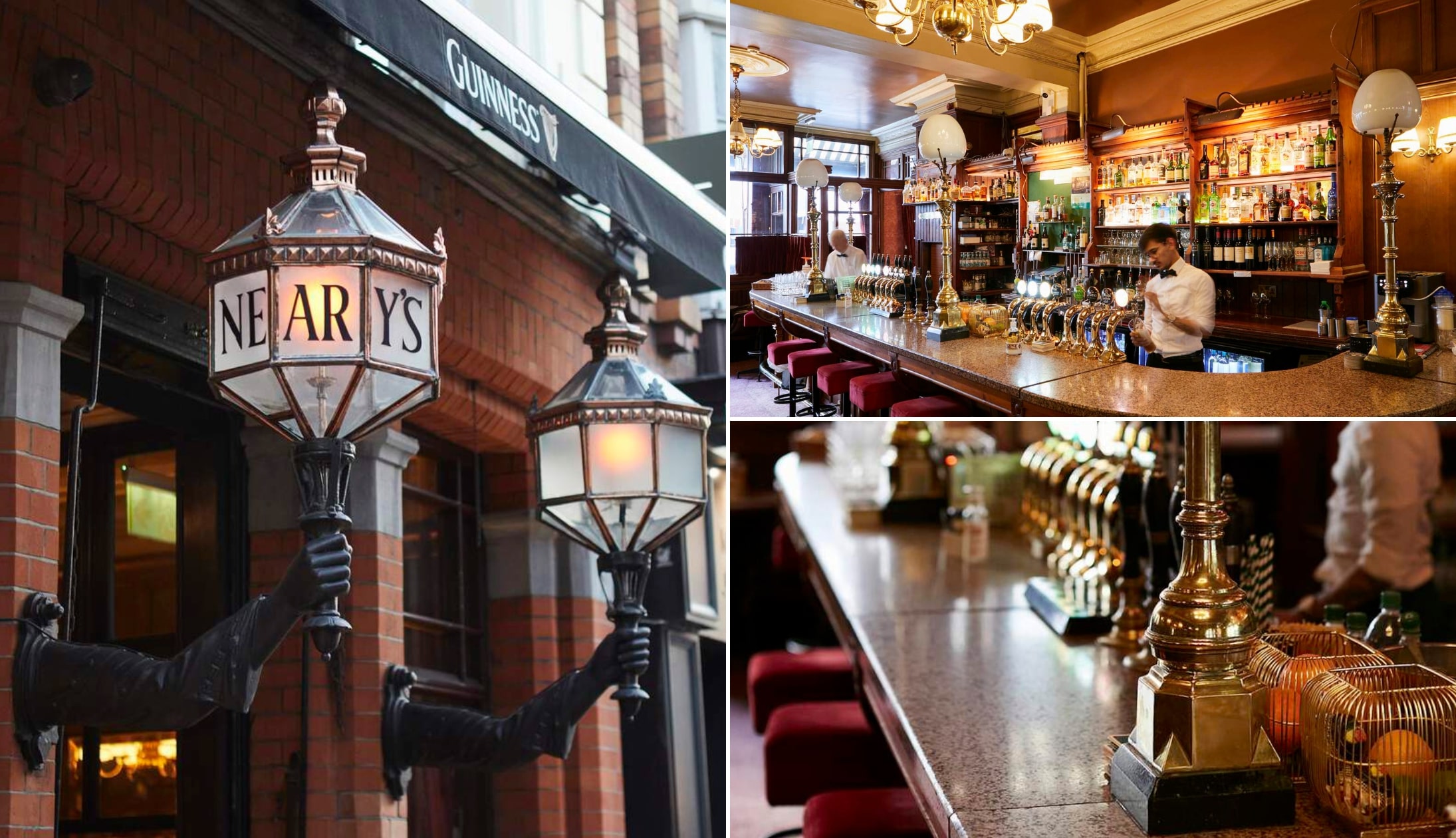
Photos © Tourism Ireland
There are plenty of great restaurants in Dublin that serve up a delicious lunch, but if you fancy a tasty bite in a lovely old-world-style pub, Neary’s (EST. 1887) just off of Grafton Street is hard to bate!
They serve simple dishes (like soups and sandwiches) that are packed with flavour and great value for money. Alternatively, Sprout and Co. on Dawson St. is also a great choice.
They have a range of hearty salad bowls, with good options for vegetarians and vegans.
Stop 2: Trinity College

Now you’re all fuelled up, it’s time to head to Trinity College to see the Book of Kells, arguably the most famous cultural attraction in Dublin.
If you can, I’d highly recommend pre-booking your tickets online, as the queues can get really long (bordering on ridiculous!). This fast-track ticket allows you to dodge the queue and gets you into Dublin Castle, too!
Spend around one hour seeing the Book of Kells, walking around the exhibit, and taking in the beauty of the Old Library. After that, give yourself another 20 minutes or so to walk around the university campus.
Stop 3: The Ha’penny Bridge (via Temple Bar)

The Ha’penny Bridge (officially named the Liffey Bridge) dates back to 1816 and was the first pedestrian bridge over the River Liffey!
It’s a seven-minute walk from the Trinity Gates, but feel free to take your time as you make your way through the lively streets of Temple Bar.
Now, Temple Bar can be a bit of a tourist trap. If you fancy a pint, here are several pubs in Temple Bar worth trying (the Palace is my go-to).
If you feel like an afternoon coffee, there are some great cafes in the Temple Bar area or on the other side of the river. Joe’s Coffee and Vice Coffee are two of my favourites across the water.
They’re both just a short stroll from the north side of the Ha’penny Bridge.
Stop 4: Dublin Castle

Next on the itinerary is Dublin Castle. Nestled in the city centre, the castle dates back to the 13th century and was the seat of the English for over 700 years.
Today, it’s an important government complex and the site of Presidential Inaugurations and key State events. The castle is around 10 minutes from the Ha’penny Bridge on foot.
There’s no admission fee to explore the grounds, but if you want to have a look inside you’ll need to purchase tickets for either a self-guided tour or a guided tour.
Guided tours include access to the State Apartments, Exhibitions, Chapel Royal, and the Mediaeval Undercroft. Self-guided tours include access to the State Apartments and Exhibitions only.
Tickets for guided tours can be purchased on the day of your visit at the ticket booth.
A handy tip for tourists: Struggling to decide when to visit Ireland? Find the pros and cons for each month here
Stop 5: Christ Church Cathedral
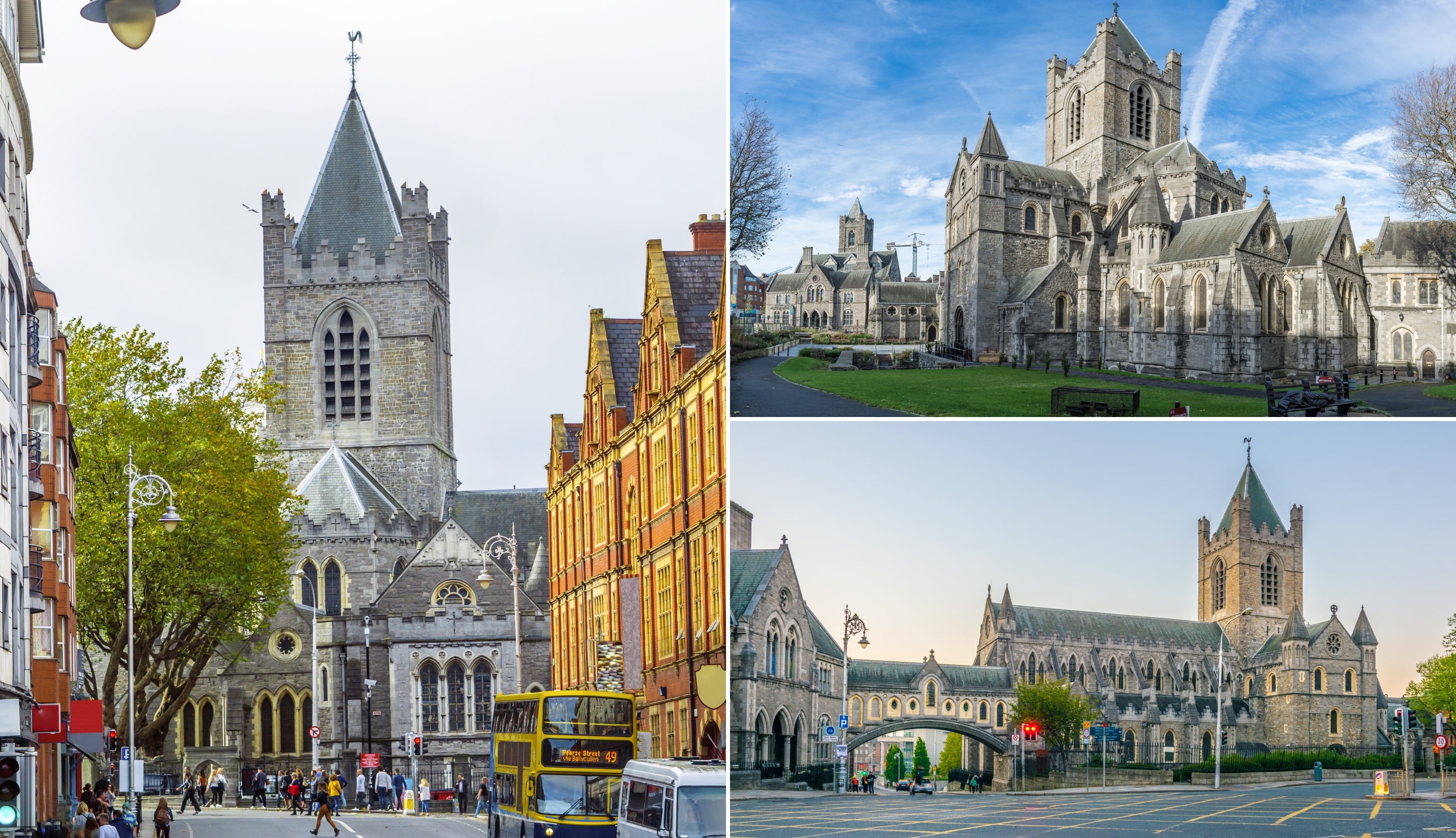
Photos via Shutterstock
Christ Church Cathedral dates back to the early 11th century when it was founded under Sigtrygg Silkbeard, a Norse King of Dublin. It was rebuilt later in stone, largely thanks to the first Anglo-Norman archbishop, John Cumin, in the late 12th century.
The cathedral is only a 4-minute walk from Dublin Castle and a really interesting place to visit. Some highlights are the restored crypt houses, Strongbow’s tomb, and the Treasures of Christ Church exhibition.
You can grab a ticket online here – these include an audio guide that comes in several languages, with three themes to choose from – ‘Power and Politics’, ‘Music and Spirituality’, and ‘Christ Church and the City’.
Self-guided tours with an audio guide usually last around one hour.
Stop 6: The Guinness Storehouse
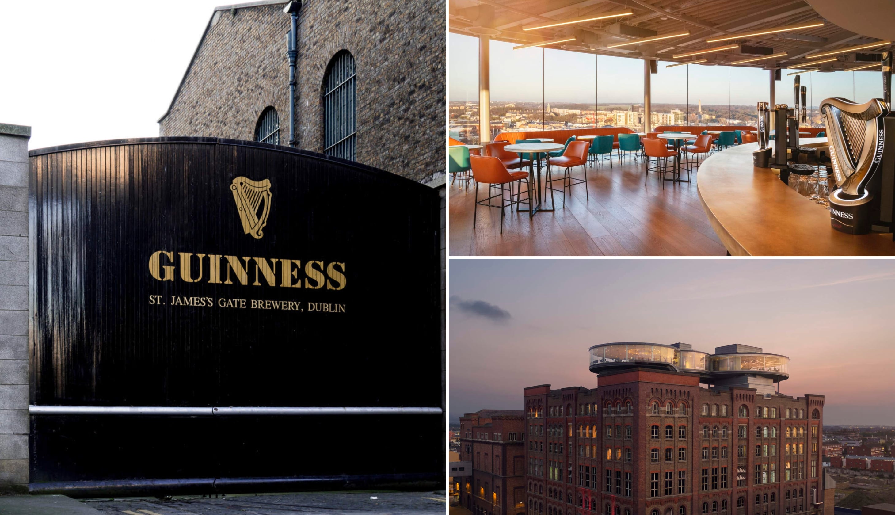
Photos © Diageo via Ireland’s Content Pool
You’re a 20-minute walk from Guinness Storehouse. It’s at St. James’s Gate, the home of Guinness, and there are several tours available.
I’d recommend the Guinness Storehouse Experience, a self-guided tour that takes roughly 90 minutes.
You’ll learn about Guinness’ history, its ingredients, and get to enjoy a pint of Guinness and one other Guinness beer whilst taking in the views of the Gravity Bar.
Stop 7: Dinner, drinks and live music

By now you must be getting hungry. Dublin has heaps of options for dinner and drinks, but I’ve a couple of suggestions for you!
Dinner recommendations
There are some outstanding restaurants in Dublin, with something to tickle most tastebuds.
- My go-to for steak: Hawksmoor (incredible interior, exceptional steak and sublime service)
- My go-to for seafood: SOLE (simply spectacular)
Live music and trad bars
Although I’ve a detailed Dublin pubs guide, my go-tos are Bowes, Kehoes and Neary’s.
There are plenty of live music pubs in Dublin, too, like the Celt, the Old Storehouse and Darkey Kelly’s!
For those that don’t fancy the pub
Skip the pub crawl and enjoy a lively night of traditional music and dance in an intimate 18th-century Dublin townhouse.
The Irish House Party offers dinner, craic, and world-class performers.
Another way that you could spend day 1

If you’ve been to Dublin before, or if you just aren’t that gone on busy cities, you’re in luck – many of the best things to do in Dublin are located a short train ride away.
I’ve outlined a route for you to follow on the map above, but you’ll find the itinerary in detail half way down the page here.
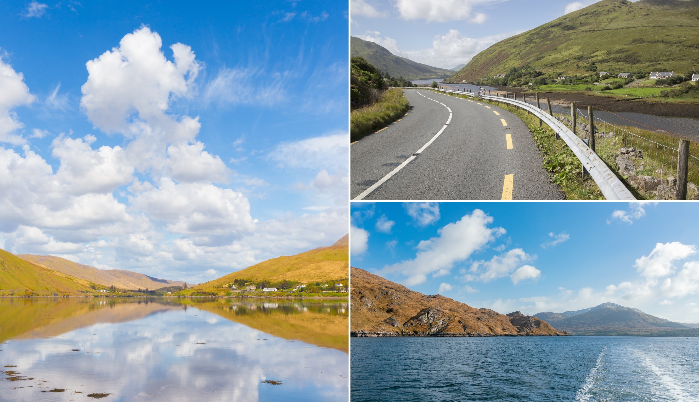
Day 2: Wicklow’s Wonders

On day 2, it’s time to put that rental car to use and head out of Dublin. Today, you’ll be exploring Wicklow, also known as the Garden of Ireland.
There are a few walks on the agenda today, so make sure to bring appropriate clothing and footwear, lots of water and snacks, and a raincoat (just in case!).
Stop 1: Glendalough Visitor Centre and Monastic City
Photos via Shutterstock
Park up at the Glendalough Visitor Centre (the Lower Car Park – €4) and plan to spend between 30 – 45 minutes exploring the centre and the ‘Monastic City’.
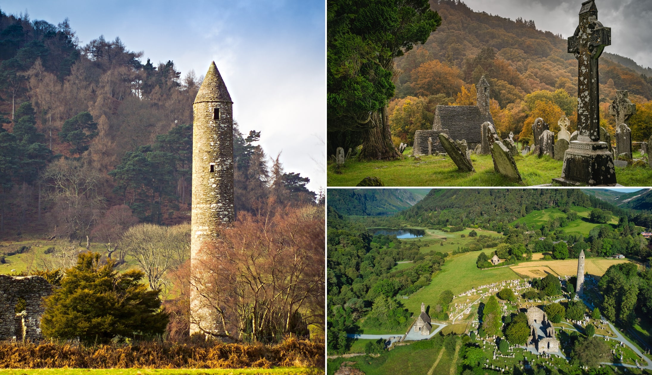
The visitor centre is right next to the Monastic City, one of the most important monastic sites in the country. The city was founded by St. Kevin in the 6th century and went on to become one of Europe’s most famous religious sites!
At the centre, there’s a wonderful exhibition on the history of Glendalough and St. Kevin. There’s also an interesting 15-minute long audio and visual presentation about early Irish Saints and monasteries.
Now you’ve learned about the site, it’s time to take a 2-minute stroll to the Monastic City next door. Whilst the remains of the city are scattered all across the glen, many of the main ruins and features are within walking distance of the visitor centre.
These include the Glendalough Round Tower, one of the city’s most well-known landmarks. It stands 33 metres high and dates back almost 1000 years! Other attractions nearby include St. Kevin’s Church and the Glendalough Cathedral ruins.
Stop 2: The Spinc Walk

The Spinc Walk is one of the finest trails in Glendalough. It takes you on a 9.5 km ramble with steep inclines and forest paths.
There’s over 600 steps near the start, but after that, it’s a little more relaxed, though there are some tricky downhill sections later.
It’s a moderate to strenuous walk, with a total ascent of 380 metres. Having said that, if you’re in reasonable shape, you should be okay and most people complete the walk in just over 3.5 hours.
Stop 3: Late lunch at the Wicklow Heather
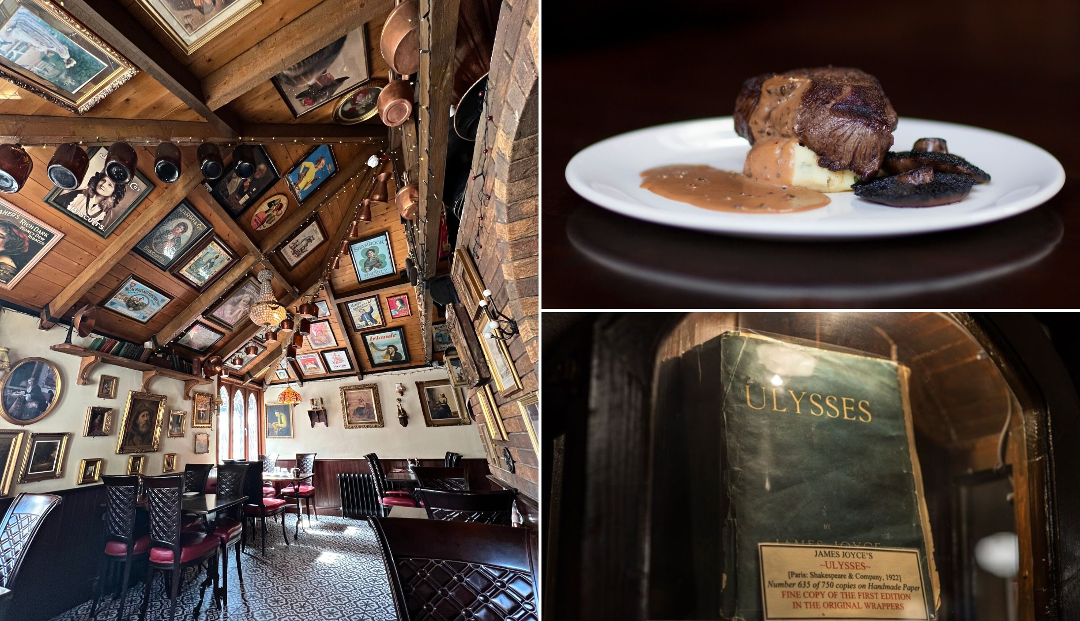
Photo left: The Irish Road Trip. Others: Via Wicklow Heather
I love nipping into the Wicklow Heather for lunch whenever I’m in Glendalough. The restaurant is in the heart of idyllic Laragh, with a historical interior and some lovely outdoor seating areas.
It’s only a 6-minute drive from the Upper Lake Car Park.
The menu has traditional Irish dishes, like comforting seafood chowder or hearty cottage pies, with an option for vegetarians and vegans.
Stop 4: The Sally Gap Drive (multiple stops)

The glorious Sally Gap Drive is one of Ireland’s finest drives. Aim for Lough Tay, first. Also known as Guinness Lake, Lough Tay is the jewel in Sally Gap’s crown!
From here, follow the winding road down, over the PS I Love You bridge and around until you reach a car park (on your right).
From here, very carefully walk around and get an eyeful of Glenmacnass Waterfall before heading on to Glendalough.
If you’re feeling up for a walk, I’ve got two for you to choose from. There’s the Djouce Mountain Walk and the Ballinastoe Woods Walk, both of which range from 2 to 2.5 hours in length.
Stop 5: Powerscourt Waterfall along with the house and gardens
Photos via Shutterstock
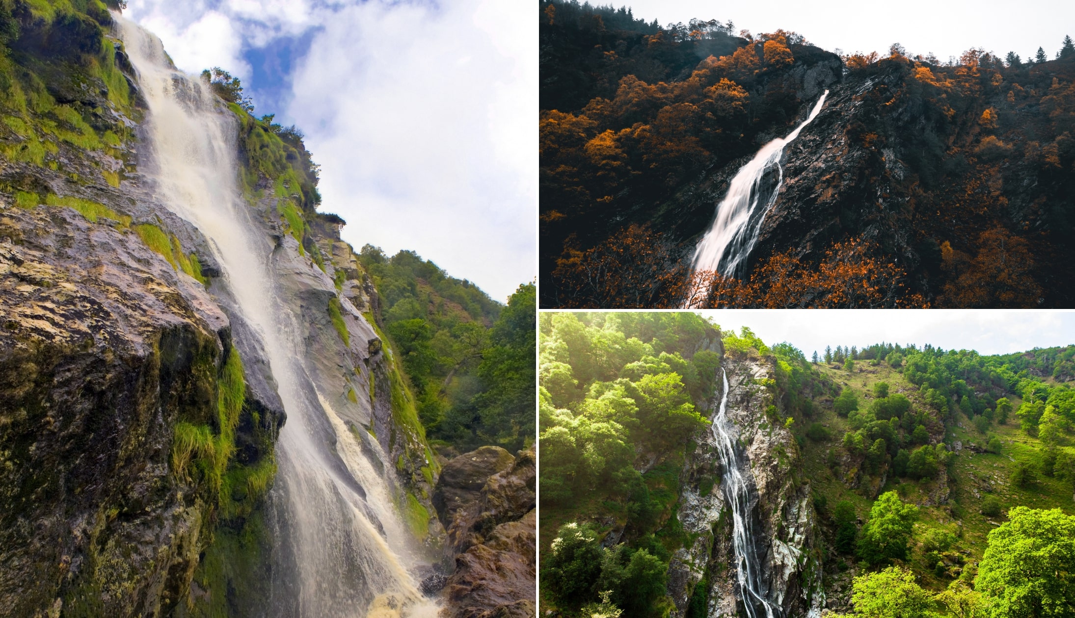
Powerscourt Waterfall is a 15-minute spin from where you’ll finish the Sally Gap Drive. This is Ireland’s tallest waterfall at 121m and it roars through ancient woodland alive with red squirrels and Sika deer.
It’s a gentle stroll from the car park out to where you can see the waterfall, so it should be very manageable even after your hike earlier in the day.
A short drive away, Powerscourt House overlooks 47 acres of formal gardens with statues, secret hollows, and sweeping terraces.
The grounds are extensive but you can easily have a coffee in the cafe and then wander at your leisure.
A handy tip for tourists: The weather can make-or-break a trip to Ireland. Here’s a guide to what to expect from each month
Stop 6: Back to Dublin for the night

After a long (and hopefully enjoyable!) day of exploring, it’s time to say goodbye to Wicklow and head back to Dublin.
If you’re still struggling to pick a place/area to stay in the city, see my guide on where to stay in Dublin!
Here are some recommendations for the evening:
- Food: There are some excellent restaurants in Dublin. SOLE and Gallaghers Boxty House are 2 I recommend over and over
- Live music: There are plenty of live music pubs in Dublin. Darkey Kellys, the Old Storehouse and the Celt rarely disappoint
- Historic pubs: From my guide to the best bars in Dublin – Kehoe’s and Neary’s are firm favourites
Day 3: Killarney via a whole lot of history

Day 3 is a big one, so I’d recommend hitting the road early. This tends to be the stand-out day for many that follow this route.
You’ll be travelling to Killarney and stopping at some very ancient landmarks along the way.
Where to stay in Killarney
- Budget: Kingdom Lodge (adjacent to the National Park) and Castle Lodge (charming B&B just outside the center)
- Mid-range: Killaran House (outstanding location in the heart of town) and Killarney Avenue (beside the park)
- Luxury: Muckross Park (prestigious 5-star hotel just outside town) and The Killarney Park (vintage charm near the train station)
An overview of the route

Here’s an overview of the stops:
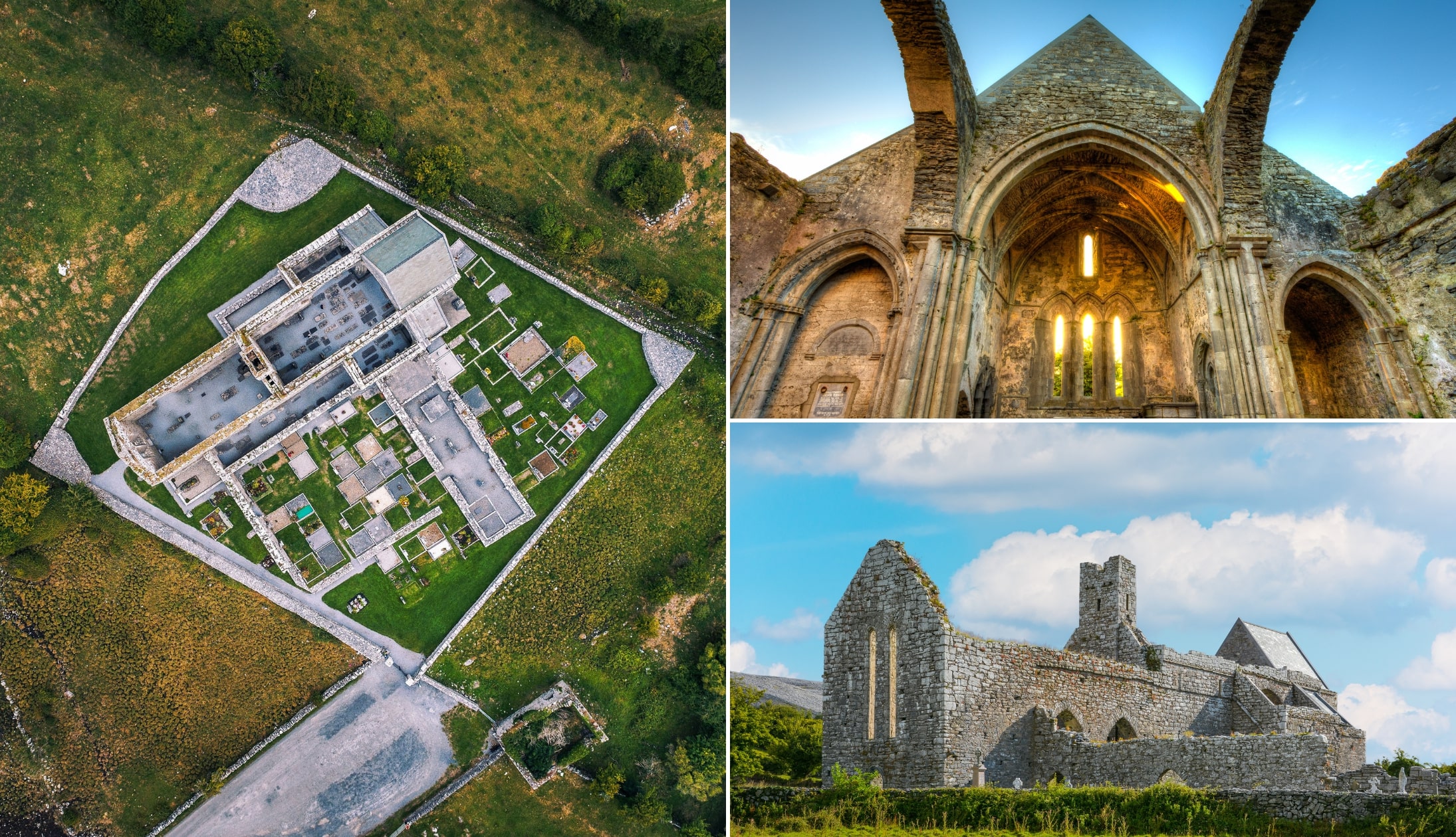
- Rock of Dunamase (1.5 hours from Dublin): 9th-century castle ruins with glorious views (spend 35 minutes here)
- Rock of Cashel (50 minutes from Dunamase): Hilltop site with 12th-century cathedral and round tower (spend 1 hour here – tour is 45 minutes long)
- Cahir Castle (20 minutes from Cashel): 13th-century fortress on an island in the River Suir (spend 1 hour here – tour lasts 40 minutes)
- Killarney (1 hour and 50 minutes from Cahir): Your base for the next few nights
Stop 1: The Rock of Dunamase

Photos via Shutterstock
The Rock of Dunamase in County Laois is around a 1-hour drive from Dublin. You’ll see it from afar as it sits in an elevated position at 46 metres/151 feet.
There have been numerous fortifications on this site over the years, as was revealed by excavations that took place in the 1990s.
There was a hill fort during the 9th century and then, around 845, Dublin’s Vikings sieged the site.
The current castle, which was built during the 12 century, is now in ruin, but you can park here and then take a short but steepish walk up to it for a look around.
Stop 2: The Rock of Cashel
Photos via Shutterstock
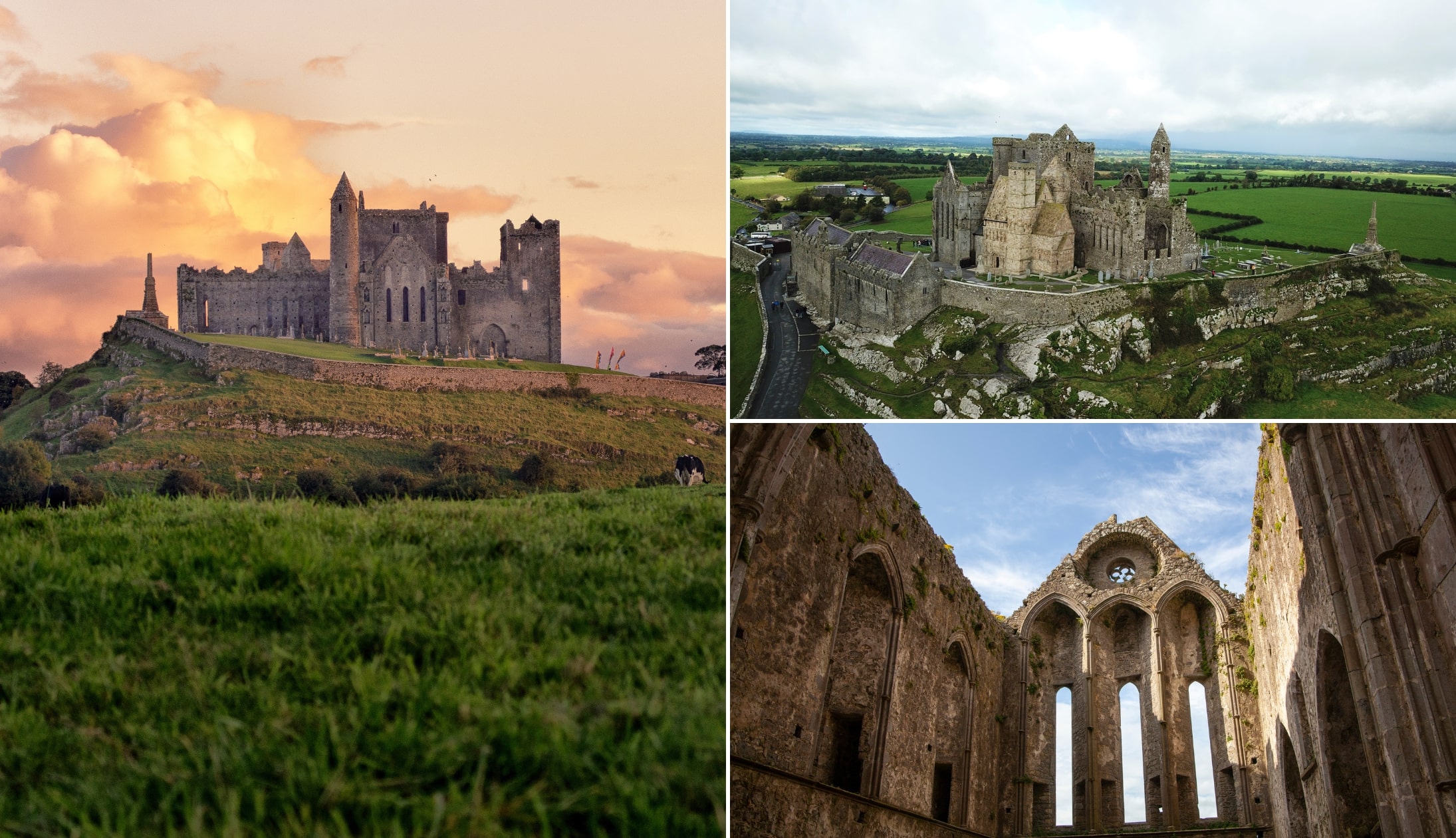
The Rock of Cashel will be the highlight for many that follow this 7 days in Ireland itinerary.
It’s a 55-minute drive from Dunamase and, although it’ll break up your trip to Killarney, it’s a hugely rewarding stop.
The Rock of Cashel looms over the busy town of Cashel in Tipperary from its position on top of a limestone outcrop.
It was originally the seat of the Kings of Munster, but in 1101, it was given to the church. It quickly became one of Ireland’s most important ecclesiastical centres.
The Rock of Cashel tour: The 1-hour guided tour is extremely popular so make sure to book tickets in advance
Stop 3: Cahir Castle

Photos via Shutterstock
The incredible 13th-15th century Cahir Castle, which was once the stronghold of the Butler family, is widely regarded as one of the best-preserved castles in Ireland.
It can be found on a rocky island on the River Suir in Tipperary a 20-minute drive from Cashel.
The castle was skilfully designed to be a state-of-the-art defensive castle and, over the course of many years, it was rebuilt and extended. It wasn’t until 1599 that the castle reached its current state.
A visit to Cahir Castle will immerse you in the eventful history of the castle, from when it was built from 1142 by Conor O’Brien right the way up to when it was declared a national monument.
Stop 4: Arrive in Killarney and get checked in
Photos via Shutterstock
It’s time to make your way to Killarney, a 1-hour and 50-minute drive from Cahir.
Check into your accommodation and then head out to explore Killarney National Park.
A mini Killarney itinerary to follow

I’d normally recommend that you rent a bike and head for a cycle around the various attractions in Killarney, but you’ll be here late afternoon and you won’t have a huge amount of time to play with.
So, your best bet is to drive. Here are the three stops that are well worth doing:
- B: Park at the 500+ year old Ross Castle and ramble around its grounds
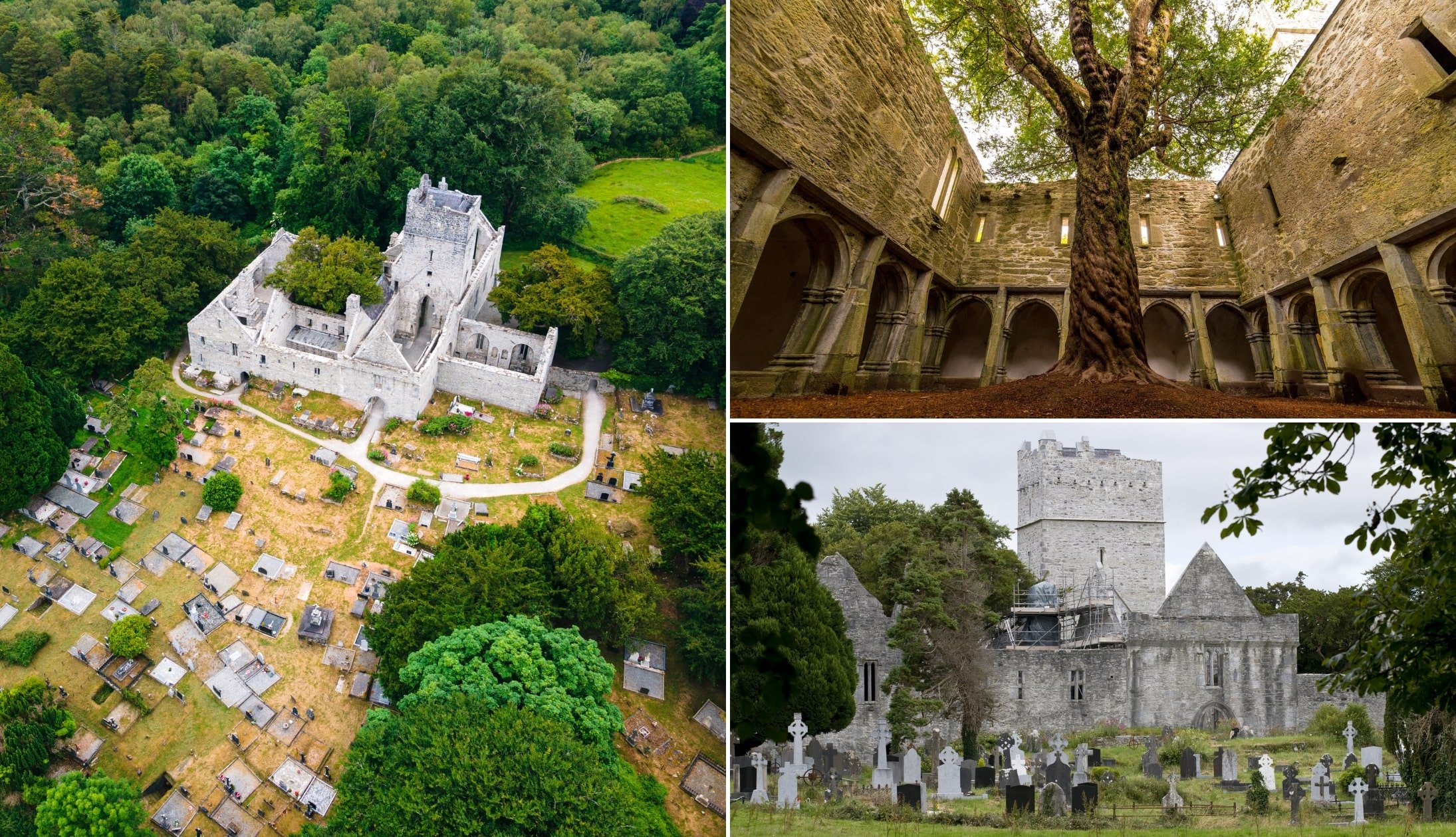
- C: Drive to Muckross Abbey and explore its ancient ruins
- D: See Torc Waterfall
Killarney for the evening

Here’s some food and pub recommendations:
Dinner recommendations
There are some exceptional restaurants in Killarney. My favourites are:
- The Mad Monk (top-notch seafood like sizzling crab claws and deep water prawn tagliatelle)
- Kitty O’Se (splash out on the Seafood Tower to share)
- Murphy Browns (hearty Irish dishes like roasted duck and fish and chips).
Pub recommendations
There’s some mighty old-school pubs in Killarney, too. For post-dinner drinks, head to JM Reidy’s, the Laurels Pub, or O’Connors.
They all have a traditional pub feel and are a great choice for a pint. JM Reidy’s has a lovely courtyard which is great in the summer, and O’Connors is perfect if you feel like cocktails.
If you want to hear some live music, JM Reidy’s and O’Connors often have live music sessions.
Day 4: The Ring of Kerry Drive

I have a tried-and-tested (I’ve done it many times) 1-day Ring of Kerry itinerary that you can follow.
It takes in the best of Killarney National Park, first, before moving out and along the N70 road.
The Ring of Kerry map above shows the entire route but, as you visited the stops around the town the previous afternoon, you can skip straight to Ladies View!
Stop 1: Ladies View

The first stop in my Ring of Kerry guide takes us to the wonderful Ladies View. It got its name after Queen Victoria and Prince Albert visited in 1861.
It’s said that the Queen’s ‘ladies-in-waiting’ (i.e. personal assistants) were so taken by the view that it was named after them!
Park next to the viewing area, step out and soak up a view of the National Park and the Lakes of Killarney.
Stop 2: Moll’s Gap

The next stop on the Ring of Kerry drive is the mighty Moll’s Gap – a bendy pass that offers spectacular views of the Macgillycuddy’s Reeks.
You can park right next to it in the Avoca car park. It got its name from Moll Kissane who ran a Sibin (unlicensed pub) during the construction of the Killarney to Kenmare road in the 1820s.
She was well-liked in the area. Possibly due to the fact that she sold homemade Poitin to the men working on the road.
A handy tip for tourists: Planning a trip to Ireland can be a pain. In this guide, you’ll find 7 tried-and-tested steps to follow
Stop 3: Kenmare

Next up is Kenmare – a lovely little town that’s a lot quieter than Killarney (it’s also home to a handful of Ring of Kerry hotels!).
Although, there are plenty of things to do in Kenmare (like the stone circle), as this is a 1 day Ring of Kerry itinerary, I’m going to recommend you grab a coffee and head for a wander.
Aim for Henry Street (left in the photo above) to see the colourful shops and pubs that have graced many-a-postcard.
Stop 4: Staigue Stone Fort

Many driving the Ring of Kerry tend to miss Staigue Stone Fort but, as the reviews online will attest, it’s well worth a visit.
It’s thought that it was constructed during the late Iron Age (sometime between 300 and 400 AD) to act as a defensive structure, likely for a local king.
It was partly restored and you can walk inside it. There are some glorious views of the surrounding countryside from Staigue, too!
Stop 5: Lunch

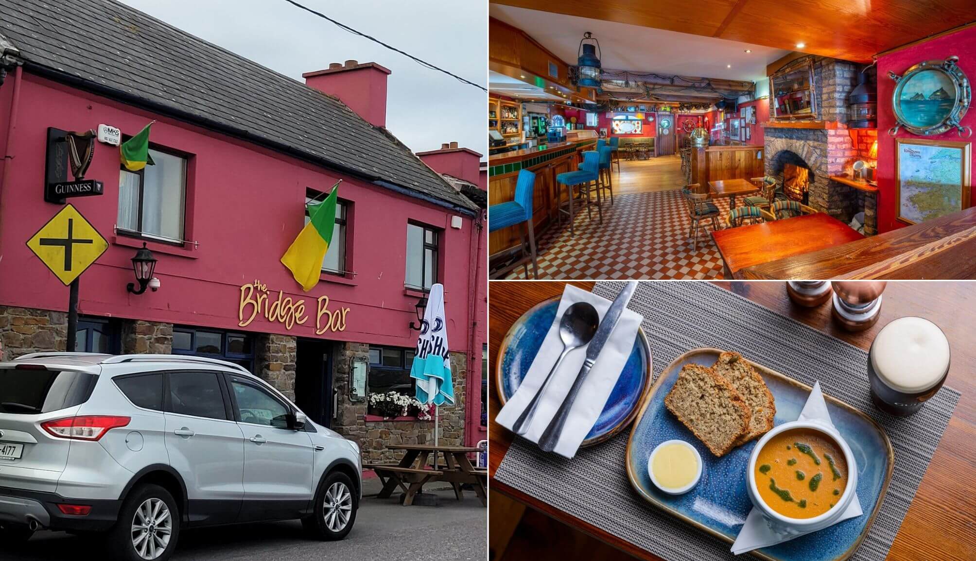
Photos via the Blind Piper
This is one of the optional Ring of Kerry stops. You’ll likely need a feed at this point and, luckily enough, you’ll have to pass through Caherdaniel.
Head for the Blind Piper (a traditional pub), relax for a bit and fuel up with some hearty fare. There’s plenty more exploring to be done!
Stop 6: Derrynane Beach

You’ll find Derrynane Beach, one of the best beaches in Kerry, a short spin from the lunch spot and the perfect place to walk off your lunch!
Derrynane is reasonably sheltered and boasts a natural harbour. Keep an eye out for the ruins of Derrynane Abbey (believed to date to the 6th century) as you saunter along the sand.
This is one of the most frequently missed Ring of Kerry stops, but it’s well worth the short detour.
Stop 7: Coomakista viewpoint

One of the best things about driving the Ring of Kerry is the endless Wild Atlantic Way discovery points that you stumble upon.
One of the most popular is the Coomakista viewpoint. There’s plenty of parking here and, on a clear day, you’ll have unbeatable views of Deenish and Scariff islands.
Stop 8: The Skellig Ring

If you look at my Ring of Kerry map with stops above you’ll see that we’re now entering the Skellig Ring.
There are a number of stops along this section of the route that you can either admire from afar or stop off at.
When you leave Coomakista, you’ll reach ‘Scenic Point’ (here on Maps), followed by Waterville (a favourite of Charlie Chaplin) and then Ballinskelligs (home to a beach and a castle)
From there, you have the Skelligs Telescope Viewpoint, St. Finian’s Bay and then, finally, the magnificent Coomanaspig viewpoint that leads to the next stop.
Stop 9: The Kerry Cliffs

Next up is another spot that’s missed by many driving the Ring of Kerry – the 1,000 ft high Kerry Cliffs.
The cliffs, which are believed to be over 400 million years old, are reached via private land (I think it was €5/6 when I was here last). It’s a steep 10-minute walk up to the view point but it’s well worth the effort.
Although Clare’s Cliffs of Moher and Donegal’s Slieve League get much of the attention from tourists, the Kerry Cliffs are strong contenders for Ireland’s most impressive cliffs.
Stop 10: Geokaun Mountain

The next stop on my Ring of Kerry road trip is Valentia Island (connected to Portmagee village by the Maurice O’Neill Memorial Bridge).
When you arrive on the island, head up to the car park near Bray Head. You’ll get an eyeful of the Skellig Islands from here. When you’re done here, make your way up to the Geokaun Mountain and Cliffs.
There’s a €5/6 entry fee and then you take the very steep ‘road’ to the viewing area. It’s from here that you’ll get one of the finest views on the Ring of Kerry drive.
You’ll see everything from Knightstown below to the Dingle Peninsula off in the distance.
Stop 11: Dinner in Portmagee
Photos via the Moorings
Next is another of the optional Ring of Kerry stops, but it’ll likely be dinner time when you reach this point so head to Portmagee.
One of the best options food-wise in this little village is the Moorings. Head in and fuel up for the final section of the Ring of Kerry route.
Stop 12: Rossbeigh Beach

The last stop on my Ring of Kerry route is the beautiful Rossbeigh Beach. Now, if you want you can stop in Cahersiveen en route to Rossbeigh (refer to my Ring of Kerry map for ideas on what to do).
However, as it’s getting late in the day, we’re going to power on. Rossbeigh Strand is one of the more popular beaches near Killarney and there’s plenty of parking.
This is a lovely stretch of sand for a ramble, especially after the long drive from Portmagee.
A handy tip for tourists: Renting a car in Ireland can be stressful. In this guide, you’ll discover what pitfalls to avoid
Stop 13: Pints in Killarney
When you finish up at Rossbeigh, it’s time to head on to Killarney, and it’s here that this Ring of Kerry itinerary comes to an end.
- Restaurants in Killarney: Cronins, Porterhouse and the Mad Monk never disappoint
- Pubs in Killarney: O’Connors and Jimmy Brien’s are two great spots for a pint
- Live music: Murphy’s Bar and J.M. Reidy’s and two good shouts for live tunes
Day 5: Dingle and on to Clare
Photos via Shutterstock
Today is another big one, but the route will be very manageable for those of you following this ‘Fast-Trip’.
You’re saying goodbye to Kerry today and heading over to Doolin for a night. However, we won’t be heading straight there – the Dingle Peninsula awaits, first!
Doolin accommodation recommendations
- Popular and central stays: West Haven House (short stroll from McDermott’s Pub) and Cullinan’s Guesthouse (great reviews and right across from Fitzpatrick’s Bar)
- Our favourites: Doolin Inn (a stone’s throw from Fisher Street), Fiddle + Bow Hotel (boutique and very central) and Hotel Doolin (good value and nice and central)
Activity for first 1/2 of day: The Dingle Peninsula Drive

The first chunk of the day will be dedicated to the Dingle Peninsula Drive, as pictured on my map above.
Here’s the schedule for the day – you’ll want to aim to leave Killarney at around 09:00:
- Killarney to Inch (40 minute drive): Arrive at 09:40 and leave at 10:10
- Inch to Minard Castle (15 minute drive): Arrive at 10:25 and leave at 10:45
- Minard Castle to Dingle Town (15-minute drive): Arrive at 11:00 and leave at 12:15
- The Slea Head Drive (starts 2 minutes from the town): Start the drive at 12:20
- Dingle Town to Ventry Beach (10 minute drive): Arrive at 12:30 and leave at 12:50
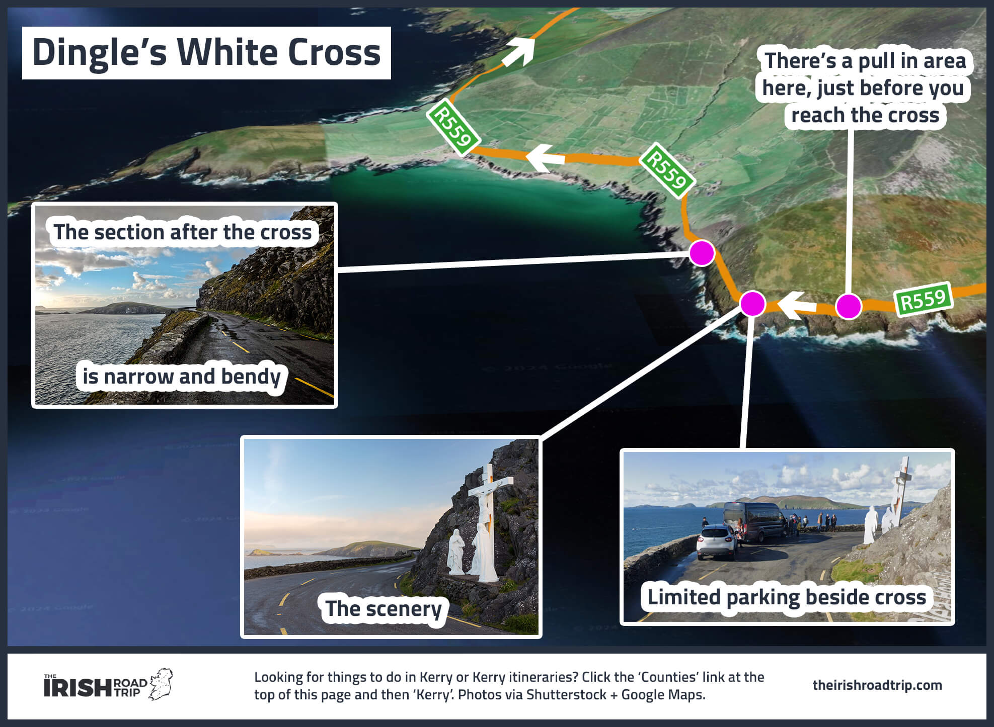
- Ventry Beach to the White Cross (15 minute drive): Arrive at 13:10 and leave at 13:25
- The White Cross to Radharc na mBlascaoidí (1 minute drive): Arrive at 13:30 and leave at 13:45
- Radharc na mBlascaoidí to Coumeenoole (5 minute drive): Arrive at 13:50 and leave at 14:15
- Coumeenoole to Dun Chaoin (5 minute drive): Arrive at 14:20 and leave at 14:45
- Dun Chaoin to Ceann Sibeal viewpoint (5 minute drive): Arrive at 14:50 and leave at 15:10
- Ceann Sibeal viewpoint to Clogher Strand (5-minute drive): Arrive at 15:15 and leave at 15:35
- Clogher Strand to Adare via Conor Pass (2 hour and 15 minute drive): Arrive at 17:50, get dinner and leave at 19:20
- Adare to Doolin (1 hour and 20 minute drive): Arrive around 20:40
Stop 1: Inch Beach

Photos via Shutterstock
Inch Beach is the first stop. You’ll find parking right next to it and there’s a great coffee spot on the sand (Sammy’s).
Inch is a little peninsula, as you’ll see from the snap on the left above. Well, I say ‘little’, but it juts out for a lofty 5.5km.
As you saunter along the sand at Inch you’ll see local and visiting surfers conquering (or at least attempting to!) the waves.
On a clear day, you’ll be treated to glorious mountain views. A fine start to your Dingle road trip.
Stop 2: Minard Castle

Photos via Shutterstock
One of the more overlooked stops on the Dingle Peninsula Loop is a short 15-minute spin from Inch – Minard Castle and Beach.
Take the drive up here very handy as you’ll be following narrow country roads that are used by farming vehicles.
You might recognise the castle here from the movie ‘Ryan’s Daughter’, which was released in the 1970’s (they referred to it as ‘The Tower’).
The castle here is finely plonked on a little grassy hill that overlooks the water, commanding breath-taking views on a clear day.
Stop 3: Dingle Town

Take the 15-minute drive to bustling Dingle Town, next, and head off for a ramble (there’s parking at the harbour).
Although the town is small it attracts thousands of domestic and international tourists each and every day throughout the summer season.
Dingle Town is walkable and it boasts a fine bit of charm and character. In the town, you have attractions like the Dingle Distillery and the Dingle Aquarium.
There’s also plenty of great restaurants in Dingle (Fish Box is my go-to!) and there are endless old-school pubs in Dingle, too!
From the town, you can join one of the various Dingle Tours, like the Sea Safari or the boat trip to the Blasket Islands.
Stop 4: Ventry Beach

Photos via Shutterstock
Ventry Beach (an easy 15-minute drive from Dingle) is a Blue Flag Beach and on a warm day, there’s few places like it.
One of the more popular beaches in Kerry, Ventry Beach stretches for 4.5km and, for many, it’s white sand marks the beginning of the Slea Head Drive.
Hop out, flick off your shoes and head for a stroll or a paddle.
It’s from this point that your Dingle Peninsula road trip goes from good to great!
Stop 5: The viewpoints
The next stretch of the route is my favourite along the Slea Head Drive part of the loop.
However, a quick heads up is needed – the Dingle road trip is dotted with magnificent view points, but there’s a problem.
Many of them are tucked away behind bends, so they’re very easy to miss. Add to this the fact that it’s near impossible to find a place to do a U-Turn safely and it can get frustrating.
Translation – time spend looking over my Dingle Peninsula Loop map above will pay dividends!
The first pair of viewpoints you’ll reach are Ceann Sleibhe and the famous White Cross. There’s a little bit of pull in space here where you can hop out and admire the view.
Stop 6: Radharc na mBlascaoidí viewpoint

The next viewpoint is Radharc na mBlascaoidí (or ‘Blasket’s View’ as it’s listed on Google Maps), is one of the stand out stops on this Dingle Peninsula itinerary, in my opinion.
There’s plenty of room to park up here and you’ll be treated to a mighty view of Dunmore Head.
If you arrive here when the weather’s wild, you can watch (and listen – you’ll have no choice!) to the waves clattering against the rugged cliffs below.
Stop 7: Coumeenoole Beach

Next up is Coumeenoole Beach – another filming location for the famous ‘Ryan’s Daughter’.
This beautiful beach comes with a WARNING – no matter how tempting that often-tropical water looks, keep your feet on dry land.
Coumeenoole may be one of the finest beaches near Dingle, but there’s unpredictable currents at play and swimming is highly unadvisable.
There’s a small parking spot right next to the beach, and you’ve got a couple of choices – enjoy the view from the top or stroll down the twisty path all the way to the sand.
Stop 8: Dun Chaoin Pier

Dun Chaoin Pier is arguably the most notable of the many Dingle Peninsula stops.
Boasting a quirky appearance that’s been snapped by a million-and-one photographers, it’s the departure point for the Blasket Island Ferry.
There’s two warnings for this place:
- Warning 1: The cliff edge is unguarded – avoid getting too close as the wind is very strong as times here
- Warning 2: Never drive down the bendy road. Park at the top near the ticket booth
Stop 9: Ceann Sibeal (Star Wars filming location)

Another of my favourite stops along the Dingle Peninsula Drive is this little viewpoint. Now, please not that there’s no dedicated car park here.
There is, however, a nice little place to park around here if you want to take a look on Google Street View.
As you may be aware, parts of Star Wars: The Force Awakens were filmed in Ireland, most notably on Kerry’s Skellig Michael.
However, a section of the Dingle Peninsula was also used to recreate the Skellig Michael set for later movies.
Stop 10: Clogher Strand

Photos by The Irish Road Trip
We’re headed to Clogher Strand next – it’s one several easily-missed beaches you’ll stumble upon along your Dingle Peninsula road trip.
Although it’s a no-go for swimming, Clogher Strand is a stunning little beach, nestled amidst craggy cliff faces on every side.
As you drive to the car park, it also looks like you’re about the head right into the sea (don’t worry, the car park is just to the left).
Stop 11: Conor Pass

Make your way back into Dingle Town and then up to Conor Pass (takes around 25 minutes).
Conor Pass is one of Ireland’s highest mountain passes, and it can be the stuff of nightmares for nervous drivers.
However, you don’t have to drive it. If you head up to it from the Dingle side, you’ll reach a car park before you hit the narrow road.
From here, you can soak up views of the surrounding valley and watch the cars navigate its narrow bends from afar.
Stop 12: Dinner in Adare
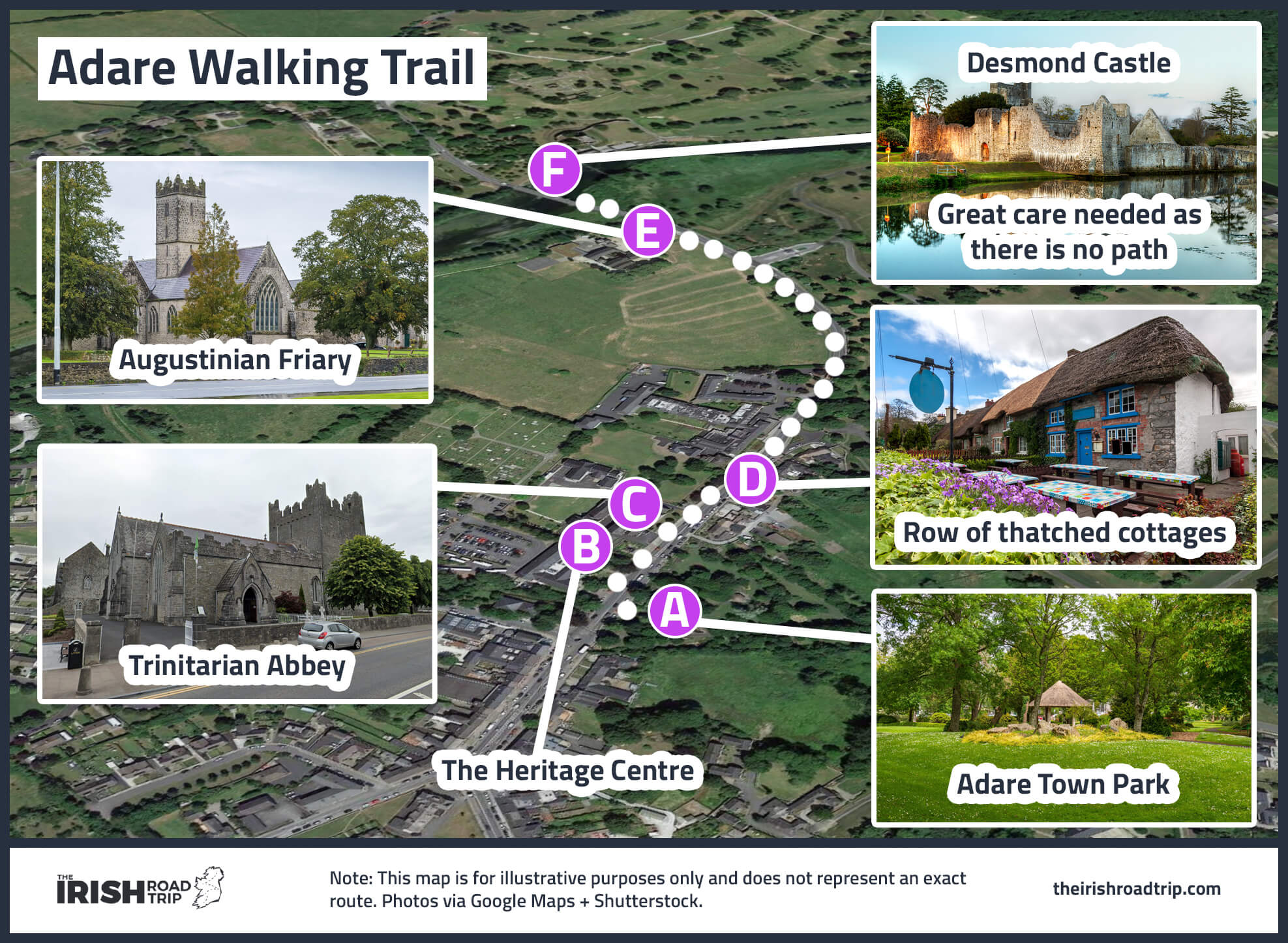
You’re a 1-hour-and-50-minute drive from the gorgeous village of Adare.
If you arrive and the sun is still out, head for a ramble – I’ve made a map above for you to follow.
When you’re ready, it’s time for some dinner. My go-tos in the town are:
- For a formal feed: 1826 Adare offers upscale Irish cuisine in a charming thatched cottage
- Casual: Aunty Lena’s Bar offers hearty Irish fare served in a lively, historic village pub setting
Stop 13: Doolin for the night

You’re going to round off the night in Doolin – a 1-hour-and-20-minute drive from Adare.
That was a lot of driving today but I’m confident you’ll have found it worth the effot.
Doolin’s well known for its cosy pubs and live music. Here’s a few recommendations to keep you going:
Doolin food and pub recommendations
- Restaurants in Doolin: Anthony’s at Doolin Inn and Russell’s Seafood Bar at Fiddle + Bow
- Pubs in Doolin: McDermott’s (my go-to for the last few years) and Gus O’Connor’s on Fisher Street
Day 6: Clare to Galway
Photos via Shutterstock
Get a bit of a lie-in on the morning of day 6 and hit the road when you feel ready to rock.
Today sees you explore around Doolin before heading up along the glorious Clare coast and then into Galway City.
The total drive-time for today is just over 2 hours, you’ll be happy to hear!
Recommended accommodation in Galway
- Budget: Feeney’s Audubon Lodge (in Salthill outside of the city by the sea) and Corrib View Guesthouse (a 45-minute walk from Eyre Square)
- Mid-range: Balcony House B&B (10-minute walk from Eyre Square) and Ash Grove House (gorgeous guesthouse near Galway Cathedral)
- Luxury: The G Hotel (luxury hotel in the city) and Glenlo Abbey (one of Ireland’s top hotels – 15-minute drive from the city)
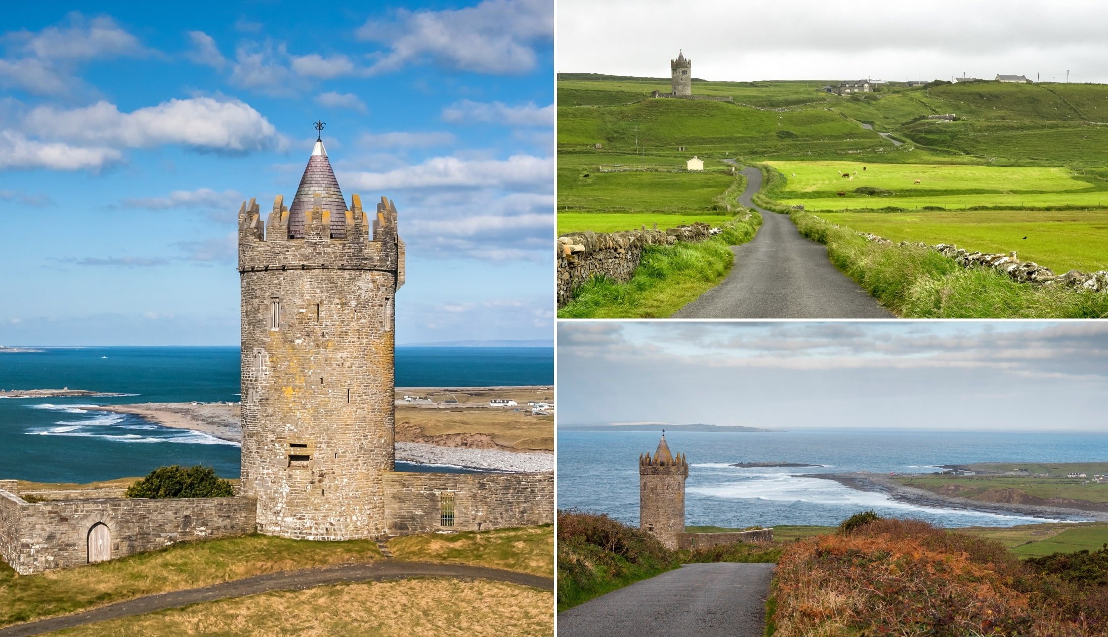
Stop 1: Doonagore Castle

Towering over Doolin Point from an impressive, elevated location, the 16th century Doonagore Castle is an impressive sight from both afar and up close.
There’s no where to park at Doonagore Castle and, as it’s on a hill on a VERY BAD BEND. If you continue up the hill (away from the castle) you’ll find a tiny spot that fits one car (here on maps). Be careful when walking back towards the castle (the road is narrow).
Doonagore Castle passed between the O’Briens and O’Connors in the 1500s before being surrendered to the Crown. In 1588, Spanish Armada survivors were hanged nearby. Post-1641, it was granted to John Sarsfield and it was then later restored by the Gore family.
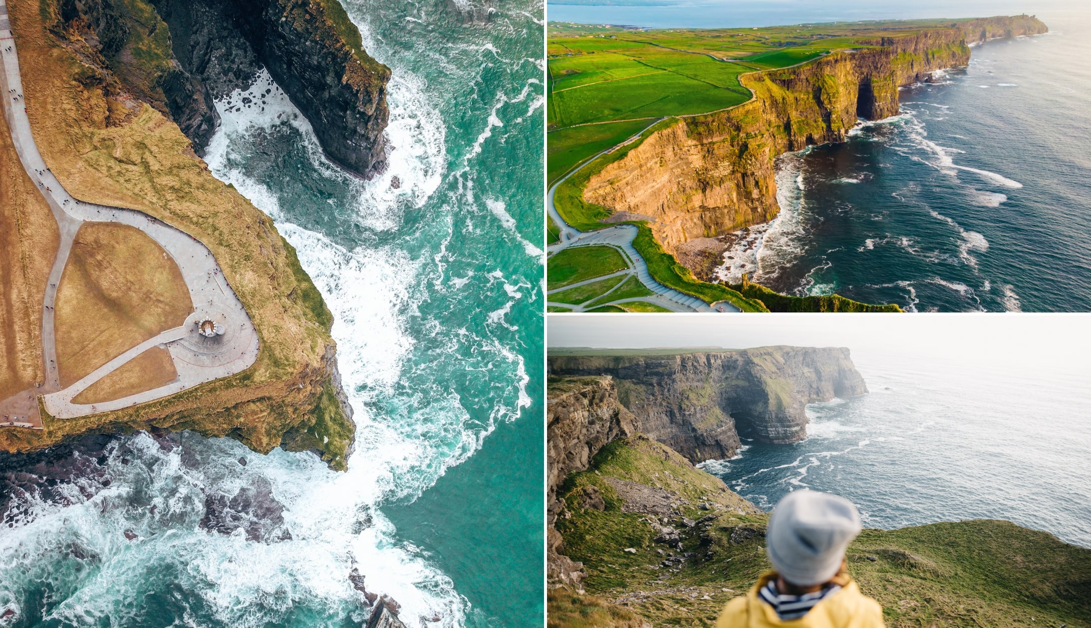
Stop 2: The Cliffs of Moher
Photos via Shutterstock
Your next stop, the magnificent Cliffs of Moher, are a 15-minute drive from Doonagore.
It’ll quickly become evident why these are one of the most popular things to do in Ireland!
There’s a visitor centre on-site, as well as 800 metres of paved walkways with viewing areas, and the historic O’Brien’s Tower.
In my opinion, the visitor centre isn’t really anything that special, but you’ll get access to all three with the Cliffs of Moher Experience.
Stop 3: Lunch in Lahinch
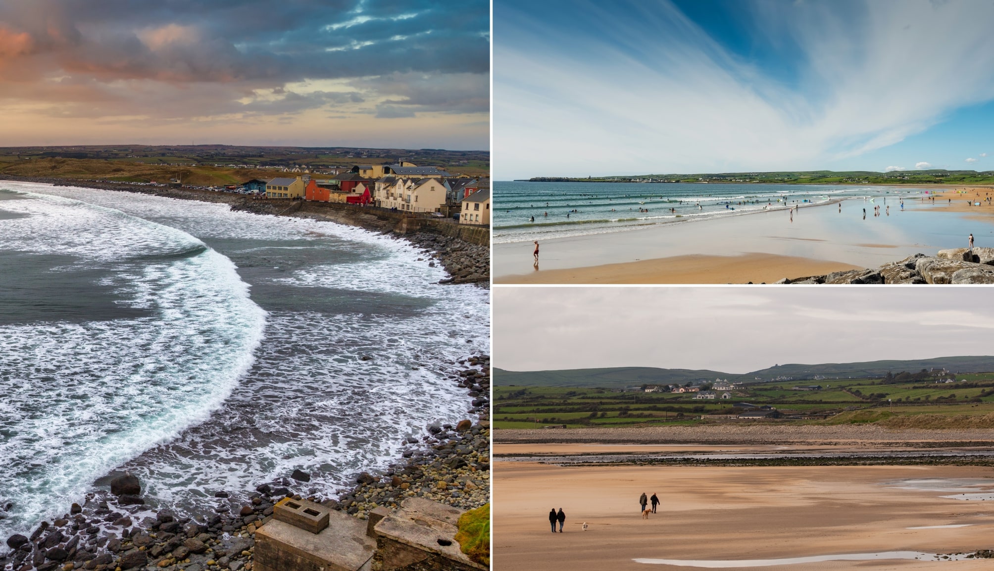
Photos via Shutterstock
When you finish up at Moher, take the 15-minute drive along the coast to Lahinch.
There are plenty of optional stops along the way, including Spanish Point and Miltown Malbay.
Lahinch is lively seaside town that’s arguably best-know as a haven for surfers the country over.
For lunch, or even just for a coffee and a baked treat, head into Dodi Cafe and then saunter along the sand.
The first half of the Burren drive

The next part of day 6 sees you follow the first half of the famous Burren Scenic Drive.
This is a nice and easy route to follow, for the most part, but take note of the comments under the first stop, as it can be tricky to find.
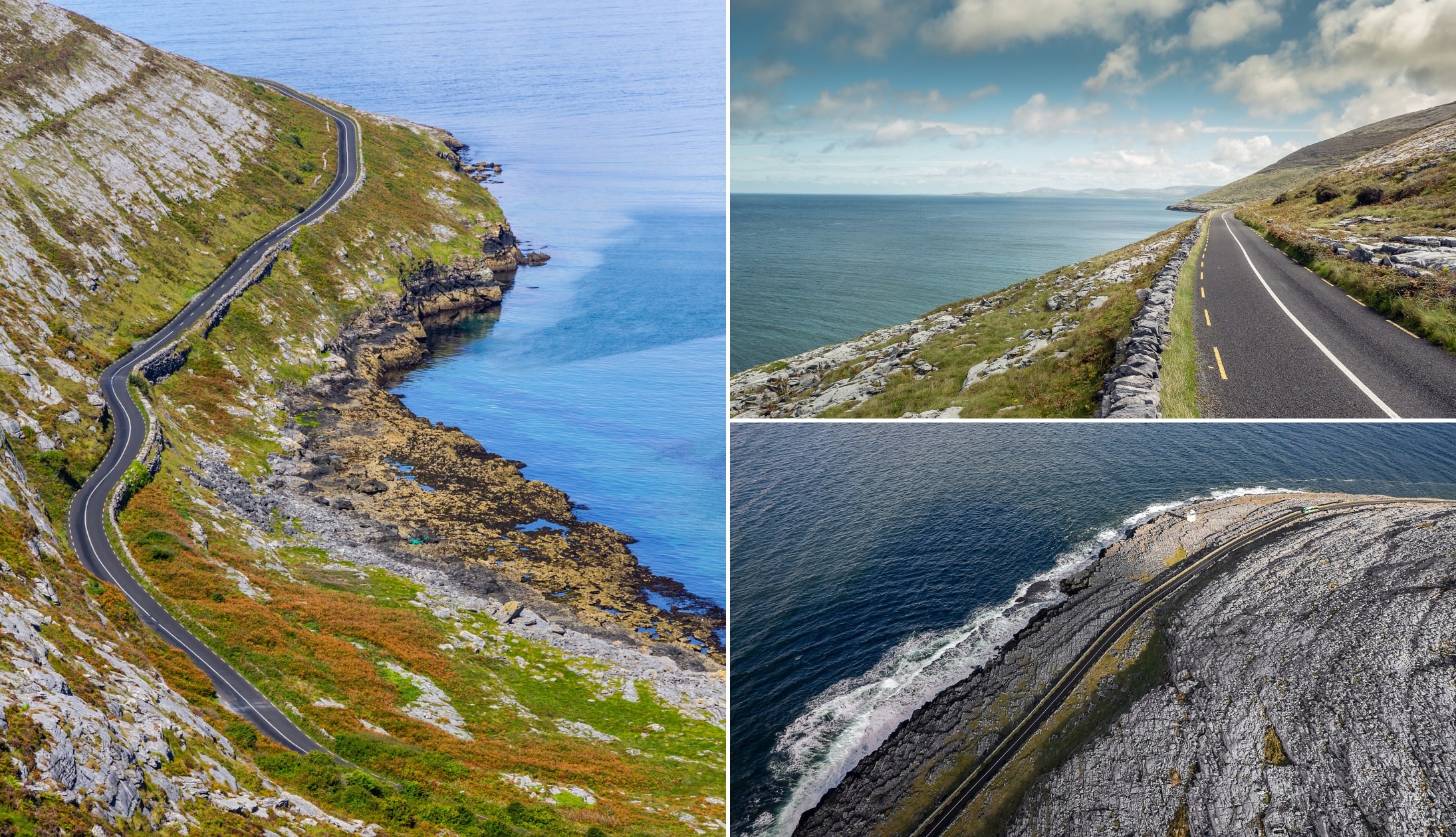
Stop 4: The Fanore Viewpoint

When you leave Doolin, you need to follow the R477 road that hugs the coast. You’ll travel along a finely maintained road with the Atlantic on one side and the famous Burren landscape on the other.
The first stop is this viewpoint. Now, as you can see in the photos above, this is accessed by a steep and narrow ‘country’ road.
However, when you reach the top you’ll be treated to glorious views of the Clare coast and beyond.
The fun really begins when you drive back down the way you came – it almost feels like you’re driving into the sea.
Stop 5: Fanore Beach
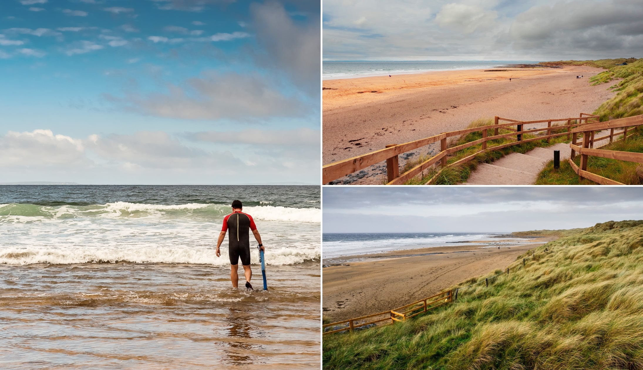
Photos via Shutterstock
The next stop on the Burren Scenic Drive is Fanore Beach, which is as good a place as any to stretch the legs!
There’s a grand big car park here that’s rarely busy outside of the summer months.
This is a Blue Flag Beach that is popular with swimmers and surfers throughout the year, however, it’s well worth a visit even if you’re keeping your toes on dry land!
Fanore’s golden sand is set against the backdrop of the Burren’s moon-like-landscape and it’s a fine spot for a stroll before the rest of the drive.
Stop 6: The Stop That Isn’t A Stop
Photos via Shutterstock
Like many of Ireland’s most scenic drives, the Burren’s magic isn’t cast through one single landmark.
Instead, its brilliance unfolds through a truly unique landscape, unlike anything you’ll encounter anywhere else in the world.
Along the way, ancient stone walls, quaint villages, and panoramic ocean views create an atmosphere of timelessness
As you drive, you’ll come across random points of interest (like Murroughtuohy Viewpoint and the Pinnacle Well) which you can, if you like, stop and investigate further.
Stop 7: Blackhead Lighthouse

The next stop on the Burren Drive is a slightly unusual one – Blackhead Lighthouse.
A heads-up: parking can be quite tricky here, and the lighthouse often seems to appear out of nowhere (it’ll be on your left).
Be prepared and keep an eye out for the limited parking spots around this area as you approach, as they can be easy to miss.
Blackhead Lighthouse stands 8 meters tall and is visible from the road. Established in 1936, its light reaches up to 11 nautical miles, serving as a key navigational aid along Galway Bay.
This is also a great viewpoint – on clear days you’ll be able to see everywhere from the Aran Islands to the hills of Connemara.
Stop 8: Corcomroe Abbey
Photos via Shutterstock
Nestled in the heart of the Burren, Corcomroe Abbey—once known as “St. Mary of the Fertile Rock”—dates back to the early 13th century.
Built using local limestone, this Gothic ruin features some of the finest stone carvings of any Irish Cistercian church.
Despite its peaceful setting today, Corcomroe witnessed historic battles, including the burial of King Conor O’Brien after his defeat in 1268.
Now a National Monument, this abbey remains a must-see for history and architecture lovers!
Stop 9: Dunguaire Castle

The final stop before heading into Galway City is Dunguaire Castle. This 75-feet-tall tower house was built in the 16th-century on the shores of glorious Galway Bay, not far from the town of Kinvara.
It was built by the powerful Ó hEidhin clan and it was once owned by the King of Connacht. During the summer, the castle opens for tours.
If you visit during the off season, you can still park across the road and admire it from the outside.
When you finish up, you’re a 40-minute drive to Galway City Centre.
Stop 10: Check-in and head out to see the city

Galway is a wonderfully walkable city and there’s plenty to see and do without having to exert yourself too much.
When you get checked-in, you have 3 options:
- Option 1: Follow my self guided Galway City walking tour (above)
- Option 2: Take the Galway hop-on/hop-off bus (handy if it’s raining/if you’re tired)
- Option 3: Take this guided walking tour or the excellent Dark History Walking tour
An evening in Galway

You’ve had a busy aul day today, so it’s time to kick-back and chill with food and, if you fancy, a drink and some live music.
Galway is a lively city regardless of the time of year. Here’s some spots worth checking out:
Dinner recommendations
There are some outstanding restaurants in Galway, with something to tickle most tastebuds.
- My go-tos: Dela (outstanding Irish food) and Ard Bia at Nimmos (beautifully presented dishes that never fail to delight)
- Casual spots: The Dough Bros (Galway’s best pizza) and McDonagh’s (mighty fish and chips)
Live music and trad bars
You’ve some tough decisions to make when it comes to the Pubs in Galway as there’s some fine choice!
In the map above, you’ll find my go-tos.
For those that don’t fancy the pub
Skip the pub crawl and enjoy a lively night at Ireland’s #1 music and dance show in nearby Salthill.
It features performers from Riverdance and The Chieftains and it promises a great alternative to the pub.
Day 7: It depends on your schedule
Photos via Shutterstock
What you do on day 7 will depend on:
- Not ideal: Whether you need to head straight back to Dublin today 🙁
- Very ideal: Whether you have the full day to work with 🙂
If you do have the full day to work with, here’s a great itinerary to follow that takes you into Connemara as well as Cong.
Stop 1: Scenic drive from Galway City to Clifden

It’s roughly 75 minutes from the city to Clifden along the N59. This scenic drive passes right through the Connemara region, with amazing views the entire journey.
You’ll pass through the traditional village of Oughterard, then onwards to Maam Cross, passing by mountains, lakes, and moorland.
Once you’ve arrived in Clifden, make a quick stop to stretch your legs and grab a coffee before continuing onto the Sky Road. I’d recommend the Upstairs Downstairs Cafe or The Blooming Gorse.
Stop 2: Sky Road

The Sky Road is a breathtaking 16km loop. It begins in Clifden, making its way around the Kingston peninsula along a coastal road with stunning views. Along the way, the loop passes by Clifden Castle, a ruined manor house overlooking the water.
After the castle, the Sky Road deviates into two routes which join up again later, the lower road which has close-up views of the sea, and the upper road, which has views over the bay.
Some scenic stops along the way are Clifden Castle, the viewing point on the upper road, and Eyrephort Beach. We’d say two hours is a good length to spend on the Sky Road including stops, but this depends on what time you arrive in Clifden.
Stop 3: Lunch in Letterfrack
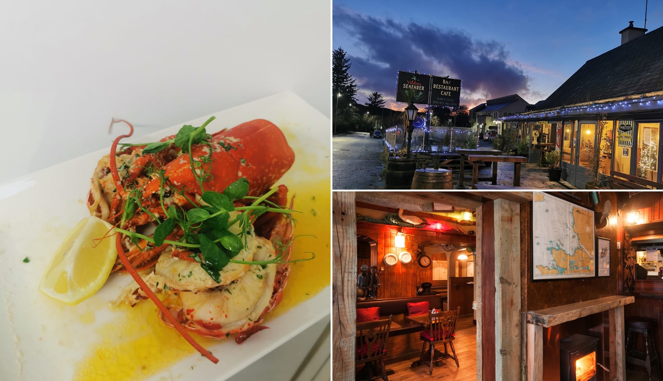
Photos via Veldons on FB
Once you get to the end of the Sky Road loop, instead of turning right onto the N59 back towards Clifden, turn left towards Letterfrack.
This takes around 13 minutes. In Letterfrack, I’d recommended Clover Fox, Veldons, or the Hungry Hiker.
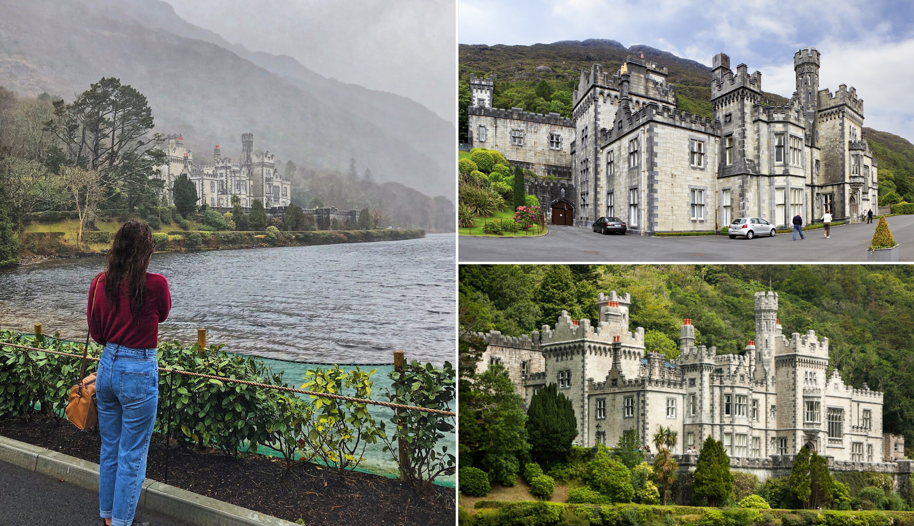
Stop 4: Kylemore Abbey
Photos via Shutterstock
It’s a short 9-minute drive to Kylemore Abbey, arguably one of the most popular places to visit in Galway.
Kylemore Abbey is a stunning Benedictine monastery that dates back to the 1920s. It’s incredibly picturesque, sitting on the shores of Pollacapall Lough.
The lower floors of the abbey have been restored and are open to the public, as well as the beautiful Victorian Walled Garden. The estate includes a Neo-Gothic church and several woodland and lake-side walks.
Stop 5: Killary Harbour and Leenane
Photos via Shutterstock
Before you leave Kylemore Abbey, enter “Killary Harbour, Connemara Loop” into Google Maps to take you to the 6th stop. The viewpoint is a 14-minute drive from the abbey, with stunning views of Killary Harbour (Ireland’s only fjord).
If you look hard enough, you may be able to spot the potato mounds across the fjord, which date back to the famine.
On your way to Cong, make a stop in Leenane to check out Gaynor’s Bar (The bar from the movie ‘The Field’), or the Sheep and Wool Centre to watch a demonstration.
You could also make a quick stopover at Aasleagh Falls, which is just outside of Leenane.
Stop 6: Cong

It takes roughly 40 minutes to drive from Leenane to Cong. It’s one of Ireland’s more popular villages, thanks to its scenic streets and link to the 1952 award-winning movie – The Quiet Man.
There’s lots to do in the village, from Quiet Man tours, grabbing a drink in Pat Cohan’s Gastro Pub (a must for Quiet Man fans), or checking out the 13th-century abbey ruins.
Stop 7: Galway for dinner, drinks and live music

It’s been a long fun-filled day, but it’s time to head back to Galway City, a roughly 50-minute drive.
Here is a reminder of my earlier recommendations for places to eat, drink, and be merry in the city!
Dinner recommendations
There are some outstanding restaurants in Galway, with something to tickle most tastebuds.
- My go-tos: Dela (outstanding Irish food) and Ard Bia at Nimmos (beautifully presented dishes that never fail to delight)
- Casual spots: The Dough Bros (Galway’s best pizza) and McDonagh’s (mighty fish and chips)
Live music and trad bars
You’ve some tough decisions to make when it comes to the Pubs in Galway as there’s some fine choice!
In the map above, you’ll find my go-tos.
For those that don’t fancy the pub
Skip the pub crawl and enjoy a lively night at Ireland’s #1 music and dance show in nearby Salthill.
It features performers from Riverdance and The Chieftains and it promises a great alternative to the pub.
Our most useful guides for planning your Irish Road Trip
And that’s a wrap on this road trip. Remember, you’ll find every length and type of road trip imaginable in our Irish Road Trip Hub.
If you’re in the middle of planning your visit, these guides should prove useful:
- Planning tips: 7 steps that make planning a trip to Ireland stress free
- When to visit: The pros and cons of every month in Ireland
- Weather: An overview of the weather in Ireland by month
- Airports: Where you can fly into
- Ireland Trip cost: What impacts the cost of a trip to Ireland
- Getting around: The pros and cons of seeing Ireland with a car vs by bus/train
- Car rental: A bs-free guide to renting a car in Ireland
- What not to do: 17 things to avoid doing in Ireland
- Tips: When and how much to tip in Ireland
- What to wear: A guide on what to pack for each month
- Budget travel: How to do Ireland on a budget
Keith O’Hara has lived in Ireland for 35 years and has spent much of the last 13 creating what is now The Irish Road Trip guide. Over the years, the website has published thousands of meticulously researched Ireland travel guides, welcoming 40 million+ visitors along the way. In 2022, the Irish Road Trip team published the world’s largest collection of Irish Road Trip itineraries. Keith lives in Dublin with his dog Toby and finds writing in the 3rd person minus craic altogether.
Gabriel
Monday 13th of November 2023
Thank you for putting this together, I can tell its very well thought out. We actually have 8 days during the winter so we are also thinking of going to County Donegal to try and see the northern lights!